Mönchhagen
| coat of arms | Germany map | |
|---|---|---|

|
Coordinates: 54 ° 9 ' N , 12 ° 14' E |
|
| Basic data | ||
| State : | Mecklenburg-Western Pomerania | |
| County : | Rostock | |
| Office : | Rostock Heath | |
| Height : | 16 m above sea level NHN | |
| Area : | 10.58 km 2 | |
| Residents: | 1248 (Dec. 31, 2019) | |
| Population density : | 118 inhabitants per km 2 | |
| Postal code : | 18182 | |
| Area code : | 038202 | |
| License plate : | LRO, BÜZ, DBR, GÜ, ROS, TET | |
| Community key : | 13 0 72 072 | |
| Office administration address: | Eichenallee 20 18182 Gelbensande |
|
| Website : | ||
| Mayor : | Karl-Friedrich Peters (FWM) | |
| Location of the community Mönchhagen in the district of Rostock | ||
Mönchhagen is a municipality in the Rostock district in Mecklenburg-Western Pomerania (Germany). The municipality is administered by the Rostocker Heide office based in the Gelbensande municipality.
geography
The municipality of Mönchhagen is located on the eastern outskirts of the Hanseatic city of Rostock in a predominantly flat area that is drained by the Peezer Bach to the Breitling . The Baltic coast is only ten kilometers from Mönchhagen ( Markgrafenheide beach ).
Mönchhagen is surrounded by the neighboring communities Rövershagen in the north, Bentwisch in the east and south and Rostock in the west.
history
The place Mönchhagen was in a sales deed of the Rostocker Heide from March 25, 1252 by Heinrich Borwin III. mentioned to the city of Rostock. In 1960 the current district of Häschendorf and the Heidekrug settlement were incorporated.
Population development
(Figures from December 31st)
|
|
|
politics
coat of arms
Blazon : "A striding golden monk in blue, each with a golden yew branch with three golden fruits."
flag
The flag of the municipality of Mönchhagen is striped in blue, gold (yellow) and blue across the longitudinal axis of the flag cloth. The blue stripes each take up a quarter, the golden (yellow) stripe takes up half the length of the flag cloth. In the middle of the golden (yellow) stripe is the municipal coat of arms, which takes up two thirds of the height of the flag. The relation of the height of the flag cloth to the length is like 3: 5.
Attractions
→ See also the list of architectural monuments in Mönchhagen
- Memorial stone from 1970 in the district of Bunny Village at today's federal highway 105 in memory of the victims of the death march of prisoners of satellite camp Barth of the concentration camp from May 1945
Economy and Infrastructure
The community is predominantly agricultural, but has developed into a residential area since 1991 - especially for people who moved from nearby Rostock. There are some farms, small businesses and a gas station. The place is a classic street village . A large part of the development is lined up along the main road ("Unterdorf"), which is located at right angles to federal highway 105.
Transport links
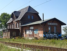
Mönchhagen is located on federal highway 105 and has its own train station connected to the parallel railway line from Rostock to Stralsund . There is a connection to the federal autobahn 19 (Rostock - Berlin) six kilometers away .
Facilities
- The central facility in Mönchhagen is the fire station, which also includes the community office and the assembly room.
- There is a daycare center, a sports field and a youth club.
Individual evidence
- ↑ Statistisches Amt MV - population status of the districts, offices and municipalities 2019 (XLS file) (official population figures in the update of the 2011 census) ( help ).


