
Polessk
| city
Polessk
Labiau Полесск
|
||||||||||||||||||||||||||||||||||||||
|
||||||||||||||||||||||||||||||||||||||
|
||||||||||||||||||||||||||||||||||||||
| List of cities in Russia | ||||||||||||||||||||||||||||||||||||||
.svg)

Polessk ( Russian Полесск ; until 1946 German Labiau , Lithuanian Labguva , Polish Labiawa / Labiewo ) is a district town with 7581 inhabitants (as of October 14, 2010) in the Russian Oblast of Kaliningrad . It is the seat of local government unit Stadtkreis Polessk in Polessky District .
Geographical location
The city is located in the historical region of East Prussia , about 40 kilometers northeast of Koenigsberg ( Kaliningrad ) and 55 kilometers southwest of Tilsit ( Sowjetsk ) at the junction of the main road and railway over the Deime (Russian Deima ; Prussian Deimena / Deiwmena ), just before them Estuary into the Curonian Lagoon . To the north-east of the city lies the Großes Moosbruch high moor area .
history
Labiau Castle was built between 1258 and 1259 after the Samland was conquered and was intended to protect Königsberg from enemies approaching across the lagoon. In 1277 the Schalauer burned it down. The castle was then rebuilt from stone as a commandery . In 1352 Heinrich Schindekopf won over the Lithuanians. The moated castle was considered impregnable and was inhabited after 1550 by Anna Maria, Duke Albrecht's second wife. It was granted town charter in 1642 by the Great Elector . In 1656 the Treaty of Labiau between Elector Friedrich Wilhelm of Brandenburg and King Karl X. Gustav of Sweden was concluded in Labiau .
At the beginning of the 20th century, the district town of Labiau had a Protestant church, a synagogue , a district court, a Reichsbank branch, a steam brewery, steam saw mills and fish trade.
Until 1945 Labiau belonged to the district of Labiau in the administrative district of Königsberg in East Prussia in the German Empire .
In 1945 Labiau was occupied by the Red Army and, after the end of the war , was placed under the administration of the RSFSR , the Russian republic of the Soviet Union . In 1946, the Soviet occupation forces introduced the place name Polessk for Labiau . Since the dissolution of the Soviet Union , the place has belonged to the Russian Federation. From 2008 to 2016 Polessk was the seat of the urban municipality Polesskoje gorodskoje posselenie with the two other settlements Podsobny ( Russian Подсобный ) (Groß Reikeninken , 1938-1945 Reiken) and Tjulenino ( Russian Тюленино ) (Viehof) .

Ordensburg (2018)

Deime in Labiau
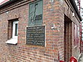
Memorial plaque Adlerbrücke

West side of the market square


Place name
Variants of the place name appearing in old documents are: Labegowe moter (1258), in terra Labigow (1261), Labigow / Labiow (1300) and Labiau / Labiaw (1420). These place names are probably related to Prussian labs = good, Prussian moter = swampy land, area, training, or also with Lithuanian labguvyna = healing stone ( cuprum aluminatum sive lapis divinus ).
Population development
1768-1939
| year | Residents | Remarks |
|---|---|---|
| 1768 | 1,679 | |
| 1782 | 2.129 | in 168 households, not including the 420 military and civilian members of the garrison (a squadron of dragoons ) |
| 1798 | 2,198 | |
| 1802 | 2,438 | |
| 1810 | 2,400 | |
| 1816 | 2,390 | of which 2,367 Protestant and 23 Catholic (none Jewish) |
| 1821 | 2,979 | |
| 1831 | 3.157 | in 201 private houses |
| 1858 | 4.216 | including 4,116 Protestant, 22 Catholic, one other Christian, one Mennonite and 76 Jewish |
| 1875 | 4,487 | |
| 1880 | 4,683 | |
| 1885 | 4,744 | almost exclusively Protestant |
| 1890 | 4,861 | thereof 29 Catholic and 92 Jewish |
| 1900 | 4,455 | mostly Protestant |
| 1910 | 4,604 | |
| 1925 | 4,840 | |
| 1933 | 5,879 | |
| 1939 | 6,544 |
1959-2010
| year | Residents |
|---|---|
| 1959 | 5,435 |
| 1970 | 5,601 |
| 1979 | 6.338 |
| 1989 | 6,859 |
| 2002 | 7,681 |
| 2010 | 7,581 |
(Sources: census data)
coat of arms
 |
Blazon : "In silver with blue clouds in the left Schildeck from which a green -clad arm is apparent that in the hand a slumped golden hunting horn holds; below:a green deciduous tree on green ground . " |
| Justification of the coat of arms: The coat of arms with forest symbol and hunter symbol given to the city of Labiau in 1642 by the Great Elector indicates the location of the city and the relationship of the Great Elector to the forest and to the aurochs hunt near Labiau. |
church
Evangelical
The Labiau town church was next to the Königsberg cathedral the only three-aisled church in the north-western part of East Prussia . As a choirless hall church made of plastered field stone , it was built at the end of the 14th century with a brick west tower in front . In the middle of the 16th century it was u. a. restored with installation of the cell vault . In 1701 the church received an organ built by Johann Josua Mosengel and in 1870 a new organ by Wilhelm Sauer from Frankfurt (Oder) . The church was damaged in World War II , was then used by others and fell into disrepair. In the 1960s, the building was demolished to extract building material. The foundations were used for the new construction of a five-story residential building, which now takes the place of the church.
Parish
The Reformation took hold relatively early in Labiau. A Lutheran clergyman was already in office here before 1532, and in 1622 an additional pastor's office was established, whose office holders - as so-called "Lithuanian pastors" - were also rectors of the city school until 1719. Until 1945 Labiau belonged with its extensive parish to the parish of Labiau in the church province of East Prussia of the Church of the Old Prussian Union . After the Second World War, church life collapsed due to the flight and displacement of the local population as well as the restrictive religious policy of the Soviet Union . In the 1990s, a new Evangelical Lutheran congregation was established in the city. It is a subsidiary of the Church of the Resurrection in Kaliningrad (Königsberg) within the Kaliningrad provost of the Evangelical Lutheran Church of European Russia .
Labiau Church District
Until 1945 Labiau was the center of the church district named after him , which belonged to the church province of East Prussia of the Church of the Old Prussian Union . Ten parishes from the districts of Labiau and Wehlau were subdivided to it, in which a total of 52,375 parish members were registered in 1925:
| Surname | Change name 1938–1946 |
Russian name |
|---|---|---|
| Augstagirren (large tree) | Sosnovka | |
|
Gilge - Agilla / Juwendt |
Haffwerder / Möwenort |
Matrossowo Krasnoye Razino |
| Kaymen | Kaimen | Zarechye |
| Labiau | Polessk | |
| Laukischken | Saranskoye | |
| Lukewarm | Hohenbruch | Gromowo |
|
Legitten based in Groß Legitten |
Turgenewo | |
| Mehlauken | Liebenfelde | Zalessye |
| Booze | Markthausen | Vysokoye |
|
Sussemilken based in Alt Sussemilken |
Friedrichsrode | Tarasovka |
Catholic
The Roman Catholic community, which was small before 1945 , had the St. Ansgar Chapel as its own church. It was built in 1928 according to plans by the Königsberg architect Schönwald . In 1925 there were 25 Catholics in the city of Labiau and 288 others in the entire county. The chapel building is no longer used for worship today. A music school is now housed here.
Orthodox
A Russian Orthodox church was built in Polessk at the end of the 1990s . The parish belongs to the diocese of Kaliningrad and Baltiysk .
Culture and sights

Buildings
- The old castle Labiau of the Teutonic Order (today industrial use) and a Russian Orthodox convent are located in the town.
- On the opposite side of the city, the Friedrichsgraben begins at the Deime .
Personalities
sons and daughters of the town
- Jacob Ephraim Polzin (1778-1851), architect
- Kasimir von Auer (1788–1837), Prussian major general
- Louis von Hanenfeldt (1815–1888), Prussian lieutenant general
- Carl Blankenstein (1864–1933), German actor and radio play speaker
- Bruno Skalweit (1867–1926), German agronomist, full professor of agricultural management at Albertus University
- Nikolaus Robert-Tornow (1886–1957), Prussian administrative lawyer and district administrator
- Bernhard Obersteller (1889–1972), German politician ( GB / BHE ), member of the Schleswig-Holstein State Parliament
- Albert Newiger (1889–1956), German major general
- Christoph Aschmoneit (1901–1984), leading German submarine builder
- Erich Altrock (1920–2004), German actor
- Dagmar Blei (* 1940), German linguist
People connected to the city
- Johannes Bretke (1536–1602), pastor at the Labiau town church from 1562 to 1587, translated the New Testament and the psalms of the Bible into the Lithuanian language here, then also the Old Testament in Königsberg (Prussia)
See also
literature
In order of appearance
- Daniel Heinrich Arnoldt : Brief messages from all preachers who have admitted to the Lutheran churches in East Prussia since the Reformation. Königsberg 1777 ( digitized pp. 48-52).
- Johann Friedrich Goldbeck : Complete topography of the Kingdom of Prussia. Part I: Topography of East Prussia. Marienwerder 1785, p. 14 ( digitized full text).
- Johann Georg Krünitz, Friedrich Jakob Floerken, Heinrich Gustav Flörke, Johann Wilhelm David Korth, Carl Otto Hoffmann and Ludwig Kossarski (eds.): Labiau. In: Economic-Technological Encyclopedia. Volume 58, Berlin 1792 ( digitized pp. 46-47).
- Leopold Krug : The Prussian Monarchy - represented topographically, statistically and economically. Part 1: East Prussia Province. Berlin 1833 ( digitized pp. 241–245).
- August Eduard Preuss : Prussian country and folklore or description of Prussia. A manual for primary school teachers in the province of Prussia, as well as for all friends of the fatherland. Brothers Bornträger, Königsberg 1835 ( digitized pp. 496–501, no. 95.)
- Max Toeppen : About Prussian Lischken, towns and cities. A contribution to the history of the municipal constitutions in Prussia. In: Old Prussian Monthly Journal , Volume 4, Königsberg 1867, pp. 511–536, in particular pp. 515–527 ( digitized full text)
- Wilhelm Sahm : History of the city of Labiau. City administration (ed.), Labiau 1942.
- Erich Weise (Hrsg.): Handbook of historical places . Volume: East and West Prussia (= Kröner's pocket edition . Volume 317). Unchanged reprint of the 1st edition 1966. Kröner, Stuttgart 1981, ISBN 3-520-31701-X .
Web links
- City of Labiau (Rolf Jehke, 2002)
- Polessk on mojgorod.ru (Russian)
Individual evidence
- ↑ a b Itogi Vserossijskoj perepisi naselenija 2010 goda. Kaliningradskaya oblastʹ. (Results of the 2010 all-Russian census. Kaliningrad Oblast.) Volume 1 , Table 4 (Download from the website of the Kaliningrad Oblast Territorial Organ of the Federal Service for State Statistics of the Russian Federation)
- ^ Eduard Heyck : German history. People, state, culture and spiritual life . Velhagen and Klasing, Bielefeld and Leipzig 1905, vol. 3, p. 126.
- ↑ a b Meyer's Large Conversation Lexicon . 6th edition, Volume 12, Leipzig and Vienna 1908 ( digitized p. 6).
- ↑ Cuprum aluminatum is also called Augenstein, Heiligenstein and Kupferalaun and is a chalcedony from the quartz group.
- ^ A b c Leopold Krug : The Prussian Monarchy - represented topographically, statistically and economically . Part 1: Province of East Prussia , Berlin 1833 ( digitized p. 241).
- ^ Johann Friedrich Goldbeck : Complete topography of the Kingdom of Prussia . Part I: Topography of East Prussia . Marienwerder 1785 ( digitized p. 14).
- ↑ a b c d Alexander August Mützell and Leopold Krug : New topographical-statistical-geographical dictionary of the Prussian state . Volume 5: T – Z , Halle 1823 ( digitized pp. 314–315, item 355).
- ^ August Eduard Preuss : Prussian country and folklore or description of Prussia. A manual for primary school teachers in the province of Prussia, as well as for all friends of the fatherland . Gebrüder Bornträger Verlag, Königsberg 1835 ( digitized pp. 496-501, no. 95).
- ↑ Adolf Schlott: Topographical-statistical overview of the government district of Königsberg, based on official sources . Hartung Verlag, Königsberg 1861 ( digitized p. 146, item 124).
- ^ A b c d e Michael Rademacher: German administrative history from the unification of the empire in 1871 to the reunification in 1990. East Prussia - Labiau district. (Online material for the dissertation, Osnabrück 2006).
- ^ Meyers Konversations-Lexikon. Leipzig 1888.
- ^ Rudolf Lembcke: Land Hadeln district. Past and present . Ed .: District of Hadeln. Buchdruckerei Günter Hottendorff, Otterndorf 1976, p. 70 (part of the coat of arms).
- ↑ Walther Hubatsch : History of the Protestant Church in East Prussia. Volume 2: Pictures of East Prussian churches. Göttingen 1968, p. 60, figs. 199–201.
- ↑ Walther Hubatsch: History of the Protestant Church in East Prussia. Volume 3: Documents. Göttingen 1968, p. 464.
- ^ Evangelical Lutheran Provosty Kaliningrad. ( Memento from August 29, 2011 in the Internet Archive ) (Russian / German)
- ↑ Walther Hubatsch: History of the Protestant Church in East Prussia. Volume 3: Documents. Göttingen 1968, pp. 464-465.
| Cities |
Bagrationovsk R | Baltiysk R | Guryevsk R | Gusew R | Gwardeisk R | Kaliningrad S | Krasnosnamensk R | Ladushkin S | Mamonowo S | Neman R | Nesterow R | Osjorsk R | Pionerski S | Polessk R | Pravdinsk R | Primorsk | Zelenogradsk R | Slavsk R | Sovetsk S | Svetlogorsk R | Swetly S | Chernyakhovsk R |
|
| Urban-type settlements |