Butler County, Iowa
 Butler County Courthouse |
|
| administration | |
|---|---|
| US state : | Iowa |
| Administrative headquarters : | Allison |
| Address of the administrative headquarters: |
County Courthouse P.O. Box 325 Allison, IA 50602-0325 |
| Foundation : | January 15, 1851 |
| Made up from: | Original County |
| Area code : | 001 319 |
| Demographics | |
| Residents : | 14,867 (2010) |
| Population density : | 9.9 inhabitants / km 2 |
| geography | |
| Total area : | 1506 km² |
| Water surface : | 3 km² |
| map | |
| Website : www.butlercoiowa.org | |
The Butler County is a county in the US -amerikanischen State Iowa . In 2010 , the county had 14,867 residents and a population density of 9.9 people per square kilometer. By 2013 the population increased to 15,021. The county seat is Allison .
geography
The county is located in northeastern Iowa and has an area of 1,506 square kilometers, of which three square kilometers are water.
The county is traversed by the West Fork Cedar River and its tributaries Shell Rock River and Beaver Creek . Across the Cedar River and the Iowa River , these rivers are part of the Mississippi basin .
It borders on the following neighboring counties:
| Cerro Gordo County | Floyd County | Chickasaw County |
| Franklin County |

|
Bremer County |
| Hardin County | Grundy County | Black Hawk County |
history
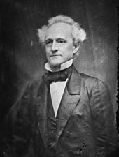
Butler County was formed on January 15, 1851 from designated as free - but in reality settled by Indians - territory. It was named after from Kentucky originating William Orlando Butler (1791-1880), a general and hero in the Mexican War , in 1848 for the office of US Vice President candidate.
| Population development | |||
|---|---|---|---|
| Census | Residents | ± in% | |
| 1860 | 3724 | - | |
| 1870 | 9951 | 167.2% | |
| 1880 | 14,293 | 43.6% | |
| 1890 | 15,463 | 8.2% | |
| 1900 | 17,955 | 16.1% | |
| 1910 | 17,119 | -4.7% | |
| 1920 | 17,845 | 4.2% | |
| 1930 | 17,617 | -1.3% | |
| 1940 | 17,986 | 2.1% | |
| 1950 | 17,394 | -3.3% | |
| 1960 | 17,467 | 0.4% | |
| 1970 | 16,953 | -2.9% | |
| 1980 | 17,668 | 4.2% | |
| 1990 | 15,731 | -11% | |
| 2000 | 15.305 | -2.7% | |
| 2010 | 14,867 | -2.9% | |
| 2013 estimate | 15,021 | 1 % | |
| Before 1900 1900–1990 2000 2010–2013 | |||
Until 1854 the county was administered by other counties. Only from this point on did it have enough residents to set up its own administration. The first trial was held in a settler's small log cabin. It wasn't until 1858 that the first Clarksville courthouse was completed. Since the county administration was relocated shortly thereafter, it served as a school from 1863 to 1903.
When the Dubuque and Dakota Railroad to Allison was built in 1878 , the headquarters of the administration were moved there on January 10, 1881. Allison was named after the Dubuque republican politician, lawyer and US Senator William B. Allison .
population
According to the 2010 census , Butler County had 14,867 people in 6,217 households. The population density was 9.9 inhabitants per square kilometer. Statistically, 2.30 people lived in each of the 6,217 households.
The racial the population was composed of 98.4 percent white, 0.2 percent African American, 0.1 percent Native American, 0.2 percent Asian and other ethnic groups; 0.7 percent were descended from two or more races. Hispanic or Latino of any race was 0.9 percent of the population.
23.6 percent of the population were under 18 years old, 56.6 percent were between 18 and 64 and 19.8 percent were 65 years or older. 50.6 percent of the population was female.
The median income for a household in the county was $ 50,400 . The per capita income was $ 23,900. 10.3 percent of the population lived below the poverty line.
Butler County localities
1 - to a small extent in Floyd County
structure
Butler County is divided into 16 townships :
|
|
See also
Individual evidence
- ^ Butler County ( English ) In: Geographic Names Information System . United States Geological Survey . Retrieved February 23, 2011.
- ↑ a b c U.S. Census Bureau, State & County QuickFacts - Butler County, IA. Retrieved November 18, 2014
- ↑ a b National Association of Counties.Retrieved November 18, 2014
- ^ US Census Bureau - Census of Population and Housing.Retrieved March 15, 2011
- ^ Extract from Census.gov.Retrieved February 16, 2011
- ↑ 2010 US Census Iowa Township and Other Subdivision Population. Retrieved July 23, 2019 .
Web links
Coordinates: 42 ° 44 ′ N , 92 ° 47 ′ W

