List of cities in Thuringia
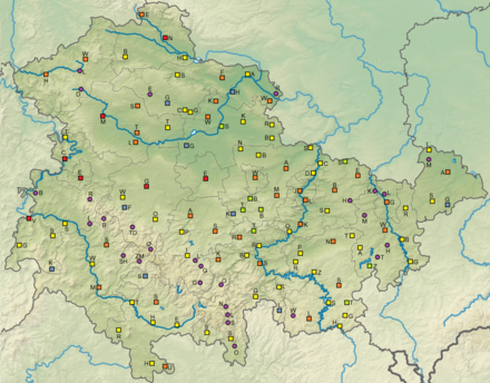
The list of cities in Thuringia includes all places with city rights in the German state of Thuringia .
118 municipalities in Thuringia currently have city rights. Up to 1718, 107 places received city rights. After that, it was not until 1847 that a place received city rights again; A total of 28 new cities followed by 1999. At the same time, cities have been amalgamated or incorporated since the 20th century, so that the number is slightly reduced again.
Explanations
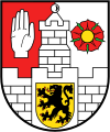
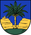
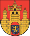
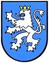
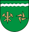
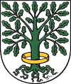
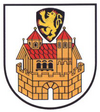
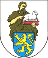
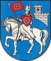
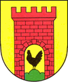
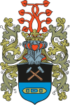
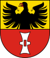
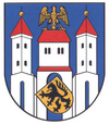
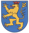
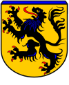
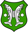
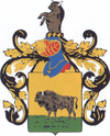
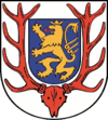
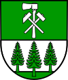
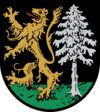
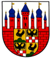
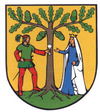
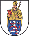
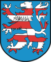
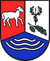
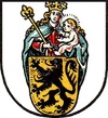
- The first columns of the table show the city arms, the name of the city and the associated district. Cities that are no longer independent today are shown in italics and provided with a reference to their current communal affiliation.
- The following two columns contain data on the first documented mention of the place and the documented designation as a city or the (not always documented) granting of city rights. The main sources for this were the works by Dehio, Kahl and Patze listed in the bibliography.
- The sixth column contains the area of the city as of December 31, 2014 according to the Thuringian State Office for Statistics.
- The seventh column contains the area of the old town in hectares according to an area calculation with Google Earth . This value is only given for cities that already had city rights before the Napoleonic period (around 1800). At that time, the legal equality between urban and rural communities had not yet taken place and the cities used physical boundaries to mark the scope of their law. Mostly this was the city wall , in smaller cities it could also be ditches, fences, hedges or gates, while completely open cities rarely occurred. As a rule, this delimitation was constant for centuries and has remained legible in the city plan to this day. The size of the enclosed area and its building density varied very strongly, so some cities in the Thuringian Basin were very large in terms of area, but only relatively thinly developed. In some cases the entire area was never built on (for example in Thamsbrück or Neumark ). South of the Thuringian Forest, the areas were smaller, but much more densely developed.
- The eighth column contains the number of inhabitants of the city as of December 31, 2019 according to information from the Thuringian State Office for Statistics.
- The ninth column contains the city's population in 1843, i.e. at the beginning of industrialization and before urbanization in the 19th and 20th centuries. Century in Thuringia. The data source for the small states is the work of Johann Friedrich Kratzsch : Lexicon of all localities of the German federal states . Naumburg, 1843. Available online from Google Books . For the Prussian territories: Handbook of the Province of Saxony. Magdeburg, 1843. Available online at Google Books .
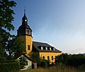
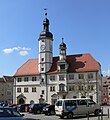
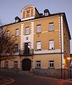
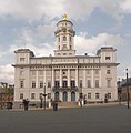
- The last two columns show a picture of the town hall as the seat and symbol of municipal self-government and of the (main) town parish church as the seat and symbol of spiritual life as the two constitutive elements of the Central European city .
- In order to ensure that the table can be sorted, the numbers of any comments on the table content are noted behind the respective city name.
- Not included in the table are places that only had partial or temporary city rights, as there is not yet an overall scientific representation of Thuringia for this comprehensive group. Decisive for inclusion in the list is the characterization as a fully-fledged city since the 19th century.
table
| coat of arms | city | district | first- repeatedly called |
City law since |
Area (in km²) |
Area of the old town (in ha) |
Population on December 31, 2019 | Peoples 1843 |
town hall | City Church |
|---|---|---|---|---|---|---|---|---|---|---|
|
Altenburg | Altenburger Land | 976 | 1256 | 45.69 | 31 | 31,633 | 13,697 |
|
|

|
Office of Creuzburg | Wartburg district | 2019 | 2019 | 69.73 | 14th | 4748 | 2,103 |
|
|

|
On the jewelry | Kyffhäuserkreis | 2019 | 2019 | 95.29 | 10 | 5967 | 1,692 |
|
|

|
Apolda | Weimar Country | 1119 | 1289 | 46.27 | 11 | 22,184 | 3,298 |
|
|

|
Arnstadt | Ilm district | 704 | 1220 | 104.99 | 35 | 27,314 | 4,709 |
|
|

|
Artern | Kyffhäuserkreis | 786 | 1323 | 45.05 | 18th | 6688 | 3,020 |
|
|

|
Auma-Weidatal | Greiz | 1237 | 1331 | 55.91 | 8th | 3441 | 1,355 |
|
|
|
Bad Berka | Weimar Country | 1119 | 1414 | 55.32 | 7th | 7500 | 1,228 |
|
|

|
Bad Blankenburg | Saalfeld-Rudolstadt | 1267 | 1323 | 35.62 | 8th | 6334 | 1.311 |
|
|
|
Bad Frankenhausen | Kyffhäuserkreis | 817 | 1282 | 91.07 | 29 | 10.139 | 4,851 |
|
|

|
Bad Köstritz | Greiz | 1364 | 1927 | 16.93 | 3514 | 1,300 |
|
|
|

|
Bad Langensalza | Unstrut-Hainich district | 932 | 1212 | 129.37 | 49 | 17,271 | 7,421 |
|
|

|
Bad Liebenstein | Wartburg district | 1137 | 1959 | 48.81 | 7748 | 700 |
|
|
|

|
Bad Lobenstein | Saale-Orla district | 1250 | 1278 | 48.92 | 5 | 5825 | 4,180 |
|
|

|
bad Salzungen | Wartburg district | 775 | 1306 | 98.50 | 9 | 20.097 | 2,945 |
|
|

|
Bad Sulza | Weimar Country | 1046 | 1300 | 91.14 | 9 | 7688 | 1,673 |
|
|

|
Bad Tennstedt | Unstrut-Hainich district | 772 | 1315 | 27.42 | 16 | 2462 | 3.117 |
|
|

|
Berga | Greiz | 1216 | 1378 | 43.52 | 6th | 3258 | 602 |
|
|
|
Blankenhain | Weimar Country | 1252 | 1424 | 113.75 | 10 | 6440 | 1,689 |
|
|

|
Bleicherode | Nordhausen | 1130 | 1326 | 108.20 | 12 | 10,327 | 2,725 |
|
|
|
Brotterode-Trusetal | Schmalkalden-Meiningen | 2011 | 2011 | 49.68 | 5993 |
|
|
||

|
Bürgel | Saale-Holzland district | 1133 | 1234 | 27.19 | 10 | 3058 | 1,308 |
|
|

|
Clings | Kyffhäuserkreis | 1200 | 1353 | 10.75 | 9 | 1068 | 932 |
|
|
|
Dingelstädt | Eichsfeld | 817 | 1859 | 59.40 | 6887 | 2,908 |
|
|
|

|
Dornburg-Camburg | Saale-Holzland district | 1078 | 1373 | 30.77 | 8th | 5360 | 1,453 |
|
|

|
Life | Kyffhäuserkreis | 1198 | 1928 | 44.54 | 2663 | 831 |
|
|
|

|
Eisenach | circular | 1150 | 1189 | 104.17 | 36 | 42,250 | 9,814 |
|
|

|
Eisenberg | Saale-Holzland district | 1171 | 1219 | 24.67 | 18th | 10,849 | 4,744 |
|
|

|
Ice field | Hildburghausen | 817 | 1316 | 86.53 | 8th | 7561 | 2,414 |
|
|

|
Ellrich | Nordhausen | 876 | 1229 | 69.43 | 9 | 5449 | 2,914 |
|
|
|
Erfurt | circular | 742 | 1120 | 269.91 | 275 | 213.981 | 28,430 |
|
|
|
Friedrichroda | Gotha | 1034 | 1594 | 36.88 | 10 | 7195 | 1,450 |
|
|

|
Gebesee | Sömmerda | 786 | 1638 | 08/24 | 28 | 2116 | 1,982 |
|
|

|
Fell | Saale-Orla district | 1303 | 1395 | 45.22 | 6th | 2477 | 1,494 |
|
|
|
Geisa | Wartburg district | 817 | 1302 | 71.94 | 6th | 4767 | 1,787 |
|
|

|
Gera | circular | 995 | 1237 | 152.18 | 10 | 93.125 | 11,255 |
|
|
|
Goessnitz | Altenburger Land | 1253 | 1718 | 14.07 | 5 | 3386 | 1,528 |
|
|

|
Gotha | Gotha | 775 | 1189 | 69.58 | 34 | 45,419 | 13,321 |
|
|

|
Graefenthal | Saalfeld-Rudolstadt | 1182 | 1337 | 36.42 | 7th | 1935 | 1,219 |
|
|
|
Greiz | Greiz | 1209 | 1359 | 84.87 | 10 | 20,392 | 6.215 |
|
|

|
Greetings | Kyffhäuserkreis | 802 | 1353 | 19.21 | 11 | 3432 | 2.165 |
|
|

|
Großbreitenbach | Ilm district | 1399 | 1855 | 80.76 | 6253 | 2,402 |
|
|
|
|
Great, really | Kyffhäuserkreis | 772 | 1521 | 63.34 | 11 | 2299 | 865 |
|
|
|
Heiligenstadt | Eichsfeld | 973 | 1227 | 70.88 | 35 | 17.129 | 4,637 |
|
|

|
Heldburg | Hildburghausen | 837 | 1394 | 112.75 | 6th | 3404 | 1,271 |
|
|

|
Herrings | Nordhausen | 876 | 1327 | 66.91 | 13 | 4720 | 2,075 |
|
|

|
Hermsdorf | Saale-Holzland district | 1256 | 1969 | 7.49 | 8051 | 1,046 |
|
|
|

|
Hildburghausen | Hildburghausen | 1234 | 1331 | 72.89 | 12 | 11,831 | 4,226 |
|
|

|
Hirschberg | Saale-Orla district | 1232 | 1397 | 24.13 | 4th | 2132 | 1,658 |
|
|

|
Hohenleuben | Greiz | 1267 | 1928 | 9.53 | 1403 | 2,103 |
|
|
|

|
Ilmenau | Ilm district | 1273 | 1341 | 198.69 | 12 | 38,891 | 2,364 |
|
|

|
Jena | circular | 1182 | 1236 | 114.77 | 16 | 111,343 | 5,166 |
|
|

|
Kahla | Saale-Holzland district | 876 | 1299 | 7.89 | 6th | 6795 | 2,417 |
|
|
|
Kaltennordheim | Schmalkalden-Meiningen | 795 | 1562 | 94.41 | 6th | 5802 | 1,536 |
|
|

|
Koelleda | Sömmerda | 786 | 1392 | 89.52 | 29 | 6348 | 2,951 |
|
|

|
Koenigsee | Saalfeld-Rudolstadt | 1199 | 1257 | 103.09 | 13 | 7350 | 2.011 |
|
|

|
Crane field | Weimar Country | 1143 | 1651 | 23.10 | 8th | 3363 | 1,411 |
|
|
|
Lauscha | Sonneberg | 1597 | 1958 | 18.72 | 3260 | 983 |
|
|
|

|
Lehesten | Saalfeld-Rudolstadt | 1071 | 1651 | 35.94 | 5 | 1672 | 972 |
|
|
|
Leinefelde-Worbis | Eichsfeld | 1227 | 1969 | 115.79 | 20,115 | 995 |
|
|
|

|
People Mountain | Saalfeld-Rudolstadt | 1187 | 1326 | 57.52 | 6th | 2079 | 1,054 |
|
|
|
Lucka | Altenburger Land | 1284 | 1331 | 12.92 | 7th | 3681 | 1,245 |
|
|

|
Magdala | Weimar Country | 876 | 1288 | 20.58 | 9 | 2029 | 675 |
|
|
|
Meiningen | Schmalkalden-Meiningen | 982 | 1230 | 105.64 | 25th | 24,796 | 5,839 |
|
|
|
Meuselwitz | Altenburger Land | 1139 | 1874 | 53.65 | 9954 | 1,527 |
|
|
|
|
Mulhouse | Unstrut-Hainich district | 967 | 1180 | 130.7 | 56 | 36,090 | 12,650 |
|
|

|
Münchenbernsdorf | Greiz | 1251 | 1904 | 15.45 | 2949 | 1,383 |
|
|
|

|
Neuhaus am Rennweg | Sonneberg | 1607 | 1933 | 108.22 | 8975 | 897 |
|
|
|

|
Neumark | Weimar Country | 1248 | 1326 | 8.67 | 8th | 478 | 535 |
|
|
|
Neustadt an der Orla | Saale-Orla district | 1120 | 1287 | 86.08 | 9 | 9198 | 4.155 |
|
|

|
Nordhausen | Nordhausen | 927 | 1180 | 108.24 | 35 | 41,726 | 12,564 |
|
|

|
Nottertal-Heilinger Heights | Unstrut-Hainich district | 2019 | 2019 | 75.95 | 9 | 5760 | 1,287 |
|
|

|
Oberhof | Schmalkalden-Meiningen | 1470 | 1985 | 23.40 | 1650 | 140 |
|
|
|

|
Ohrdruf | Gotha | 725 | 1348 | 113.60 | 22nd | 9820 | 3,669 |
|
|

|
Orlamünde | Saale-Holzland district | 1039 | 1344 | 7.47 | 5 | 1107 | 1,123 |
|
|

|
Plaue | Ilm district | 1273 | 1346 | 22.69 | 5 | 1985 | 810 |
|
|
|
Poessneck | Saale-Orla district | 1252 | 1324 | 24.43 | 8th | 11,842 | 3,621 |
|
|
|
Ranis | Saale-Orla district | 1190 | 1381 | 10.57 | 5 | 1678 | 1,151 |
|
|

|
Rastenberg | Sömmerda | 1055 | 1378 | 35.52 | 6th | 2482 | 1.012 |
|
|

|
Römhild | Hildburghausen | 800 | 1317 | 122.45 | 6th | 6822 | 1,620 |
|
|

|
Ronneburg | Greiz | 1209 | 1304 | 19.13 | 11 | 5011 | 4,995 |
|
|

|
Roßleben-Wiehe | Kyffhäuserkreis | 890 | 2019 | 73.04 | 7476 | 1,771 |
|
|
|

|
Rudolstadt | Saalfeld-Rudolstadt | 786 | 1326 | 135.17 | 16 | 24,943 | 5,743 |
|
|

|
Ruhla | Wartburg district | 1355 | 1896 | 38.55 | 5456 | 3,005 |
|
|
|

|
Saalburg-Ebersdorf | Saale-Orla district | 2003 | 2003 | 72.05 | 3359 |
|
|
||
|
Saalfeld | Saalfeld-Rudolstadt | 899 | 1208 | 145.56 | 29 | 29,278 | 4,417 |
|
|

|
Schalkau | Sonneberg | 1232 | 1317 | 44.03 | 6th | 3318 | 977 |
|
|

|
Schkölen | Saale-Holzland district | 1046 | 1425 | 53.43 | 6th | 2622 | 1,534 |
|
|
|
Schleiz | Saale-Orla district | 1232 | 1297 | 108.22 | 8th | 8947 | 4,850 |
|
|

|
Schleusingen | Hildburghausen | 1232 | 1268 | 125.59 | 9 | 10,930 | 3,067 |
|
|

|
Schmalkalden | Schmalkalden-Meiningen | 874 | 1227 | 105.38 | 18th | 19,647 | 5,405 |
|
|

|
Schmoelln | Altenburger Land | 1066 | 1329 | 94.72 | 9 | 13,724 | 3,616 |
|
|

|
Schwarzatal | Saalfeld-Rudolstadt | 2019 | 2019 | 25.99 | 3543 | 1,716 |
|
|
|

|
Sömmerda | Sömmerda | 876 | 1459 | 87.56 | 32 | 18,947 | 2,950 |
|
|
|
Sondershausen | Kyffhäuserkreis | 1125 | 1341 | 201.21 | 13 | 21,290 | 3,407 |
|
|

|
Sonneberg | Sonneberg | 1260 | 1349 | 84.69 | 6th | 23,516 | 3,606 |
|
|

|
Stadtilm | Ilm district | 1196 | 1268 | 120.26 | 18th | 8406 | 1999 |
|
|

|
Stadtroda | Saale-Holzland district | 1247 | 1340 | 07/24 | 9 | 6646 | 2,679 |
|
|

|
Steinach | Sonneberg | 1519 | 1920 | 26.35 | 3799 | 1,970 |
|
|
|

|
Steinbach-Hallenberg | Schmalkalden-Meiningen | 1228 | 1936 | 76.72 | 9575 | 2,621 |
|
|
|

|
Suhl | circular | 1232 | 1527 | 141.62 | 14th | 36,789 | 7,828 |
|
|
|
Tambach-Dietharz | Gotha | 1919 | 1925 | 41.63 | 4256 | 1,749 |
|
|
|
|
Tanna | Saale-Orla district | 1232 | 1495 | 87.35 | 6th | 3514 | 1,469 |
|
|
|
Themar | Hildburghausen | 796 | 1303 | 20.18 | 17th | 2807 | 1,440 |
|
|

|
Hit | Wartburg district | 1104 | 1309 | 72.46 | 13 | 6034 | 1,962 |
|
|
|
Triptis | Saale-Orla district | 1212 | 1328 | 33.15 | 7th | 3658 | 1,480 |
|
|
|
Ummerstadt | Hildburghausen | 1223 | 1290 | 15.73 | 6th | 463 | 755 |
|
|

|
Vacha | Wartburg district | 817 | 1186 | 44.41 | 10 | 5125 | 2,239 |
|
|

|
Waltershausen | Gotha | 1209 | 1357 | 60.62 | 7th | 12,838 | 2,755 |
|
|

|
Wasungen | Schmalkalden-Meiningen | 874 | 1308 | 89.09 | 7th | 5498 | 2,457 |
|
|
|
Weida | Greiz | 1122 | 1209 | 36.80 | 20th | 8372 | 3,756 |
|
|

|
Weimar | circular | 899 | 1254 | 84.48 | 16 | 65,228 | 11,444 |
|
|

|
Weissensee | Sömmerda | 1168 | 1212 | 46.71 | 23 | 3699 | 2,602 |
|
|

|
Werra-Suhl valley | Wartburg district | 2019 | 2019 | 77.67 | 6398 | 1,180 |
|
|
|

|
Wurzbach | Saale-Orla district | 1250 | 1930 | 72.32 | 3081 | 1,460 |
|
|
|

|
Zella Mehlis | Schmalkalden-Meiningen | 1919 | 1919 | 52.99 | 12,727 | 3,307 |
|
|
|

|
Zeulenroda shoot | Greiz | 1325 | 1438 | 135.14 | 7th | 16,350 | 4,881 |
|
|
|
Ziegenrück | Saale-Orla district | 1222 | 1328 | 8.25 | 4th | 657 | 797 |
|
|
Former cities
| coat of arms | city | district | First mentioned |
City law since |
City up | Area (in km²) |
Area of the old town (in ha) |
Peoples 1843 |
town hall | City Church |
|---|---|---|---|---|---|---|---|---|---|---|

|
Am Ettersberg (has given up designation as a town) |
Weimar Country | 2019 | 2019 | 2019 | 92.42 |
|
|||

|
Auma ( Auma-Weidatal ) |
Greiz | 1237 | 1331 | 2011 | 30.08 | 8th | 1,355 |
|
|
|
Berka ( Werra-Suhl Valley ) |
Wartburg district | 786 | 1847 | 2019 | 56.93 | 1,180 |
|
|
|

|
Brotterode ( Brotterode-Trusetal ) |
Schmalkalden-Meiningen | 1216 | 1936 | 2011 | 23.81 | 2,394 |
|
|
|
|
Buttelstedt ( Am Ettersberg ) |
Weimar Country | 786 | 1334 | 2019 | 18.85 | 5 | 825 |
|
|

|
Buttstädt (has given up designation as a city) |
Sömmerda | 786 | 1331 | 2019 | 104.8 | 15th | 2.164 |
|
|

|
Camburg ( Dornburg-Camburg ) |
Saale-Holzland district | 1078 | 1373 | 2008 | 8th | 1,453 |
|
|
|

|
Creuzburg ( Office Creuzburg ) |
Wartburg district | 775 | 1189 | 2019 | 35.40 | 14th | 2,103 |
|
|

|
Dornburg ( Dornburg-Camburg ) |
Saale-Holzland district | 937 | 1343 | 2008 | 6th | 593 |
|
|
|

|
Gehren ( Ilmenau ) |
Ilm district | 1299 | 1855 | 2018 | 43.85 | 1,542 |
|
|
|

|
Heldrungen ( At the jewelry ) |
Kyffhäuserkreis | 876 | 1530 | 2019 | 23.27 | 10 | 1,692 |
|
|
|
Kindelbrück (has given up designation as a city) |
Sömmerda | 786 | 1291 | 2019 | 57.85 | 18th | 1,796 |
|
|

|
Langenberg ( Gera ) |
circular | 1196 | 1933 | 1950 | 1,048 |
|
|||

|
Langewiesen ( Ilmenau ) |
Ilm district | 1198 | 1855 | 2018 | 27.51 | 1,285 |
|
|
|
|
Leinefelde ( Leinefelde-Worbis ) |
Eichsfeld | 1227 | 1969 | 2004 | 995 |
|
|
||
|
Lobeda ( Jena ) |
circular | 1156 | 1284 | 1946 | 5 | 731 |
|
|
|

|
Mehlis ( Zella-Mehlis ) |
Schmalkalden-Meiningen | 1250 | 1894 | 1919 | 1,706 |
|
|
||

|
Oberlind ( Sonneberg ) |
Sonneberg | 1225 | 1931 | 1950 | 889 |
|
|
||
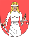
|
Oberweißbach ( Schwarzatal ) |
Saalfeld-Rudolstadt | 1370 | 1932 | 2019 | 9.62 | 1,716 |
|
|
|

|
Remda ( Rudolstadt ) |
Saalfeld-Rudolstadt | 786 | 1286 | 2018 | 79.76 | 7th | 935 |
|
|

|
Roßleben ( Roßleben-Wiehe ) |
Kyffhäuserkreis | 890 | 1999 | 2018 | 33.42 | 1,771 |
|
|
|

|
Saalburg ( Saalburg-Ebersdorf ) |
Saale-Orla district | 1216 | 1313 | 2003 | 6th | 1,134 |
|
|
|

|
Schlotheim ( Nottertal-Heilinger Heights ) |
Unstrut-Hainich district | 974 | 1277 | 2019 | 22.40 | 9 | 1,287 |
|
|

|
Stadtlengsfeld ( Dermbach ) |
Wartburg district | 1137 | 1306 | 2018 | 27.7 | 6th | 2,239 |
|
|

|
Tannroda ( Bad Berka ) |
Weimar Country | 1115 | 1403 | 1994 | 3 | 911 |
|
||
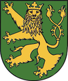
|
Teichel ( Rudolstadt ) |
Saalfeld-Rudolstadt | 1076 | 1417 | 1997 | 5 | 428 |
|
|
|
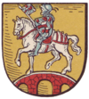
|
Thamsbrück ( Bad Langensalza ) |
Unstrut-Hainich district | 802 | 1206 | 1994 | 23 | 1,067 |
|
|
|

|
Shoot ( Zeulenroda shoot ) |
Greiz | 1209 | 1919 | 2006 | 1,254 |
|
|
||

|
Wiehe ( Roßleben-Wiehe ) |
Kyffhäuserkreis | 786 | 1297 | 2018 | 24.35 | 8th | 1,769 |
|
|

|
Worbis ( Leinefelde-Worbis ) |
Eichsfeld | 1162 | 1255 | 2004 | 11 | 1.941 |
|
|
|

|
Zeulenroda ( Zeulenroda shoot ) |
Greiz | 1325 | 1438 | 2006 | 7th | 4,881 |
|
|
Remarks
- ^ Population of the municipalities from the Thuringian State Office for Statistics ( help on this ).
- ↑ 7 hectares of the area of the walled city are in the old town in the southeast and 11 hectares in the new town in the northwest. Both were only merged into one city in 1832.
- ↑ The new community was created in 2012 from the merger of Bad Liebenstein , Schweina and Steinbach . Bad Liebenstein received town charter in 1959. Schweina was first mentioned in 933 and received market rights in 1523.
- ↑ In 1843, 1,179 inhabitants lived in Stadtsulza, 251 in Bergsulza and 243 in Dorfsulza.
- ↑ In 1843, 9,377 people lived in Eisenach and 437 in the suburb of Ehrensteig.
- ↑ Town charter / becoming town: As early as 1120 there were merchant settlements in which free people lived. Erfurt had had a coin since 1020, and Jews lived there from 1137, so that extensive urban structures were already in place in the first half of the 12th century. The area inside the first / inner city wall is about 140 hectares.
- ↑ Old town area within the inner city fortifications. The area within the outer city fortifications (remained thinner developed) is about 180 hectares.
- ↑ First mentioned under the old name Röthen .
- ↑ In 1843 2,357 residents lived in Stadtroda and 322 in Kloster-Roda.
- ↑ Tambach-Dietharz was created in 1919 from the merger of the villages of Tambach (first mentioned in 1251) and Dietharz (first mentioned in 1246). In 1843 there were 1,351 residents in Tambach and 398 in Dietharz.
- ↑ Zella-Mehlis was created in 1919 from the merger of the city of Mehlis (first mentioned in 1250) with the market town of Zella (first mentioned in 1112). In 1843 there were 1,601 inhabitants in Zella and 1,706 in Mehlis.
- ↑ First mention of Millingen, the predecessor settlement of the city of Creuzburg.
literature
- Georg Dehio: Handbook of the German art monuments Thuringia . Deutscher Kunstverlag, Munich 2003, ISBN 3-422-03095-6 .
- Wolfgang Kahl : First mention of Thuringian cities and villages. A manual. Rockstuhl Publishing House, Bad Langensalza, 2010, ISBN 978-3-86777-202-0 .
- Hans Patze , Peter Aufgebauer (Ed.): Handbook of the historical sites of Germany . Volume 9: Thuringia (= Kröner's pocket edition . Volume 313). 2nd, improved and supplemented edition. Kröner, Stuttgart 1989, ISBN 3-520-31302-2 .
