
Loire
| Loire | ||
 Course of the Loire |
||
| Data | ||
| Water code | FR : ---- 0000 | |
| location | France , Auvergne-Rhône-Alpes regions , Bourgogne-Franche-Comte , Center-Val de Loire and Pays de la Loire | |
| River system | Loire | |
| source |
Massif Central , on Mont Gerbier-de-Jonc 44 ° 50 ′ 18 ″ N , 4 ° 13 ′ 33 ″ E |
|
| Source height | approx. 1400 m | |
| muzzle | at Saint-Nazaire in the Atlantic Ocean Coordinates: 47 ° 17 '3 " N , 2 ° 10' 23" W 47 ° 17 '3 " N , 2 ° 10' 23" W |
|
| Mouth height | approx. 0 m | |
| Height difference | approx. 1400 m | |
| Bottom slope | approx. 1.4 ‰ | |
| length | 1004 km | |
| Catchment area | 117,480 km² | |
| Drain at the Saint-Nazaire gauge |
MQ |
930 m³ / s |
| Reservoirs flowed through | Lac de Villerest | |
| Big cities | Orléans , Tours , Angers , Nantes | |
| Medium-sized cities | Roanne , Nevers , Blois , Saumur , Saint-Nazaire | |
| Navigable | from the estuary to Bouchemaine | |
 The Loire at Bréhémont |
||
The Loire [ lwaːʁ ] ( Latin Lĭgĕr , Occitan Léger , Breton Liger , outdated German Liger ) is the largest of the rivers in France that flows into the Atlantic with a length of 1004 kilometers . From the Massif Central it flows north and north-west to Orléans , then south-west and west through Tours , Montsoreau , Saumur and Nantes to the confluence at Saint-Nazaire .
Six departments were named after the Loire : Haute-Loire , Loire , Saône-et-Loire , Indre-et-Loire , Maine-et-Loire and Loire-Atlantique , as well as the regions Center-Val de Loire and Pays de la Loire .
course
The Loire rises in the Massif Central , on Mont Gerbier-de-Jonc . After 2.5 km it meets its first tributary, Aigue Nègre , which has already passed 4 km. The Loire then flows northwards through Roanne to Digoin , from where the Canal du Center connects it with the Saône , a tributary of the Rhône . There it turns to the northwest in the Bourbon Trench , takes its largest tributary Allier shortly after Nevers and reaches Orléans , which geologically belongs to the Paris Basin .
From Orléans to shortly after Blois , the Loire flows in a south-westerly direction, then with deviations to the west. It passes Tours , Saumur and Nantes and flows into the Atlantic Ocean at Saint-Nazaire in the Bay of Biscay . Below Nantes, the Loire is already exposed to the tides and forms a 30-kilometer-long estuary .
Loire Valley
Due to the length of the river and the significant amount of runoff, the river has a major impact on the design of the Loire Valley and the environmental conditions for its inhabitants. In 1856, 1866 and 1910 floods in the Loire caused great damage. In the upper reaches, the Loire was finally dammed several times at Roanne. In the middle and lower reaches, the Loire is still a free-flowing body of water today; no dams or locks affect their natural course. Due to the large amount of debris that the river transports, it is constantly changing its appearance, sandbanks and river islands are constantly being built up and relocated, but they offer ideal living conditions for flora and fauna . The Loire crosses the Loire-Anjou-Touraine Regional Nature Park on its way .
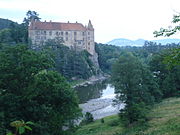
Because of the beauty of the valley, the French nobility preferred to settle here since the beginning of the Renaissance in the 16th century and built magnificent castles on the Loire . During this time, a large part of French politics took place here, so that Paris at times assumed an almost provincial character.
In 2000, the Loire Valley between the cities of Sully-sur-Loire and Chalonnes-sur-Loire was declared a World Heritage Site by UNESCO . Decisive were the rich architectural heritage, especially the numerous castles, and the two thousand year old development of the Loire Valley as a cultural landscape.

The mesoclimate formed by the river favors the agricultural use of the Loire Valley. Of particular importance are the wine-growing areas on the river, which are grouped under the umbrella brand of the Val de Loire wine-growing area .
The inhabitants of the Loire Valley are called Ligériens , derived from Liger , the Latin name of the river. They celebrate the Festival de Loire every two years (in odd years) in Orléans and other participating locations .

shipping
In the past, the Loire was an important axis for shipping and freight traffic, today it can only be used by larger ships from the estuary to Nantes . Above Nantes to the confluence of the Maine , at Bouchemaine , it is used by excursion boats, in the rest of the course you can only find fishermen and water sports enthusiasts . Because of its restricted navigability , the Loire is accompanied by navigable canals : the Canal de Roanne à Digoin between Roanne and Digoin and the Canal latéral à la Loire (German: Loire Lateral Canal ) between Digoin and Briare . A river cruise ship has been cruising the Loire between Saint-Nazaire and Angers since April 2015 . The new building, which was laid on keel in 2014, is equipped with a side-wheel drive so that it can sail despite the shallow water.
Economic use
Many industrial companies that use hydropower and transport facilities on and around the Loire have settled in the urban centers.
There are four nuclear power plants along the Loire , operated by the French company Électricité de France (EDF): Belleville , Dampierre , Saint-Laurent and Chinon . They use the river to cool off.
Tributaries

Explanations for the table:
- If in a line the indication of the confluence side (“right” / “left”) has been moved under the name box of a line above, the body of water shown in the bottom line flows into the one shown in the above line.
- If in the line under an inflow of a tributary an inflow of a next higher-ranking river is listed, the associated page number is accordingly further up under the beginning of the name box of the higher-ranking river.
- Arrows point downstream and mark the upper parts of a previously mentioned river course.
| Mouth in the direction of flow seen from |
Surname | Code SANDRE |
Length [km] |
Catchment area [km²] |
Mean discharge [m³ / s] |
|||
|---|---|---|---|---|---|---|---|---|
| Loire | ---- 0000 | 1.006 | 117,356 | 931 | ||||
| Left | Acheneau from Lac de Grand-Lieu , there: | M8-0270 | 28.8 | 700 | ? | |||
| Left | Boulogne | M8-0260 | 86.5 | 470 | ? | |||
| right | Ognon | M8205000 | 48.4 | 185 | ? | |||
| Left | Sèvre Nantaise | M7-0240 | 141.8 | 2,360 | 24.7 | |||
| Left | Maine | M74-0300 | 68.4 | 679 | 5.6 | |||
| right | Erdre | M63-0300 | 97.4 | 472 | 2.7 | |||
| Left | Layon | M5-0200 | 89.9 | 950 | 4.0 | |||
| right | Maine from the confluence of: | M4-0190 | 11.5 | 22,350 or 23,314? | 127 | |||
| right | Mayenne | M --- 0090 | 202.3 | 5,820 | 50 | |||
| right | Oudon | M3-0180 | 103.2 | 1,480 | 9.0 | |||
| Left | Sarthe | M --- 0060 | 313.9 | 16,374 or 22,185? | 80-85 | |||
| Left | Loir | M1-0160 | 317.4 | 8,294 | 32.2 | |||
| Left | Huisne | M0-0150 | 164.4 | 2,404 | 13.1 | |||
| right | Authion | L9-0220 | 99.8 | 1,400 | ? | |||
| Left | Thouet | L8-0210 | 142.5 | 3,396 | 17th | |||
| right | Dive | L85-0300 | 73.7 | 850 | 24.9 | |||
| Left | Vienne | L --- 0060 | 363.2 | 21,161 | 210 | |||
| right | Creuse | L --- 0070 | 263.6 | 10,279 | 85 | |||
| right | Claise | L6-0200 | 87.6 | 1,123 | 4.5 | |||
| Left | Gartempe | L5-0180 | 204.6 | 3,922 | 38 | |||
| right | Anglin | L5-0190 | 91.3 | 1,693 | 12.5 | |||
| Left | Clain | L2-0160 | 144.3 | 3,217 | 21.5 | |||
| Left | Indre | K7-0260 | 279.3 | 3,428 | 18.7 | |||
| Left | Cher | K --- 0090 | 367.8 | 13,920 | 95.9 | |||
| right | Sauldre | K6-0250 | 183.1 | 2,254 | 14.6 | |||
| Left | Arnon | K6-0240 | 150.5 | 2,274 | 14.4 | |||
| right | Yèvre | K5-0230 | 80.6 | 2,220 | 15.5 | |||
| right | Cisse | K4-0150 | 81 | 1,295 | 1.5 | |||
| right | Burn | K48-0310 | 54.2 | 263 | 1.2 | |||
| Left | Beuvron | K4-0220 | 115.2 | 2,193 | 11 | |||
| Left | Cosson | K47-0300 | 96.4 | 779 | 4.0 | |||
| Left | Arroux | K1-0180 | 129.4 | 3,166 | 34.5 | |||
| right | Nohain | K4094000 | 47.3 | 530 | 3.5 | |||
| Left | Vauvise | K40-0310 | 57.7 | 392 | 2.8 | |||
| right | Nièvre | K19-0300 | 49.6 | 630 | 5.3 | |||
| Left | Allier | K --- 0080 | 420.7 | 14,310 | 144 | |||
| Left | Sioule | K3-0200 | 163.4 | 2,458 | 25.6 | |||
| right | Dore + over the mouth longer: | K2-0190 | 140.5 | 1,523 | 20.3 | |||
| right | Dolore | K2834000 | 37.1 | 70 | 1.2 | |||
| Left | Alagnon | K25-0300 | 85.9 | 1,042 | 11.8 | |||
| right | Senouire | K23-0300 | 63.1 | 170 | 1.6 | |||
| Left | Chapeauroux | K21-0300 | 56.1 | 399 | 3.4 | |||
| right | Aron | K17-0300 | 103.8 | 1,600 | 17.6 | |||
| Left | Alène | K17-0310 | 56 | 338 | 4.48 | |||
| Left | Acolin | K1-0150 | 63 | 384 | 2.5 | |||
| right | Somme | K16-0300 | 46 | ? | ? | |||
| Left | Besbre | K15-0300 | 106.4 | 762 | 9.2 | |||
| Left | Vouzance | K1414000 | 41.3 | 152 | 0.8 | |||
| right | Arroux | K1-0180 | 129.4 | 3,166 | 34.5 | |||
| Left | Bourbince of Canal du Center accompanied | K13-0300 | 82.4 or 83.7 | 877 | 7.8 | |||
| right | Oudrache | K1374000 | 48.3 | 178 | ||||
| right | Arconce | K11-0320 | 99.8 | 599 | 5.7 | |||
| right | Sornin | K10-0300 | 47 | 520 | 7.4 | |||
| right | Rhins | K09-0300 | 59.8 | 427 | 5.3 | |||
| Left | Aix | K08-0300 | 49.5 | 436 | 3.1 | |||
| Left | Lignon du Forez | K07-0320 | 59 | 664 | 8.3 | |||
| right | Coise | K06-0330 | 49.6 | 350 | 1.6 | |||
| Left | Mare | K06-0310 | 46.9 | 245 | 0.9 | |||
| right | Semène | K0567700 | 45.7 | 155 | 1.9 | |||
| Left | Ance | K05-0300 | 77.1 | 547 | 4.3 | |||
| right | Lignon du Velay | K04-0300 | 85.1 | 714 | 9.8 | |||
| right | Dunières ← Dunerette | K0454000 | 42.1 | 236 | 3.2 | |||
| Left | Arzon | K03-0300 | 43.9 | 156 | 1.5 | |||
| Left | Borne ← Borne Occidentale | K02-0300 | 48.4 | 428.7 | 3.9 | |||
photos
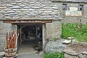
Source of the Loire in the former stable
Official source of the Loire
Lavoûte-sur-Loire , 10 km downstream from Le Puy-en-Velay

Loire just above Retournac

Loire just below Retournac

Loire near Andrézieux , the end of the first (horse) railway on the European continent

The Loire near Orléans

Loire east of Amboise upstream

Questionable remains of a Roman bridge in Tours

Bridge over the Loire in Saumur


.jpg)


See also
Web links
Individual evidence
- ↑ Source geoportail.gouv.fr
- ↑ estuary geoportail.gouv.fr
- ↑ Water information system , Service d'Administration National des Données et Référentiels sur l'Eau (French) ( information ), accessed on November 26, 2011, rounded to full kilometers
- ↑ a b hydro.eaufrance.fr (station: M8420010 , option: Synthèse )
- ↑ The Loire Valley between Sully-sur-Loire and Chalonnes ( Memento of the original from November 27, 2018 in the Internet Archive ) Info: The archive link has been inserted automatically and has not yet been checked. Please check the original and archive link according to the instructions and then remove this notice. Entry in the UNESCO World Heritage List (English)
- ↑ Festival de Loire (French)
- ^ Bonapart.de: paddle wheel river cruiser "Loire Princesse" christened in Nantes. Retrieved April 21, 2015 .
- ↑ Persée: Un pont (?) Antique (?) À Tours / An ancient (?) Bridge (?) At Tours

Historic city centers:
Episcopal city of Albi (2010) |
Roman and Romanesque Monuments of Arles (1981) |
Papal Palace , Cathedral and Avignon Bridge (1995) |
Bordeaux , Port de la Lune (2007) |
Carcassonne (1997) |
Le Havre (2005) |
Lyon (1998) |
Stanislas, de la Carrière and d'Alliance squares in Nancy (1983) |
Seine River from Paris (1991) |
Provins , city of medieval fairs (2001) |
Strasbourg: from Grande-Île to New Town (1988, 2017) |
Vézelay abbey church and hill (1979)
Structures:
Fontenay Abbey (1981) |
Saint-Savin Abbey (1983) |
Belfries in Belgium and France (2005) |
Canal du Midi (1996) |
The architectural work of Le Corbusier (2016) |
Vauban's fortifications (2008) |
Great Saltworks of Salins-les-Bains and Royal Saltworks of Arc-et-Senans (1982) |
Amiens Cathedral (1981) |
Bourges Cathedral (1992) |
Chartres Cathedral (1979) |
Mont-Saint-Michel and its bay (1979) |
Pont du Gard (1985) |
Notre Dame Cathedral, former Saint-Remi Abbey and Palais du Tau in Reims (1991) |
Fontainebleau Castle and its Park (1981) |
Palace and Park of Versailles (1979) |
Orange Theater and Arc de Triomphe (1981)
Archaeological sites:
Chauvet grotto near Vallon-Pont-d'Arc (2014) |
Prehistoric pile dwellings around the Alps (2011) |
Vézère valley: sites and cave paintings (1979)
Cultural and natural landscapes:
Nord-Pas de Calais mining area (2012, K) | District Saint-Emilion (1999 K) |
Causses and Cevennes (2011, K) |
Climats - vineyards in Burgundy (2015, K) |
French Southern Territories and Seas (2019, N) |
Way of the pilgrims in France (1998, K) |
Gulf of Porto: Piana Calanche, Gulf of Girolata and Scandola Nature Reserve (1983, N) |
Mont Perdu (1997, K / N) |
New Caledonia lagoons (2008, N) |
Loire Valley - Between Sully-sur-Loire and Chalonnes-sur-Loire (2000, K) |
Taputapuātea (2017, K) |
Volcanic landscape on La Réunion (2010, N) |
Vineyards, wine houses and wine cellars of Champagne (2015, K)