
Moorhusen (Wilstermarsch)
| coat of arms | Germany map | |
|---|---|---|

|
Coordinates: 53 ° 58 ' N , 9 ° 23' E |
|
| Basic data | ||
| State : | Schleswig-Holstein | |
| Circle : | Stone castle | |
| Office : | Itzehoe country | |
| Height : | -1 m above sea level NHN | |
| Area : | 4.68 km 2 | |
| Residents: | 84 (Dec. 31, 2019) | |
| Population density : | 18 inhabitants per km 2 | |
| Postal code : | 25554 | |
| Area code : | 04823 | |
| License plate : | IZ | |
| Community key : | 01 0 61 070 | |
| Office administration address: | Margarete-Steiff-Weg 3 25524 Itzehoe |
|
| Website : | ||
| Mayor : | Frank Nagorny | |
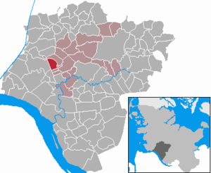
| Location of the municipality of Moorhusen in the Steinburg district | ||
  |
||

Moorhusen is a municipality in the Steinburg district in Schleswig-Holstein .
Geography and traffic
Moorhusen is about 10 km northwest of the district town of Itzehoe and is on the border of the marsh to the Geest . The village extends for about two kilometers. The Herrenmoor , a nature reserve, is located north of the municipality .
history
Moorhusen is first mentioned in 1247. 16 wind turbines have been operated in Moorhusen since 2005. Construction work on the first plants began in the late 1990s.
politics
coat of arms
_Siegel.png)
The “coat of arms” of the community cannot be heraldically described and is therefore not a coat of arms in the actual sense, but rather to be assigned to the image seals. It was elected by the community after the Second World War in the absence of official seals that are free from National Socialist and Imperial symbols and is still used today.
The picture seal shows the centuries-long struggle of the Moorhusener with the water in the low-lying marshland and moor areas . Shown in the form of a dike and scoop mills .
Personalities
The architect Emil Thormählen was born in Moorhusen in 1859.
Web links
Individual evidence
- ↑ North Statistics Office - Population of the municipalities in Schleswig-Holstein 4th quarter 2019 (XLSX file) (update based on the 2011 census) ( help on this ).
- ↑ Schleswig-Holstein's municipal coat of arms
- ^ Wikipedia: Coats of arms in Schleswig-Holstein approved by the British military government
Carrion | Abbissinwish | Agethorst | Altenmoor | Auufer | Bahrenfleth | Beidenfleth | Bekdorf | Bekmünde | Besdorf | Blomean Wilderness | Bokelrehm | Bokhorst | Borsfleth | Breitenberg | Breitenburg | Brokdorf | Brokstedt | Büttel | Christinenthal | Dägeling | Dammfleth | Drage | Ecklak | Elskop | Engelbrecht Wilderness | Fitzbek | Glückstadt | Grevenkop | Gribbohm | Hadenfeld | Heiligenstedten | Heiligenstedtenerkamp | Hennstedt | Heart horn | Hingstheide | Hodorf | Hohenaspe | Hohenfelde | Hohenlockstedt | Holstenniendorf | Horst (Holstein) | Huje | Itzehoe | Kaaks | Kaisborstel | Kellinghusen | Lapwing row | Kleve | Kollmar | Kollmoor | Krempdorf | Brim | Kremperheide | Krempermoor | Kronsmoor | Krummendiek | Kudensee | Lägerdorf | Land law | Landscheide | Lockstedt | Lohbarbek | Looft | Mehlbek | Moordiek | Moorhusen | Mühlenbarbek | Münsterdorf | Neuenbrook | Neuendorf b. Elmshorn | Neuendorf-Sachsenbande | Nienbüttel | Nortorf | Nutteln | Oelixdorf | Oeschebüttel | Oldenborstel | Oldendorf | Ottenbüttel | Peissen | Pöschendorf | Poyenberg | Pulse | Quarnstedt | Wheel | Reher | Rethwisch | Rosdorf | Sankt Margarethen | Sarlhusen | Schenefeld | Schlotfeld | Silzen | Summer land | Stördorf | Störkathen | Süderau | Vaale | Vaalermoor | Wacken | Warring wood | Westermoor | Wewelsfleth | Wiedenborstel | Wills | Wilster | Winseldorf | Wittenbergen | Wrist | Wulfsmoor