
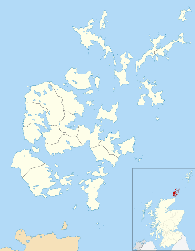
Orkney
|
Orkney Arcaibh |
|
|---|---|
 Orkney flag |
|
  |
|
| Administrative headquarters | Kirkwall |
| surface | 990 km² (16.) |
| Population (2010) | 20,110 (32nd) |
| ISO 3166-2 | GB-ORK |
| ONS code | 00RA |
| Website | www.orkney.gov.uk |
Orkney ( Orkney Islands [ ˌɔːknɪˈaɪləndz ]; dt. Outdated also Orkaden; still used adjective: Orkadisch ) is an archipelago belonging to Scotland and consists of the main island Mainland and around 70 smaller islands . It is north of Caithness within sight of the Scottish north coast, separated from it by the Pentland Firth .
Names
The origin of the name Orkney is unknown. S. Tomany assumes that the Latin name orcades contains the Celtic word ork "young boar", possibly a tribal name. The Norwegian conquerors would have taken a phonetic relationship with the word orkn " seal " as an opportunity to name the archipelago Orkn-eyjar , ie "seal islands ".
Place names
In the 8th and 9th centuries AD, the Norwegian replaced the original Pictish place names almost completely. There are over 10,000 place names, most of which are derivatives or falsifications of an Old Norse name. These words were mixed up with a few words of Celtic origin and a handful of later Scottish imports.
Administrative division
Community Council Areas
In July 2012 there were 20 Community Council Areas in the Orkney Islands. Those marked with an asterisk have active community councils.
- Birsay *
- Eday *
- Evie and Rendall *
- Firth and Stenness *
- Flotta *
- Graemsay , Hoy and Walls *
- Harray and Sandwick *
- Spar *
- Kirkwall & St Ola *
- North Ronaldsay *
- Orphir *
- Papa Westray *
- Rousay , Egilsay , Wyre & Gairsay *
- Sanday *
- Shapinsay *
- South Ronaldsay and Burray *
- St Andrews and Deerness *
- Stromness *
- Stronsay *
- Westray *
Civil Parishes
|
|
.svg)

The islands

The archipelago is spread over an area of almost 50 km east-west and 85 km north-south, between the 58th and 59th degrees north. This corresponds to the geographic height of Saint Petersburg and southern Greenland . Of the 990 km² area with 492 km² almost exactly half is on the main island The Mainland .
All major islands except Mainland have names with the suffix "ay", which is derived from the Old Norse word for "island" and is contained in the German word Eiland .
The rise of the Holocene sea level changed the area of the Orkneys. It reached its present position about 4,000 years ago.
List of islands

The larger uninhabited and mostly permanently or seasonally inhabited islands are listed.
| Today's names | Skarðsá annál (14th century) |
|---|---|
|
|
population
20 islands are inhabited. Papa Stronsay as a monastery settlement ( Transalpine Redemptorists ) with limited access for the public, another island has been seasonally inhabited in recent years. The most important cities are Kirkwall as the administrative center and hub of all traffic with around 7000 inhabitants and Stromness as one of the ferry ports from / to the mainland with around 2000 inhabitants; both are on mainland . The islands had the highest population in 1861 with over 32,000 inhabitants. It fell continuously until 1971 (17,000) and was around 21,000 in 2011.
administration
The administrative district ( Unitary Authority ) is officially called “Orkney Islands”, but is also often referred to as “Orkney” for short by the Scottish government in laws and pronouncements . The Orkneys form an independent Lord-Lieutenancy (lieutenancy area). The main political body is the Orkney Islands Council with 21 members, which also owns and operates Orkney Ferries , the ferry company that operates between the islands of the Orkneys.
The official language and lingua franca on the islands is English , the common language is Orcadian , a variant of the Insular Scots . In this dialect , especially in the vocabulary, in the pronunciation, but also in the grammar, remnants of the Scandinavian Norn language used between 800 and 1700 AD - but which became extinct in the course of the 18th century - have been preserved.
history
prehistory

Left: ideal-typical Stalled Cairn .
Middle: generalized chambered cairn of the maeshowe type .
Right: an ideal heel-shaped cairn (also horned cairn ), which occurs almost exclusively on Shetland. It is possible that the Isbister Cairn on South Ronaldsay with a “facade” tapering to a point is the only example on the Orkneys belonging to the heel-shaped Cairns.
By 11500 BC The Orkneys lay under the ice of the glaciers. When the Pentland Firth was flooded so that the landmass became the archipelago is a matter of dispute. The dates are between 10,000 and 8,000 BC. Chr. Two back knives from flint , on 2007 Stronsay were found, the earliest evidence of human activity could be on the islands. The archaeologists Caroline Wickham-Jones and Torbin Ballin assigned the 12,000 to 10,000 year old artifacts to the hunters and collectors of the Ahrensburg culture .
Around 5900 BC Ferns, grass and hazel bushes covered the archipelago. The Mesolithic is attested by microliths of the narrow blade tradition (narrow blades) and hazelnut shells from Longhowe on Tankerness, dating back to 6740 ± 80 years BC. Are dated. A pollen diagram from Quoyloo (Mainland) with charcoal deposits shows a clearing episode around 6500 BC. Chr.
Neolithic
Around 3900 BC The Neolithic era began on the islands. The oldest pottery, which can also be found in northwestern Scotland, is the Unstan Ware (named after a megalithic complex on the Mainland). The Knap of Howar settlement and the specific shape of the megalithic Stalled cairns , which belong to the Orkney-Cromarty type of the Passage Tombs , date from this period . The 58 Stalled Cairns are represented on all the large and some of the small islands (Faray, Swona, Eday, Helliar, Papa Westray). Rousay alone still houses 15 systems and thus more than the mainland (10). The younger passage graves of the Maes Howe type with cruciform chambers can be found on Eday (1), Egilsay (1), Mainland (5), Sanday (2), South Ronaldsay (2), Westray (1) and Papa Westray (1) . The Unstan Ware is around 3300 BC. Superseded by the Grooved Ware (grooved goods) of the Rinyo subtype, which was found in Skara Brae , Rinyo , Barnhouse and at the enclosure near Sandwick .
In addition to megalithic systems such as Blackhammer , Cuween Hill , Isbister Cairn - "Tomb of the Eagle", Knowe of Yarso , Maes Howe , Midhowe Cairn , Quoyness , Taversoe Tuick , Unstan Cairn and Wideford Hill Cairn are stone circles and henges (such as the Ring of Brodgar ) known. The rock chambers of Crantit Cairn (bricked) and the Dwarfie Stane (picked) are structurally just as unique as the Cairn on the Head of Work . The settlement of Smerquoy near St Ola on Mainland was excavated in 2013 and dated to 3200 BC. Dated. Finds of the bell beaker culture date from around 2000 BC. From the Sand Fiold cist . The Orkney cists are only partially comparable with the continental stone boxes ; At most, the small stone boxes of the Uckermark are similar , whereby the stone boxes of the Orkneys are on average much smaller, mostly no wider than 0.6 m and no longer than 1.0 m. Sand Fiold is one of the largest with dimensions of 1.6 × 1.0 × 1.0 m. At the same time, it is one of the few free-standing copies. It was built in an artificially created rock pit measuring around 3.0 × 3.2 m and used repeatedly. There is evidence of gold jewelry from other stone boxes.
Bronze age
Between 1000 and 400 BC The Burnt Mounds ( Ancient cooking place ) emerged, of which over 200 are known. They are piles of burned stones that are always close to fresh water and can be up to 30 m in diameter. The Liddle Burnt Mound on South Ronaldsay was excavated .
Between about 2500 and 700 BC There are no traces of construction (possibly due to a climate change).
Iron age
The Iron Age , which became the period of the Brochs ( Gurness , Midhowe , Birsay , Borwick , Bu , Windwick etc.) began around 700 BC. The round houses of Pierowall and Quanterness were also built in this period. Souterrains or earth houses are also known from other parts of the British Isles and Brittany. They come from the first millennium BC. The Crantit , Grain Earth House (near Kirkwall ) and Rennibister (all on Mainland) systems cannot be dated precisely.
antiquity

- Around 325 BC The Greek Pytheas is said to have visited the "Cape Orcas" on his exploration trip, which is usually equated with the Orkneys. He describes the inhabitants as Pretani .
- After Tacitus (Agricola), the Roman governor sent a fleet to explore the islands in 83 AD.
- Claudius Ptolemy calls the islands Orcades in his Geographika .
- The earliest date before the Normans landed before AD 800 is Cormac's missionary trip to the Orkneys, which is said to have taken place around AD 580. It is believed that the inhabitants of the Orkneys were Picts before the Viking invasion .
- The Pict king Bridei mac Bili and his fleet destroyed the growing naval power of the Orkneys in 682.
Viking Age on Orkney
The modern inhabitants are partly descended from Norwegians . According to Snorris Heimskringla , their king Harald I (Fairhair) is said to have left the islands to Røgnvald I. Eysteinsson from Møre in Norway in 876 and made him Jarl after the islands had been in Viking hands for decades. Archeologically there are no corresponding early finds. It is possible that Sigurd the Mighty, mentioned in the Heimskringla, was the first Norwegian Jarl on the islands. Even Erik Bloodaxt is only reported to have roamed the Orkneys and Hebrides. When the Norwegians actually set foot on the Orkneys is unknown. One of the main sources is the Orkneyinga saga , if not necessarily for people and events from this period, but at least for the view of the 13th century in Norway. An earlier version was probably written around 1200, the surviving version dates from the middle of the 13th century. Their evaluation as a historical source is extremely difficult. It is archaeologically certain that there were Christian Picts there before the pagan Norwegian immigrants . The Orkneyinga saga doesn't mention the Picts at all and tries to give the impression that Olav Tryggvason brought Christianity to the Orkneys. In the second chapter the Pictish Jarl Melbrikta (Máelbrigte Tusk, Máel Brigte of Moray) is mentioned, but not that he was a Christian. Sigurd's death is attributed to the magical properties of Melbrikta's poisonous teeth, which injured him when he rode home with his head as a trophy on the saddle. The political conditions of the plot period such as the conflicts of the 9th century including the Danelag in England are not mentioned in the Orkneya saga.
The relationship between Scandinavians and Picts is controversial. The archaeologist Anna Ritchie concluded from the archaeological finds that Scandinavians and Picts coexist in peace. Brian Smith sees the loss of all Pictish place names as evidence of the violent suppression of the Pictish population and culture.
Orkney did not refer to the islands in the Middle Ages, but the Jarltum Orkney. Around 1050, Þorfinnur the Mighty Jarl was on Orkney . His domain included northern Scotland ( Caithness , Sutherland ), Shetland and the Hebrides. He sought his own empire from Shetland to the Isle of Man with a parallel ecclesiastical organization ( Kingdom of the Isles ). But this structure fell apart under his sons. Instead, Scottish families gained influence over Orkney. Scottish bishops were even installed in the 12th century. Then two Jarls emerged: Orkney-Shetland under Norwegian, Caithness under Scottish suzerainty. In 1231 the Norwegian Jarls line ended in Orkney. After the battle of Largs, which was not victorious for the Norwegian king Håkon Håkonsson, in 1263 AD, the Norwegian influence on Scotland and the Orkneys gradually waned. But Orkney was still the only real hereditary fief of the Norwegian Empire. The episcopal see at Saint Magnus Cathedral was subordinate to the archbishopric in Nidaros and was the only episcopal see in the Norwegian tributary countries that had its own cathedral chapter . Around 1350 the connection to Norway was still strong. This was due to the fact that Jarl Erengisle Sunesson , a Swedish nobleman, had no fiefs in Scotland. His father-in-law Malise of Strathearn was the last Jarl who was also Jarl of Caithness. The Jarltum on Orkney was apparently inherited according to private law rules. Malisle only had daughters. These could not become Jarle themselves, but through them the Jarltum could reach their husbands. Erengisle was married to the eldest daughter of Malisle and so came to Jarlsrang. Erengisle belonged to the Swedish aristocratic family that led Erik Magnusson to rebel against his father Magnus . With the comparison between father and son, Erengisle was no longer a Norwegian hereditary man. His wife, over whom he had the jury, died childless. Erengisle retained rank and title, but the fief went to the sons of his sister-in-law. But none of them were of age. So came the Sysselmann Håkon Jonsson and supported the Norwegian royal power. At this time there was a conflict between the royal power and the church, the reason for which is not exactly known. Håkon Jonsson represented the king, the Scottish bishop Viljalm the church. He was in a relationship of loyalty to the Scottish king. In 1369 a comparison was made between the two. After that, the bishop had to pay 141 nobles and promise to give ministries only to locals from Orkney and Shetland. The other Norwegian bishops were also required to employ local clergy. This leads to the conclusion that Bishop Viljalm brought along fellow Scottish people, for whom he had procured the best benefices. The 141 nobles could be connected with the Peace of Perth of 1266, in which Magnus lagabætir had handed over the Isle of Man and the Hebrides to Scotland in return for a payment of 4000 marks sterling and an annual contribution of 100 marks. In all probability, these 100 marks were paid to the bishop at St. Magnus Cathedral to be passed on to the Norwegian king and had been embezzled by him. The Norwegian-Danish crown estate on the Orkneys - d. H. the land in question and the rights arising from the land - came under the control of Scotland in 1469 as security for the dowry of the daughter of the Danish King Christian I , when this King James III. of Scotland married.
Orkney as part of Scotland
In 1468 the Orkneys were annexed to the Kingdom of Scotland and integrated into the general administration of the Empire. The treasures went out. In 1472 the islands passed from the Archdiocese of Nidaros to the Archdiocese of St. Andrews . When Christian III. of Denmark and Norway equipped a fleet of more than 125 ships in 1555, which sailed from the Oresund - presumably to combat privateers - in the North Sea, it was assumed that the Hanseatic League , but also in France and Scotland behind it, intended to destroy the "orcades" to want to recapture.
The language of the Scandinavian rulers in the Orkneys gradually changed to the norn , a dialect that became extinct in the 17th century. Nevertheless, traditional ties to Norway were maintained for a long time. In the years 1613–1650, 78 Orkney citizens were registered in Bergen . The early modern copies of the Orkneyinga saga were made in Bergen.
The Reformation destroyed the economic foundations of the church. Their property was distributed to influential families at the Scottish royal court. The Stewart Earls Robert and Patrick ruled Orkney until 1615. That year Patrick was beheaded. The allegation was collaboration with Denmark and the use of wrong weights and measures. It is believed that old traditions were held here against the Scottish crown. In the centuries that followed, land ownership was concentrated in a few families, the so-called lairds . At the end of Queen Victoria's reign, only 10% of the farmers were farming on their own land. There was a boom between 1780 and 1830, when large quantities of sodium carbonate and potassium carbonate were extracted from kelp . In 1848–1880 there was an agricultural revolution with also considerable income, which destroyed the last remnants of peasant traditions and family cultures. After that, revenues dwindled, economic interest turned to industry, and interest in land ownership in Orkney waned. The large estates were divided up and sold to the local farmers in small areas ( ownership revolution ).
The Orkneys played a not insignificant role in World War II . The number of soldiers stationed there exceeded that of the local population many times over. This led to a great economic boom. As a result, numerous foreigners moved to the Orkneys.
Today only half as many people are employed in agriculture as in the 1920s. The Orkney people have always been seen as farmers who do a little fishing, the Shetlanders as fishermen who do a little farming. New jobs were created primarily in administration, the oil industry and tourism.
geography
Scapa Flow is a small inland sea in the south of the archipelago. The numerous natural harbors on all coasts shaped not only the economic and military history of the archipelago in all historical epochs, but also that of the entire United Kingdom. These include:

- Osmundswall, South Walls / Hoy , Hamnavoe (now Stromness ), Houton, Orphir, Scapa and Holm, all The Mainland and St. Margarete's Hope / South Ronaldsay as important landing sites for the Vikings, safe havens for their fleets and locations of the Orkneyinga saga .
- Longhope, South Walls / Hoy as a safe haven for the "Achter rum" voyage, the meeting point for the continental whalers of the Greenland voyage and later - fortified by the Martello towers and artillery batteries from Hackness North and Hackness South - as a meeting point for the convoys breaking blockade at the time of the continental blockade by Napoleon .
- Stromness as the port of last call (last home port to be served) of the British Admiralty, especially its expedition trips under Drake, Bligh, Franklin and others. a., as a base and probably the most important recruiting location of the Hudson's Bay Company or as one of the most important port locations of various fishing booms from the 16th to the 19th century with up to well over 10,000 seasonal workers in the processing plants on land.
- Lyness / Hoy as the home port and base of the Grand Fleet in the First World War , Lyness and Flotta as the home port and base of the Home Fleet in the Second World War and the scene of the self-sinking of the interned Imperial German fleet in the sea area immediately east of the islands of Cava and Rysa Little on 21. June 1919.
- Scapa Bay in the northeastern part of the Flow . On the night of October 14, 1939, the German submarine U 47 under commandant Günther Prien penetrated the now heavily secured Scapa Flow and sank the British battleship HMS Royal Oak , which was an anti-aircraft battery off Kirkwall and otherwise only as Training ship and served for reconnaissance trips. 833 British seamen died.
- Flotta with the Flotta Oil Terminal , which was built from 1970 on the area of the former naval base and is now the second most important landing site for crude oil production from the North Sea oil fields .
- Stromness , St. Margaret's Hope and Burwick on South Ronaldsay as today's ferry ports to connect the archipelago to the Scottish mainland.
Four of the South Islands ( Lamb Holm , Glims Holm, Burray and South Ronaldsay ) are now connected by the so-called Churchill Barriers . Winston Churchill had them built during World War II to make it impossible for German submarines to pass through.
Geology and morphology


The rocks from which the islands are made up are essentially sediments from the Paleozoic Era , the Middle Old Red Sand - & Flagstones , which were formed in the Devonian . Almost 100 percent of the rocks are attributable to the Orkney group and the Caithness group , fine-grained to medium-sized sandstones that were deposited in the fresh and brackish water of the Orcadian Basin .
Stratigraphically, the following can essentially be distinguished:
- the (younger) Hoy sandstone , limited in occurrence to most of the island of Hoy
- among the Middle Old Red Sand & Flagstones
- the Eday beds found on Eday, West Sanday and Stronsay, East Shapinsay, in central and eastern The Mainland, on Burray, South Hoy and most of South Ronaldsay
- the Rousay flags , the islands of Rousay, Egilsay, Wyre, Gairsay, Westray, Papa Westray and North Ronaldsay completely, covering most of Sanday, Stronsay and Shapinsay and with extensive occurrences in the central and eastern part of The Mainland, with smaller occurrences in South Hoy / South Walls and on the islands of Scapa Flow
- the Stromness flags in the largest (western) part of west mainland and in the north of the island of Hoy as well as on Graemsay
- the (older) basement complex , which, however, only appears on a very small scale in an arc from Rackwick / Hoy via Nord-Graemsay, the Stromness area and at Yesnaby , both on The Mainland.
The layers of the Old Red Sandstone were never folded in the Orkney area, but were broken along several lines and discarded minimally. Almost everywhere the shift packages are almost horizontal, especially in the area of the west coast of The Mainland (between Warbeth Beach west of Stromness to Skipi Geo in the north), but also around North Ronaldsay or on the east coast of Sanday for the formation of large, flat rocky beaches and the Skerries, flatter, barely rising rocky reefs even at low tide.
The lack of folding explains the low heights of the hills on the Orkneys (highest point: Ward Hill, Hoy with 479 m). In the hilly landscapes on Hoy or Rousay, individual fragments of the strata of the Old Red were lifted to varying degrees as a result of the mountain building processes outside the region (such as the Caledonian mountain building). In the course of the Tertiary and Quaternary Ice Ages, the glacier currents milled their way along natural weak zones through the otherwise undisturbed layer packages, whereby the hollow and full forms (mountains and valleys) visible today were modeled.
In terms of color, the rocks vary between different gray, yellow and red to reddish-brown tones, depending on the time and conditions of origin, which is also shown again and again in topographical names: Red Geo / Hoy, Red and Gray Head / Eday. Some formations are very fossil-bearing; so have z. B. the numerous finds of coelacanth and panzerfish in the Stromness Beds (main location: Quoyloo Quarry) world renown. In other places, such as in the area of the coast of Yesnaby / West Mainland, small coral stocks, which are also called horse teeth formations due to their weathering forms , characterize the surface.
The rocks of the Old Red Sandstone found in the Orkneys are relatively "soft"; H. Susceptible to weathering, so that on the islands, similar to the neighboring Caithness on the mainland and in marked contrast to the rest of northern Scotland, comparatively good soils have developed. They established the archipelago's reputation as the “granary of Northern Scotland” and today provide the basis for intensive grassland farming with a focus on cattle breeding.
Houses, walls and even the furniture were made of stone in the Neolithic. Easily stackable, almost cuboidal weathering products and easy-to-break flagstones , large slabs only a few centimeters thick, were used. Natural forms of weathering are also reflected in the large slabs of prehistoric cultural monuments, make up a large part of their aesthetic appeal with their triangles, "chevrons", beveled plate ends, but also in popular scientific publications repeatedly lead to daring speculations about the "(art- ) manual skills and intentions “of the builder. The Orkney flags are still used today as a popular building material as flooring in residential buildings, as paving stones and for roofing in rural buildings .
The post-glacial forest seems to have been almost completely used up by the Mesolithic hunters and gatherers at the latest . According to 14 C-dated pollen analyzes on Mainland, shortly after 7040–6830 BC, The development of hazel-birch bushes. These disappeared from 2880-2710 BC. Again from the landscape. Individual ash horizons in the soil profiles of various locations may indicate slash and burn in the course of the earliest Neolithic land grab . The root system of larger hazel bushes that was unearthed on Sanday after 2000 seems, according to previous knowledge, at best suitable for modifying the overall picture described above only in very small-scale to local areas.
The pollen analysis provides indications that, with basically the same course of the fluctuations in the extremes, the values were not reached as in the neighboring regions of Shetland and Caithness. For the modern age, this is obviously certain knowledge. There are no catastrophic reports from Orkney for the middle of the 17th century as from Shetland, where within a few years entire farms were drowned in the rapidly increasing sandstorms (blowen to Bergene).
The current coastlines were created as a result of the post-glacial sea level rise on the one hand and the subsidence of the mainland, especially in the area of the west coasts, due to glacial-isostatic compensatory movements on the other. According to the “10-fathom submarine contour”, corresponding to the 20-meter depth line, the Neolithic coastline, the archipelago at that time consisted of only two islands. The South Island consisted of the mainland and almost all the islands off the coast to the south with a smaller bay, Scapa Flow and a strongly indented north island less than a kilometer away with the remaining islands of today's archipelago.
As a result of the processes mentioned above, today's large “inland lakes” of West Mainland were also formed: the basin, which was originally dry after the Ice Age, was later penetrated by sea water from the southwest, creating a large bay. After sea level rise, land subsidence and increasing siltation in the transition to Hamnavoe (a northern branch of the Scapa Flow sea area) balanced each other in the recent geological past, the lochs of Harray and Stenness became increasingly sweet. Both lochs still have a connection to the sea, although the water exchange from south-east to north-west is practically zero.
The lochs of Harray and Stenness seem to have been largely dry in the Neolithic, when the henge monuments of Stenness, Brodgar and Bookan were built; at most there were very small inland lakes at the bottom of the large, central hollow of West Mainland, in which the water from the surrounding streams collected. Geophysical surveys in the field of UNESCO - World Heritage on the promontory of Brodgar from the years 2004/2005 show in today's seabed some clear anomalies as abandoned stones on the direct route between the monuments and the likely quarries of Vestra Fiold (north of Skara Brae ) can be interpreted.
Considered across the entire archipelago, erosion or cliff coasts and compensation coasts are roughly equally represented, each with a share of around a third. With a few exceptions, they represent the entire treasure trove of forms ( graphic to the forms ) that can be observed in Scotland and beyond in Europe. In the area of the cliff coast, only the blowholes are currently missing as a transition form between the coastal cave and Gloup. Some of the large morphological forms along the Orkney cliffs are some of the most beautiful natural sights of their kind that Scotland has to offer. Of the stacks , the rock needles, these include the Old Man of Hoy with an impressive 137 m height and Yesnaby Castle off the west coast of The Mainland. Also to be mentioned on the west coast of Deerness / east mainland are The Gloup (actually already in the development stage of a geo ) and the neighboring headland of the Brough of Deerness (shortly before the transition to a tidal island, comparable to the Brough of Birsay), but above all also the Vat of Kirbister, a gloup in the old age, in which the former cave ceiling is reduced to a huge rock gate above the former cave entrance ( see photos for selected shapes ).
In the area of the compensation coasts, the existing tombolo, for example between Hoxa and South Ronaldsay or Hunda and Burray, are difficult to recognize because either the natural development has advanced so far that they appear like the remains of larger land bridges, or because they are highly anthropogenic (e.g. by road construction) are overformed.
During the last Ice Age (Devensian), Orkney was on the edge of the ice and was probably no longer completely covered with glaciers. This can be concluded not only from the glacial-isostatic compensatory movements, but also from the fact that at least one flowering plant, the extremely small Primula scotica orcadensis , survived the Ice Age in several locations. The findings for the island of Hoy are controversial. Due to some morphological forms in the hillside elevations of Ward Hill and Cuilags, which are interpreted as the remains of former glacial cirques, some experts suspect that it has its own icing center.
The glacier flows of the last Ice Age consistently followed the vastly cleared valleys that had been created in the course of tertiary glaciation. This is particularly clear in the central and eastern part of The Mainland and across the island of Shapinsay (there mainly stroking from north-northeast to south-southwest) and between the northwest of The Mainland and the island of Rousay (there stroking from east to west) . Unless it was flooded after the Ice Age, eroded by wind erosion or shaped by agricultural activities, we can still find the clearest examples from the glacial treasure trove in these regions: large-scale traces of glacial erosion, of glacier cut and moraine remnants on the southern flanks of the heights of Rousay or the drumlins on Shapinsay.
The processes and forms of late and post-glacial Aeolian erosion and sedimentation are of particular importance for the appearance of the landscape and the development of the cultural landscape. Through them z. B. the "highlands" especially of the northern islands. These are more or less thickened moraine or rock cores that have been used as settlement sites since ancient times. With several Holland farms , the best known on Papa Westray and North Ronaldsay, the Houllands on The Mainland and elsewhere, they can still be identified today by place and district names.
The most important overall product of these processes, however, is the island of Sanday. The sand island , as the name is literally translated, consists of several thickened, flat rock cores which, comparable to the neighboring Skerries, would only protrude a little above sea level today. The island with its bizarre shape, which clearly distinguishes it from all other Orkney islands, was only created as a result of sand transport parallel to the coast through beach ridges, subsequently connected by spits (ayers) and subsequently silted up and further thinned out. Around 30% of today's island was created by sand transport. All of these processes are still very active today. That is why the eastern half of the islands, including the extensive, pure sandy mudflats of the Cata Sands and in the Otters Wick, was placed under protection as the RAMSAR East Coast of Sanday site .
Orkney has a number of Sites of Specific Scientific Interest (SSSI). These are limited areas that, due to their geological and / or biological importance, enjoy the most extensive protection under UK / Scottish nature conservation law. Of these, the ones that are particularly worth mentioning
- Northwaa SSSI / Sanday, a complex mixture of fossil and active dunes in the north of the island with a very differentiated vegetation unusual for this geographical latitude
- The Loons SSSI in the northwest of The Mainland, a slowly silting inland lake in a small deflation basin, which has been showing signs of raised bog formation in older siltation zones for several years
and
- Aikerness SSSI on the peninsula of the same name in North Mainland. Aeolionites can be observed here in the status nascendi , i.e. H. fossil dunes in the transition to a very porous sand-lime brick, whereby the lime released from the broken shell that was blown with the sand serves as a binding agent.
Of the unprotected geomorphological phenomena or shapes that laypeople perceive as less spectacular, at least the Rousay storm coast must be addressed. Storm coasts are formed when the interplay of surf and wind transports rock debris from the foot of a cliff upwards and over the edge of the cliff into the hinterland. Such a storm coast can be observed on the west coast of the island of Rousay, a little southwest of Sacquoy Head. Even if the forces acting here are significantly lower than at the most important storm coast occurrence in Scotland (Eshaness / Shetland), they are still sufficient to regularly throw debris up to football-sized over the 40 to 60 meter high cliffs and them to be deposited on the land sorted by size: the further they are from the cliff edge, the smaller the stones are.
climate
| Kirkwall | ||||||||||||||||||||||||||||||||||||||||||||||||
|---|---|---|---|---|---|---|---|---|---|---|---|---|---|---|---|---|---|---|---|---|---|---|---|---|---|---|---|---|---|---|---|---|---|---|---|---|---|---|---|---|---|---|---|---|---|---|---|---|
| Climate diagram | ||||||||||||||||||||||||||||||||||||||||||||||||
| ||||||||||||||||||||||||||||||||||||||||||||||||
|
Average monthly temperatures and rainfall for Kirkwall
Source: wetterkontor.de
|
|||||||||||||||||||||||||||||||||||||||||||||||||||||||||||||||||||||||||||||||||||||||||||||||||||||||||||||||||||||||||||||||||||||||||||||||||||||||||||||||||||||
Orkney has a cool temperate climate ( Cfc ) that is remarkably mild and uniform for an area at such latitudes due to the Gulf Stream . The average annual temperature is 8 ° C, the average temperature for winter 4 ° C and for summer 12 ° C.
The average rainfall varies from 850 mm to 940 mm. The wind is a key feature of the climate and even in summer you can feel almost constant breezes. The winters are very windy, with an average wind speed of 52 km / h.
One of the tourist attractions are the "nightless" summers. On the summer solstice, the sun rises at 3:00 AM and sets at 9:29 PM. The long twilight is known as "simmer dim" on the northern islands. The winter nights are long. On the winter solstice, the sun rises at 9:05 am and sets at 3:16 pm. In winter, northern lights can occasionally be seen on the northern horizon.
Attractions on Mainland and the connected islands
Others see under the appropriate island name


- Scapa Flow
- Burray; Orkney Fossil & Vintage Center
- Mainland
-
UNESCO - World Heritage Heart of Neolithic Orkney
- Skara Brae Neolithic Settlement
- Barnhouse Neolithic Settlement
- Stones of Stenness
- Ring of Brodgar
- Ring of Bookan
- Maeshowe Chambered Cairn
- Enclosure at Sandwick
- The Standing Stones of the Orkney World Heritage Site
- Brough of Birsay
- Brough of Deerness
- Earl's Palace Birsay
- Orphir Round Church , Earl's Bu and Viking Interpretation Center
- Barony Mill
- Grain Earth House basement
- Rennibister
- Tormiston Mill
- Kirbuster Farm
- Corrigal Farm
- Broch from Gurness
- Skaill House
- Mine Howe
- Odin Stone
- Unstan Cairn
- Kitchener Tower on the west coast
- Pelamis , wave power station near Stromness
- Seal colonies west of Stromness
- Seabird breeding colonies in the cliffs of Marwick Head and Brough of Birsay (puffins, guillemots, razorbills, kittiwakes, shags)
- The cities on Mainland
-
Kirkwall
- Highland Park (whiskey distillery)
- Scapa distillery
- Orkney Wireless Museum
- Orkney Museum , Tankerness House
- St. Magnus Cathedral
- Earl's Palace
- Bishop's Palace
-
Stromness
- Stromness Museum
- Pier Arts Center
-
Kirkwall
-
UNESCO - World Heritage Heart of Neolithic Orkney
- Lamb Holm: Italian Chapel
-
South Ronaldsay
- Isbister Cairn Tomb of the Eagles
- Liddle Burnt Mound ; Ancient cooking place
- see also list of category A structures on the Orkney Islands
Personalities
- George Mackay Brown (1921–1996), writer and poet
- J. Storer Clouston , writer and historian
- Sir Stanley Cursitter , painter
- Sir Peter Maxwell Davies (1934-2016), composer
- John Gow (around 1698-1725), pirate
- Eric Linklater (1899–1974), writer
- Edwin Muir (1887–1959), writer
- John Rae (1813–1893), discoverer of the last navigable part of the Northwest Passage
Regular events
- The annual St. Magnus Festival (classical and contemporary music)
- The annual Orkney Folk Festival
- The Ba'Games (also Baa Games) from Kirkwall and Stromness (around Christmas and New Years)
Footnotes
- ↑ Official population figures 2010 ( Memento of the original dated August 30, 2011 in the Internet Archive ) Info: The archive link was inserted automatically and has not yet been checked. Please check the original and archive link according to the instructions and then remove this notice. (PDF file; 424 kB)
- ↑ Tomany, p. 115.
- ↑ Sigurd Towrie: Orkney Placenames. In: orkneyjar.com. Retrieved July 5, 2018 .
- ↑ Orkney Islands Council - Community Council Elections ( Memento of the original from August 13, 2018 in the Internet Archive ) Info: The archive link was automatically inserted and has not yet been checked. Please check the original and archive link according to the instructions and then remove this notice.
- ↑ orkneyjar.com
- ↑ "Biskupatal" in: Diplomatarium Islandicum Vol. 3. P. 50/51. Numbering and spelling as in the template.
- ↑ http://www.orkneyjar.com/placenames/pl-isle.htm
- ↑ Archived copy ( memento of the original from November 25, 2012 in the Internet Archive ) Info: The archive link was inserted automatically and has not yet been checked. Please check the original and archive link according to the instructions and then remove this notice.
- ^ Rudolf Simek , Hermann Pálsson : Lexicon of Old Norse Literature. The medieval literature of Norway and Iceland (= Kröner's pocket edition . Volume 490). 2nd, significantly increased and revised edition. Kröner, Stuttgart 2007, ISBN 978-3-520-49002-5 , p. 296.
- ↑ Tomany p. 74 f. with further literature, particularly with reference to the account of the dispute in William PL Thomson: The New History of Orkney . Edinburgh 2008, pp. 43-49; on Sigurd's death: p. 28.
- ↑ Tomany p. 63.
- ↑ Tomany p. 10 f.
- ↑ Haug p. 70 f.
- ↑ Barbara Crawford. The Earls of Orkney - Caithness and their Relations with Norway and Scotland. Glasgow 1971.
- ↑ See Dietrich Schäfer: History of Denmark , Vol. IV. Perthes, Gotha 1893, p. 482f.
- ^ Report by the Cologne ambassadors Melchior von Mülheim (1510–1583) and Heinrich Sudermann from the Hanseatic League in Lübeck , July 18, 1555; Historical archive of the city of Cologne (holdings 83 Hanse, A 29, sheet 13).
- ↑ Tomany p. 92.
- ↑ Thomson (2001) p. 240.
- ↑ Thomson (2001) pp. 247-286.
- ↑ Tomany p. 93.
- ↑ Thomson (2001) pp. 301-314.
- ↑ http://www.ambaile.org.uk/en/item/item_photograph.jsp?item_id=21649
- ↑ Thomson (2001) pp. 416-433.
- ↑ Thomson (2001) pp. 434-450.
- ↑ Wrong technical language, but usually addressed as a bay in colloquial language ; behind this is the linguistic difference in German between z. B. the Sundasee , the Barents Sea , the Zuidersee in contrast to the Bodensee , the Balaton u. Ä.
- ↑ in particular the East and West India voyage around Scotland
- ↑ today throughout only as causeways called
- ↑ In the absence of another source, the most important topographical, physical-geographical, geological and geomorphological terms will be translated and explained in the geo-glossary of the Scotland portal ( memento of the original from December 30, 2006 in the Internet Archive ). Info: The archive link became automatic used and not yet tested. Please check the original and archive link according to the instructions and then remove this notice. referenced. The glossary only takes into account the situation in Scotland and does not deal with modified terms for the English, Welsh or Irish area in case of doubt. It contains very brief explanations of all perhaps less common terms in italics in the following text as well as numerous explanations of terms that can be helpful when working in parallel with common topographic maps. The names of the islands, places, districts and waters are shown in the map that has already been linked.
- ↑ In the case of small-scale overviews, insofar as they are used primarily for general information, the younger Hoy sandstones and the Eday beds are shown as the Orkney group and the Rousay & Stromness flags as the Caithness group for reasons of presentation .
- ↑ This is not intended to deny that one or the other found form has been reworked. However, there is no solid evidence for this.
- ↑ 8000 bp, 1σ, calibrated with Oxcal
- ↑ 3000 bc, calibrated with Oxcal
- ↑ This can and must, however, be interpreted in at least two directions: Either the extent of the catastrophe was actually not as strong overall or only less important, extensively managed marginal yield areas were affected. What is certain is that there was also increased dune formation on the Orkneys at this time (fossil dunes on the Aikerness peninsula).
- ↑ Scapa Flow only became a larger bay later.
- ↑ Chalmers, Jim "Agriculture in Orkney Today" in Omand (2003) p. 129.
- ↑ a b "Regional mapped climate averages" Met Office .
- ^ "The Climate of Orkney" Orkneyjar.
- ^ "About the Orkney Islands" . Orkneyjar.
- ^ "Climatology: Sunrise / Sunset for Orkney, United Kingdom" The Weather Channel.
- ↑ John Vetterlein: Sky Notes: Aurora Borealis Gallery . December 21, 2006. Retrieved September 9, 2009.
- ↑ Kitchener died off the coast in 1916.
swell
- Publius Cornelius Tacitus : Agricola , Latin and German. Translated, explained and edited with an afterword by Robert Feger, In: Reclams Universal-Bibliothek Volume 836 (RUB 836), Reclam , Stuttgart 1990, ISBN 3-15-000836-0 .
literature
prehistory
- JL Davidson, AS Henshall: The chambered cairns of Orkney: an inventory of the structures and their contents ; Edinburgh: University Press, 1989.
- Jane Downes, Sally M. Foster, CR Wickham-Jones: The Heart of Neolithic Orkney: World Heritage Site research agenda ; Edinburgh: Historic Scotland, 2005.
- Jane Downes, Anna Ritchie (Eds.): Sea change: Orkney and northern Europe in the later Iron Age AD 300-800 ; Balgavies: Pinkfoot 2003.
- T. Pollard, A. Morrison (Eds.): The Early Prehistory of Scotland ; Edinburgh: University Press, 1996.
- Colin Renfrew (Ed.): The Prehistory of Orkney ; Edinburgh: University Press, 1985.
- Anna Ritchie: The ancient monuments of Orkney ; Edinburgh: HMSO, 1995.
- A. Saville, TB Ballin: An Ahrensburgian-type tanged point from Shieldaig, Western Ross, Scotland, and its implications ; Oxford Journal of Archeology 22/2 (2003), pp. 115-131; (To the "Ahrensburg" back tip).
- A. Saville: Studying the Mesolithic Period in Scotland: A Bibliographic Gazetteer. In: N. Ashton, F. Healy, Paul Pettitt (Eds.): Stone Age Archeology: Essays in Honor of John Wymer ; Oxford: Oxbow Books, 1998.
history
- Joseph Anderson (Ed.): The Orkneyinga Saga ; The Mercat Press, 1999; ISBN 1-84183-002-X (English).
- Eldbjørg Haug: Margrete. Den siste Dronningen i sverreætten ; Oslo 2000.
- Solveig Krüger-Hoge: Shetland, Orkney , In: Reise-Handbuch . Stein, Kiel 1991, ISBN 3-89392-018-8 .
- Liv Kjorsvik Schei, Gunnie Moberg: The Islands of Orkney ; 2000; ISBN 1-84107-064-5 (English).
- Olwyn Owen (Ed.): The World of Orkneyinga Saga ; Kirkwall: The Orcadian Press, 2005 (English).
- Hermann Palsson, Paul Edwards (Eds.): Orkneyinga Saga: The History of the Earls of Orkney ; Penguin Classics (English).
- Wolfgang Schlick: Orkney & Shetland , In: DuMont-Reise-Taschenbücher Volume 2188, DuMont, Cologne 2000, ISBN 3-7701-4842-8 .
- Maria-Claudia Tomany: Destination Viking and Orkneya saga. Historiography and Regional Identity Problems in Orkney. Utz, Munich 2004. ISBN 978-3-8316-0417-3 (also dissertation at the University of Munich 2004).
- William PL Thomson: The new History of Orkney ; 1987, 2001; ISBN 1-84183-022-4 (English).
geology
- Adrian M. Hall (Ed.): The Quaternary of Orkney: field guide ; Cambridge: Quaternary Research Association, 1996.
Culture
- Simon W. Hall: The history of Orkney literature , Edinburgh: Donald, 2010, ISBN 978-1-906566-21-0 .
Web links
- Treasures of the World: Orkney Islands: The Neolithic Monuments of the Orkney Islands Video, 14 minutes
- Crantit
- John Gow
- Map of the Community Council Areas
- Civil Parishes map
Auskerry | Burray | Calf of Eday | Cava | Copinsay | Damsay | Eday | Egilsay | Eynhallow | Fara | Faray | Flotta | Gairsay | Graemsay | Holm of Grimbister | Holm of Huip | Holm of Papa | Hoy | Lamb Holm | Linga spar | Mainland | Muckle Skerry | North Ronaldsay | Papa Stronsay | Papa Westray | Rousay | Rysa Little | Sanday | Shapinsay | South Ronaldsay | Stronsay | Sule Skerry | Column stack | Switha | Swona | Westray | Wyre
Aberdeen | Aberdeenshire | Angus | Argyll and Bute | Clackmannanshire | Dumfries and Galloway | Dundee | East Ayrshire | East Dunbartonshire | East Lothian | East Renfrewshire | Edinburgh | Falkirk | Fife | Glasgow | Highland | Inverclyde | Midlothian | Moray | Outer Hebrides | North Ayrshire | North Lanarkshire | Orkney | Perth and Kinross | Renfrewshire | Scottish Borders | Shetland | South Ayrshire | South Lanarkshire | Stirling | West Dunbartonshire | West Lothian
Aberdeenshire | Angus | Argyll | Ayrshire | Banffshire | Berwickshire | Bute | Caithness | Clackmannanshire | Cromartyshire | Dumfriesshire | Dunbartonshire | East Lothian | Fife | Inverness-shire | Lanarkshire | Kincardineshire | Kinross-shire | Kirkcudbrightshire | Midlothian | Morayshire | Nairnshire | Orkney | Peeblesshire | Perthshire | Renfrewshire | Ross-shire | Roxburghshire | Selkirkshire | Shetland | Stirlingshire | Sutherland | West Lothian | Wigtownshire
Coordinates: 59 ° 0 ′ N , 3 ° 6 ′ W