Warmsroth
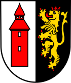
| coat of arms | Germany map | |
|---|---|---|

|
Coordinates: 49 ° 57 ' N , 7 ° 47' E |
|
| Basic data | ||
| State : | Rhineland-Palatinate | |
| County : | Bad Kreuznach | |
| Association municipality : | Langenlonsheim-Stromberg | |
| Height : | 328 m above sea level NHN | |
| Area : | 5.91 km 2 | |
| Residents: | 471 (Dec. 31, 2019) | |
| Population density : | 80 inhabitants per km 2 | |
| Postal code : | 55442 | |
| Area code : | 06724 | |
| License plate : | KH | |
| Community key : | 07 1 33 110 | |
| Community structure: | 2 districts | |
| Address of the municipal administration: |
Bergstrasse 39 55442 Warmsroth |
|
| Website : | ||
| Local Mayor : | Thomas Diederich | |
| Location of the local community Warmsroth in the Bad Kreuznach district | ||
Warmsroth is a municipality in the Bad Kreuznach district in Rhineland-Palatinate . It belongs to the Langenlonsheim-Stromberg community .
geography
Warmsroth is located in the Hunsrück southwest of the Rhine . Almost half of the district area is forested. The district of Wald-Erbach belongs to Warmsroth. To the east is Waldalgesheim , south Roth and west is Stromberg .
history
The place was first mentioned in 1281 as Warmsrait . From 1398 until the French Revolution it belonged to the Electoral Palatinate . The district of Wald-Erbach formed an independent municipality until it was incorporated into Warmsroth in 1920, but in 1910 it only had 13 inhabitants.
- Statistics on population development
The development of the population of Warmsroth, the values from 1871 to 1987 are based on censuses:
|
|
politics
Municipal council
The municipal council in Warmsroth consists of eight council members, who were elected by a majority vote in the local elections on May 26, 2019 , and the honorary local mayor as chairman.
mayor
The position of the local mayor is exercised by Thomas Diederich. After no one from the village ran for office, Thomas Diederich was elected as an elected councilor by the local council on October 2nd, 2019.
Culture and sights
The landmark of Warmsroth is the bell tower with its baroque dome from 1754, which belonged to the former local church. The elaborately restored St. Pankratius Chapel is located in Wald-Erbach.
See also: List of cultural monuments in Warmsroth
Economy and Infrastructure
The federal highway 61 runs in the southwest .
Web links
- Local community Warmsroth on the website of the Verbandsgemeinde Stromberg
- Literature about Warmsroth in the Rhineland-Palatinate State Bibliography
Individual evidence
- ↑ State Statistical Office of Rhineland-Palatinate - population status 2019, districts, communities, association communities ( help on this ).
- ^ Local history of Wald-Erbach
- ↑ www.gemeindeververzeichnis.de: Population figures 1910
- ↑ State Statistical Office Rhineland-Palatinate - regional data
- ^ The Regional Returning Officer RLP: City Council Election 2019 Warmsroth. Retrieved September 15, 2019 .


