
Schwalm (Eder)


The Schwalm (from Old High German : "Sualme", fog, steam or swallow water) is the main tributary of the Eder in Hesse , which it reaches from the southwest and orographically on the right side . With a stretch of 97.1 km, it is the longest river that runs exclusively in Hesse. It flows in the central Hessian Vogelsbergkreis and in the north Hessian Schwalm-Eder-Kreis .
The Schwalm, which rises in the northern part of the Vogelsberg low mountain range, flows through the Upper Hessian hill country, then reaches the Schwalm lowlands around Alsfeld and Schwalmstadt , located between Vogelsberg, Knüllgebirge (Knüll) and Kellerwald and named after it, and flows into the Fulda in the western Hessian depression near the Altenburg district of Felsberg - Tributary Eder.
course
The Schwalm rises in the Vogelsbergkreis on the northern roof of the Lower Vogelsberg . Its source is 1.7 km east-northeast of Köddingen (to Feldatal ), 1.6 km west of Meiches (to Lautertal ) and 1.7 km north-northeast of Helpershain (to Ulrichstein ), three villages through which the Schwalm does not flow, and 4, 2 km south-south-west of Storndorf on the upper reaches (to Schwalmtal ). It is located in the Köddingen district 2.1 km northwest of the Totenköppel ( 559.6 m above sea level ) and 0.6 km north of the Tannenköppel (approx. 525 m ) at an altitude of about 499 m . The forest path "Fohlenstall-Schneise" leads past the source, where wrought-iron letters dowelled into a boulder let you know: "Schwalmquelle".
The Schwalm, which runs mainly in a northerly direction, quickly loses height from its source. The upper course flows a little below the source for 1.3 km along the northern edge of the Hoher Vogelsberg Nature Park . It runs on the municipal boundary of Feldatal and Lautertal. When leaving the park boundary, the river enters the municipal area of Schwalmtal, where it first runs through Storndorf and shortly afterwards Vadenrod . Then the Schwalm flows through Ober-Sorg , east past Unter-Sorg , west past Renzendorf and through the northern part of Hopfgarten . Then it leaves the Untere Vogelsberg and enters the Alsfelder Mulde , the southern part of the Schwalm landscape .
Then the Schwalm flows through the city of Alsfeld first through Altenburg , then east of the city center and west of the industrial and commercial park east . It then runs west past Eudorf and east past Münch-Leusel . It flows through the Heidelbach flood retention basin , the dam of which stands above the village district of Heidelbach partially on the border with the Schrecksbach community in the Schwalm-Eder district. The Berf flows in from the southeast a little below the village . There it changes from the Alsfelder Mulde to the Wasenberger Terrassen , the central part of the Schwalm lowland landscape.
Shortly thereafter, the Schwalm flows through the Schrecksbacher core town in this circle and then between Röllshausen in the west and Schönberg in the east. Then it runs north past Salmshausen and changes from the Wasenberger Terrassen to the Schwalmgrund , the northern part of the Schwalm landscape.
Then the Schwalm changes into the municipality of Willingshausen , where it first flows through Zella . In front of the village it flows west around a hill (approx. 228 m ), which protrudes from the river sediments surrounding it on all sides. This is probably a circulating mountain , because like the surrounding valley slopes, it consists of red sandstone and is not a hardy . Then the Schwalm reaches Loshausen . The Grenff , which comes from the east, joins the castle park to the east . Shortly afterwards, the Alte Schwalm branches off in the large flood retention basin Treysa-Ziegenhain , into which the Steina flows. The Alte Schwalm unites a little further north with the Grenzebach to form an approximately 850 m long canal that flows into the Schwalm in the urban area of Schwalmstadt .
After that, the Schwalm in the Schwalmstadt area first flows west past the glider airfield Der Ring in Schwalmstadt and then runs through Ziegenhain . After passing Ascherode to the north and leaving the Treysa-Ziegenhain flood retention basin, it flows through Treysa . The Knüllgebirge (Knüll) rises to the east and the Kellerwald to the northwest . Below Treysa, the river leaves the Schwalmgrund and with it the Schwalm landscape.
After that, Schwalm flows into the country Burger sink counting reason Löwensteiner one. In it, it bends a western arc around Rommershausen and passes Dittershausen in the east and Allendorf an der Landsburg in the west, after which it passes the mountain Landsburg ( 342.7 m ) with the former Landsburg .
Then the Schwalm runs into the municipality of Neuental , where it first flows northeast of Schlierbach . A little further north it runs past Waltersbrück to the west . After crossing under the federal motorway 49 , it passes east of the Kellerwald Bischhausen in the east, after which the Gilsa coming from the southwest joins.
Then the Schwalm changes to the municipality of Bad Zwesten , where it takes up the Urff , which comes from the Kellerwald , east of Niederurff . Then she makes a long left curve around the mountain Altenburg ( 432.7 m ) and passes the Zwestener town to the east.
After changing to the urban area of Borken , the Schwalm leaves the Löwensteiner Grund immediately after Kerstenhausen and flows a short distance through the Hessenwald . They runs between Kerstenhausen and Kleinenglis by the Schwalmpforte , a water gap by the pending red sandstone panel; there it crosses under the A 49 for the last time and flows into the West Hessian valley . Presumably the river was forced to flow through the Löwensteiner Grund by the rising Knüllgebirge and a tertiary lava flow northeast of Ziegenhain. After passing the Stockelache , it runs between the Borken core town in the south-southwest and Gombeth in the north-northeast, north of the Gombether See and then north of the Singliser See near Singlis .
After that, the Schwalm flows through the municipality of Wabern between Uttershausen and Unshausen , with the Efze coming in from the south . Then it runs between the Wabern town center in the west and Harle .
After changing to the urban area of Felsberg , the Schwalm flows into the West Hessian basin between Rhünda and Altenburg at about 158 m above sea level in the Fulda tributary Eder coming from the west . The Altenburg castle ruins are located about 150 m northeast of the mouth across the Eder in Altenburg .
Curiosities about the Schwalm spring
According to various sources, the "Schwalmquelle" located in the Köddingen district is controversial because another stream source is mentioned as the beginning of the Schwalm: This source is located southwest of Wallenrod (zu Lauterbach ) or 1075 m southwest of the Pfingstberg ( 402.3 m ) around 405 m altitude, the 8.5 km long flowing water resulting from this source is called "Bach von Wallenrod" and is much shorter than the upper section of the Schwalm near the source, which is 12.2 km long to the confluence with the "Bach von Wallenrod" is. In addition, the 8.2 km long Wannbach flows into the upper reaches of the Schwalm in Storndorf, where the Schwalm is only 5.5 km long.
Catchment area and tributaries
The catchment area of the Schwalm is 1298.783 km². The mean water discharge ( MQ ) at the Schwalm level Uttershausen (9.4 km above the mouth, AEO: 986 km²) is 6.79 m³ / s. At this point the Efze, among other things, has not yet flowed in - the extrapolated total MQ of the Schwalm is a good 9 m³ / s. This corresponds to a rather low discharge (Mq) of around 6 m³ / km² · s.
The upper reaches of the Schwalm are mainly fed by tributaries from the Vogelsberg (on the left, mainly via the Drift ). Further down the Schwalm (= north) follow from the left as drained mountain ranges the northern Vogelsberg foreland ( Wiera ), Gilserberger Höhen ( Gilsa ) and Kellerwald ( Urff ), while the Knüll and its foothills (especially over Grenff and Efze ) are drained from the right.
The following tributaries have a catchment area of more than 10 km²:
| Surname | location | Length (km) |
EZG (km²) |
Discharge ( MQ ; l / s) |
Mouth height ( m above sea level ) |
Locations / mouth |
DGKZ |
|---|---|---|---|---|---|---|---|
| Wannbach | right | 8.2 | 18.8 | 353 | Storndorf | 4288-112 | |
| Bach of Wallenrod | right | 8.5 | 26.4 | 300 | Wallenrod , Brauerschwend , Renzendorf | 4288-114 | |
| Krebsbach | Left | 8.1 | 14.6 | 244 | Alsfeld | 4288-116 | |
| Eifa | right | 11.0 | 27.4 | 240 | Eifa | 4288-12 | |
| Erlenbach | Left | 9.4 | 19.0 | 232 | Leusel , Reibertenrod , Schwabenrod , Münch-Leusel | 4288-14 | |
| Berf | right | 20.0 | 42.2 | 218 | 226 | Berfa , Elbenrod , Hattendorf , below Heidelbach | 4288-16 |
| Bodenbach | right | 8.4 | 14.3 | 82 | 224 | Immichenhain , Schrecksbach | 4288-18 |
| Drive | Left | 38.6 | 115.3 | 607 | 214 | Strebendorf , Romrod , Billertshausen , Angenrod , Seibelsdorf , Ruhlkirchen , Bernsburg , Willingshausen , Merzhausen , Zella | 4288-42 |
| Grenff | right | 22.0 | 86.4 | 711 | 214 | Görzhain , Nausis , Neukirchen , Rückershausen , Riebelsdorf , Loshausen | 4288-32 |
| Steina | right | 13.9 | 20.5 | 167 | 213 | Steina | 4288-332 |
| Grenzebach | right | 13.3 | 18.9 | 135 | 210 | Seigertshausen , upper limit stream , lower limit stream , goat grove | 4288-334 |
| Wiera | Left | 14.8 | 87.8 | 590 | 207 | Neustadt , Wiera , Treysa | 4288-36 |
| Katzenbach | Left | 7.4 | 12.5 | 82 | 206 | Sachsenhausen , above Rommershausen | 4288-372 |
| Gers | right | 10.3 | 23.7 | 117 | 203 | Schönborn , Rörshain , under Allendorfs | 4288-38 |
| Gilsa | Left | 20.9 | 93.6 | 757 | 197 | Gilserberg , Densberg , Jesberg , Gilsa , Bischhausen | 4288-4 |
| Urff | Left | 20.1 | 41.7 | 495 | 192 | Oberurff-Schiffelborn , Niederurff | 4288-6 |
| Walzebach | Left | 9.0 | 19.5 | 156 | 189 | Odershausen , Braunau , Bad Zwesten | 4288-72 |
| Lohrbach | Left | 12 | 186 | Braunau , Betzigerode , Bad Zwesten | 4288-73 | ||
| Olmes | right | 11.1 | 48.1 | 208 | 174 | Nassenerfurth , Trockenerfurth , Borken | 4288-76 |
| Lembach | right | 6.4 | 11.4 | 32 | 167 | Freudenthal , Lembach , Lendorf | 4288-78 |
| Efze | right | 38.2 | 220.5 | 1481 | 163 | Camp Schwarzenborn , Grebenhagen , Appenfeld , Wallenstein , Völkershain , Remsfeld , Homberg , Caßdorf , Mühlhausen , Berge , Hebel | 4288-8 |
| Riedwiesengraben | Left | 12.2 | 24.4 | 93 | 160 | Wabern , Harle | 4288-94 |
| Rhünda | right | 13.0 | 31.9 | 194 | 159 | Dickershausen , Sipperhausen , Ostheim , Rhünda | 4288-96 |
gallery
dried up Schwalm spring near Köddingen at the end of July 2019

Schwalm in detention basin
Treysa-Ziegenhain
Frozen Schwalm near Loshausen

Schwalm near Zella

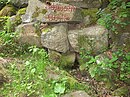
Weir between Loshausen and Zella

Morning mood at the Schwalm

Northeast end of the Löwensteiner Grund with the Schwalmpforte (middle right)


literature
Web links
- The Schwalm ... , at the Schwalm water association with an overview of its tasks and historical photos, on wasserverband-schwalm.de
References and comments
- ↑ a b Map services of the Federal Agency for Nature Conservation ( information )
- ↑ a b c d e f g Water map service of the Hessian Ministry for the Environment, Climate Protection, Agriculture and Consumer Protection ( information )
- ^ Deutsches Gewässerkundliches Jahrbuch Weser-Ems 2012. Lower Saxony State Agency for Water Management, Coastal and Nature Conservation, p. 145, accessed on October 4, 2017 (PDF, German, 6523 kB).
- ↑ Frank Schmidt-Döhl : The Hessian Bergland - The emergence of a landscape . Shaker Media, Aachen 2012, ISBN 978-3-86858-891-0 .
- ↑ Max Blanckenhorn : Explanations of the geological map of Prussia and neighboring German countries, delivery 261, sheet Ziegenhain, grading department 68, sheet 6 . Prussian Geological State Institute, Berlin 1926.
- ^ German Hydrological Yearbook 2011 Single sheet Uttershausen level , Hessian State Office for Environment and Geology, accessed on May 23, 2017 (PDF, German).
- ↑ Some discharge values of small tributaries are no longer available in the referenced water service!
- ↑ For a better overview and sortability pro is running waters in the DGKZ -Number according to the number 4288 , which represents the Schwalm, each inserted a hyphen.
- ↑ The actual catchment area is somewhat larger, since the lowest estuary is included in the Schwalm