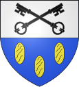
Gouy (Seine-Maritime)
| Gouy | ||
|---|---|---|

|
|
|
| region | Normandy | |
| Department | Seine-Maritime | |
| Arrondissement | Rouen | |
| Canton | Darnétal | |
| Community association | Métropole Rouen Normandy | |
| Coordinates | 49 ° 21 ' N , 1 ° 9' E | |
| height | 2-133 m | |
| surface | 4.97 km 2 | |
| Residents | 869 (January 1, 2017) | |
| Population density | 175 inhabitants / km 2 | |
| Post Code | 76520 | |
| INSEE code | 76313 | |
| Website | http://www.mairie-ymare.fr/ | |
Gouy is a French municipality with 869 inhabitants (as of January 1 2017) in the department of Seine-Maritime in the region Normandy . The municipality is located in the arrondissement of Rouen , is part of the canton Darnétal (until 2015: canton Boos ).
geography
Gouy is about ten kilometers south-southeast of Rouen . Gouy is surrounded by the neighboring communities of Belbeuf in the north, Saint-Aubin-Celloville in the east and northeast, Ymare in the south and southeast, Les Authieux-sur-le-Port-Saint-Ouen and Tourville-la-Rivière in the southwest, Oissel in the west and Saint-Étienne-du-Rouvray in the north-west.
Population development
| Population development | ||||||||
|---|---|---|---|---|---|---|---|---|
| year | 1962 | 1968 | 1975 | 1982 | 1990 | 1999 | 2006 | 2013 |
| Residents | 365 | 348 | 446 | 468 | 644 | 794 | 788 | 803 |
Attractions
- Saint-Pierre-et-Saint-Paul church from the 12th century
- Grotte de Gouy cave
Web links
Commons : Gouy - collection of images, videos and audio files
Individual evidence
- ↑ INSEE - Gouy ( page no longer available , search in web archives ) Info: The link was automatically marked as defective. Please check the link according to the instructions and then remove this notice.
