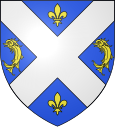
La Cote-Saint-André
| La Cote-Saint-André | ||
|---|---|---|

|
|
|
| region | Auvergne-Rhône-Alpes | |
| Department | Isère | |
| Arrondissement | Vienne | |
| Canton | Bièvre (main town) | |
| Community association | Bièvre Isère | |
| Coordinates | 45 ° 24 ' N , 5 ° 16' E | |
| height | 335-581 m | |
| surface | 27.93 km 2 | |
| Residents | 4,811 (January 1, 2017) | |
| Population density | 172 inhabitants / km 2 | |
| Post Code | 38260 | |
| INSEE code | 38130 | |
| Website | www.lacotesaintandre.fr | |
 View of the town hall of La Côte-Saint-André |
||
La Côte-Saint-André is a French commune with 4,811 inhabitants (as of January 1 2017) in the department of Isère in the region Auvergne Rhône-Alpes . La Côte-Saint-André is located in the arrondissement of Vienne and is the main town ( chef-lieu ) of the canton of Bièvre .
geography
La Côte-Saint-André is located on the Plateau de Bièvre . La Côte-Saint-André is surrounded by the neighboring communities
- Nantoin in the north and northeast,
- Mottier in the northeast,
- Gillonnay in the east,
- Saint-Siméon-de-Bressieux in the south,
- Sardieu in the south and south-west,
- Ornacieux-Balbins with Balbins in the west and Ornacieux in the northwest,
- Porte-des-Bonnevaux with Commelle to the north and north-west.
The former National Route 518 runs through the municipality .
Population development
| year | 1962 | 1968 | 1975 | 1982 | 1990 | 1999 | 2006 | 2011 |
| Residents | 3,623 | 3,522 | 3,865 | 3,857 | 3,966 | 4,240 | 4,653 | 4,886 |
Events and sights
The Berlioz Festival is held every year at the end of August .
Attractions:
- Romanesque church of Saint-André
- Saint-Camille church, built for Camille Rocher in the 19th century
- Ludwig XI castle
- Hector Berlioz's birthplace
- Hôtel de Bocsozel, Monument historique
- various town houses from the 16th century
- Market halls
Personalities
- Jean-Baptiste Davaux (1742–1822), composer
- Hector Berlioz (1803-1869), composer
- Johan Barthold Jongkind (1819–1891), Dutch painter
- Georges Tainturier (1890–1943), sword fencer
Web links
Commons : La Côte-Saint-André - Collection of images, videos and audio files


