
Lampertheim
| coat of arms | Germany map | |
|---|---|---|

|
Coordinates: 49 ° 36 ' N , 8 ° 28' E |
|
| Basic data | ||
| State : | Hesse | |
| Administrative region : | Darmstadt | |
| Circle : | Mountain road | |
| Height : | 92 m above sea level NHN | |
| Area : | 72.28 km 2 | |
| Residents: | 32,598 (Dec. 31, 2019) | |
| Population density : | 451 inhabitants per km 2 | |
| Postal code : | 68623 | |
| Primaries : | 06206, 06256, 06241 | |
| License plate : | HP | |
| Community key : | 06 4 31 013 | |
| City structure: | Core city and 4 districts | |
City administration address : |
Römerstrasse 102 68623 Lampertheim |
|
| Website : | ||
| Mayor : | Gottfried Störmer ( independent ) | |
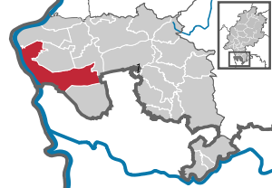
| Location of the city of Lampertheim in the Bergstrasse district | ||
  |
||


Lampertheim is a town in the Bergstrasse district in southern Hesse .
geography
Location and neighboring communities
Lampertheim is located on the right bank of the Rhine in the southern Hessian part of the Upper Rhine Plain on the Lampertheimer Altrhein nature reserve ( Altrheinarm ). The city borders on the communities Biblis , Bürstadt , Lorsch , Viernheim (all in the Bergstrasse district ), in the west on the independent city of Worms and the community Bobenheim-Roxheim (both Rhineland-Palatinate ) and in the south on Mannheim and its districts Sandhofen and Kirschgartshausen ( Baden-Württemberg ). It is the third largest city in the Bergstrasse district.
City structure
In addition to the core city, the localities Hofheim , Hüttenfeld , Neuschloß and Rosengarten belong to the city of Lampertheim as districts. There are also the settlements and farmstead groups Heide, Oberlache-Rosenau, Am Küblinger Damm, Lache, An der Wormser Straße, In den Böllenruthen, In den Ruthen, Wehrzollhaus, Wildbahn and Seehof .
The municipality is divided into the districts of Lampertheim, Hofheim, Hüttenfeld and Rosengarten. The parts of the Seehof district were taken over to Lampertheim in 1971.
history
overview
As finds in the district show, Lampertheim and its surroundings have been inhabited since the early Stone Age (3,000–2,000 BC). The Celts , who had been resident for centuries, were followed by the Teutons and a Roman occupation . A Roman burial ground, Roman bowls, fibulae and coins from the time of Emperor Domitian (81–96 AD) suggest that Lampertheim was a Roman camp. The first name forms handed down from the year 832, such as Langobardonheim or Langbardheim, initially suggested that the Longobards were founded. Today, however, there is hardly any doubt that Lampertheim arose during the Frankish settlement and is to be interpreted as the home of Lantberth "the country shimmering" (also Lampert or Lambert).
Hofheim was first mentioned in 991 in the Codex Edelini of the Weißenburg monastery . In 1422 three peninsulas, which are located opposite Worms in the strongly meandering Rhine, were named "Rosengarten".
Already 35 years earlier, half of the Stein (Worms) winery with its three districts of Lampertheim, Hofheim and Nordheim was pledged to the Electoral Palatinate in 1387 . This resulted in a double and often competing jurisdiction by the Bishop of Worms , to whose bishopric Lampertheim previously belonged completely, and the Elector of the Palatinate, "Count Palatine bey Rhein". Therefore Lampertheim came under the Schriesheim Central Court , which ruled on behalf of both gentlemen.
Regardless of this, the influence of the Electorate of the Palatinate prevailed in the long run, and around 1540 the Reformation was introduced in the newly rebuilt town - burned down in 1504 during the War of the Bavarian Succession .
The Thirty Years' War hit Lampertheim particularly hard: after the destruction in 1622 there were only 10 inhabitants - those of the others who had survived had fled to the fortified places in the area. Already 50 years after the end of the Thirty Years' War, the region had to suffer again from the consequences of the war when France tried to move its borders to the east through the Palatinate War of Succession . It was not until the Peace of Rijswijk in 1697 that the French withdrew behind the Rhine. In 1705 Lampertheim again fell fully under the territory of the Hochstift Worms . With the " Reichsdeputationshauptschluss " of February 25, 1803, the territorial conditions in the Reich were reorganized. The occasion was the conquests of Napoleon , who had extended the French state border to the Rhine. This last piece of legislation from the old empire implemented the provisions of the Treaty of Luneville , according to which the episcopal office ( cellar ) Lampertheim and with it the community came to the Landgraviate of Hessen-Darmstadt . During the Napoleonic Wars , under pressure from Napoleon in 1806, the Grand Duchy of Hesse was created , which incorporated the Landgraviate of Hesse-Darmstadt. The Grand Duchy of Hesse was a member state of the German Confederation from 1815 to 1866 and then a federal state of the German Empire . It existed until 1919, after the First World War, the Grand Duchy for was republican written People's State of Hesse . In 1945 after the end of the Second World War , the area of today's Hesse was in the American zone of occupation and the state of Hesse was created within its current boundaries by order of the military government .
In 1716 the place received market rights and on August 2, 1951, city rights .
The Riedbahn has been running through the community since 1879 . In the station Lampertheim a serious accident occurred on 12 August 1965: The TEA Helvetia clashed here with the non profile freestanding last car of a freight train and derailed . Four people died and many were injured.
In January 1992 there was an arson attack against the refugee accommodation in Lampertheim. A family of three from Sri Lanka was killed.
Historical descriptions

The statistical-topographical-historical description of the Grand Duchy of Hesse reports on Langenthal in 1829:
“Lampertheim (L. Bez. Heppenheim) market town; is on the border of the Grand Duchy of Baden, 3 St. from Heppenheim, has large wide streets with 454 houses and 2040 Evangel. Protest., 1042 Cath. And 79 Jews. There are 569 farmers and 146 artisans among the population. Lampertheim is the seat of the rent office, the forest inspector, the district forester and a border secondary customs office 2nd class, has 1 communal church, 1 town hall, 1 administrative building, 2 rectories, 3 schoolhouses, 1 tobacco factory, important peat cuttings and tree nurseries, in which many seedlings are raised ; a lot of tobacco is also grown. 3 markets are held annually. The place was formerly called Langobardonheim, belonged to the diocese of Worms and came to Hesse in 1802. "
and
“Lampertheimer Hütte (L. Bez. Heppenheim) Hof; belongs to Lampertheim; here is a border secondary customs office of the 2nd class. Opposite is the Baden portion of this farm. "
From The Grand Duchy of Hesse by history, country, people, state and locality from 1854:
"Lampertheim, Mrktfl. on the border between Hesse and Baden with a district of 17452 acres (8822 Acher, 2031 meadows, 5445 forest) and 4381 inhabitants, about 2/3 of which are Protestant and grow tobacco and grow fruit. Seat of a district collection, a rent office, a chief forester. The peat pits in its district are very productive. Every year 3 markets visited are held here. The name of the place is shortened from Langonbardonheim. It belonged to the diocese of Worms and came to Hessen in 1802. Half an hour away is the hamlet of Neuschloß with a chemical factory. Lampertheim also has two brick huts, a resin oven, the Rosengarten inn, the Biedensand island on the Rhine , the Lampertheimer Aue, Bonnenaue, the Beckerwörth, Ludwigswörth, Froschwörth and the Friedrichsaue. "
Time of world wars
On August 1, 1914, the First World War broke out and put an end to the positive economic development throughout the German Empire . When the armistice was signed after the German defeat on November 11, 1918, Lampertheim had 331 dead soldiers to mourn, while the war cost a total of around 17 million human lives. The end of the German Empire was thus sealed, and the troubled times of the Weimar Republic followed. In the period from 1921 to 1930, there were 566,500 emigrants in Germany who tried to escape the difficult conditions in Germany. On January 30, 1933, Adolf Hitler became Chancellor, which sealed the end of the Weimar Republic and the beginning of the National Socialist dictatorship. In the spring of 1933, Adolf Hitler made May 1 a public holiday called “German Labor Day”. In this way, a union demand was met by the government of all people, which the unions strictly opposed. The unions called for participation in the May events, as they felt they were the initiators of the May idea. The official program was already heavily influenced by the National Socialists: “6 o'clock wake up by the SA bands. 8 a.m. flag hoisting in the factories, march to the parade ground, 9 a.m. transmission of the rally from the pleasure garden in Berlin to the public squares of the cities. 10.45 am State act of the Hessian government (...), reception of a workers' delegation from the three Hessian provinces. (...) Common singing of the 'Song of the Workers'. (...) 7.30 am Transmission from the Tempelhofer Feld, Berlin: Manifesto of Reich Chancellor Adolf Hitler, 'The first year of the four-year plan'. Then light music and German dance. 12 noon: Broadcast of the speech by Prime Minister Hermann Göring. (...) Former Marxist singing, gymnastics and sports clubs can take part in the trains, but you must refrain from carrying Marxist flags or symbols. ”The rude awakening for the unions came a day later when the“ NSDAP took over the leadership of the red trade unions took over ":" The Marxist leaders since then in protective custody - a 3 million account of the former Reichstag President Löbe blocked - the rights of the workers secured - the buildings of the free trade unions occupied ", headlined the newspapers, which had already been harmonized throughout the Reich.
In Hesse, on July 3, 1933, the "Law for the implementation of field clearing for the purpose of creating jobs in the course of the redevelopment " was passed. In 13 municipalities in the Starkenburg province, including Lampertheim, the field clearing procedure was ordered over an area of 200,000 ha. In the course of this amelioration and settlement program, the two places Riedrode and Worms-Rosengarten were created .
In November 1938 the so-called Reichskristallnacht brought hardship and misery to the Jewish fellow citizens. The Lampertheim synagogue was burned down and the homes and businesses of Jewish families devastated. As early as 1933, part of the Jewish community, which at that time consisted of 86 people, had moved away or emigrated as a result of increasing reprisals. In connection with the November pogrom, almost all Jewish men were sent to the Buchenwald concentration camp for a few weeks . In 1942 the last nine Germans of Jewish faith still living in Lampertheim were deported to extermination camps. Of those who were born in Lampertheim or who had lived here for a long time, 42 died as a result of the Nazi tyranny.
On September 1, 1939, when German troops marched into Poland, the Second World War began , the effects of which were even more dramatic than the First World War and the number of victims is estimated at 60 to 70 million people. On the night of August 5th to 6th, 1941, there was a bombing raid on Lampertheim, in which over 20 people were killed and 29 people were wounded. Dozens of families were left homeless. From 1944 the intensified air war against Germany also made itself felt in Lampertheim. Large aviation associations flew over Lampertheim in their attacks on the surrounding industrial cities of Ludwigshafen, Mannheim or Worms. On the night of May 15-16, 1944, the Protestant church was destroyed by bombs. In that year, work in the fields became life-threatening due to the continued low-flying attacks. Nobody was safe on the train or on the streets either. In the final phase of the Second World War in Europe, the American units reached the Rhine between Mainz and Mannheim in mid-March 1945. The bridgeheads on the left bank of the Rhine could not be held by the weak German forces, which led to the demolition of the Rhine bridges at Worms, Nordheim and Gernsheim on March 20. The remnants of the German 7th Army, which had withdrawn to the right bank of the Rhine, had to leave almost all of their heavy equipment such as tanks and artillery behind, which made a continuation of the fighting with the absolute air supremacy of the Americans and the lack of any German reserves actually completely pointless. On the American side, the primary goal was now to avoid further losses, which led to the massive use of artillery, tanks and aircraft, even without precise knowledge of a possible counter-defense, on all cities and villages to be captured. If the advancing forces encountered resistance, there was an immediate retreat and massive use of the air force and artillery. On March 22nd, the 3rd US Army crossed the Rhine near Oppenheim and occupied Darmstadt on March 25th. From the American point of view, this made it necessary for the neighboring US 7th Army to move up quickly to secure its flanks. In preparation for their crossing of the Rhine, most of the Ried communities were shelled by American artillery on March 25th and on the night of March 26th. In all affected communities people were killed and property damage was caused to buildings. In the first hours of March 26, 1945, American troops crossed the Rhine near Hamm and south of Worms. The forces transferred at Worms took possession of the village of Rosengarten that night. To the east, the American units marched into Bürstadt in the early hours of the morning and advanced on today's B47 towards Lorsch. They advanced to the southeast in the direction of Lampertheim, with heavy fighting with units of the German Wehrmacht between Bürstadt and Lampertheim . Lampertheim itself was not defended, so that when the Americans marched in on the same day, no major damage was caused. After the capture of Lampertheim, the American tanks rolled on via Neuschloß towards Bergstrasse. On March 27, the American units were in Lorsch, Bensheim and Heppenheim and a day later Aschaffenburg am Main and the western and northern parts of the Odenwald were occupied. The war in Europe ended with the unconditional surrender of all German troops, which came into effect on May 8, 1945 at 11:01 p.m. Central European Time. Lampertheim had about 600 fallen or missing soldiers in this war.
Administration and courts
During the Hessian period, the responsible administrative units changed several times as a result of administrative reforms. At first the place belonged to the Lampertheim office . In 1821, as part of a comprehensive administrative reform, the district bailiffs in the provinces of Starkenburg and Upper Hesse of the Grand Duchy were dissolved and districts were introduced, with Lampertheim being assigned to the district of Heppenheim . As part of this reform, regional courts were also created that were now independent of the administration. For the district of Heppenheim, the Lorsch district court was the court of first instance. The seat of the court was deliberately separated from the seat of the district administrator in order to underline the independence of the judiciary.
In 1832 the administrative units were further enlarged and circles were created. With the reorganization announced on August 20, 1832, there should only be the districts of Bensheim and Lindenfels in the future in Süd-Starkenburg; the district of Heppenheim was to fall into the Bensheim district. Even before the entry into force in October 15, 1832 but this was revised to the effect that instead of the circle Lindenfels next to the circle Bensheim the county Heppenheim was formed as the second circle. Lampertheim was initially assigned to the Bensheim district, but when the area was reorganized in 1840, it became part of the Heppenheim district. In 1842 the tax system in the Grand Duchy was reformed and the tithe and the basic pensions (income from property) were replaced by a tax system of the kind that still exists today.
As a result of the March Revolution of 1848, with the "Law on the Relationships of the Classes and Noble Court Lords" of April 15, 1848, the special rights of the class were finally repealed. In addition, in the provinces, the districts and the district administration districts of the Grand Duchy were abolished on July 31, 1848 and replaced by "administrative districts", whereby the previous districts of Bensheim and Heppenheim were combined to form the administrative district of Heppenheim . Four years later, however, they returned to the division into districts, which resulted in the district of Bensheim and, temporarily, the districts of Lindenfels and Wimpfen again being created in addition to the Heppenheim district . Lampertheim now belonged to the Heppenheim district again.
In the statistics of the Grand Duchy of Hesse, based on December 1867, Lampertheim had its own mayor's office , 632 houses, 4776 inhabitants, the Heppenheim district, the Lorsch district court, the Protestant parish of Lampertheim of the Deanery of Zwingenberg and the Catholic parish of Lampertheim of the Deanery of Bensheim . The mayor's office also acquired the hamlet of Neuschloss (13 houses, 88 inh.), The Fialdorf Hüttenfeld (50 houses, 309 in.), The Rosengarten inn (2 houses, 21 in.) And the forester's house Wildbahn (1 house, 7 in .) managed.
On November 1, 1938, a drastic regional reform was carried out in the three provinces of Starkenburg, Rheinhessen and Upper Hesse. In Starkenburg, the Bensheim district was particularly affected. Most of it is added to the Heppenheim district, which also became the legal successor to the Bensheim district. The new administrative unit was renamed the Bergstrasse district . The municipalities of Lampertheim, Bürstadt , Hofheim and Biblis on the right bank of the Rhine were incorporated into the newly created Worms district, which emerged from the Worms district. With the redistribution of the federal states by the victorious powers of World War II after 1945, Rheinhessen west of the Rhine was added to the state of Rhineland-Palatinate and Lampertheim was integrated into the Bergstrasse district.
In 1961 the size of the district was given as 5145 ha , of which 2306 ha were forest.
With the formation of the regional courts in the Grand Duchy of Hesse, the Lorsch regional court in the Heppenheim district was the court of first instance from 1821 . On the occasion of the introduction of the Courts Constitution Act with effect from October 1, 1879, the previous grand-ducal Hessian regional courts were replaced by local courts in the same place, while the newly created regional courts now functioned as higher courts. This led to the renaming of the Lorsch District Court and allocation to the district of the Darmstadt District Court . On June 1, 1905, the District Court of Lampertheim was newly created, whose district includes the districts of Lampertheim with Hüttenfeld and Neuschloß, See-Hof (field mark), Biedensand (field mark), Viernheim and Wildbahn (forest mark).
The following list gives an overview of the territories in which Lampertheim was located and the administrative units to which it was subordinate:
- before 1803: Holy Roman Empire , Duchy of Worms , Lampertheim Office , Stein official winery
- from 1803: Holy Roman Empire, Landgraviate of Hesse-Darmstadt (through Reichsdeputationshauptschluss ), Principality of Starkenburg , Lampertheim office
- from 1806: Grand Duchy of Hesse , Principality of Starkenburg, Lampertheim Office
- from 1815: German Confederation , Grand Duchy of Hesse, Province of Starkenburg , Lampertheim Office
- from 1821: German Confederation, Grand Duchy of Hesse, Starkenburg Province, Heppenheim District District (separation between justice ( Lorsch District Court ) and administration)
- from 1832: German Confederation, Grand Duchy of Hesse, Starkenburg Province, Bensheim district
- from 1840: German Confederation, Grand Duchy of Hesse, Province of Starkenburg, District of Heppenheim
- from 1848: German Confederation, Grand Duchy of Hesse, administrative district of Heppenheim
- from 1852: German Confederation, Grand Duchy of Hesse, Starkenburg Province, Lindenfels District
- from 1865: German Confederation, Grand Duchy of Hesse, Province of Starkenburg, District of Heppenheim
- from 1867: Grand Duchy of Hesse, Province of Starkenburg, District of Heppenheim
- from 1871: German Empire , Grand Duchy of Hesse, Province of Starkenburg, District of Heppenheim
- from 1874: German Empire, Grand Duchy of Hesse, Starkenburg Province, Bensheim district
- from 1918: German Empire, People's State of Hesse , Starkenburg Province, Bensheim district
- from 1938: German Empire, People's State of Hesse , Worms district (In the course of the regional reform in 1938 , the three Hessian provinces of Starkenburg, Rheinhessen and Upper Hesse are dissolved.)
- from 1945: American zone of occupation , Greater Hesse , Darmstadt administrative district, Bergstrasse district
- from 1949: Federal Republic of Germany , State of Hesse , Darmstadt district, Bergstrasse district
Incorporations
As part of the regional reform in Hesse on October 1, 1971, the previously independent municipalities of Hofheim and Rosengarten were incorporated into Lampertheim. The formerly independent district Seehof was divided between the cities of Lampertheim and Lorsch.
Each one was for the districts of Hofheim, Hüttenfeld, Neuschloß and Rose Garden City district with town council and mayor set up. For this purpose, the formerly community-free land "Wehrzollhaus" was assigned to the Hofheim district, the formerly independent district "Wildbahn" and the formerly independent district "Seehof", as far as they were legally incorporated into the city of Lampertheim, the local district Hüttenfeld and the residential area " In the Ruthen "assigned to the Neuschloß district.
Outsourcing
On August 1, 1972, a part of the area with then around 40 inhabitants was assigned to the neighboring town of Lorsch.
population
Population structure
According to the 2011 census , there were 31,037 residents in Lampertheim on May 9, 2011. These included 2565 (8.26%) foreigners of whom 1145 came from outside the EU , 1005 from other European countries and 415 from other countries. Of the German residents, 10.3% had a migration background . The inhabitants lived in 14,099 households. Of these, 4578 were single households , 4455 couples without children and 3672 couples with children, as well as 1098 single parents and 296 shared apartments .
Population development
| • 1806: | 1985 inhabitants, 330 houses |
| • 1829: | 3182 inhabitants, 454 houses |
| • 1867: | 5206 inhabitants, 599 houses |
| Lampertheim: Population from 1806 to 2015 | ||||
|---|---|---|---|---|
| year | Residents | |||
| 1806 | 1,985 | |||
| 1829 | 3,182 | |||
| 1834 | 3,988 | |||
| 1840 | 4,792 | |||
| 1846 | 4,910 | |||
| 1852 | 5,021 | |||
| 1858 | 4,787 | |||
| 1864 | 5,180 | |||
| 1871 | 5,307 | |||
| 1875 | 5,617 | |||
| 1885 | 6,429 | |||
| 1895 | 7,262 | |||
| 1905 | 8,941 | |||
| 1910 | 10,333 | |||
| 1925 | 11,580 | |||
| 1939 | 13,844 | |||
| 1946 | 14,384 | |||
| 1950 | 15,953 | |||
| 1956 | 18,185 | |||
| 1961 | 19,518 | |||
| 1967 | 22,750 | |||
| 1970 | 23,963 | |||
| 1972 | 30,779 | |||
| 1976 | 31,697 | |||
| 1984 | 30,645 | |||
| 1992 | 31,050 | |||
| 2000 | 32,200 | |||
| 2005 | 31,779 | |||
| 2010 | 31,229 | |||
| 2011 | 31,037 | |||
| 2015 | 31,991 | |||
| Data source: Historical municipality register for Hesse: The population of the municipalities from 1834 to 1967. Wiesbaden: Hessisches Statistisches Landesamt, 1968. Further sources:; 1972 :; 1976 :; 1984 :; 1992 :; 2000 :; 2005 :; 2010 :; 2011 census; 2015: From 1972 including the towns incorporated into Hesse as part of the regional reform . | ||||
Religious affiliation
| • 1829: | 2040 Protestant prostheticians (= 64.54%), 79 Jewish (= 2.50%) and 1042 Catholic (= 32.96%) residents |
| • 1961: | 10,863 Protestant (= 56.53%), 7722 Catholic (= 40.18%) residents |
| • 2011: | 12,430 Protestant (= 40.1%), 9730 Catholic (= 31.4%), 280 free church (= 0.9%), 380 Orthodox (= 1.2%), 1250 non-believers (= 4.0%) ), 6,870 other (= 22.2%) residents |
Gainful employment
The municipality in comparison with the district, administrative district Darmstadt and Hesse:
| year | local community | district | Administrative district | Hesse | |
|---|---|---|---|---|---|
| Employees subject to social security contributions | 2017 | 8,296 | 72,939 | 1,695,567 | 2,524,156 |
| Change to | 2000 | + 7.4% | + 17.1% | + 16.1% | + 16.0% |
| of which full-time | 2017 | 72.5% | 70.8% | 72.8% | 71.8% |
| of which part-time | 2017 | 27.5% | 29.2% | 27.2% | 28.2% |
| Only marginally paid employees | 2017 | 1,699 | 15,613 | 224.267 | 372.991 |
| Change to | 2000 | −19.6% | −4.3% | + 9.0% | + 8.8% |
| Branch | year | local community | district | Administrative district | Hesse |
|---|---|---|---|---|---|
| Manufacturing | 2000 | 52.5% | 39.6% | 27.0% | 30.6% |
| 2017 | 43.5% | 32.1% | 20.4% | 24.3% | |
| Commerce, hospitality and transport | 2000 | 16.7% | 25.1% | 26.4% | 25.1% |
| 2017 | 19.3% | 25.8% | 24.7% | 23.8% | |
| Business services | 2000 | 12.5% | 11.6% | 25.1% | 20.2% |
| 2017 | 15.8% | 15.5% | 31.6% | 26.1% | |
| other services | 2000 | 17.0% | 22.0% | 20.1% | 22.5% |
| 2017 | 19.9% | 25.3% | 23.0% | 25.4% | |
| Other (or without assignment) | 2000 | 1.2% | 1.7% | 1.4% | 1.5% |
| 2017 | 1.5% | 1.1% | 0.3% | 0.4% |
religion

The following religious communities exist in Lampertheim:
- Roman Catholic Parish of the Annunciation
- Evangelical Martin Luther Congregation
- Catholic St. Andrew's Congregation
- Evangelical Church of St. Luke
- Methodist Church
- Evangelical Free Church Congregation ( Baptists )
- Evangelical Liebenzeller Congregation
- New Apostolic Church
politics
City Council
The city council is the highest body of the city. Its political composition is determined every five years in local elections by the city's electorate. Whoever has reached the age of 18 and is a German citizen within the meaning of the Basic Law or a citizen of one of the other member states of the European Union may vote. Everyone has to have been registered in the city for at least three months.
In the local elections on March 6, 2016 , the members of the city council and the city councils were elected for the legislative period from April 1, 2016 to March 31, 2021.
Of the 26,062 eligible voters, 10,906 voted. As a result, voter turnout rose from 40.8% in 2011 to 41.8% in 2016.
| Parties and constituencies | 2016 |
 |
2011 |
 |
2006 |
 |
2001 |
 |
1997 |
 |
||||||
|---|---|---|---|---|---|---|---|---|---|---|---|---|---|---|---|---|
| Share a | Seats | Share a | Seats | Share a | Seats | Share a | Seats | Share a | Seats | |||||||
| Social Democratic Party of Germany | SPD | 40.9 | 19th | 44.1 | 20th | 44.4 | 20th | 46.6 | 21st | 44.7 | 21st | |||||
| Christian Democratic Union of Germany | CDU | 31.1 | 14th | 31.3 | 14th | 37.6 | 17th | 31.8 | 14th | 26.1 | 13 | |||||
| Free Democratic Party | FDP | 16.4 | 7th | 6.9 | 3 | 10.0 | 4th | 8.2 | 4th | 4.9 | - | |||||
| Alliance 90 / The Greens | GREEN | 11.6 | 5 | 17.8 | 8th | 8.0 | 4th | 6.4 | 3 | 9.0 | 4th | |||||
| Free community of voters | FWG | - | - | - | - | - | - | 7.0 | 3 | 15.3 | 7th | |||||
| percentage of invalid votes | 6.8 | 4.7 | 2.7 | 3.6 | 2.5 | |||||||||||
| Seats of the city council as a whole | 45 | 45 | 45 | 45 | 45 | |||||||||||
| voter turnout | 41.8% | 40.8% | 37.7% | 44.1% | 60.8% | |||||||||||
mayor

Mayors in Lampertheim have been since 1821:
| Term of office | mayor |
|---|---|
| 1821-1822 | Jakob Haumüller |
| 1822-1824 | Adam Schick |
| 1825-1830 | Adam Thomas |
| 1831-1853 | Valentin Billau |
| 1853-1861 | Martin Billau |
| 1862-1870 | Adam Billau |
| 1870-1872 | Hartmann Seelinger |
| 1872-1874 | Johann Strauss (assumption of official business after Hartmann Seelinger's death on August 22, 1872) |
| 1874-1904 | Adam Seelinger IX. |
| 1905-1919 | Johann Martin Boxheimer |
| 1919-1920 | Adam Württemberger 1. |
| 1920-1925 | Adam Servant IX. |
| 1925-1933 | Adam Keller |
| 1933-1937 | Walter Koehler |
| 1937-1945 | Georg Ludwig Grünewald |
| 1945 | Adam Keller |
| 1945 | Albert Schulte |
| 1945 | Adam Keller |
| 1945-1946 | Ernst Kretschmar |
| 1946-1960 | Adam Günderoth |
| 1960-1966 | Kurt Zeilfelder |
| 1966-1981 | Hans Pfeiffer |
| 1982-1994 | Gisbert Dieter |
| 1994-1997 | Jürgen Dieter |
| 1997-2013 | Erich Maier |
| since 2013 | Gottfried Störmer |
Districts
The following local districts with local advisory board and local councilor according to the Hessian municipal code exist in the municipality:
- District Hofheim (areas of the former community Hofheim with the former community-free area Wehrzollhaus). The local advisory board consists of nine members.
- District Hüttenfeld (settlement area Hüttenfeld with the former area Wildbahn and parts of the former area Seehof). The local advisory board consists of nine members.
- Neuschloß district ( Neuschloß and "In den Ruthen" settlements ). The local advisory board consists of nine members.
- Rosengarten district (areas of the former Rosengarten community ). The local advisory board consists of nine members.
coat of arms
The coat of arms was officially awarded on March 5, 1930 by Wilhelm Leuschner , Minister of the Interior of the People's State of Hesse .
 |
Blazon : "In black, a silver St. Andrew's cross accompanied by two six-pointed golden stars." |
| Foundation of the coat of arms: The St. Andrew's cross, which was already used in the oldest Lampertheim seal, indicates that the Worms St. Andrew's Foundation was the patron saint of St. Andrew's Church in Lampertheim and was entitled to a tithe. |
flag
In February 1951 the municipality of Lampertheim was granted the right to fly a flag by the Hessian State Ministry.
Town twinning
Lampertheim has partnerships with six municipalities:
- Adriatic in Italy ,
- Dieulouard in France (partner municipality of Hofheim),
- Ermont in France,
- Maldegem in Belgium ,
- Świdnica in Poland and
- Wierden in the Netherlands
Culture and sights
Buildings
The parish church of St. Michael in Hofheim is probably the most important building in the city. It was built by master builder Balthasar Neumann , who also worked right next door on Worms Cathedral .
The symbol of the city is the church of the Protestant Lukasgemeinde, the so-called Domkirche Lampertheim .
Worth mentioning in Hüttenfeld are the Rennhof Palace , built by Baron Rothschild in 1853, and the old schoolhouse built in 1906/07. A Lithuanian grammar school has been located in Rennhof Palace since 1953 .
A remnant of the Friedrichsburg can be seen in the Neuschloß district .
Museums
The Heimatmuseum Lampertheim is run by the Heimat-, Kultur- und Museumverein. Housed in a half-timbered house of a farm from 1737, it offers the opportunity on Sundays to be guided through different epochs of the local history of Lampertheim.
Parks
The local group of bird lovers operates the Lampertheim bird park, which has been a national excursion destination since 1955.
music
Various musicians based in Lampertheim and the surrounding area have come together under the name of Musician Initiative Lampertheim . They organize concerts of various musical styles in regular succession.
Regular events
- Lampertheim asparagus run
- Lampertheim Asparagus Festival
- Hofheimer Volkslauf
- Lampertheimer Kerwe
- Hofheimer Kerwe
- Lampertheim trade show
- Lampertheim Motor Show
sports clubs
The following clubs shape the sports offer:
- 1. Boxing club Punching Lampertheim
- TTC 1957 Lampertheim
- TV 1896 Hofheim
- Badminton Club Lampertheim 88
- SG Neptun Lampertheim (swimming)
- Water sports club Lampertheim 1929 (including canoe)
- Canoe Club Lampertheim 1952 e. V.
- AS Azzurri ITALIA Lampertheim (soccer)
- Olympia Lampertheim (soccer)
- VfB Lampertheim (soccer)
- FC Waldesruh Lampertheim (soccer)
- FC Waldhorn Lampertheim (women and men football)
- FV Hofheim (soccer)
- VLK Lampertheim (bowling, chess)
- TV Lampertheim 1883 e. V. (gymnastics, handball , football etc.)
- Equestrian Weiland
- DLRG OV Lampertheim
- Tc Rot Weiß Lampertheim (tennis)
- Tae-Kwon-Do "Black Tigers" Lampertheim e. V.
- Solidarity Lampertheim cycling club (art and unicycling)
- SV Alemania Lampertheim (soccer)
- TGV rose garden (jazz and modern dance)
- THC Lampertheim
- ASV Lampertheim (wrestling)
- Rifle Club 1923 Hubertus
- Diving Club Lampertheim (TCL)
- Pro Fighting Lampertheim (Thai kickboxing / K1)
- TTC 1957 Lampertheim (table tennis)
Other clubs
- NABU Lampertheim e. V.
- DPSG Lampertheim
- Local group of bird lovers and breeders
Economy and Infrastructure
Land use
The municipality covers a total area of 7228 hectares, of which the following hectares are:
| Type of use | 2011 | 2015 | |
|---|---|---|---|
| Building and open space | 757 | 761 | |
| from that | Living | 436 | 436 |
| Business | 109 | 110 | |
| Operating area | 76 | 77 | |
| from that | Mining land | 11 | 11 |
| Recreation area | 79 | 85 | |
| from that | Green area | 47 | 49 |
| traffic area | 467 | 471 | |
| Agricultural area | 3411 | 3415 | |
| from that | moor | 0 | 0 |
| pagan | 0 | 0 | |
| Forest area | 1855 | 1854 | |
| Water surface | 468 | 465 | |
| Other use | 114 | 101 | |
Companies and offices
Lampertheim is the headquarters of the Quoka Group. There are also branches of some large companies ( Roche , BASF and IXYS ). However, the majority of employers make up small businesses in the craft and service sectors.
The District Court of Lampertheim has its seat in the city.
media
- Lampertheim newspaper
- South Hesse morning edition Lampertheim
Institutions of the former occupying powers
The American troops operate the Coleman Barracks air force base in neighboring Mannheim-Sandhofen until the end of 2014 . The American military used some military training and shooting ranges in the Lampertheim Forest, the Lampertheim Training Area and operated other military facilities that are now idle and are to be used again for recreation and forestry. Between Neuschloß and Hüttenfeld on the L 3110, the US foreign service operates International Broadcasting Bureau , the transmitter Lampertheim station .
traffic
The Lampertheim train station is on the Riedbahn . Regional trains in the direction of Mannheim , Karlsruhe and Frankfurt am Main run every hour .
education
Of the total of five primary schools, three are in Lampertheim and one each in Hofheim and Hüttenfeld. There is a wide range of secondary schools. The Lessing-Gymnasium has even the official certificate for on 4 April 2008. Gifted received. It is also one of the first independent schools in Hessen and has the title of a European school. There is also the Alfred Delp School, a joint secondary school and secondary school, a special school for pupils who are particularly in need of support, the Biedensand School, and a vocational school with different departments. Hofheim also has its own secondary school.
Personalities
sons and daughters of the town
- Constantin Braun (* 1988), ice hockey player
- Laurin Braun (* 1991), ice hockey player
- Reinhard Gaier (* 1954), judge at the Federal Constitutional Court and law professor
- Denis Gremelmayr (* 1981), ATP tennis professional
- Andreas Großerler (* 1967), economist
- Wilhelm Herz (1912–1998), motorcycle racing driver and world record holder
- Martin Jakob Kärcher (1875–1951), Member of the State Parliament (DVP)
- Karl Keilmann (1900–1975), member of the state parliament and city councilor in Lampertheim (FDP)
- Manfred H. Krämer (* 1956), journalist and book author
- Carolin Leonhardt (* 1984), canoeist
- Erich Maier (* 1947), politician, mayor of Lampertheim
- Oscar Ortega Sánchez (born 1962), actor
- Nicole Reinhardt (* 1986), canoeist (Olympic champion)
- Klaus Schlappner (* 1940), football coach
- Norbert Schwefel (1960–2015), musician and producer
- Julius Usinger (1828–1902), Hessian civil servant and member of the 2nd Chamber of the Estates of the Grand Duchy of Hesse
- Elke Voelker (* 1968), organist, musicologist
Personalities who worked in Lampertheim
- Kyra Inachin (1968–2012), historian
- Balthasar Nick (1678–1749), baroque master builder
Honorary citizen
Honorary citizens of the city of Lampertheim are:
- 1836: Anton Camesasca (1792–1840), member of the state parliament
- 1843: Franz Steppes (1790–1844), Grand Ducal Hessian District Councilor
- 1882: Dr. Julius Usinger (1828–1902), Grand Ducal Hessian District Councilor
- 1951: Carl Lepper (1886–1962), Rector
- 1951: Jakob Günderoth (1858–1952), master shoemaker
- 1956: Wilhelm Herz (1912–1998), racing driver
- 1960: Ferdinand Keilmann (1880–1968), professor, composer
- 1979: Wilhelm Ohl (1909–1976), Protestant pastor (posthumous appointment)
- 1979: Wilhelm Friedrich (1912–2010), Catholic pastor, clergyman
- 1982: Hans Pfeiffer (1923–1981), Mayor (posthumous appointment)
- 1995: Alfred Delp (1907–1945), Jesuit priest, member of the Kreisau Circle resistance group (posthumous appointment)
- 2007: Heinrich Karb (1922–2018), city archivist, local history researcher, dialect poet, founder and long-term chairman of the local history, culture and museum association
- 2008: Nicole Reinhardt (* 1986), multiple world champion, Olympic champion in kayak
literature
- Literature by and about Lampertheim in the catalog of the German National Library
- Literature about Lampertheim in the Hessian Bibliography
Web links
- Lampertheim, Bergstrasse district. Historical local dictionary for Hessen. In: Landesgeschichtliches Informationssystem Hessen (LAGIS).
- Information on the community of Lampertheim. In: Hessisches Gemeindelexikon. HA Hessen Agentur GmbH , 2016.
- Historical pictures of Lampertheim. In: LAGIS
- Vogelpark Lampertheim Website of the bird park
Individual evidence
- ↑ Hessian State Statistical Office: Population status on December 31, 2019 (districts and urban districts as well as municipalities, population figures based on the 2011 census) ( help ).
- ↑ Once upon a time there was a village. The fall of Seehof near Hüttenfeld. (No longer available online.) Lampertheimer Zeitung, February 23, 2013, archived from the original ; accessed on December 14, 2014 .
- ^ A b c Stadtarchiv Lampertheim, Hubert Simon, Stadtarchivar: Chronicle of the city of Lampertheim and its districts
- ↑ a b c Chronicle of the city of Lampertheim and its districts. In: Website of the city of Lampertheim. Stadtarchiv Lampertheim, Hubert Simon, Stadtarchivar, accessed in December 2019 .
- ^ Lampertheim District Court. Website.
- ^ Johann Konrad Dahl: Historical-topographical-statistical description of the principality of Lorsch or church history of the Upper Rhinegau . Darmstadt 1812, OCLC 162251605 , p. 150 ( online at google books ).
- ↑ Granting of the right to use the designation “city” to the municipality of Lampertheim, Bergstrasse district, Reg.-Bez. Darmstadt (point 745) of August 2, 1951 . In: The Hessian Minister of the Interior (ed.): State Gazette for the State of Hesse. 1951 no. 33 , p. 470 f . ( Online at the information system of the Hessian State Parliament [PDF; 2.1 MB ]).
- ↑ 149 fatalities right-wing violence. In: Tagesspiegel.de . May 31, 2012 .
- ^ A b c Georg Wilhelm Justin Wagner : Statistical-topographical-historical description of the Grand Duchy of Hesse: Province of Starkenburg . tape 1 . Carl Wilhelm Leske, Darmstadt October 1829, OCLC 312528080 , p. 132 ( online at google books ).
- ^ Ph. AF Walther : The Grand Duchy of Hessen: according to history, country, people, state and locality . G. Jonghaus, Darmstadt 1854, DNB 730150224 , OCLC 866461332 , p. 345 ( online at google books ).
- ^ Lampertheim, World War I. In: Online project fallen memorials. Accessed September 2019 .
- ↑ Hunger, injuries and many deaths. In: News portal of the Rhein-Neckar-Zeitung (Morgenweb). August 1, 2014, accessed December 24, 2014 .
- ↑ Headlines from Bensheim on the 175th anniversary of the "Bergsträßer Anzeiger" 2007. (PDF 8.61 MB) Fresh birch green, waving flags. P. 66 , archived from the original on October 5, 2016 ; accessed on December 28, 2014 .
- ↑ Timeline of the community of Biblis. (1900-1944). Biblis parish, accessed December 15, 2014 .
- ^ History of the Jewish community in Lampertheim. In: website. Alemannia Judaica , accessed December 24, 2014 .
- ↑ Bombs make the house tremble. In: News portal of the Rhein-Neckar-Zeitung (Morgenweb). September 3, 2014, accessed December 24, 2017 .
- ↑ Series of articles in the Bergstrasse Gazette from 2005 about the end of the war on Bergstrasse. Mountain road. Bergsträßer Anzeiger, accessed on December 20, 2014 .
- ^ Lampertheim, World War II. In: Online project fallen memorials. Retrieved July 16, 2014 .
- ^ Announcement, district changes regarding the districts of Bensheim and Heppenheim from December 31, 1839 . In: Grand Ducal Ministry of the Interior and Justice (Ed.): Grand Ducal Hessian Government Gazette. 1839 no. 37 , p. 480 ( online at the information system of the Hessian state parliament [PDF; 72.2 MB ]).
- ↑ Law on the Conditions of the Class Lords and Noble Court Lords of August 7, 1848 . In: Grand Duke of Hesse (ed.): Grand Ducal Hessian Government Gazette. 1848 no. 40 , p. 237–241 ( online at the information system of the Hessian state parliament [PDF; 42,9 MB ]).
- ^ Ordinance on the division of the Grand Duchy into circles of May 12, 1852 . In: Grand Ducal Hessian Ministry of the Interior (ed.): Grand Ducal Hessian Government Gazette 1852 No. 30 . S. 224–229 ( online at the Bavarian State Library digital [PDF]).
- ↑ a b Ph. AF Walther : Alphabetical index of residential places in the Grand Duchy of Hesse . G. Jonghaus, Darmstadt 1869, OCLC 162355422 , p. 50 ( online at google books ).
- ↑ Headlines from Bensheim on the 175th anniversary of the "Bergsträßer Anzeiger". (PDF; 9.0 MB) The creation of the Bergstrasse district. 2007, p. 109 , archived from the original on October 5, 2016 ; Retrieved February 9, 2015 .
- ↑ a b c d e Lampertheim, Bergstrasse district. Historical local dictionary for Hessen. (As of May 25, 2018). In: Landesgeschichtliches Informationssystem Hessen (LAGIS).
- ^ Ordinance on the implementation of the German Courts Constitution Act and the Introductory Act to the Courts Constitution Act of May 14, 1879 . In: Grand Duke of Hesse and the Rhine (ed.): Grand Ducal Hessian Government Gazette. 1879 no. 15 , p. 197–211 ( online at the information system of the Hessian state parliament [PDF; 17.8 MB ]).
- ^ Announcement concerning the establishment of a local court in Lampertheim on April 1, 1905 . In: Grand Ducal Ministry of Justice (Ed.): Grand Ducal Hessian Government Gazette. 1905 no. 13 , p. 132 ( online at the information system of the Hessian state parliament [PDF; 23.1 MB ]).
- ^ Michael Rademacher: German administrative history from the unification of the empire in 1871 to the reunification in 1990. State of Hesse. (Online material for the dissertation, Osnabrück 2006).
- ^ Grand Ducal Central Office for State Statistics (ed.): Contributions to the statistics of the Grand Duchy of Hesse . tape 1 . Großherzoglicher Staatsverlag, Darmstadt 1862, DNB 013163434 , OCLC 894925483 , p. 43 ff . ( Online at google books ).
- ↑ a b List of offices, places, houses, population. (1806) HStAD inventory E 8 A No. 352/4. In: Archive Information System Hessen (Arcinsys Hessen), as of February 6, 1806.
- ↑ Karl-Heinz Meier barley, Karl Reinhard Hinkel: Hesse. Municipalities and counties after the regional reform. A documentation . Ed .: Hessian Minister of the Interior. Bernecker, Melsungen 1977, DNB 770396321 , OCLC 180532844 , p. 210 .
- ↑ Law on the reorganization of the Bergstrasse district (GVBl. II 330–15 § 7) of July 11, 1972 . In: The Hessian Minister of the Interior (ed.): Law and Ordinance Gazette for the State of Hesse . 1972 No. 17 , p. 222 ff . ( Online at the information system of the Hessian State Parliament [PDF; 1,2 MB ]).
- ↑ a b main statute. (PDF; 14 kB) § 3. In: Website. City of Lampertheim, accessed September 2019 .
- ^ Federal Statistical Office (ed.): Historical municipality directory for the Federal Republic of Germany. Name, border and key number changes in municipalities, counties and administrative districts from May 27, 1970 to December 31, 1982 . W. Kohlhammer, Stuttgart / Mainz 1983, ISBN 3-17-003263-1 , p. 350 .
- ^ A b Population by nationality groups: Lampertheim, Stadt. In: Zensus2011. Bavarian State Office for Statistics , accessed in July 2015 .
- ↑ Migration background in%: Lampertheim, city. In: Zensus2011. Bavarian State Office for Statistics , accessed in July 2015 .
- ^ Households by family: Lampertheim, city. In: Zensus2011. Bavarian State Office for Statistics , accessed in July 2015 .
- ^ Local elections 1972; Relevant population of the municipalities on August 4, 1972 . In: The Hessian Minister of the Interior (ed.): State Gazette for the State of Hesse. 1972 No. 33 , p. 1424 , point 1025 ( online at the information system of the Hessian state parliament [PDF; 5.9 MB ]).
- ↑ Local elections 1977; Relevant population of the municipalities (item 1668) from December 15, 1976 . In: The Hessian Minister of the Interior (ed.): State Gazette for the State of Hesse. 1976 No. 52 , p. 2283 ( online at the information system of the Hessian state parliament [PDF; 10.3 MB ]).
- ^ Local elections 1985; Relevant population of the municipalities as of October 30, 1984 . In: The Hessian Minister of the Interior (ed.): State Gazette for the State of Hesse. 1984 No. 46 , p. 2175 , point 1104 ( online at the information system of the Hessian state parliament [PDF; 5.5 MB ]).
- ↑ local elections 1993; Relevant population of the municipalities as of October 21, 1992 . In: The Hessian Minister of the Interior (ed.): State Gazette for the State of Hesse. 1992 No. 44 , p. 2766 , point 935 ( online at the information system of the Hessian state parliament [PDF; 6.1 MB ]).
- ↑ a b municipality data sheet : Lampertheim. (PDF; 222 kB) In: Hessisches Gemeindelexikon. HA Hessen Agency GmbH
- ^ The population of the Hessian communities (June 30, 2005). In: Hessian State Statistical Office . Archived from the original .
- ^ The population of the Hessian communities (June 30, 2010). In: Hessian State Statistical Office . Archived from the original .
- ^ The population of the Hessian communities (June 30, 2015). In: Hessian State Statistical Office . Archived from the original .
- ↑ Religious affiliation : Lampertheim, city. In: Zensus2011. Bavarian State Office for Statistics , accessed in July 2015 .
- ^ Result of the municipal election on March 6, 2016. 431013 Lampertheim, Stadt. Hessian State Statistical Office, accessed in April 2016 .
- ^ Result of the municipal election of March 27, 2011. 431013 Lampertheim, Stadt. Hessian State Statistical Office, accessed in December 2019 .
- ^ Result of the municipal election of March 26, 2006. 431013 Lampertheim, Stadt. Hessian State Statistical Office, accessed in December 2019 .
- ↑ a b Results of the municipal elections of 2001 and 1997. (No longer available online.) Hessian State Statistical Office, archived from the original ; accessed in December 2019 .
- ↑ Lampertheim Mayor. In: website. City of Lampertheim, accessed September 2019 .
- ↑ Mayoral elections in Lampertheim. Hessian State Statistical Office , accessed in December 2019 .
- ↑ for the names (here: IX.) Compare the ordinance concerning the name of local citizens of the same name
- ↑ The Lampertheim city arms. In: website. City of Lampertheim, accessed September 2019 .
- ↑ Granting the right to fly a flag to the community of Lampertheim, Bergstrasse district, Darmstadt administrative district (point 152) on February 8, 1951 . In: The Hessian Minister of the Interior (ed.): State Gazette for the State of Hesse. 1951 no. 8 , p. 86 ( online at the information system of the Hessian state parliament [PDF; 2.5 MB ]).
- ^ Len Killick: Bird Park Lampertheim. AZ Lampertheim, February 2, 2020, accessed on July 14, 2020 .
- ^ Canoe clubs in Lampertheim. Website.
- ^ TV Lampertheim 1883. Website.
- ↑ DLRG - Local Association Lampertheim eV website.
- ↑ Andrea Hartkorn: NABU Lampertheim. Website. NABU, accessed December 2019 .
- ^ DPSG Lampertheim. Website.
- ↑ Hessisches Statistisches Informationssystem In: Statistics.Hessen.
- ^ Honorary citizen of the city of Lampertheim. (No longer available online.) City of Lampertheim, archived from the original on December 1, 2017 ; accessed in September 2019 .

Abtsteinach | Bensheim | Biblis | Birkenau | Bürstadt | Einhausen | Fürth | Gorxheimertal | Grasellenbach | Gross-Rohrheim | Heppenheim (Bergstrasse) | Hirschhorn (Neckar) | Lampertheim | Lautertal (Odenwald) | Lindenfels | Lorsch | Mörlenbach | Neckarsteinach | Rimbach | Viernheim | Wald-Michelbach | Zwingenberg
Non- parish area in the Bergstrasse
Michelbuch district