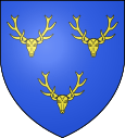
Le Luart
| Le Luart | ||
|---|---|---|

|
|
|
| region | Pays de la Loire | |
| Department | Sarthe | |
| Arrondissement | Mamers | |
| Canton | La Ferté-Bernard | |
| Community association | Pays de l'Huisne Sarthoise | |
| Coordinates | 48 ° 4 ′ N , 0 ° 35 ′ E | |
| height | 77-134 m | |
| surface | 12.23 km 2 | |
| Residents | 1,439 (January 1, 2017) | |
| Population density | 118 inhabitants / km 2 | |
| Post Code | 72390 | |
| INSEE code | 72172 | |
| Website | http://mairie.du.luart.pagesperso-orange.fr/ | |
 Entrance to Le Luart |
||
Le Luart is a French city with a population of 1,439 (as at 1st January 2017) in Arrondissement Mamers in the department of Sarthe in the region Pays de la Loire . Le Luart belongs to the canton of La Ferté-Bernard (until 2015: Canton Tuffé ) and to the community association Communauté de communes du Pays de l'Huisne Sarthoise . The inhabitants are called Luartais .
geography
Le Luart is located about 29 kilometers east-northeast of Le Mans . Le Luart is surrounded by the neighboring municipalities of Sceaux-sur-Huisne in the north and north-west, Saint-Maixent in the north-east, Bouër in the east, Lavaré in the south-east, Dollon in the south and Duneau in the west.
Population development
| 1962 | 1968 | 1975 | 1982 | 1990 | 1999 | 2006 | 2013 |
|---|---|---|---|---|---|---|---|
| 643 | 687 | 792 | 914 | 952 | 995 | 1,237 | 1,450 |
| Source: Cassini and INSEE | |||||||
Attractions
- Notre-Dame-de-la-Présentation church
- Le Luart Castle from the 19th century, a historic monument since 1989
Web links
Commons : Le Luart - collection of images, videos and audio files

