
Massignac
|
Massignac Massinhac |
||
|---|---|---|
|
||
| region | Nouvelle-Aquitaine | |
| Department | Charente | |
| Arrondissement | Confolens | |
| Canton | Charente-Bonnieure | |
| Community association | Charente limousine | |
| Coordinates | 45 ° 47 ' N , 0 ° 39' E | |
| height | 218-290 m | |
| surface | 23.93 km 2 | |
| Residents | 390 (January 1, 2017) | |
| Population density | 16 inhabitants / km 2 | |
| Post Code | 16310 | |
| INSEE code | 16212 | |
 Town hall (Mairie) of Massignac |
||

Massignac ( Occitan : Massinhac ) is a French municipality with 390 inhabitants (as of January 1 2017) in the department of Charente in the region Nouvelle-Aquitaine (before 2016: Poitou-Charentes ); it belongs to the Arrondissement Confolens and the canton Charente-Bonnieure (until 2015: canton Montembœuf ).
geography
Massignac is located about 41 kilometers east-northeast of Angoulême on the Moulde . Massignac is surrounded by the neighboring communities of Lésignac-Durand in the north, Pressignac in the north-east, Verneuil in the east, Les Salles-Lavauguyon in the south-east, Sauvagnas in the south, Le Lindois in the south-west and Mouzon in the west and north-west.
Population development
| year | 1962 | 1968 | 1975 | 1982 | 1990 | 1999 | 2006 | 2013 |
| Residents | 780 | 745 | 620 | 515 | 451 | 401 | 410 | 390 |
| Source: Cassini and INSEE | ||||||||
Attractions
- Thauzac Dolmen, a historic monument since 1929
- neo-Gothic church
- Les Étangs castle
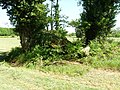
Thauzac dolmen

church

Les Étangs castle


Web links
Commons : Massignac - collection of images, videos and audio files