
Grebs-Niendorf
| coat of arms | Germany map | |
|---|---|---|

|
Coordinates: 53 ° 15 ' N , 11 ° 18' E |
|
| Basic data | ||
| State : | Mecklenburg-Western Pomerania | |
| County : | Ludwigslust-Parchim | |
| Office : | Dömitz-Malliss | |
| Height : | 21 m above sea level NHN | |
| Area : | 31.18 km 2 | |
| Residents: | 533 (Dec. 31, 2019) | |
| Population density : | 17 inhabitants per km 2 | |
| Postal code : | 19294 | |
| Primaries : | 038750, 038754 | |
| License plate : | LUP, HGN, LBZ, LWL, PCH, STB | |
| Community key : | 13 0 76 053 | |
| Community structure: | 4 districts | |
| Office administration address: | Goethestrasse 31 19303 Dömitz |
|
| Website : | ||
| Mayor : | Detlef Schranck | |
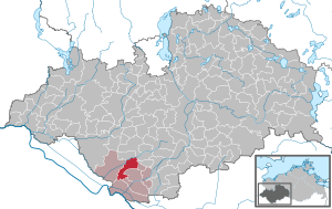
| Location of the municipality of Grebs-Niendorf in the Ludwigslust-Parchim district | ||
  |
||

Grebs-Niendorf is a municipality in the Ludwigslust-Parchim district in Mecklenburg-Western Pomerania (Germany). It is administered by the Office Dömitz-Malliß , based in the city of Dömitz .
geography

The community is located in the Griesen area on the northern edge of a terminal moraine . The area around Grebs-Niendorf lies between the Rögnitz and the Elde Canal . The highest elevation in the municipality is the Galgenberg near Schlesin at 42.3 m above sea level. NN, the meadow lowlands of the Rögnitz have a height of about 20 m above sea level. NN. Grebs-Niendorf is characterized by extensive coniferous forests south of Schlesin and south of Niendorf an der Rögnitz and the meadow area around the Rögnitz.
Community structure
The community consists of the districts Grebs, Menkendorf, Niendorf an der Rögnitz and Schlesin , as well as the settlement Neu-Grebs.
history

There are first signs of settlement with a Slavic rampart on the northern boundary of Göhlen near Menkendorf, which dates from between 900 and 1200. Excavations have shown that a wall surrounding the castle was built from a wood-earth construction. This still rises clearly from the area today. The Menkendorfer Group was named after the finds in the castle wall , a Middle Slavic archaeological ceramic group of the 9th and 10th centuries, which stretched from the Mecklenburg Lake District to the Baltic Sea area. The place Niendorf was first mentioned in 1431 as Neyedorp , Grebs in 1285 as Grebece . The formerly independent communities Grebs and Niendorf an der Rögnitz merged on June 13, 2004 to form the new community Grebs-Niendorf.
politics
Coat of arms, flag, official seal
The municipality has no officially approved national emblem, neither a coat of arms nor a flag. The official seal is the small state seal with the coat of arms of the state of Mecklenburg. It shows a looking bull's head with torn off neck fur and crown and the inscription "GEMEINDE GREBS-NIENDORF".
religion

The Protestant Christians in Grebs-Niendorf belong to the Conow parish of the Evangelical Lutheran State Church of Mecklenburg , there is a small chapel in Niendorf. On the Catholic side, Grebs-Niendorf belongs to the area of the parish Maria Rosenkranzkönigin zu Dömitz , Archdiocese of Hamburg .
Attractions
- Castle ramparts in Menkendorf, wooden structures rebuilt until 2010 (no claim to be true to the original)
The architectural monuments of the community are listed in the list of architectural monuments in Grebs-Niendorf .
societies
- The Jugendhof Mullewapp e. V. can be used for school camp-like trips. This is also where the Mullewapp theater barn is located , which is used both for performances and as a rehearsal stage.
- The non-profit local history and museum association Grebs und Umgebung e. V. was founded on April 21, 1995 and aims to maintain rural cultural assets and use the local barn as a museum for traditional agricultural technology.
- In the Erntekronen GmbH traditional harvest crowns are tied annually at harvest time, which are then issued and valued. Harvest festivals are visited in other places with decorated floats and in old costumes.
traffic
Grebs is about 3.5 kilometers north of the federal highway 191 near Malliss . Since the Ludwigslust – Dömitz railway line was closed, there has only been a bus connection in local public transport.
Web links
Individual evidence
- ↑ Statistisches Amt MV - population status of the districts, offices and municipalities 2019 (XLS file) (official population figures in the update of the 2011 census) ( help ).
- ↑ Main statutes of the Grebs-Niendorf community. (PDF; 165 kB) Grebs-Niendorf municipality, December 19, 2014, p. § 2 , accessed on June 7, 2016 .
- ^ StBA: Changes in the municipalities in Germany, see 2004
- ↑ Main Statute, Section 1, Paragraph 2

Alt Krenzlin | Old Zachun | Balow | Bandenitz | Banzkow | Barkhagen | Barnin | Belsch | Bengerstorf | Possession | Blankenberg | Blievenstorf | Bobzin | Boizenburg / Elbe | Borkow | Brahlstorf | Brenz | Bresegard at Eldena | Bresegard near Picher | Bruel | Brunow | Bülow | Cambs | Crivitz | Dabel | Dambeck | Demes | Dersenow | Dobbertin | Dobin at the lake | Dömitz | Domsühl | Dumber | Eldena | Friedrichsruhe | Gallin | Gallin Cupcentess | Gammelin | Ganzlin | Gehlsbach | Gneven | Göhlen | Goldberg | Gorlose | Grabow | Granzin | Grebs-Niendorf | Greetings | Greven | Great Godems | Big stuff | Groß Laasch | Hagenow | Hohen Pritz | Holthusen | Hoort | Hülseburg | Parental leave | Karrenzin | Karstädt | Church of Jesar | Klein Rogahn | Tempzin Monastery | Kobrow | Kogel | Circling | Kremmin | Kritzow | Kuhlen-Wendorf | Cow peat | Langen Brütz | Leezen | Lewitzrand | Luebesse | Lueblow | Lübheen | Luebz | Ludwigslust | Lüttow-Valluhn | Malk Göhren | Malliss | Mestlin | Milow | Möllenbeck | Moraas | Muchow | Mustin | New Gülze | New Kaliss | New Poserin | Neustadt-Glewe | Nostorf | Upper Warnow | Pampow | Parchim | Passow | Pätow-Steegen | Picher | Pinnow | Plate | Plau am See | Prislich | Pritzier | Raben Steinfeld | Rastow | Redefin | Rome | Ruhner Mountains | Lap in | Schwanheide | Siggelkow | Spornitz | Sternberg | Stumble | Stralendorf | Straw churches | Sukow | Sülstorf | Techentin | Teldau | Ticino | Toddin | Tramm | Uelitz | Vellahn | Vielank | Warlitz | Warlow | Warsow | Weitendorf | Werder | Wittenburg | Wittendbod | Wittenförden | Witch | Wöbbelin | Zapel | Zarrentin am Schaalsee | Ziegendorf | Zierzow | Zölkow | Zulow