
Barkhagen
| coat of arms | Germany map | |
|---|---|---|

|
Coordinates: 53 ° 29 ' N , 12 ° 12' E |
|
| Basic data | ||
| State : | Mecklenburg-Western Pomerania | |
| County : | Ludwigslust-Parchim | |
| Office : | Plau am See | |
| Height : | 65 m above sea level NHN | |
| Area : | 30.28 km 2 | |
| Residents: | 585 (Dec. 31, 2019) | |
| Population density : | 19 inhabitants per km 2 | |
| Postal code : | 19395 | |
| Area code : | 038735 | |
| License plate : | LUP, HGN, LBZ, LWL, PCH, STB | |
| Community key : | 13 0 76 006 | |
| Community structure: | 5 districts | |
| Office administration address: | Am Markt 2 19395 Plau am See |
|
| Website : | ||
| Mayor : | Burkhard Melcher | |
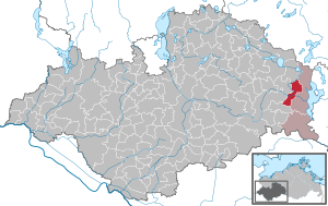
| Location of the municipality of Barkhagen in the Ludwigslust-Parchim district | ||
  |
||

Barkhagen is a municipality in the east of the Ludwigslust-Parchim district in Mecklenburg-Western Pomerania (Germany). It is administered by the Plau am See office based in the city of the same name .
Geography and traffic
The municipality is located on the federal highway 191 and can be reached from the Malchow junction of the federal highway 19 (approx. 20 km). Barkhagen is about 10 kilometers east of Lübz and about five kilometers west of Plau am See . The Müritz-Elde waterway runs through the district of Barkow . The Mildenitz rises in the municipality . The highest point is the Black Mountain at 79.5 m above sea level. NHN in the southwest of the municipality on the Kritzower See . To the south of Plauerhagen lies the Rauenberger Moor wetland and in the far south the Blockkoppel forest area .
Districts
In the main statute of the municipality five districts are named:
history
The district of Barkow was first mentioned on April 13, 1274 and the district of Plauerhagen on August 3, 1235. The districts of Barkow, Kolonie Lalchow and Altenlinden, which belong to the municipality, merged in 1950 to form what was then the municipality of Barkow. The community then emerged on June 13, 2004 from the merger of the communities of Barkow and Plauerhagen.
During the GDR era, the VEB FZM Schlieben / Berga ran a company holiday camp for the children of its employees in the Barkow district .
politics
Coat of arms, flag, official seal
The municipality has no officially approved national emblem, neither a coat of arms nor a flag. The official seal is the small state seal with the coat of arms of the state of Mecklenburg. It shows a looking bull's head with torn off neck fur and crown and the inscription "GEMEINDE BARKHAGEN".
Names
The name Barkhagen is a mixture of the Slavic place name Barkow and the place name of German / Slavic origin Plauerhagen .
Barkow was 1274 originally Bercove or Berchove. and was probably named after its Slavic locator Berka. The syllable ber stands for take away or rob , but could also be derived from brk , Slovenian / Serbo-Croatian for beard hair .
The name Plauerhagen is made up of the German word hagen for clearing with fencing (clearing) and the presumably Slavic name plav for swimming, rafting, flooding .
The district of Altenlinden was called (Hof) Malchow until May 13, 1939.
Attractions
- Elde with a lock in Barkow
- Barkow village church : The Gothic stone church with a flat wooden beam ceiling in the nave probably dates from the middle of the 14th century and was expanded as a half-timbered building towards the west in the 17th and 18th centuries. The wooden bell tower from the 14th century has been replaced by the half-timbered tower from 1786 with a pyramid spire . The church was renovated and expanded from 2005 to 2008.
- Pfarrhof Barkow (seat of the state trombone factory Mecklenburg-Western Pomerania)
- Village church in Plauerhagen from 1784 made of half-timbered with brick and a roof turret.
- Blue oak with a memorial stone from 1913 in Plauerhagen
- Friedhofseiche in Barkow, a pedunculate oak that is over 500 years old
- Victory oak in Barkow with a memorial stone in memory of the Franco-German War 1870/71

Village church in Barkow

Village church in Plauerhagen

Railway station in Zarchlin

War memorial 1914–1918 in Barkow


Personalities
- Helene Dolberg (1881–1979), painter, was born in Barkow
- Heinrich Zander (1800–1876), ornithologist and pastor in Barkow
Web links
Individual evidence
- ↑ Statistisches Amt MV - population status of the districts, offices and municipalities 2019 (XLS file) (official population figures in the update of the 2011 census) ( help ).
- ↑ Main statutes of the community of Barkhagen. (PDF; 1452.3kB) Office Plau Land, October 18, 2014, p. 6 , accessed on May 17, 2018 .
- ↑ a b c Barkow community: A small chronicle 1274–1999: 725 years Barkow. 1999
- ^ Area changes in Mecklenburg-Western Pomerania 2004. (PDF; 61 kB) Statistical Office Mecklenburg-Western Pomerania, February 28, 2005, p. 8 , accessed on June 11, 2015 .
- ↑ Main Statute, Section 1, Paragraph 2
- ^ Paul Kühnel: The Slavic place names in Meklenburg . In: Yearbooks of the Association for Meklenburg History and Antiquity . Yearbooks of history. tape 46 , 1881, ISSN 0259-7772 , p. 23 ( online [accessed June 11, 2015]).
- ↑ gov.genealogy.net
- ^ Website of the association for the reconstruction of the village church Barkow e. V.

Alt Krenzlin | Old Zachun | Balow | Bandenitz | Banzkow | Barkhagen | Barnin | Belsch | Bengerstorf | Possession | Blankenberg | Blievenstorf | Bobzin | Boizenburg / Elbe | Borkow | Brahlstorf | Brenz | Bresegard at Eldena | Bresegard near Picher | Bruel | Brunow | Bülow | Cambs | Crivitz | Dabel | Dambeck | Demes | Dersenow | Dobbertin | Dobin at the lake | Dömitz | Domsühl | Dumber | Eldena | Friedrichsruhe | Gallin | Gallin Cupcentess | Gammelin | Ganzlin | Gehlsbach | Gneven | Göhlen | Goldberg | Gorlose | Grabow | Granzin | Grebs-Niendorf | Greetings | Greven | Great Godems | Big stuff | Groß Laasch | Hagenow | Hohen Pritz | Holthusen | Hoort | Hülseburg | Parental leave | Karrenzin | Karstädt | Church of Jesar | Klein Rogahn | Tempzin Monastery | Kobrow | Kogel | Circling | Kremmin | Kritzow | Kuhlen-Wendorf | Cow peat | Langen Brütz | Leezen | Lewitzrand | Luebesse | Lueblow | Lübheen | Luebz | Ludwigslust | Lüttow-Valluhn | Malk Göhren | Malliss | Mestlin | Milow | Möllenbeck | Moraas | Muchow | Mustin | New Gülze | New Kaliss | New Poserin | Neustadt-Glewe | Nostorf | Upper Warnow | Pampow | Parchim | Passow | Pätow-Steegen | Picher | Pinnow | Plate | Plau am See | Prislich | Pritzier | Raben Steinfeld | Rastow | Redefin | Rome | Ruhner Mountains | Lap in | Schwanheide | Siggelkow | Spornitz | Sternberg | Stumble | Stralendorf | Straw churches | Sukow | Sülstorf | Techentin | Teldau | Ticino | Toddin | Tramm | Uelitz | Vellahn | Vielank | Warlitz | Warlow | Warsow | Weitendorf | Werder | Wittenburg | Wittendbod | Wittenförden | Witch | Wöbbelin | Zapel | Zarrentin am Schaalsee | Ziegendorf | Zierzow | Zölkow | Zulow