
Sülstorf
| coat of arms | Germany map | |
|---|---|---|

|
Coordinates: 53 ° 31 ' N , 11 ° 23' E |
|
| Basic data | ||
| State : | Mecklenburg-Western Pomerania | |
| County : | Ludwigslust-Parchim | |
| Office : | Ludwigslust-Land | |
| Height : | 44 m above sea level NHN | |
| Area : | 18.67 km 2 | |
| Residents: | 820 (Dec. 31, 2019) | |
| Population density : | 44 inhabitants per km 2 | |
| Postal code : | 19077 | |
| Area code : | 03865 | |
| License plate : | LUP, HGN, LBZ, LWL, PCH, STB | |
| Community key : | 13 0 76 134 | |
| Community structure: | 3 districts | |
| Office administration address: | Wöbbeliner Strasse 5 19288 Ludwigslust |
|
| Website : | ||
| Mayor : | Horst Busse | |
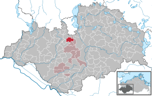
| Location of the municipality of Sülstorf in the Ludwigslust-Parchim district | ||
  |
||

Sülstorf is a municipality in the Ludwigslust-Parchim district in Mecklenburg-Western Pomerania . It is administered by the Office Ludwigslust-Land with its seat in the non-official city of Ludwigslust .
The districts of Boldela and Sülte belong to Sülstorf.
Geography and traffic

The community is located about twelve kilometers south of the state capital Schwerin . The federal highway 321 is about seven kilometers away. The federal autobahn 24 can be reached in ten kilometers via the Hagenow junction .
Sülstorf is surrounded by the neighboring communities of Holthusen in the north, Lübesse in the east, Uelitz in the southeast, Hoort in the southwest and Alt Zachun in the west.
Sülstorf has a stop on the Ludwigslust – Wismar railway line .
history
The first written mention of Sülstorf comes from the year 1217. Here the place was mentioned in a deed of donation from the Counts of Schwerin to the Commandery of Sülstorf . The Commander of the Order of St. John had its seat here until 1315. Around 1700 there was a sovereign court in Boldela, to which Sülstorf also served. In 1882 a mill was still shown on a map near Sülstorf. A fire destroyed the Sülstorf church in 1979 , which was rebuilt in 1984 and a wooden tower in 2003.
On January 1, 1951, the previously independent municipality Boldela was incorporated.
From April 13 to 15, 1945, a train with around 4,600 concentration camp prisoners stopped on a track near the station. Hundreds of prisoners died in the transport with almost no water or food. The prisoners came from the Helmstedt-Beendorf satellite camp , a satellite camp of the Neuengamme concentration camp, and were to be brought to the Wöbbelin concentration camp . The train stopped in Sülstorf because another trek from the Schandelah subcamp was blocking the siding of the Wöbbelin concentration camp. On April 15, the Sülstorf train drove to the Wöbbelin concentration camp, where the SS drove the men into the camp. For the women, the odyssey ended only on 20 and 21 April in satellite camps of Neuengamme concentration camp, the concentration camp Hamburg-Sasel , concentration camp Hamburg-Wandsbek , concentration camp Hamburg-Eidelstedt and concentration camp langenhorn . In 1947 a cemetery of honor was built opposite the train station for the dead. A memorial stone of the Jewish state community from 1951 commemorates 53 Jewish women from Hungary whose bodies were found in Sülstorf after the end of the war. The actual number of victims in the Sülstorf municipality is unknown.
politics
coat of arms
|
|
Blazon : "In red a golden linden branch with three leaves, accompanied in the left upper corner by a silver Maltese cross."
The coat of arms and the flag were designed by the Schwerin heraldist Heinz Kippnick . It was approved together with the flag on September 21, 2000 by the Ministry of the Interior and registered under the number 229 of the coat of arms of the state of Mecklenburg-Western Pomerania. |
| Justification of the coat of arms: In the coat of arms, the main symbol, the linden branch, is intended to indicate the wooded area on the one hand and the number of leaves on the three districts on the other. The eight-pointed silver medal of the Order of Malta, founded in 1048, reminds of Sülstorf's membership of the former Johanniter Commandery Kraak, which was important for the colonization of the area. With the tinging in red and gold, the reference to the former county of Schwerin is established. |
flag

The flag is striped in red, yellow and red across the longitudinal axis of the flag cloth. The red stripes each take up a quarter, the yellow stripe takes up half the length of the flag cloth. In the middle of the yellow stripe is the municipal coat of arms, which takes up two thirds of the height and one third of the length of the flag. The length of the flag is related to the height as 5: 3.
Official seal
The official seal shows the municipal coat of arms with the inscription “• GEMEINDE SÜLSTORF • LANDKREIS LUDWIGSLUST-PARCHIM”.
Attractions
→ See also the list of architectural monuments in Sülstorf
- Johanniterkirche as a late Gothic hall church from the 15th century on old foundations from 1217; wooden tower from 2003.
- Rectory with residential house, barn and stable barn
- Cemetery of honor from 1947 to commemorate 53 female Jewish concentration camp inmates of a misdirected evacuation train from Beendorf to Wöbbelin concentration camp , two satellite camps of Neuengamme concentration camp , at Sülstorf train station. In 1951 a memorial stone was erected for these 53 of the more than 200 fatalities
- Neo-Gothic church in the Sülte district


Personalities
- Jochen Bachfeld (* 1952), amateur boxer, 1976 Olympic champion welterweight in Montreal.
Web links
Individual evidence
- ↑ Statistisches Amt MV - population status of the districts, offices and municipalities 2019 (XLS file) (official population figures in the update of the 2011 census) ( help ).
- ↑ a b c § 1 of the main statute (PDF; 192 kB) of the municipality
- ^ Georg Christian Friedrich Lisch: Documents of the Comthurei Kraak and the Priorei Eixen . In: Yearbooks of the Association for Mecklenburg History and Archeology. Vol. 1 (12), pp. 197-232. ( Digitized version )
- ↑ Hans-Heinz Schütt: On shield and flag - the coats of arms and flags of the state of Mecklenburg-Western Pomerania and its municipalities . Ed .: production office TINUS; Schwerin. 2011, ISBN 978-3-9814380-0-0 , pp. 147/148 .

Alt Krenzlin | Old Zachun | Balow | Bandenitz | Banzkow | Barkhagen | Barnin | Belsch | Bengerstorf | Possession | Blankenberg | Blievenstorf | Bobzin | Boizenburg / Elbe | Borkow | Brahlstorf | Brenz | Bresegard at Eldena | Bresegard near Picher | Bruel | Brunow | Bülow | Cambs | Crivitz | Dabel | Dambeck | Demes | Dersenow | Dobbertin | Dobin at the lake | Dömitz | Domsühl | Dumber | Eldena | Friedrichsruhe | Gallin | Gallin Cupcentess | Gammelin | Ganzlin | Gehlsbach | Gneven | Göhlen | Goldberg | Gorlose | Grabow | Granzin | Grebs-Niendorf | Greetings | Greven | Great Godems | Big stuff | Groß Laasch | Hagenow | Hohen Pritz | Holthusen | Hoort | Hülseburg | Parental leave | Karrenzin | Karstädt | Church of Jesar | Klein Rogahn | Tempzin Monastery | Kobrow | Kogel | Circling | Kremmin | Kritzow | Kuhlen-Wendorf | Cow peat | Langen Brütz | Leezen | Lewitzrand | Luebesse | Lueblow | Lübheen | Luebz | Ludwigslust | Lüttow-Valluhn | Malk Göhren | Malliss | Mestlin | Milow | Möllenbeck | Moraas | Muchow | Mustin | New Gülze | New Kaliss | New Poserin | Neustadt-Glewe | Nostorf | Upper Warnow | Pampow | Parchim | Passow | Pätow-Steegen | Picher | Pinnow | Plate | Plau am See | Prislich | Pritzier | Raben Steinfeld | Rastow | Redefin | Rome | Ruhner Mountains | Lap in | Schwanheide | Siggelkow | Spornitz | Sternberg | Stumble | Stralendorf | Straw churches | Sukow | Sülstorf | Techentin | Teldau | Ticino | Toddin | Tramm | Uelitz | Vellahn | Vielank | Warlitz | Warlow | Warsow | Weitendorf | Werder | Wittenburg | Wittendbod | Wittenförden | Witch | Wöbbelin | Zapel | Zarrentin am Schaalsee | Ziegendorf | Zierzow | Zölkow | Zulow