
Warsow
| coat of arms | Germany map | |
|---|---|---|

|
Coordinates: 53 ° 32 ' N , 11 ° 18' E |
|
| Basic data | ||
| State : | Mecklenburg-Western Pomerania | |
| County : | Ludwigslust-Parchim | |
| Office : | Stralendorf | |
| Height : | 44 m above sea level NHN | |
| Area : | 14.89 km 2 | |
| Residents: | 667 (Dec. 31, 2019) | |
| Population density : | 45 inhabitants per km 2 | |
| Postal code : | 19075 | |
| Area code : | 038859 | |
| License plate : | LUP, HGN, LBZ, LWL, PCH, STB | |
| Community key : | 13 0 76 147 | |
| Community structure: | 3 districts | |
| Office administration address: | Dorfstrasse 30 19073 Stralendorf |
|
| Website : | ||
| Mayoress : | Gisela Buller | |
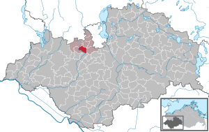
| Location of the community of Warsow in the Ludwigslust-Parchim district | ||
  |
||

Warsow is a municipality in the Ludwigslust-Parchim district in Mecklenburg-Western Pomerania (Germany). It is administered by the Stralendorf Office , based in the Stralendorf municipality.
The districts Warsow, Kothendorf and Krumbeck belong to the community.
Geography and transport links
Warsow is located about eleven kilometers southwest of Schwerin and 15 kilometers northeast of Hagenow directly on the federal highway 321 . The Sude flows along the southern border of the municipality. There is a connection to the federal motorway 24 six kilometers away at the Hagenow junction . The next train station on the Hagenow Land – Schwerin railway line is in Alt Zachun (5 km).
history

According to the first documentary mention from 1217, Warsow was a manor and parish village.
The church, which was rebuilt several times in the past, is a Gothic building made of granite rubble with buttresses. The church's two bells date from 1309 and 1474. The organ, built in 1833 by Jacob Friedrich Friese , has been in this church since 1874.
A low German hall house from 1787 has been preserved to this day. In 1972 Kothendorf and Krumbeck were incorporated into Warsow.
District of Kothendorf
The first documentary mention comes from the year 1297, in which Nikolaus Graf von Schwerin sold the village to the monastery Zarrentin . In 1873 Kothendorf is merged with Sudenmühle.
District Krumbeck
The Krumbeck settlement came into being because eight hereditary tenants built their houses on fields west of Kothendorf because of too dense settlement and for fire protection reasons.
politics
The municipal council elected in 2019 is composed as follows:
- SPD : 3 seats
- Free Warsower voter alliance for the future, the environment and proximity to the citizen: 3 seats
- Voting community Kothendorf: 2 seats
- Individual applicant Becker
Coat of arms, flag, official seal
The municipality has no officially approved national emblem, neither a coat of arms nor a flag. The official seal is the small state seal with the coat of arms of the state of Mecklenburg. It shows a looking bull's head with torn off neck fur and crown and the inscription "GEMEINDE WARSOW • LANDKREIS LUDWIGSLUST-PARCHIM".
Attractions
→ See also the list of architectural monuments in Warsow
- Gothic , medieval hall church in Warsow with half-timbered roof turrets ; Field stone choir ; Greatly changed by renovations in 1863; with frieze organ from 1833.
- Hall houses in Krumbeck
- Mill building and Sudetal in Sudenmühle
Individual evidence
- ↑ Statistisches Amt MV - population status of the districts, offices and municipalities 2019 (XLS file) (official population figures in the update of the 2011 census) ( help ).
- ↑ § 1 of the main statute (PDF; 22 kB) of the municipality
- ↑ Final results of the 2019 local elections. Accessed July 9, 2019 .
- ↑ Main Statute, Section 2, Paragraph 1
Web links

Alt Krenzlin | Old Zachun | Balow | Bandenitz | Banzkow | Barkhagen | Barnin | Belsch | Bengerstorf | Possession | Blankenberg | Blievenstorf | Bobzin | Boizenburg / Elbe | Borkow | Brahlstorf | Brenz | Bresegard at Eldena | Bresegard near Picher | Bruel | Brunow | Bülow | Cambs | Crivitz | Dabel | Dambeck | Demes | Dersenow | Dobbertin | Dobin at the lake | Dömitz | Domsühl | Dumber | Eldena | Friedrichsruhe | Gallin | Gallin Cupcentess | Gammelin | Ganzlin | Gehlsbach | Gneven | Göhlen | Goldberg | Gorlose | Grabow | Granzin | Grebs-Niendorf | Greetings | Greven | Great Godems | Big stuff | Groß Laasch | Hagenow | Hohen Pritz | Holthusen | Hoort | Hülseburg | Parental leave | Karrenzin | Karstädt | Church of Jesar | Klein Rogahn | Tempzin Monastery | Kobrow | Kogel | Circling | Kremmin | Kritzow | Kuhlen-Wendorf | Cow peat | Langen Brütz | Leezen | Lewitzrand | Luebesse | Lueblow | Lübheen | Luebz | Ludwigslust | Lüttow-Valluhn | Malk Göhren | Malliss | Mestlin | Milow | Möllenbeck | Moraas | Muchow | Mustin | New Gülze | New Kaliss | New Poserin | Neustadt-Glewe | Nostorf | Upper Warnow | Pampow | Parchim | Passow | Pätow-Steegen | Picher | Pinnow | Plate | Plau am See | Prislich | Pritzier | Raben Steinfeld | Rastow | Redefin | Rome | Ruhner Mountains | Lap in | Schwanheide | Siggelkow | Spornitz | Sternberg | Stumble | Stralendorf | Straw churches | Sukow | Sülstorf | Techentin | Teldau | Ticino | Toddin | Tramm | Uelitz | Vellahn | Vielank | Warlitz | Warlow | Warsow | Weitendorf | Werder | Wittenburg | Wittendbod | Wittenförden | Witch | Wöbbelin | Zapel | Zarrentin am Schaalsee | Ziegendorf | Zierzow | Zölkow | Zulow