
Spornitz
| coat of arms | Germany map | |
|---|---|---|

|
Coordinates: 53 ° 24 ' N , 11 ° 43' E |
|
| Basic data | ||
| State : | Mecklenburg-Western Pomerania | |
| County : | Ludwigslust-Parchim | |
| Office : | Parchimer area | |
| Height : | 82 m above sea level NHN | |
| Area : | 49.02 km 2 | |
| Residents: | 1225 (Dec. 31, 2019) | |
| Population density : | 25 inhabitants per km 2 | |
| Postal code : | 19372 | |
| Area code : | 038726 | |
| License plate : | LUP, HGN, LBZ, LWL, PCH, STB | |
| Community key : | 13 0 76 126 | |
| LOCODE : | DE SOZ | |
| Community structure: | 4 districts | |
| Office administration address: | Walter-Hase-Strasse 42 19370 Parchim |
|
| Website : | ||
| Mayoress : | Britta Gnadke | |
| Location of the municipality of Spornitz in the Ludwigslust-Parchim district | ||
  |
||

Spornitz is a municipality in the Ludwigslust-Parchim district in Mecklenburg-Western Pomerania, Germany. It is administered by the Parchimer Umland Office based in Parchim.
geography
Spornitz is located about eight kilometers west of Parchim on the northern foothills of the Ruhner Mountains , at the transition from the landscape to the flat plains of the Lewitz nature reserve . In the south are the long mountain ( 124.9 m above sea level ) and the leaning mountain ( 119.2 m above sea level ), the highest peaks. A large part of the municipality is characterized by arable land, the southeastern part is forested. Here and in the east there are well-preserved remains of the Parchim Landwehr , which was a late medieval and wall-like border security system for the city of Parchim. In the northwest there is a part of the nature reserve Fischteiche in the Lewitz in the Spornitz district, the Müritz-Elde-Wasserstraße forms the municipal boundary there for a short distance.
The districts of Dütschow , Primank , Spornitz and Steinbeck belong to the community .
There are three marks:
| District number |
District name |
Landmark area (in ha ) |
|---|---|---|
| 131191 | Spornitz | 2411.3936 |
| 131192 | Dütschow | 1004.3295 |
| 131193 | Steinbeck-Primank | 1495.2728 |
history
Spornitz was first mentioned in a document around 1300 as Sporniz . The place name is derived from the Old Slavic word sporŭ for abundant or fertile . The place name should indicate the fertile environment. It is also possible to derive it from the locator of the village, descendants of Zbron .
On July 1, 1950, the previously independent municipality of Steinbeck-Primank was incorporated.
politics
coat of arms
|
|
Blazon : "In green, two diagonally crossed golden gable boards with turned away horse heads, accompanied by seven silver stones placed on each side."
The coat of arms and the flag were designed by the Schwerin heraldist Heinz Kippnick . It was approved together with the flag on March 16, 2001 by the Ministry of the Interior and registered under number 239 of the coat of arms of the state of Mecklenburg-Western Pomerania. |
| Reasons for the coat of arms: In the coat of arms, the diagonally crossed horse heads stand for the Lower Saxon farmhouses that characterize the village, the stones for the prehistoric finds in the municipality. The seven stones - large blocks of granite - probably represent the enclosure of a prehistoric monument. |
flag
The flag is striped in green, yellow and green across the longitudinal axis of the flag cloth. The green stripes each take up a quarter, the yellow stripe takes up half the length of the flag cloth. In the middle of the yellow stripe is the municipal coat of arms, which takes up two thirds of the height of the flag. The relation of the height of the flag cloth to the length is like 3: 5.
Official seal
The official seal shows the municipal coat of arms with the inscription "• GEMEINDE SPORNITZ • LANDKREIS LUDWIGSLUST-PARCHIM".
Attractions
→ See also the list of architectural monuments in Spornitz
Spornitz
- Gothic church from the 13th century, probably from field and brick with a choir with 5/8 closing and almost 55 meters high, square tower with an octagonal spire . Major structural changes were made around 1840. The Memel organ dates from 1876.
- War memorial 1914-18 in front of the church
- Forest house and barn
- Büdnerei with barn part
- Seven legend stones , large, deep-lying boulders next to the railway line, which, according to a legend, represent seven unfaithful, petrified shepherds.
- Remnants of the Parchim Landwehr , a late medieval border security ring around the town of Parchim
Dütschow
- Late Gothic church, as a brick building with a flat roof on the inside with an eastern 5/8 end and a wooden western tower from 1742
- Gut Dütschow as a former state domain with the two-storey manor house from 1850, after 1952 residential building of the LPG ; renovated after 1995 to 2005.
- Fire station (syringe house), Dorfstrasse 5
- Railway station from around 1880 on the Parchim – Ludwigslust railway line
- Hallenhäuser , Dorfstrasse 13 and 15
- Dealings
Steinbeck
- manor
Primank
- War memorial 1914–18 in the center of the village
- Petition
- Part of the old Primanker Höfe in the adjacent forest
- A ruin from the time of the peat cutting is 500 meters east of the town exit
- Hallenhaus, Primanker Dorfstrasse 15
- A partly destroyed sheepfold, to Primanker Dorfstraße 17

Spornitz village church

Dütschow village church
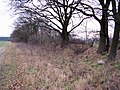
Earth wall of the Parchimer Landwehr in the east of Spornitz


traffic
The federal road 191 runs through Spornitz and connects to the towns of Parchim and Neustadt-Glewe . The next junction to the federal motorway 24 is at Neustadt-Glewe, about eight kilometers away.
Spornitz has a stop , Dütschow a stop on demand on the Ludwigslust – Parchim railway line served by the RB 14 ( ODEG ) .
Sons and daughters of the church
- Helmuth Schröder (1842–1909), Low German poet
- Ursula Eisenberg (* 1945), writer
- Reinhard Fritz (* 1946), painter and graphic artist
literature
- Winfried Dazert: Family Book Spornitz Dütschow . Magdeburg: Working Group for Genealogy 2011 (= Family Research Today Special Volume 11), ISBN 978-3-942235-10-5 .
Web links
Individual evidence
- ↑ Statistisches Amt MV - population status of the districts, offices and municipalities 2019 (XLS file) (official population figures in the update of the 2011 census) ( help ).
- ↑ § 1 of the main statutes ( Memento of the original from May 7, 2014 in the Internet Archive ) Info: The archive link was automatically inserted and not yet checked. Please check the original and archive link according to the instructions and then remove this notice. of the community (PDF; 2.4 MB)
- ↑ Geoportal of the Parchim district. Retrieved November 11, 2011.
- ^ Paul Kühnel: The Slavic place names in Meklenburg. In: Yearbooks of the Association for Mecklenburg History and Archeology. Vol. 46, 1881, ISSN 0259-7772 , pp. 3-168, here p. 42.
- ↑ a b Hans-Heinz Schütt: On shield and flag - the coats of arms and flags of the state of Mecklenburg-Western Pomerania and its municipalities . Ed .: production office TINUS; Schwerin. 2011, ISBN 978-3-9814380-0-0 , pp. 208/209 .
- ↑ Main Statute, Section 1, Paragraph 4 (PDF).

Alt Krenzlin | Old Zachun | Balow | Bandenitz | Banzkow | Barkhagen | Barnin | Belsch | Bengerstorf | Possession | Blankenberg | Blievenstorf | Bobzin | Boizenburg / Elbe | Borkow | Brahlstorf | Brenz | Bresegard at Eldena | Bresegard near Picher | Bruel | Brunow | Bülow | Cambs | Crivitz | Dabel | Dambeck | Demes | Dersenow | Dobbertin | Dobin at the lake | Dömitz | Domsühl | Dumber | Eldena | Friedrichsruhe | Gallin | Gallin Cupcentess | Gammelin | Ganzlin | Gehlsbach | Gneven | Göhlen | Goldberg | Gorlose | Grabow | Granzin | Grebs-Niendorf | Greetings | Greven | Great Godems | Big stuff | Groß Laasch | Hagenow | Hohen Pritz | Holthusen | Hoort | Hülseburg | Parental leave | Karrenzin | Karstädt | Church of Jesar | Klein Rogahn | Tempzin Monastery | Kobrow | Kogel | Circling | Kremmin | Kritzow | Kuhlen-Wendorf | Cow peat | Langen Brütz | Leezen | Lewitzrand | Luebesse | Lueblow | Lübheen | Luebz | Ludwigslust | Lüttow-Valluhn | Malk Göhren | Malliss | Mestlin | Milow | Möllenbeck | Moraas | Muchow | Mustin | New Gülze | New Kaliss | New Poserin | Neustadt-Glewe | Nostorf | Upper Warnow | Pampow | Parchim | Passow | Pätow-Steegen | Picher | Pinnow | Plate | Plau am See | Prislich | Pritzier | Raben Steinfeld | Rastow | Redefin | Rome | Ruhner Mountains | Lap in | Schwanheide | Siggelkow | Spornitz | Sternberg | Stumble | Stralendorf | Straw churches | Sukow | Sülstorf | Techentin | Teldau | Ticino | Toddin | Tramm | Uelitz | Vellahn | Vielank | Warlitz | Warlow | Warsow | Weitendorf | Werder | Wittenburg | Wittendbod | Wittenförden | Witch | Wöbbelin | Zapel | Zarrentin am Schaalsee | Ziegendorf | Zierzow | Zölkow | Zulow