
Sörth
| coat of arms | Germany map | |
|---|---|---|

|
Coordinates: 50 ° 42 ' N , 7 ° 41' E |
|
| Basic data | ||
| State : | Rhineland-Palatinate | |
| County : | Altenkirchen (Westerwald) | |
| Association municipality : | Altenkirchen-Flammersfeld | |
| Height : | 250 m above sea level NHN | |
| Area : | 1.99 km 2 | |
| Residents: | 250 (Dec. 31, 2019) | |
| Population density : | 126 inhabitants per km 2 | |
| Postal code : | 57636 | |
| Area code : | 02681 | |
| License plate : | AK | |
| Community key : | 07 1 32 106 | |
| Association administration address: | Rathausstrasse 13 57610 Altenkirchen |
|
| Website : | ||
| Local Mayor : | Walter Fischer | |
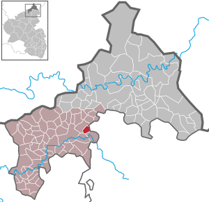
| Location of the local community of Sörth in the Altenkirchen district (Westerwald) | ||
  |
||

Sörth is a municipality in the Altenkirchen (Westerwald) district in Rhineland-Palatinate . It belongs to the community of Altenkirchen-Flammersfeld .
Geographical location
Sörth is located in a valley about 10 km northwest of Hachenburg and 3 km northeast of the district town of Altenkirchen . The place lies in the middle of a kind of rectangle, formed from the federal highway 256 in the west and northwest, the federal highway 290 in the northeast and east and the federal highway 414 in the south.


Population development
The development of the population of Sörth, the values from 1871 to 1987 are based on censuses:
|
|
politics
Municipal council
The council in Sörth consists of six council members, who in the local elections on May 26, 2019 in a majority vote were elected, and the honorary mayor as chairman.
mayor
Walter Fischer became the local mayor of Sörth in 2012. In the direct election on May 26, 2019, he was confirmed in his office for another five years with a share of 88.68% of the votes.
economy
Several small commercial and trading companies are based in Sörth, including a photo agency that specializes in astro photography. Agriculture is only practiced as a sideline.
Culture and clubs
- The Paragliding Friends Sörth eV has existed in Sörth since 2004 and maintains a paragliding and kite towing area close to the town . The club is now called Paragliding Friends Westerwald.
see also: List of cultural monuments in Sörth
Individual evidence
- ↑ a b State Statistical Office of Rhineland-Palatinate - population status 2019, districts, municipalities, association communities ( help on this ).
- ↑ State Statistical Office Rhineland-Palatinate - regional data
- ^ The Regional Returning Officer Rhineland-Palatinate: Municipal Council Election 2019 Sörth. Retrieved December 29, 2019 .
- ^ The Regional Returning Officer for Rhineland-Palatinate: Applicants for the direct elections that will take place in August 2012. Retrieved December 29, 2019 .
- ^ The Regional Returning Officer of Rhineland-Palatinate: direct elections 2019. see Altenkirchen-Flammersfeld, Verbandsgemeinde, 59th result line. Retrieved December 29, 2019 .
Web links

Almersbach | Alsdorf | Altenkirchen (Westerwald) (city, seat of the district administration) | Bachenberg | Berod near Hachenburg | Berzhausen | Betzdorf (city) | Birch honey meal | Birch bump | Birnbach | Bitches | Brachbach | Breitscheidt | Bruchertseifen | Bürdenbach | Burglahr | Busenhausen | Daaden (city) | That | Dickendorf | Eichelhardt | Oak trees | Elves | Elkenroth | Emmerzhausen | Ersfeld | Etzbach | Eulenberg | Fensdorf | Fiersbach | Flammersfeld | Floodlight | Forest | Forstmehren | Friedewald | Friesenhagen | Fürthen | Gebhardshain | Gieleroth | Giershausen | Grünebach | Güllesheim | Hamm (victory) | Harbach | Hasselbach | Helmenzen | Helmeroth | Hemmelzen | Herdorf (city) | Haylofts | Hilgenroth | Hirz-Maulsbach | Horhausen (Westerwald) | Hövels | Idelberg | Ingelbach | Isert | Katzwinkel (victory) | Chew | Kescheid | Kettenhausen | Churchib | Churches (victory) (city) | Kraam | Krunkel | Malberg | Mammelzen | Mauden | More | Michelbach (Westerwald) | Mittelhof | Molzhain | Mudersbach | Nauroth | Neitersen | Niederdreisbach | Niederfischbach | Niederirsen | Niedersteinebach | Nisterberg | Obererbach (Westerwald) | Oberirsen | Oberlahr | Obernau | Obersteinebach | Oberwambach | Oils | Orfgen | Peterslahr | Pleckhausen | Splendor | Racksen | Reiferscheid | Rescuers | Rosenheim (District of Altenkirchen) | Roth | Rott | Scheuerfeld | Schöneberg | Stokes | Schutzbach | Seelbach (Westerwald) | Seelbach near Hamm (victory) | Soaps | Selbach (victory) | Sörth | Steinebach / Victory | Steineroth | Stürzelbach | Volkerzen | Wallmenroth | Walterschen | Weitefeld | Werkhausen | Weyerbusch | Willroth | Knowledge (city) | Wölmersen | Goat grove