Haylofts
| coat of arms | Germany map | |
|---|---|---|
 Help on coat of arms |
Coordinates: 50 ° 43 ' N , 7 ° 37' E |
|
| Basic data | ||
| State : | Rhineland-Palatinate | |
| County : | Altenkirchen (Westerwald) | |
| Association municipality : | Altenkirchen-Flammersfeld | |
| Height : | 310 m above sea level NHN | |
| Area : | 2.58 km 2 | |
| Residents: | 247 (Dec. 31, 2019) | |
| Population density : | 96 inhabitants per km 2 | |
| Postal code : | 57612 | |
| Area code : | 02681 | |
| License plate : | AK | |
| Community key : | 07 1 32 051 | |
| Community structure: | 2 districts | |
| Association administration address: | Rathausstrasse 13 57610 Altenkirchen |
|
| Website : | ||
| Local Mayor : | Rainer fertilizer | |
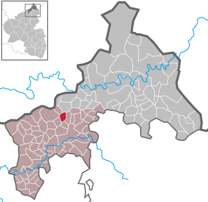
| Location of the local community Heupelzen in the district of Altenkirchen (Westerwald) | ||
Heupelzen is a municipality in the Altenkirchen (Westerwald) district in Rhineland-Palatinate . It belongs to the community of Altenkirchen-Flammersfeld .
geography
The main town of Heupelzen, located at an altitude of 309 m, is surrounded by meadows and forests of the Altenkirchen state forest.
The community comprises two districts : Heupelzen and Beul, 1 km to the northeast . However, only the left, western side of the street from Beul belongs to the municipality of Heupelzen, the other side of Beul is a district of Busenhausen .
Other neighboring communities are Ölsen in the north-west, Birkenbeul in the north, Busenhausen in the east, Kettenhausen in the south and Oberirsen and Wölmersen in the west.
history
Heupelzen was first mentioned in 1493 as Huypeltzhusen when a local farm was sold to the church in Hilgenroth . The current place name is probably made up of the ending “-zen” as a contraction of “-hausen” and the more precise definition “Heupel”, presumably meaning Hubbel / hill. This could indicate the nearby bulge head , the highest elevation in the Altenkirchen association.
Heupelzen belonged to the rulership of the Counts of Sayn , who had extensive holdings in the Westerwald and Eifel since the 12th century . After the introduction of the Reformation in the county of Sayn, the inhabitants were first Lutheran and later reformed . After the older line of the Counts of Sayn had expired in 1606, the County of Sayn came to the Counts of Sayn-Wittgenstein-Sayn . After the death of the last count in 1636, the two heir daughters inherited the county and finally divided it into Sayn-Hachenburg and Sayn-Altenkirchen in the 17th century . Beul and Heupelzen belonged to Sayn-Altenkirchen and were thus in the border area to the parishes of Hamm and Birnbach , which were assigned to Sayn-Hachenburg. The border area of the counties is still partially recognizable today through border ditches and old boundary stones .
Based on the agreements of the Congress of Vienna (1815), the region was ceded to the Kingdom of Prussia . Under the Prussian administration, Heupelzen and Beul were assigned to the Altenkirchen mayor's office in the newly established Altenkirchen district ( Koblenz district ) and from 1822 belonged to the Rhine Province .
Today the landmark of the place is the 35 m high Raiffeisen observation tower .
- Population development
The development of the population of Heupelzen, the values from 1871 to 1987 are based on censuses:
|
|
politics
Municipal council
The council in Heupelzen consists of six council members, who in the local elections on May 26, 2019 in a majority vote were elected, and the honorary mayor as chairman.
mayor
Rainer Düngen became mayor of Heupelzen in the summer of 2014. Elected for the first time in the direct election on May 25, 2014, he was confirmed in his office for another five years in the following election on May 26, 2019 with a share of the vote of 53.55%. Rainer Düngen's predecessor was Bernd Ochsenbrücher, who held the office for ten years.
Culture and sights
On the Beulskopf is the Raiffeisen Tower with a view of the Rothaargebirge , Siebengebirge and up to the Hohe Acht (747 m) in the Eifel (distance 57 km).
Economy and Infrastructure
Heupelzen is still dominated by agriculture, but is increasingly developing into a residential community .
traffic
The proximity to the city of Altenkirchen and the Au (Sieg) train station offers good connections. A bus line operates between Altenkirchen, Heupelzen and Hamm.
literature
- Local community Heupelzen (Ed.): 500 years of Heupelzen. 1493-1993 , Heupelzen 1993.
Web links
Individual evidence
- ↑ a b State Statistical Office of Rhineland-Palatinate - population status 2019, districts, municipalities, association communities ( help on this ).
- ^ Daniel Schneider: The development of denominations in the county of Sayn in the ground plan, in: Heimat-Jahrbuch des Kreis Altenkirchen 58 (2015), pp. 74-80.
- ↑ State Statistical Office Rhineland-Palatinate - regional data .
- ^ The Regional Returning Officer Rhineland-Palatinate: City Council Election 2019 Heupelzen. Retrieved December 25, 2019 .
- ^ The Regional Returning Officer of Rhineland-Palatinate: direct elections 2019. see Altenkirchen-Flammersfeld, Verbandsgemeinde, 24th line of results. Retrieved December 25, 2019 .
- ↑ Wolfgang Wachow: Former council members and local mayors honored. Bürger Kurier, Rhein-Westerwald-Sieg, November 19, 2014, accessed on December 26, 2019 .


