
Ersfeld
| coat of arms | Germany map | |
|---|---|---|

|
Coordinates: 50 ° 42 ' N , 7 ° 31' E |
|
| Basic data | ||
| State : | Rhineland-Palatinate | |
| County : | Altenkirchen (Westerwald) | |
| Association municipality : | Altenkirchen-Flammersfeld | |
| Height : | 270 m above sea level NHN | |
| Area : | 1.4 km 2 | |
| Residents: | 69 (Dec. 31, 2019) | |
| Population density : | 49 inhabitants per km 2 | |
| Postal code : | 57635 | |
| Area code : | 02686 | |
| License plate : | AK | |
| Community key : | 07 1 32 027 | |
| Association administration address: | Rathausstrasse 13 57610 Altenkirchen |
|
| Website : | ||
| Mayoress : | Christa Hentschel-Verfürth | |
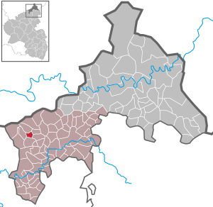
| Location of the local community Ersfeld in the district of Altenkirchen (Westerwald) | ||
  |
||

The village of Ersfeld , first mentioned in a document in 1411 , with 77 inhabitants (as of December 31, 2019) is one of the smallest local communities in the Altenkirchen district (Westerwald) in the northernmost part of Rhineland-Palatinate . It belongs to the community of Altenkirchen-Flammersfeld and is located in the immediate vicinity of the historic Raiffeisenstrasse on the northern edge of the Rhine-Westerwald nature park .
Ersfeld has an area of about 1.4 square kilometers and the settlement form of a row village . Some old half-timbered buildings , the Peschbach , which flows through the middle of the village, old oak and beech trees, meadows and forest areas and the somewhat remote location next to a small county road characterize the current rural character of the district .
In earlier times Ersfeld was remote and had only inadequate connections to larger settlements. As in many other Westerwald villages, the residents eke out a meager existence with hard work in the forest, cattle and agriculture. In addition, over the centuries, in many wars, the place was repeatedly plundered and robbed by soldiers passing through and taking quarters, by friends and foes alike.
Nonetheless, Ersfeld has withstood attempts at incorporation and community amalgamation and has retained a relative independence. The financial sources of the municipal budget consist of municipal tax revenues and hunting leases . Most Ersfelder lived partly up to the 1980s was still largely on agricultural main and part-time farms . In the meantime, apart from a few traders, the place is a pure residential community . The majority of the employed work in the surrounding larger towns, some commuters also drive to the metropolitan areas of the Rhine-Main or Rhine-Ruhr areas.
etymology
The place name Ersfeld is unique in Germany and in the local dialect is Appeard . In addition, Ersfeld occurs more often as a hallway and family name. The origin of the place name has not yet been clearly established.
Over the years, various attempts, which have only been passed down orally, have been made to interpret the origin of the name. One possibility is seen in deriving the quality of the agricultural soils and areas with the meaning of “first field”. Another interpretation of the name favors the term Erzfeld . Although no ore deposits worth mentioning were recorded in the place, this interpretation refers to a tunnel on the edge of the place, for whose former function and use one could not yet find a proper explanation. However, the tunnel was used, among other things, to store clay , which does not support the origin of the place name of Erzfeld .
Other considerations see a connection with a topographical explanation. According to this, the old German prefixes Ers or Ars refer to the location or shape of the ground, so that Ersfeld could be understood as a part of a section of terrain located at the end or “at the back”. Ers and Ars mean nothing more than " ass " in Old High German and can be found in many place and field names.
geography
Geographical location

Ersfeld is located in the Niederwesterwald (also: Unterwesterwald or Vorderwesterwald ), on the northeastern edge of the Asbach plateau before the transition to the Altenkirchen plateau , twelve kilometers west of Altenkirchen and one kilometer north of Mehren . It is a little off the county road 24 at the end of a small, about 800 meters wide and 1.5 kilometers long valley that continues to the northwest to the next town of Rettersen . Other neighboring towns are Fiersbach in the west, Forstmehren in the northeast and Kraam in the east. The mean altitude is 270 meters above sea level . The state border with North Rhine-Westphalia in the north is about 4 kilometers away.
geology
From a geological point of view, Ersfeld belongs as part of the front Westerwald to the Rhenish Slate Mountains , a heavily eroded remnant of the great Variscan mountain system of the Mesozoic . The Devonian basement is covered by volcanic masses from the Tertiary , especially basalts and tuffs .
The German Institute for Construction Technology (DIBt) assigns Ersfeld to the earthquake zone (EZON) “0” and the geological subsoil class (GUK) “R” (rock-like rock subsoil). However, in many parts of the district there is also very loamy soil. Due to underground water currents that flow from the edge of the forest above Ersfeld into the valley and wash under the surface, more or less large and deep holes in the ground appear in the fields and pastures. These pose a threat to agricultural machinery and tractors, among other things, and are therefore backfilled with rubble and other material.
Climate and vegetation
From a climatic point of view, the Westerwald is generally regarded as a rough area with comparatively less sunshine and a relatively high amount of precipitation . However, the climate in Ersfeld is generally more moderate compared to the higher Oberwesterwald and Hohen Westerwald. Ersfeld does not have its own station for determining weather data . Measurements at the closest station in Hilgenroth show an annual average temperature of 8.5 ° C with average highs of 16.7 ° C in July and low values of 0.3 ° C in January. The average annual rainfall is 996.3 millimeters. April is the driest month with an average of 70.4 millimeters, while December has the highest amounts of precipitation with 105.4 millimeters.
The hilly place and landscape of Ersfeld is characterized by meadows, agricultural areas and mixed forest . The most common are spruce , less often fir , beech , hornbeam , oak , maple , linden , alder and ash , occasionally chestnuts and poplars . As Bush - and shrubbery forms are hawthorn , hazel , elderberry , rosehip and birch family most widespread.
history
Although the place celebrated its official 600th anniversary on May 1st, 2011, Ersfeld was probably built between the 6th and 8th centuries. It is assumed that the area around Mehren, to which Ersfeld also belongs, was already settled in Franconian times and formed a large manor during the Carolingian district administration .
From the Archdiocese of Cologne to the County of Sayn, Reformation
As Arsfeld far oldest written record in the lapel of a feudal document from August 1, 1411 has the irreversible transition Ersfelds and other places from the Archdiocese of Cologne to the Sayn . With the deed of 1411, Friedrich III pledged . von Saar Werden , the then Archbishop of Cologne , Count Gerhard I. von Sayn for 700 Rhenish guilders for the land and people of the region. Wonderfully country belonged Ersfeld and 1652 to Sayn, then to Sayn-Altenkirchen . The place was also mentioned in writing or in documents in the years 1579, 1580, 1589, 1596 and 1610. Before the Thirty Years War , 16 fireplaces , so-called smokes, are said to have existed, which can be equated with residential houses. It can be seen from the tax lists of the time that sixteen taxable families lived in Ersfeld in 1580.
In 1561 the Reformation was introduced in the county of Sayn , and the inhabitants of Ersfeld switched to the Protestant creed . Ersfeld never had its own church and was part of the Mehren parish . So it belonged to the parish court Mehren in the saynischen office Altenkirchen until 1802 . Parish Mehren was until the reformation of the land section Auelgau of Archidiakonates Bonn assigned in Erzbistum Cologne.
Thirty Years War, dissolution of sovereignty, Prussia
No more detailed records are known of the events of the Thirty Years' War in the region. However, one knows from old lists of quarters about the great stresses to which the parish of Mehren and its localities were exposed. To cover the billing costs of the soldiers, sums had to be raised that could not be managed without taking out loans and tax increases. For Ersfeld, on the occasion of an eight-day visit by Rittmeister König and his company in 1625, this meant the accommodation of 64 horses, 67 people (more than their own population) and the loss of 84 Reichsthalers , which those who had stolen from their hosts. The village also had to raise 400 liters of wine. All in all, both friendly and enemy troops passing through looted and devastated, robbed money and food, and did not stop at murder and pillage.
From the War of the Austrian Succession (1740–1748) it is reported that French officers in the villages of the parish of Mehren, like common soldiers, “stole cattle, ruined hunting, crops and fishing without any distinction from all four columns” . When they left, the farmers had to give them 13 horses and 31 pairs of oxen as additional draft animals.
During the coalition wars in 1795, the damage from looting by retreating French to the Ersfeld residents was estimated at 597 guilders. Further records document the theft of 35 sheaves of grain, 2,637 sheaves of oats and 900 quintals of hay for the following year. Hardly anything was left for the population and there was bitter hardship, especially as more troops kept arriving. Napoleon's demand of his allies to provide him with soldiers led in 1806 to the fact that Haubrich Eckenbach from Ersfeld also had to fight for Napoleon.
As a result of the Reichsdeputationshauptschluss , Sayn-Altenkirchen and with it the place Ersfeld came to the County of Nassau-Usingen in 1803 . After joining the Rhine Confederation , Ersfeld belonged to the Duchy of Nassau from 1806 to 1815 .
After the Congress of Vienna , the area of the County of Sayn-Altenkirchen became part of Prussia in 1815 . With its administrative reform , its provinces were divided into administrative districts and districts . This is how the Altenkirchen district in the Coblenz administrative district came into being in 1816 . The parish constitution was repealed and mayorships were established. Ersfeld was initially assigned to the Weyerbusch mayor and in 1816 to the newly formed Altenkirchen district . The mayor's offices of Altenkirchen , Daaden , Flammersfeld , Friesenhagen , Gebhardshain , Hamm , Kirchen and Wissen also belonged to the district.
The October edict of 1807, part of the Prussian agrarian reform , ended the serfdom of the peasants and thus created at least the legal basis for the acquisition and ownership of previously mostly self-managed farms and land ( peasant liberation ).
Forestry
At times of land and feudal rule , the respective princes divided up the forest and assigned it to the residents through a special form of owner association , a so-called forest interest group , according to the number of smokes . The proportions of the shares could later change through inheritance or marriage. The economic exploitation of the forest stands therefore often led to disputes between the neighboring villages that had to be regulated by higher authorities. Various processes are on record for this purpose. The archival file 4810 of the State Main Archives Koblenz (LHAKo) deals, for example, for the period from 1736 to 1753 “The incursion and violation of the Flogert committed by the Retterser Waldbeerbten (the communities Kraam, Rettersen, Forstmehren and Ersfeld, all in the parish of Mehren) Hachenburg area ”. Another factual file in 1854 from 1780 refers to the “ trial of the communities of Rettesern, Kraam and Ersfeld with those interested in the Kraamer Erbzinsmühle because of the fire wood tax”. And a factual file 2062 of the Koblenz municipal supervision from 1818 deals with "forest disputes between the communities of Fiersbach and Ersfeld".
The municipal councils regularly set up forest rangers to supervise the forests, who watch over logs and other uses.
The log book, the main source for the community from 1845 onwards

The municipality of Ersfeld has a log book from 1845 with the minutes and resolutions of the council meetings up to September 21, 1966, an important document of the village and / or municipality politics and development. At the beginning of 1990 the book was restored from private funds on the condition that it remained in the possession of the local community, and in 2011, on the occasion of the 600th anniversary of the town, it was transferred from the German Kurrentschrift to today's typeface.
The social reformer Friedrich Wilhelm Raiffeisen , who became mayor of Weyerbusch at the age of 26 and described the impoverishment of the Westerwald farmers, had created the log book on the basis of § 66 of the municipal code on January 23, 1845 and was there until the second meeting on March 19, 1847 Secretary.
The first entry in the protocol dates from December 14, 1846 and documents the remuneration of the mayor ( remuneration ) of six talers annually. Not infrequently, the office of mayor passed from one family generation to the next, borne by the council resolution. The families Klein and Bierbrauer were named .
Further records of the council meetings deal with statutes on the construction of dirt roads and the associated compulsory labor of the citizens according to § 23 of the property regulations, personnel and tax decisions as well as budget debates . Compulsory labor were services to the community that were linked to tax discounts. Servants, journeymen and apprentices were exempt from this.
The famine of 1846, Raiffeisen
Unusual drought in the first half of 1846 threatened the harvest, hailstorms and potato rot destroyed large parts of the crops and garden crops and led to famine . Without suitable transport routes it was not possible to fall back on imports , so prices rose steeply. The farmers felt compelled to eat their own seeds . Friedrich Wilhelm Raiffeisen founded the Brodverein , he distributed flour free of charge. In 1847 the association issued seeds in exchange for promissory notes , which could be paid for with the yield of the new harvest. Raiffeisen recommended the construction of the Rheinstrasse from Weyerbusch to Neuwied-Heddesdorf (today B 256 ), which since 1984 has also been known as Historic Raiffeisenstrasse . Work was thus obtained at short notice; In the long term, the remote forest villages were connected to the economic development of the Neuwied region . Communities like Ersfeld or Kraam also used the forest to get stones for road construction and bread for the poor in Weyerbusch, as well as in Maulsbach or Neitersen .
Raiffeisen succeeded in further job creation measures . After the need for help from poor sections of the population had been established, the Ersfeld municipal council decided on March 31, 1847 to dig a ditch on the way from Forstmehren to Mehren, which offered the residents an opportunity to earn eight talers subsidized by the municipality .

In April 1847, the municipality of Ersfeld received an interest-free loan of 10 thalers from the surplus of "lead proceeds" from repair work on the Mehrener church tower in the amount of 18 thalers in exchange for a guarantee from the municipal council, in order to enable the cultivation of potatoes for the poor .
In order to improve the working and production conditions of the farms, the first land consolidation procedure was carried out in Ersfeld in 1896 . The clear maps with the field numbers and names created for this purpose on a scale of 1: 1000 are owned by the municipality. This also includes the so-called material place on the northern edge of the village, popularly known as Leimpöhl . The building materials of the place, such as clay, for building and repairing the houses were stored on it.
On December 28, 1911, the parish council met for the first time in the neighboring town of Mehren at the invitation of the church.
First World War
There are no records of the days of the First World War in Ersfeld. The minutes of the municipal council meetings, which are usually held twice a year, show that discussions were held almost exclusively on the municipal budget; nothing can be learned from this source about the events of the war . An exception is an entry from October 16, 1916, in which the community leader was granted a doubling of his remuneration during the war.
It is reported that men from Ersfeld also went into battle as soldiers. After the initial general enthusiasm for war in 1914 with the return of the first transports of the wounded was overtaken by the tragic reality, one quickly found oneself surrounded by hardship, hunger, privation and reprisals . Farmers in particular came under increasing pressure to have to produce enough food to feed not only their own population, but also the prisoners of war performing forced labor . The Altenkirchener Kreisblatt published appeals like this several times : “The field army urgently needs oats , hay and straw . Farmers, help the army! ” With threats of punishment and moral blackmail,“ spendthrifts ” were treated with the following advertisements : “ Anyone who feeds oats , mixed grains , mixed fruit containing oats or barley over and above the legally permissible level is sinning against the fatherland. ” After all, the war winter of 1917/1918 brought great hardship with freezing cold and the shortage of potatoes and other foodstuffs . The black market flourished, " hamstering " spread and led to extremely high exorbitant prices . Compared to the urban population, however, the Ersfeld farmers were able to rely on their own reserves because they were self-sufficient .
It is not known whether, after the end of the war, German withdrawal troops passed through or past Ersfeld as part of the demobilization , as was the case in many other localities. The number of prisoners of war from Ersfeld is also not known. However, the minutes of a municipal council meeting on August 14, 1934, in which the amount of the grant to the Volksbund deutscher Kriegsgräberfürsorge e. V. , depending on the number of own fallen, it was determined that there must have been three from the community.
Economic crisis and currency reform, National Socialism
The economic development after the end of the First World War was characterized by constant inflationary allowances, wage increases and enormous devaluations , which Ersfeld also had to take into account in order to keep the current community expenditures and necessary investments , for example for the infrastructural expansion of the energy supply and supply lines for the households to be able to cover. The result were recurring increases in the municipal tax burden and supplementary budgets . If the municipal council decided on September 23, 1918 to levy a burden of 270% on all taxes for the financial year 1919 (which had already been increased by another 150% on January 13, 1920), in 1921 this was already 1200%. the real and operating taxes. With the municipal council resolution of June 29, 1921, an accommodation tax was also introduced on the basis of the Local Taxes Act, but this only provided temporary relief. As early as 1923, property and building taxes were increased again to 9,000% and trade and operating taxes to 6,000%. At the municipal council meeting on September 25, 1923, however, it was established that, due to the increasing price and inflation, these levies were also by far not sufficient to cover expenses. The consequence was a further increase in property and building tax by a factor of twenty.
With the Coin Act of August 30, 1924, the Reichsmark became the official currency in Germany. In an emergency meeting of the Ersfeld municipal council on October 30, 1924, the property tax rate was set at 150% and the trade and business tax rate at 200%. By July 1929, however, both had risen to 400%. Despite the new currency , the currency abbreviation M for Mark and not RM for Reichsmark was used in the log book until October 16, 1933 .
Ersfeld's independent supply of electricity did not begin until 1924. Until then, the place, like Rettersen and Fiersbach, was supplied with electricity from the Fiersbach schoolhouse. The infrastructural framework was first roughly formulated at a municipal council meeting on October 30, 1924. This also included the house connections of the Ersfeld citizens. In the spring of 1925, the mayor was replaced as negotiator by a "lighting committee". After a commissioned company went bankrupt , an electrical engineer from Oberirsen was commissioned with the completion.
At the meeting on July 17, 1929, a budget deficit of 209 Reichsmarks was erroneously recorded with income of 2,698 Reichsmarks and expenses of 2917 Reichsmarks , although the difference was 219 Reichsmarks.
With a resolution of May 22, 1930, the Ersfeld municipal council rejected a merger with the municipalities of Mehren, Kraam (Craam), Ziegenhain, Ziegenhahn, Giershausen and Walterschen on the grounds, among other things, of wanting to "avoid the large number of civil servants". In addition, no advantages were seen and they would have learned in the last few decades to be able to do business in an acceptable manner even with low percentage levies.
Nothing is known about National Socialist activities or more intensive relationships in Ersfeld, and only two entries are made in the town's log book. From the minutes of the meeting of September 23, 1935 it becomes clear that decisions about the mayor's office and the number of councilors and councilors required the approval of the NSDAP commissioner . Furthermore, at the meeting on April 7, 1938, the local council sent a declaration of thanks to Reich Chancellor Adolf Hitler . She was connected to the clear invitation to all eligible voters, the annexation of Austria to the German Reich , the German already on 13 March 1938, the invasion of Wehrmacht - and SS was dressings done in a subsequent referendum on April 10, 1938 with Yes to agree.
Second World War
During the Second World War fewer and fewer parish council meetings were held. In 1939 it was decided to introduce an agricultural and forestry property tax with a rate of 115 percent. The remaining property tax was set at 200 percent, as was trade tax , although there were no commercial operations in Ersfeld at that time. In 1940 the council passed a resolution to increase the mayor's remuneration by 25 percent during the war. The minutes of a meeting in which “the budget statute presented by the mayor for the financial year 1944 was discussed in detail” is striking. Neither the names of the meeting participants were given, nor were signatures given for the minutes.
The chaos of war did not leave Ersfeld unaffected. Male members were recruited from almost every family for the service of the weapon , so that sooner or later the field and forest work could no longer be done adequately. In order to remedy this situation, each family whose male relatives were doing military service was assigned one or more prisoners of war, mostly French , later also Poles , as forced laborers by the Gau Arbeitsamt Moselland in Koblenz and the Neuwied employment office . They were housed in a large hall in the neighboring village of Fiersbach and had to be picked up in the morning by the residents of Ersfeld and brought back in the evening. During bombing raids , the population found shelter in the few cellars of some courtyards. Two Ersfeld soldiers were killed in combat far from home, nothing is known about the whereabouts of another one, an old-established citizen was killed two days before the end of the war by stray bullets from her own soldiers.
Despite the close proximity to Bundesstraße 8 , on which the Allies moved eastwards with heavy military equipment, the village was not directly involved in combat operations. The occupiers' projectiles flew from their location in Heuberg without causing damage via Ersfeld to the neighboring Fiersbach. The community's spruce stands were so damaged by shrapnel that they could no longer be used commercially. At the end of March 1945 the 1st US Army succeeded in conquering the entire area after crossing the Rhine at the Remagen bridge and sometimes fierce fighting in the neighboring villages, especially in Fiersbach. This ended the war for the Ersfelder too.
Post-war period and economic miracle
After the end of the war , the area was first administered by the US and from July 10, 1945 by the French occupying power. In general, their great severity was lamented, from which the population had to suffer. Curfew and exit bans were the order of the day. Most of what was already little that could be earned by the local farmers at the time had to be delivered to the occupiers. There was a lack of fuel, but collecting wood under threat of punishment was strictly forbidden.
The log book provides for the year 1946 four council meetings, the next to the Statute of the Bull entertainment purpose association , as well as the allocation for voluntary Office Fire Department and the contribution of the municipalities for repair and maintenance of the warrior graves busy with the election of a new council and budgetary matters.

At the council meeting on April 17, 1948, it was decided to submit a motion to lift the ban on municipal property imposed by the military government on the basis of Act No. 52, a first step towards regaining economic capacity. With the currency reform in June 1948, the situation slowly improved. Jobs were created and agricultural products became affordable again, from which the Ersfeld farmers also benefited. Milk , oats, potatoes, beets and other goods were bought in the whole region by commercial agents for the cooperatives and with the sales they made, they slowly got back to normal life. By resolution of October 27, 1948, the municipal council commissioned the mayor and council chairman to enter into negotiations with the electricity suppliers RWE and E. W. Siegerland about the sale of the local electricity network and the associated future tariffs . This led to the sale of the Ersfeld local network to E. W. Siegerland in early 1949 and the negotiation of a new electricity tariff, which set the course for the future energy supply of the community.
In the course of time, an increasing number of small and medium-sized companies with new jobs have been founded in the region. The demand for services and products increased, as did that for workers and new employees. This led to the fact that in the 1950s and 1960s not a few farmers took up work in a commercial or handicraft business and their own farms were increasingly run only as part-time businesses or even completely shut down. As a result of this structural change , only nine of the formerly 15 farms were run as full-time or part-time farms at the beginning of the 1970s. The further development in this direction was confirmed by the declining population and the increasing rural exodus of the 1980s and 1990s.
Politics and communal matters
Population development
Around 1830 the village of Ersfeld had 68 inhabitants, as the topographical-statistical description of the Royal Prussian Rhine Province shows.
The chronological development of the population (the values from 1871 to 1987 are based on censuses ):
|
|
|
|
|
Data source: State Statistical Office of Rhineland-Palatinate and Festschrift 600 Years Ersfeld

Compared to other localities, Ersfeld has a relatively young population. 21.9% of the population are under 20 years of age, 64.1% between 20 and 65 years and 14.1% are 65 years and older. 54.7% of the population are women (as of December 31, 2018), with a few exceptions since 1962 there has always been a surplus of women. The population has increased faster in the last few years compared to places of comparable size. It increased by 14.3% compared to 2007; the comparative value was only 0.8%.
elections
With 94.2% (49 of 52 eligible voters ) Ersfeld had the relatively highest voter turnout in 2004 in a local election in Rhineland-Palatinate. In 2009 it was 89.7% (38 of 45 eligible voters). In state elections Ersfeld belongs to constituency 02-Altenkirchen , in federal elections to constituency 198-Neuwied .
Bundestag elections
| Results of the federal elections 1965–2017 | ||||||||
| year | voter turnout | SPD | CDU | FDP | GREEN | left | AfD | Others |
|---|---|---|---|---|---|---|---|---|
| 1965 | 89.8 | 43.9 | 31.7 | 14.6 | - | - | - | 9.8 |
| 1969 | 88.6 | 28.9 | 39.5 | 23.7 | - | - | - | 7.9 |
| 1972 | 93.9 | 40.0 | 37.8 | 22.2 | - | - | - | 0.0 |
| 1976 | 92.2 | 44.7 | 42.6 | 10.6 | - | - | - | 2.1 |
| 1980 | 78.4 | 35.0 | 37.5 | 25.0 | 2.5 | - | - | 0.0 |
| 1983 | 75.0 | 28.2 | 53.8 | 7.7 | 10.3 | - | - | 0.0 |
| 1987 | 70.8 | 14.7 | 58.8 | 14.7 | 11.8 | - | - | 0.0 |
| 1990 | 65.2 | 37.9 | 31.0 | 27.6 | 3.4 | - | - | 0.0 |
| 1994 | 94.1 | 43.8 | 31.3 | 18.8 | 3.1 | - | - | 3.1 |
| 1998 | 83.8 | 33.3 | 33.3 | 6.7 | 23.3 | - | - | 3.3 |
| 2002 | 93.5 | 48.8 | 20.9 | 14.0 | 16.3 | - | - | 0.0 |
| 2005 | 91.1 | 42.5 | 25.0 | 17.5 | 5.0 | 10.0 | - | 0.0 |
| 2009 | 82.1 | 22.7 | 27.3 | 11.4 | 20.5 | 15.9 | - | 2.3 |
| 2013 | 72.0 | 22.2 | 38.9 | 5.6 | 22.2 | 8.3 | - | 0.0 |
| 2017 | 78.4 | 25.0 | 12.5 | 17.5 | 22.5 | 5.0 | 15.0 | 2.5 |
All results in%
State elections
| Results of the state elections 1967–2016 | |||||||||
| year | voter turnout | SPD | CDU | FDP | GREEN | The left | ALFA | AfD | Others |
|---|---|---|---|---|---|---|---|---|---|
| 1967 | 83.3 | 30.0 | 27.5 | 35.0 | - | - | - | - | 7.5 |
| 1971 | 66.0 | 41.9 | 32.3 | 16.1 | - | - | - | - | 9.7 |
| 1975 | 89.8 | 45.5 | 36.4 | 13.6 | - | - | - | - | 4.5 |
| 1979 | 82.4 | 45.2 | 40.5 | 14.3 | - | - | - | - | 0.0 |
| 1983 | 75.0 | 31.6 | 63.2 | 5.3 | - | - | - | - | 0.0 |
| 1987 | 73.8 | 42.3 | 42.3 | 11.5 | 3.8 | - | - | - | 0.0 |
| 1991 | 72.3 | 46.9 | 40.6 | 6.3 | 6.3 | - | - | - | 0.0 |
| 1996 | 84.4 | 61.1 | 22.2 | 8.3 | 5.6 | - | - | - | 2.8 |
| 2001 | 64.7 | 46.9 | 28.1 | 12.5 | 9.4 | - | - | - | 3.1 |
| 2006 | 61.2 | 67.9 | 10.7 | 17.9 | 3.6 | - | - | - | 0.0 |
| 2011 | 70.8 | 32.6 | 32.6 | 2.3 | 32.6 | - | - | - | 0.0 |
| 2016 | 73.0 | 33.3 | 26.7 | 6.7 | 15.6 | 2.2 | 4.4 | 11.1 | 0.0 |
All results in%
Municipal council
The municipal council in Ersfeld consists of six council members , at least half of whom have been women since 2001, who were last elected in a majority vote in the local elections on May 26, 2019 , and the chairperson, the honorary local mayor . This was elected by the local mayor election on the same day with 71.43 percent for five years in the office.
household
The financial budget shows a financial deficit of 7.35% for 2018. The local income comes mainly from the property tax, the trade tax of the settled businesses and from the income from the hunting lease for the hunting area of the district. For the 2018 budget year, the property tax rate for agricultural and forestry operations is 320% and for land 380%. The trade tax multiplier is 400%. The dog tax is between 36.00 and 600.00 euros per year.
coat of arms
Since 2007 Ersfeld has had its own coat of arms , to which the following blazon (coat of arms description) applies: Divided by a silver sloping bar , covered with a blue wavy bar; above in green a silver rooted oak, below in red a left-turning, double-tailed, facing, blue-armored and blue-tongued golden lion . The blue wavy line symbolizes the Peschbach flowing through the town, the oak gives an indication of the trees that characterize the town, and the lion is the symbol of the Counts of Sayn .
Economy and Infrastructure

Ersfeld's total area of 1.4 square kilometers and a circumference of 5.99 kilometers is divided into 77.5% agricultural area, 9.9% forest area, 10.2% settlement and traffic area and 0.7% water area (status: December 31, 2018). The nearest shops, doctors and pharmacies are in Weyerbusch, three kilometers away . The federal road 8 , which can be reached via the district road 24, which passes Ersfeld and is two kilometers away, enables a fast east-west connection. It used to be not only an important trade route between Cologne and Frankfurt am Main as Cölnische Hohe Heerstrasse and Geleitstrasse , but part of it was also a pilgrimage route between Cologne and Marburg , which was designated as the Way of St. James in 2007 . The A 3 and A 59 motorways are around twenty kilometers away.
Apart from a few tradespeople who belong to the Koblenz Chamber of Commerce and Industry, the place is purely a residential community . The increasing number of residents in recent years suggests a certain attractiveness , but the rather poor connection to public transport makes individual mobility necessary. From Monday to Friday, only lines 291 and 523 of the Rhein-Mosel transport association (VRM) pass Ersfeld, each running twice between Altenkirchen and Asbach or Altenkirchen and Uckerath with a connection to Hennef and supplemented by two Saturday trips on line 291 to Asbach. During regular school days there are a few additional trips. Only line 291 runs to Altenkirchen Monday to Friday between 6:00 a.m. and 9:00 a.m. and in the early afternoon.
Until the beginning of the 1970s there was only one street name with consecutive house numbers in the village, the Dorfstraße . Even today only four street names are mentioned in Ersfeld's address directory, Am Peschbach , Im Oberdorf , Unter den Eichen and Mehrbachstraße . A new development area is not designated as there are still a few privately owned vacant lots . Since 2009, the entire local area has been traffic-calmed with a speed limit of 30 km / h . In the same year, a has -profit organization established in the village and runs a Gnadenbrothof . In the event of a fire or disaster , the Mehren volunteer fire brigade is responsible for Ersfeld, which also includes some Ersfeld citizens. As a community of the "Zweckverband Friedhof Mehren", the Ersfelders are also allowed to use the cemetery.
There was also a post office here until the end of 1973 . After this was closed, the only public telephone in the village was also lost. The post office in Mehren responsible from this point in time has also long been out of service.
Water and energy supply
After a controversial discussion in the population about the construction of a reed sewage treatment plant , Ersfeld was connected to the sewage pipe of the Mehrbachtal sewage treatment plant in the neighboring village of Mehren between 2000 and 2003 with a 100% separation system , a local sewer network two kilometers in length and a connection rate of 100% . The community gets its drinking water from the Upper Bergische Aggertalsperre . The average consumption in 2007 per resident supplied was 144 liters per day.
Ersfeld's electricity supplier is E.ON , which replaced the network operator RWE in 2014. Private producers produce around 91 MWh / year of EEG electricity using solar systems , which corresponds to around 21%. Ersfeld is thus well above the average for the Altenkirchen community at just 5%. With a unanimous resolution of the municipal council, it was decided that as an energy-saving measure from 2010 the street lights in the town will remain switched off in the summer months, especially since it is still light or dusk until about half an hour before the official switch-off in the late evening hours. The same applies to the early hours of the morning, when it is usually bright enough when it is switched on.
Agriculture

There used to be fifteen farms , all of which had their own well and were thus self-sufficient in terms of water supply . They operated animal husbandry with cattle and pigs and built mainly oats , rye , wheat , potatoes and beets to. In addition to selling the animals, the production of butter brought modest sales. The harvested fruit was used as feed or for self-sufficiency. With the establishment of dairy cooperatives , the company switched from butter to milk production , which until the late 1980s was the main source of income for the businesses that were still active until the last milk-producing farms sold their milk quotas and ceased operations.
In 1971 there were still nine farms cultivating around 95 hectares of land, in 2003 there were only three farms with 25 hectares of agricultural land. After 2003, the State Statistical Office of Rhineland-Palatinate no longer manages Ersfeld's farms. Most of the land has been set aside or is used as pastureland by some private horse owners . A number of fields are leased and are being planted with maize for a biogas plant in the neighboring village.
The second merger procedure with the municipalities of Ersfeld, Mehren, Fiersbach and Rettersen was opened in April 1999 and ended nine years later in 2008. By adapting the corridor areas to today's agricultural machinery sizes , the elimination of some dirt roads and serious changes in the landscape , so-called ecological areas were designated as compensation and transferred to the municipalities as property. They serve to protect nature , plants and animals , and their management is prohibited.
The forest is managed by a community of owners, the forest interest group . The wood is either used itself or sold.
School system
Ersfeld never had its own school building, the place was too small and the number of students too few. You therefore had to make do with alternatives to enable the Ersfeld children to attend school.
Ersfeld thing school
From old records it emerges that in Ersfeld, as in other places, there was a so-called thing school in earlier times ( things : to hire someone, to recruit). The teachers employed there were not trained teachers, but could only read, write or do arithmetic, and the use of corporal punishment was often used to distract from a lack of pedagogical skills. Thing school teachers were poorly paid and only employed for a short time at a time. They were provided with the changing table , moving from house to house and getting their food there. Every now and then they were given a convertible bed , a place to sleep with the locals.
There was no school building, so classes were held in rented living spaces. In principle, a winter school was held, as most of the local children had to help with field work and harvest during the other seasons. Nevertheless, the pupils came to lessons only very irregularly, which was recorded in an old school file for 1788. The following entries are available for the children of the Ersfeld community:
" Sendschöff Eckenbach - 1 - is always coming
Johannes Gerhard Hoffmann - 2 - are also only coming for several weeks they stayed at home
Johannes Müller - 2 - have also come and also stayed at home for several weeks
Wilhelm Schmidt - 2 - are several days in coming during the week, sometimes staying at home for whole weeks "
This was commented on as follows:
" Up. Princely governorates order, humbly report how those parents in Parish Mehren who did not send their children properly to school, what everyone made before an objection, as follows: "
For the Ersfeld children
“ Johannes Gerhard Hoffmann pretended that he had 2 children and 1 son he would have rented out, which is why he could no longer go to school, 1 daughter would have been sick for 3 weeks, which is why he would have missed school.
Johannes Müller pretended that he had 1 son rented out, the other son would have been sick for 3 weeks.
Wilhelm Schmidt pretended that he had a daughter, that he had been sick all winter and that the son would have suffered so they could not have gone to school. "
“Renting” in this context means that the son was “rented” to other farmers or families for work.
School Association Mehren

Ersfeld belonged to the Mehren School Association until its dissolution in 1971. The children were apparently in good hands in the parish school of Mehren, which they had attended since the early 19th century, and were also judged relatively well, as a review by Superintendent Marius Müller in 1844 showed. In contrast to the thing school, the lessons were held by a trained and permanently employed teacher. The classrooms were also spacious enough for the students. The short way to school led over a straight dirt road, the so-called Kirchsweg, directly into Mehren, one kilometer away.
The log book of the municipal council shows that the school resources to be paid to the Mehren School Association accounted for an average of around 60% of Ersfeld's tax burden and could often only be met with great effort. In October 1953, the district administrator ordered a contribution to the maintenance of the Catholic School Weyerbusch , which the Ersfelder should also make. However, with a municipal council resolution of November 10, 1953, they refused a grant on the grounds that the only Catholic schoolchild in the municipality was attending the school in Mehren and would be released from school next spring. Also, in the foreseeable future, no more Catholic students can be expected.
Today's school system
Since the dissolution of the school association Mehren in 1971 the children who visit Mayor Raiffeisen elementary school in Weyerbusch and state cooperative comprehensive school with upper secondary school to college (Westerwald-Gymnasium) in the district town of Altenkirchen . Despite a somewhat longer journey, more and more students are attending the Integrated Comprehensive School (IGS) in Horhausen , sixteen kilometers away , which also has an upper school level with a general university entrance qualification . Another option for further schooling is the Bodelschwingh-Gymnasium in Herchen , which is about fifteen kilometers away and is already in North Rhine-Westphalia . A private transport service brings the schoolchildren from Ersfeld to Weyerbusch or to the nearest school bus stop.
Church and religion
Most of Ersfeld's citizens are Protestant. The few Catholics have moved here, and there are also a few without religious affiliation . Ersfeld and the parish of Mehren belong to the Evangelical Church District Altenkirchen and the Evangelical Church in the Rhineland , while the Catholic Christians belong to the parish of St. Josef in Weyerbusch and the pastoral care area of Westerwald in the district dean of the Archdiocese of Cologne .
Townscape and sights, cultural


Ersfeld owns some well-preserved old half-timbered buildings. One of them, a partially solidly built residential stable from 1758, is a listed building . A 120 meter long tunnel runs under it, which extends to the northern outskirts and has a closed access there. For a long time nothing was known about its origin and its former use, and it was assumed that it served the inhabitants as a shelter and refuge during the First and Second World Wars. Other information says that the tunnel, which opens near the site's former material site (Leimpöhl) , was used to store clay for building and for repair work. It also served as a shelter during violent thunderstorms, even if people feared a collapse every now and then. In principle, however, little is known about its past, especially its origins, so that there are still controversial views on this.
The Westerwald-Steig , which opened in 2008, runs through the district , a 235-kilometer premium hiking trail that leads from Herborn to Bad Hönningen . Ersfeld is also located directly on the 225 km long Westerwaldschleife cycle path , a joint project of the districts of Altenkirchen, Westerwald and Neuwied. The historic Raiffeisenstrasse runs in the immediate vicinity east of Ersfeld. The Rhine-Westerwald Nature Park begins with its northern border around five kilometers away.
In the district around Ersfeld there is a population of red kites and gray herons . Black storks are also observed again and again .
According to its own statement, the youth wind orchestra Mehrbachtal began in 1967 in the neighboring community of Forstmehren. The first rehearsal room for the until then nameless music group, which also included three girls, was the living room of the Ersfeld couple, Altgeld . After the number of members of the orchestra grew rapidly, the rehearsal room was moved to the Gasthof Fuchs in Forstmehren, where the name Jugendblasorchester Mehrbachtal was named. Taking this development into account, Forstmehren is regarded as the place where the orchestra was constituted, but Ersfeld as its "cradle".
Peschbach - Retterserbach - Scherenbach
Coming from Rettersen, the Retterserbach (also: Scherenbach ) flows to the northern border of Ersfeld . As Peschbach , it crosses the village, lined with some tall poplars , first to the south, then to the east, and joins the Mehrbach at Kreisstraße 24 . Up until the 1960s there were still many crawfish there , for the Ersfelders a culinary variety on special occasions. After the crayfish had almost completely disappeared from the water in the following decades, probably also due to the discharge of fertilizers from the surrounding fields, the population has recovered somewhat in recent years. It is not known why the 3.3 kilometer long stream has three different names in different sections. A conceptual relationship between “Peschbach” and the word pêcheur ( French : angler ) or pesce ( Italian : fish ) is obvious.
On the left side of the Peschbach, roughly in the middle of the village, there is a small fortified village square that is used for community festivities of all kinds and is also used by hikers to rest. Here in autumn 2011 District Administrator Michael Lieber planted a cherry tree on the occasion of the 600th anniversary of the community, which promptly received the name Lieberkirsche in the village . In 2015, a small wooden house, the Weierhäuschen , was built there , which is intended for meetings, celebrations and other occasions.
On the right, especially downstream, as well as in the eastern area, there are rows of large oaks and beeches , some of which are over a hundred years old , which significantly shape the townscape.
Web links
- Official website of the municipality of Ersfeld
- Local community Ersfeld on the website of the Altenkirchen association
- SWR RP - TV report about Ersfelder Strasse "Im Oberdorf" from the Hierzuland series
Individual evidence

- ↑ State Statistical Office of Rhineland-Palatinate - population status 2019, districts, communities, association communities ( help on this ).
- ↑ community statistics VG old churches, Bulletin of the municipality Old Church Flammer field, Issue No. 7 from 13.02.2020.
- ↑ Hermann-Josef Stolz: On the trail of the archaeological past. In: Heimatjahrbuch 1996. Vulkaneifel district, accessed on April 5, 2019 .
- ↑ Dieter Sommerfeld: Festschrift 600 Years Ersfeld - Past and Present. Published in May 2011 p. 48.
- ↑ Dieter Sommerfeld: Festschrift 600 Years Ersfeld - Past and Present. Published in May 2011 p. 5 ff.
- ^ Heinrich Dittmaier: Rheinische Flurnamen , 1963 p. 17.
- ↑ Berlin-Brandenburg Academy of Sciences and Humanities - Dictionary portal Old High German Dictionary .
- ^ R. Schützeichel: Old German Dictionary , 1981, M. Lexer: Middle High German Dictionary .
- ^ Asbacher plateau in the Rhineland-Palatinate landscape information system .
- ^ Altenkirchen plateau in the Rhineland-Palatinate landscape information system .
- ↑ German Institute for Building Technology (DIBt) - classification of earthquake zones.
- ^ German Weather Service (DWD) - archive .
- ^ Deutscher Wetterdienst (DWD) - Average mean values .
- ↑ a b c d e f g Dieter Sommerfeld: Festschrift 600 years Ersfeld - From the past and the present. Released in May 2011.
- ↑ Bulletin of the Altenkirchen Association of May 12, 2011, No. 19, Volume 24.
- ↑ Dieter Sommerfeld: Festschrift 600 Years Ersfeld - Past and Present. Published in May 2011 p. 5.
- ^ Hellmuth Gensicke: Landesgeschichte des Westerwaldes . Wiesbaden 1958, p. 12 ff.
- ↑ Dieter Sommerfeld: Heimat-Jahrbuch des Kreis Altenkirchen 2010, page 101.
- ↑ Dieter Sommerfeld: Festschrift 600 Years Ersfeld - Past and Present. Published in May 2011 p. 10 ff.
- ↑ From the State Main Archives Koblenz, Best. 30, No. 5253 II - Ersfeld tax lists 1579 to 1582.
- ^ Hellmuth Gensicke: Landesgeschichte des Westerwaldes . 3. Edition. Historical Commission for Nassau, Wiesbaden 1999, page 457, ISBN 3-922244-80-7 .
- ↑ Dieter Sommerfeld: Festschrift 600 Years Ersfeld - Past and Present. Published in May 2011 p. 13.
- ↑ State Main Archive Koblenz Stock 30, No. 5253 II.
- ↑ Daniel Schneider: The development of denominations in the county of Sayn in the ground plan, in: Heimat-Jahrbuch des Kreis Altenkirchen 2015, pp. 74-80 and Gerhard Müller: Theologische Realenzyklopädie, Volume 28 , 1997, page 163, ISBN 3-11- 002218-4 .
- ↑ On denominational development see Daniel Schneider: The development of denominations in the county of Sayn in the ground plan, in: Heimat-Jahrbuch des Kreis Altenkirchen 2015, pp. 74-80.
- ↑ Dieter Sommerfeld: Festschrift 600 Years Ersfeld - Past and Present. Published in May 2011 p. 20.
- ^ Story of Mehren on the site's website ( memento from July 19, 2011 in the Internet Archive ).
- ↑ For the general conditions see Daniel Schneider: The Battle of Altenkirchen 1796 in its historical context, in: Heimat-Jahrbuch des Kreis Altenkirchen 2012, pp. 183–194.
- ↑ Dieter Sommerfeld: Festschrift 600 Years Ersfeld - Past and Present. Published in May 2011 p. 30 ff.
- ↑ State Main Archive Koblenz, Best. 30, No. 2999.
- ^ Dieter Sommerfeld: They fought for Napoleon, in: Heimat-Jahrbuch des Kreis Altenkirchen 2007, pp. 263–266.
- ^ Main conclusion of the extraordinary Reichsdeputation of February 25, 1803 , § 12.
- ^ Karl Friedrich Wilhelm Dieterici: Communications from the Statistical Bureau in Berlin , 1846, page 27.
- ↑ On the historical development of the mills in the County of Sayn cf. Daniel Schneider: The mill trade in the county of Sayn-Altenkirchen, in: Heimat-Jahrbuch des Kreis Altenkirchen 2016, pp. 219–239.
- ↑ a b Landeshauptarchiv Koblenz - archive database, online inventory overview and finding aids .
- ↑ a b c d e f g h i j k l m n o Old record book of the municipality of Ersfeld, can be viewed there.
- ↑ From the Rhein-Zeitung of January 23, 2010, Volume 65, No. 19, Page 14.
- ↑ Gerrit Friedrich Bub: Forest use and forest condition in the Middle Rhine county of Wied from the 17th to the 20th century: Landscape change under contradicting claims, Diss., Bonn 2003, pp. 362–364.
- ↑ Altenkirchener Kreisblatt No. 55 of May 8, 1918, in: District administration Altenkirchen (ed.): Mobilization and bread ration - The First World War in the Altenkirchen district , Altenkirchen.
- ↑ Altenkirchener Kreisblatt No. 85 of July 18, 1916, in: District administration Altenkirchen (ed.): Mobilization and bread ration - The First World War in the Altenkirchen district , Altenkirchen.
- ↑ ( Page no longer available , search in web archives: Günter Heuzeroth: prisoners of war and forced laborers during the Second World War in the Westerwald , in: Heimat-Jahrbuch des Kreis Altenkirchen 1985, pp. 222–228 ).
- ↑ Hermine Friedrich: End of War 1945 - Hard Times in the Westerwald , in: Heimat-Jahrbuch des Kreis Altenkirchen 2006, pp. 128–129.
- ↑ Friedrich von Restorff : Topographical-Statistical Description of the Royal Prussian Rhine Province , Nicolai, Berlin and Stettin 1830, page 700.
- ↑ a b c d e f g State Statistical Office Rhineland-Palatinate - regional data .
- ↑ State Statistical Office of Rhineland-Palatinate - Population Structure in Comparison ( Memento from November 1, 2013 in the Internet Archive ) (PDF; 1.1 MB).
- ^ The Regional Returning Officer Rhineland-Palatinate: Local elections 2004 .
- ↑ State Statistical Office Rhineland-Palatinate - Federal Parliament election results
- ↑ State Statistical Office of Rhineland-Palatinate - Bundestag election results from 2013 ( Memento from April 29, 2015 in the Internet Archive )
- ↑ Result of the Bundestag election 2017 ( Memento from October 11, 2017 in the Internet Archive )
- ^ The State Returning Officer Rhineland-Palatinate - State Election Results ( Memento from August 26, 2011 in the Internet Archive ) accessed on March 24, 2016
- ^ The Regional Returning Officer Rhineland-Palatinate - municipal elections 2019, city and municipal council elections .
- ↑ Verbandsgemeinde Altenkirchen - budget statutes and budget for the 2014 and 2015 budget years of the Ersfeld community ( memento of March 5, 2016 in the Internet Archive ) (PDF; 309 kB).
- ↑ Old roads in Hesse - Cölnish High Heer and Geleitstrasse
- ↑ The Way of St. James in Germany - here online .
- ↑ VRM Verkehrsverbund Rhein-Mosel (Altenkirchen) ( Memento from May 14, 2013 in the Internet Archive ).
- ↑ From Google Maps .
- ↑ Mehren volunteer fire brigade ( page no longer available , search in web archives ).
- ^ Zweckverband Friedhof Mehren
- ↑ Citizen Courier - network takeover in the Altenkirchen district is perfect .
- ↑ Energy Map of the German Society for Solar Energy e. V. (DGS) .
- ^ From the Rheinzeitung , issue of July 21, 2010 .
- ↑ State Main Archives Koblenz, Best. 30, No. 2565.
- ↑ From Wiktionary .
- ↑ From the European history portal . Volkmar Wittmütz: The Prussian elementary school in the 19th century .
- ↑ Hans Gerhard Helzer: From the Dingschule to the school center in Altenkirchen - to the development of the school system in the Verbandsgemeinde Altenkirchen, in: Heimat-Jahrbuch des Kreis Altenkirchen 1976, p. 67.
- ^ Heinz Viehmeyer: The thing schools at the end of the 18th century around Altenkirchen, in: Heimat-Jahrbuch des Kreis Altenkirchen 1961, p. 84.
- ↑ Dieter Sommerfeld: Festschrift 600 Years Ersfeld - Past and Present. Published in May 2011, pp. 25 ff.
- ↑ Dieter Sommerfeld: Festschrift 600 Years Ersfeld - Past and Present. Published in May 2011, p. 26 ff.
- ↑ Dieter Sommerfeld: Festschrift 600 Years Ersfeld - Past and Present. Published May 2011, p. 26.
- ↑ a b ( page no longer available , search in web archives: documentation of the local community in Mehren ).
- ^ Website of the Westerwald-Gymnasium Altenkirchen .
- ^ Website of the IGS Horhausen .
- ↑ On denominational development see Daniel Schneider: The development of denominations in the county of Sayn in the ground plan, in: Heimat-Jahrbuch des Kreis Altenkirchen 2015, pp. 74-80.
- ^ Website of the Evangelical Church District Altenkirchen .
- ^ Archdiocese of Cologne Online ( Memento from November 20, 2012 in the Internet Archive ).
- ↑ Rhineland-Palatinate General Directorate for Cultural Heritage, informational register of cultural monuments (PDF; 1.4 MB).
- ^ Air raid protection in the community of Altenkirchen .
- ↑ Dieter Sommerfeld: Festschrift 600 Years Ersfeld - Past and Present. Published May 2011, p. 49.
- ↑ Jürgen Plogmann: Westerwald-Steig from Herborn to Bad Hönningen. Bergverlag Rother, September 2009. ISBN 3-7633-4376-8 .
- ↑ Westerwald Touristik-Service: Cycling Westerwald: On the Westerwaldschleife around the Westerwald . Retrieved December 23, 2019 .
- ^ AK-Kurier: The "Westerwaldschleife" cycle path was officially opened . October 20, 2010, accessed December 23, 2019 .
- ^ State of Rhineland-Palatinate: Westerwaldschleife . Retrieved December 23, 2019 .
- ↑ Rhein-Westerwald Nature Park e. V. ( Memento of October 3, 2011 in the Internet Archive ).
- ^ Website of the youth wind orchestra Mehrbachtal e. V. ( Memento of October 17, 2013 in the Internet Archive ).
- ↑ Water directory of the State Office for Nature, Environment and Consumer Protection North Rhine-Westphalia - GSK3B, edition July 31, 2006 (PDF; 1.1 MB).
- ↑ Geoexplorer of the Rhineland-Palatinate Water Management Authority ( memento of October 24, 2014 in the Internet Archive ).
- ^ Website of Ersfeld - Das Weierhäuschen

Almersbach | Alsdorf | Altenkirchen (Westerwald) (city, seat of the district administration) | Bachenberg | Berod near Hachenburg | Berzhausen | Betzdorf (city) | Birch honey meal | Birch bump | Birnbach | Bitches | Brachbach | Breitscheidt | Bruchertseifen | Bürdenbach | Burglahr | Busenhausen | Daaden (city) | That | Dickendorf | Eichelhardt | Oak trees | Elves | Elkenroth | Emmerzhausen | Ersfeld | Etzbach | Eulenberg | Fensdorf | Fiersbach | Flammersfeld | Floodlight | Forest | Forstmehren | Friedewald | Friesenhagen | Fürthen | Gebhardshain | Gieleroth | Giershausen | Grünebach | Güllesheim | Hamm (victory) | Harbach | Hasselbach | Helmenzen | Helmeroth | Hemmelzen | Herdorf (city) | Haylofts | Hilgenroth | Hirz-Maulsbach | Horhausen (Westerwald) | Hövels | Idelberg | Ingelbach | Isert | Katzwinkel (victory) | Chew | Kescheid | Kettenhausen | Churchib | Churches (victory) (city) | Kraam | Krunkel | Malberg | Mammelzen | Mauden | More | Michelbach (Westerwald) | Mittelhof | Molzhain | Mudersbach | Nauroth | Neitersen | Niederdreisbach | Niederfischbach | Niederirsen | Niedersteinebach | Nisterberg | Obererbach (Westerwald) | Oberirsen | Oberlahr | Obernau | Obersteinebach | Oberwambach | Oils | Orfgen | Peterslahr | Pleckhausen | Splendor | Racksen | Reiferscheid | Rescuers | Rosenheim (District of Altenkirchen) | Roth | Rott | Scheuerfeld | Schöneberg | Stokes | Schutzbach | Seelbach (Westerwald) | Seelbach near Hamm (victory) | Soaps | Selbach (victory) | Sörth | Steinebach / Victory | Steineroth | Stürzelbach | Volkerzen | Wallmenroth | Walterschen | Weitefeld | Werkhausen | Weyerbusch | Willroth | Knowledge (city) | Wölmersen | Goat grove