
Obersteinebach
| coat of arms | Germany map | |
|---|---|---|

|
Coordinates: 50 ° 35 ' N , 7 ° 30' E |
|
| Basic data | ||
| State : | Rhineland-Palatinate | |
| County : | Altenkirchen (Westerwald) | |
| Association municipality : | Altenkirchen-Flammersfeld | |
| Height : | 260 m above sea level NHN | |
| Area : | 3.33 km 2 | |
| Residents: | 245 (Dec. 31, 2019) | |
| Population density : | 74 inhabitants per km 2 | |
| Postal code : | 56593 | |
| Area code : | 02687 | |
| License plate : | AK | |
| Community key : | 07 1 32 085 | |
| Association administration address: | Rathausstrasse 13 57610 Altenkirchen (Westerwald) |
|
| Website : | ||
| Local Mayor : | Oliver Rüßel | |
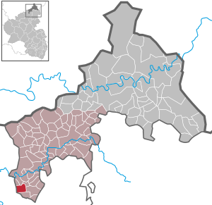
| Location of the local community Obersteinebach in the district of Altenkirchen (Westerwald) | ||
  |
||


Obersteinebach is a municipality in the Altenkirchen (Westerwald) district in the north of Rhineland-Palatinate . It belongs to the community of Altenkirchen-Flammersfeld .
Geographical location
Obersteinebach is about 300 m above sea level. NHN in the valley of the Lahrbach with its reservoir in the middle of the Rhine-Westerwald nature park .
history
The place was in the northeastern area of the former Engersgau . It was first mentioned in a document "soon around 1250" or towards the end of the 13th century in the leveling castors of the Herford Marienstift . The village or "the Huben zu Obersteinbach and Niedersteinebach " belonged to the territory of the Electorate of Trier . The Counts of Isenburg were feudal lords here .
In 1803 Obersteinebach came to the Principality of Nassau-Weilburg , in 1806 to the Duchy of Nassau and in 1815 to Prussia . Under the Prussian administration, Obersteinebach was assigned to the Flammersfeld mayor in the newly established Altenkirchen district , which from 1822 belonged to the Rhine Province .
Above the village, which consists of the "Überdorf, Oberdorf and the Balkans", there was a prayer chapel around 1828, which belonged to the Obersteinebach branch mentioned in 1550. It was rebuilt in 1926/27 and dedicated to St. Joseph consecrated as the patron saint. In the following years it was renovated several times.
In earlier times, in addition to the usual agriculture, iron ore mining was a source of income for the inhabitants. Old " ping trains " and the old "tunnel behind the Heiderhof" still bear witness to 400–500 years of mining.
Since the early 1990s, the place has been developing more and more into a rural residential community .
- Statistics on population development
The development of the population of Obersteinebach, the values from 1871 to 1987 are based on censuses:
|
|
politics
Municipal council
The local council in Obersteinebach consists of six council members who were elected in the local elections on May 26, 2019 , and the honorary local mayor as chairman.
mayor
Oliver Rüßel became the local mayor of Obersteinebach on October 4th, 2019. In the renewed direct election on September 1, 2019, he was elected for five years with a share of 64.5% of the vote. Oliver Rüßel is the successor to Gisbert Groß, who was actually re-elected in the direct election on May 26, 2019 with a share of 58.5% of the votes, but resigned from his office shortly after the election. This made a new election necessary.
coat of arms
|
|
|
| Justification of the coat of arms: The "Trier cross" as well as the colors red and silver, which are also the coat of arms of the archbishopric and that of the Isenburg counts, remind of the former sovereigns or liege lords. The golden heraldic lily stands as a symbol of Mary for the first documentary mention by the Herford Marienstift. The brook, and thus also the place name, are documented in the coat of arms in front by a silver wave bar. The St. Joseph's Chapel is shown in the coat of arms as a silver chapel in red at the front. For iron ore mining, which is now dormant, the coat of arms shows, overturned and crossed, black hammer and mallet. The silver oak branch with a golden acorn symbolizes the forest and the district. In the municipal coat of arms, the front blue field stands for the reservoir. |
Attractions
The "picture oak" is a natural monument in the forest between Obersteinebach and Peterslahr . A special feature of the Obersteinebach area is the “Lahrbach reservoir” located at the northern end of the town.
see also: List of cultural monuments in Obersteinebach
traffic
- Obersteinebach is located about two kilometers north of the motorway 3 and ICE - the new Cologne-Rhine / Main , running bundled in this section.
- The closest motorway junction is Neuwied , about six kilometers away. The nearest train stations are Altenkirchen (Westerwald) on the Oberwesterwaldbahn , Au (Sieg) , the ICE train stations Montabaur and Limburg Süd as well as Linz (Rhine) and Bad Hönningen on the right Rhine route Cologne - Koblenz .
Web links
- Official homepage of the local community Obersteinebach
- Ortgemeinde Obersteinebach on the website of the Altenkirchen-Flammersfeld community
Individual evidence
- ↑ State Statistical Office of Rhineland-Palatinate - population status 2019, districts, communities, association communities ( help on this ).
- ↑ State Statistical Office Rhineland-Palatinate - regional data
- ^ The Regional Returning Officer Rhineland-Palatinate: City Council Election 2019 Obersteinebach. Retrieved December 21, 2019 .
- ↑ AK-Kurier: Oliver Rüßel now officially in office as the local mayor. October 4, 2019, accessed December 21, 2019 .
- ↑ State Statistical Office Rhineland-Palatinate: direct election 2019: Obersteinebach. September 2, 2019, accessed December 21, 2019 .
- ↑ AK-Kurier: Local mayor wanted: Obersteinebach has to vote again. July 10, 2019, accessed December 21, 2019 .

Almersbach | Alsdorf | Altenkirchen (Westerwald) (city, seat of the district administration) | Bachenberg | Berod near Hachenburg | Berzhausen | Betzdorf (city) | Birch honey meal | Birch bump | Birnbach | Bitches | Brachbach | Breitscheidt | Bruchertseifen | Bürdenbach | Burglahr | Busenhausen | Daaden (city) | That | Dickendorf | Eichelhardt | Oak trees | Elves | Elkenroth | Emmerzhausen | Ersfeld | Etzbach | Eulenberg | Fensdorf | Fiersbach | Flammersfeld | Floodlight | Forest | Forstmehren | Friedewald | Friesenhagen | Fürthen | Gebhardshain | Gieleroth | Giershausen | Grünebach | Güllesheim | Hamm (victory) | Harbach | Hasselbach | Helmenzen | Helmeroth | Hemmelzen | Herdorf (city) | Haylofts | Hilgenroth | Hirz-Maulsbach | Horhausen (Westerwald) | Hövels | Idelberg | Ingelbach | Isert | Katzwinkel (victory) | Chew | Kescheid | Kettenhausen | Churchib | Churches (victory) (city) | Kraam | Krunkel | Malberg | Mammelzen | Mauden | More | Michelbach (Westerwald) | Mittelhof | Molzhain | Mudersbach | Nauroth | Neitersen | Niederdreisbach | Niederfischbach | Niederirsen | Niedersteinebach | Nisterberg | Obererbach (Westerwald) | Oberirsen | Oberlahr | Obernau | Obersteinebach | Oberwambach | Oils | Orfgen | Peterslahr | Pleckhausen | Splendor | Racksen | Reiferscheid | Rescuers | Rosenheim (District of Altenkirchen) | Roth | Rott | Scheuerfeld | Schöneberg | Stokes | Schutzbach | Seelbach (Westerwald) | Seelbach near Hamm (victory) | Soaps | Selbach (victory) | Sörth | Steinebach / Victory | Steineroth | Stürzelbach | Volkerzen | Wallmenroth | Walterschen | Weitefeld | Werkhausen | Weyerbusch | Willroth | Knowledge (city) | Wölmersen | Goat grove