Saint-Agne
| Saint-Agne | ||
|---|---|---|

|
|
|
| region | Nouvelle-Aquitaine | |
| Department | Dordogne | |
| Arrondissement | Bergerac | |
| Canton | Canton Lalinde | |
| Community association | Communauté de communes des Bastides Dordogne-Périgord | |
| Coordinates | 44 ° 50 ′ N , 0 ° 38 ′ E | |
| height | 18-132 m | |
| surface | 5.87 km 2 | |
| Residents | 441 (January 1, 2017) | |
| Population density | 75 inhabitants / km 2 | |
| Post Code | 24520 | |
| INSEE code | 24361 | |
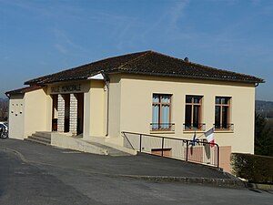
 Mairie (Town Hall) |
||
Saint-Agne is a French commune in the Dordogne department in the region Nouvelle-Aquitaine . It has an area of 5.87 km² and 441 inhabitants (2017).
Neighboring municipalities are: Mouleydier , Saint-Capraise-de-Lalinde , Varennes , Lanquais , Verdon and Saint-Germain-et-Mons .
history
The place was first mentioned in the 13th century as Sanctus Anianus .
The name Saint-Aigne was changed to Saint-Agne in 1985.
Population development
| year | 1962 | 1968 | 1975 | 1982 | 1990 | 1999 | 2006 | 2013 | 2015 |
|---|---|---|---|---|---|---|---|---|---|
| Residents | 274 | 254 | 251 | 258 | 325 | 357 | 382 | 422 | 435 |
| Source: Cassini and INSEE | |||||||||
Attractions
- Saint-Aignan church
- Château de la Rivière (castle)
Web links
Commons : Saint-Agne - Collection of images, videos and audio files

