Couze-et-Saint-Front
| Couze-et-Saint-Front | ||
|---|---|---|
|
|
||
| region | Nouvelle-Aquitaine | |
| Department | Dordogne | |
| Arrondissement | Bergerac | |
| Canton | Lalinde | |
| Community association | Communes des Bastides Dordogne-Périgord | |
| Coordinates | 44 ° 50 ′ N , 0 ° 42 ′ E | |
| height | 25-143 m | |
| surface | 8.19 km 2 | |
| Residents | 716 (January 1, 2017) | |
| Population density | 87 inhabitants / km 2 | |
| Post Code | 24150 | |
| INSEE code | 24143 | |
| Website | www.couze-et-saint-front.fr | |
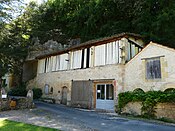
 View of Couze-et-Saint-Front |
||
Couze-et-Saint-Front is a French municipality with 716 inhabitants (at January 1, 2017) in the department of Dordogne in the region Nouvelle-Aquitaine (before 2016: Aquitaine ). The municipality belongs to the Arrondissement of Bergerac and the canton of Lalinde .
The name is Cosa e Sent Front in the Occitan language . The first part of the name refers to the river Couze , which crosses the municipality and whose name probably goes back to the ancient Celtic "° kus" ( German (wild) water ). The second part refers to the Fronto of Perigueux consecrated chapel in the eastern part of the territory of the municipality.
The inhabitants are called couzots and couzotes .
geography
Couze-et-Saint-Front is located about 18 km east of Bergerac in the Bergeracois region of the historic Périgord province .
Couze-et-Saint-Front is surrounded by the neighboring municipalities:
| Baneuil | Lalinde | |
|
Varennes Lanquais |

|
Pontours |
| Bayac |
Couze-et-Saint-Front is on the left bank and thus in the catchment area of the Dordogne river . The Couze river is one of its tributaries and flows into the Dordogne in the northern part of the municipality.
history
The village is believed to have pre-Celtic origins. An excavation called fauteuil des rois ( German Fauteuil of the Kings ) is located on the steep face of the river bank. In the Middle Ages , the community was dominated by a castle , whose seigneur blackmailed and plundered the region. According to Vicomte de Gourgues, there was a priory in Couze, which was under the Abbey of Charroux . In 1448 the Sire of Lanquais razed Couze and its castle to the ground and put an end to the mischief of the Seigneur of Couze. Due to the high purity of the Couze River and its high flow speed, paper mills established themselves from the 15th century and brought Couze a certain reputation. At the same time a port was built to transport the paper to Bergerac and Bordeaux by river boat. A land register from 1530 listed nine mills that were in operation until the 19th century. They were not available exclusively for papermaking because they also milled wheat. In the 17th and 18th centuries, Couze was one of the largest papermaking centers with thirteen mills. In the first half, manual paper production faced competition from mechanical workshops. From 1873, the production therefore specialized in filter paper for the chemical industry. After the economic difficulties in the first half of the 20th century, papermaking was revived at the end of the century. In 1829 the municipalities of Couze and Saint-Front merged to form the municipality of Couze-et-Saint-Front.
On the hill with the church of Saint-Front, the ground to the right of the entrance is covered with an exceptionally high amount of slag , which was produced in the extraction of iron during ancient times .
Toponymy
Toponyms and mentions of Couze were:
- Coza (1117, Collection de l'abbé de Lespine ),
- Cosa (1210, copy book of Cadouin Abbey ),
- Prooratus Sancti Stephani de Cosia, vulgo de Coze, ord. Saint-Bénéd. (1471, register of Charroux Abbey ),
- Cousa (1474, Collection de l'abbé de Lespine ),
- Chosa (16th century),
- Couze (1750 and 1793, map by Cassini or Notice Communale ),
- Couse (1801, Bulletin des Lois ).
Toponyms and mentions of Saint-Front were:
- Sanctus Fronto al corols (1276, Chapter of the Cathedral of Périgueux ),
- Sanctus Fronto super flumine de Dordonia (1289, Rôles gascons ),
- Sanctus Fronto de Corolio propre Lindiam ,
- Saint-Fronto de Corols (1471, register of the Archdiocese of Bordeaux ),
- Saint Front de Colors (1471),
- Saint Front de Colloreis (1742, notaries of Lanquais),
- Saint Front (1750, map by Cassini),
- Front de Coulouvre (1793, Notice Communale ),
- Front (1801, Bulletin des Lois ).
Population development
After records began, the population rose to a peak of around 1,045 in the first half of the 19th century. In the following period, the size of the community fluctuated essentially between 800 and 930, until a downward trend began in the 1980s, which is still going on today.
| year | 1962 | 1968 | 1975 | 1982 | 1990 | 1999 | 2006 | 2010 | 2017 |
|---|---|---|---|---|---|---|---|---|---|
| Residents | 885 | 876 | 921 | 831 | 781 | 759 | 773 | 765 | 716 |
Attractions
Parish Church of Saint-Etienne
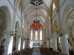
The church, consecrated to the patron saint of the community, was built from stone around 1895 . The three-aisled nave is covered with a ribbed vault. Fifteen -glass windows are by the glass painter Perrier from Périgueux and emerged at the same time as the construction of the church. Each window bears the name of the donor in addition to the signature of the glass painter.
In the lancets of the ogival windows they show the following motifs and biblical people:
- the good shepherd ,
- the Immaculate Conception ,
- Saint Stephen as a deacon ,
- St. Francis of Assisi ,
- the apostle Peter
- John the Baptist ,
- St. Clare of Assisi ,
- St. Elisabeth of Thuringia ,
- St. Johanna Franziska von Chantal ,
- Saint Catherine of Alexandria ,
- St. Honorius,
- Saint Charles Borromeo and
- Louis IX , called the saint.
- Parish Church of Saint-Etienne
Former parish church of Saint-Pierre de Couze
The church was built in the 12th century and, like many rural churches in Périgord, only the choir and facade remain from the original building . Destruction in the Huguenot Wars and subsequent new buildings have changed the remaining elements. The single nave nave was probably rebuilt in the 16th century. The bell gable has four openings for the bells. Inside the building there are three side chapels. The northern one, called du Mondonel , could date from the 13th century. The southern one, called the Jardel , has a ribbed vault and dates from the 14th or 15th century. The third chapel, called de Bayac , leads to the choir and may also have been built in the 13th century. In 1832 the cemetery on the south side of the church was relocated. In 1844, gravestones were excavated during earthworks on the site of the former cemetery. One is now under an arched niche on the east side of the church. The building is no longer used for church services today. It now functions as an office for the paper manufacturing company Michaut Prat.
- Former parish church of Saint-Pierre
Chapel Saint-Front-de-Colubry
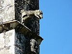
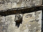
Pastor Audierne, historian of the Périgord, said in 1851 that the chapel dates from the eighth century. Pastor Goustat wrote in 1883 that a small church had already stood on this site in the eighth or eleventh century. The chapel was destroyed several times over the centuries and partially or completely rebuilt. Two Romanesque capitals are on pillars at the entrance. One shows the scene of disobedience between Adam and Eve , the other shows three lions. A bell in the bell gable dates from 1835. The chapel has been inscribed as a monument historique since May 11, 2015 .
Grotto de la Cavaille
The grotto contains rock carvings from the Périgordian era in the form of around ten figures. It has been registered as a Monument historique since January 31, 2007 .
Former paper mills
Many former and one current paper mills are inscribed as Monument historique :
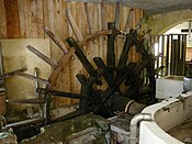
- Rouzique Mill. It was first mentioned in 1530 and probably existed as a wheat mill since the 16th century. Rebuilt as a paper mill in the 18th century, the building was renovated around 1865. She has received the apparatus for making filter paper, a round machine, three paper dummies , basins and three water wheels , one with iron shovels and one with wooden shovels. This mill has been registered as a Monument historique since December 5th, 1989 . Today an Écono-musée for paper has been set up in the building .
- Rouzique Mill
- Guillandoux Mill. It was built in the 19th century and was used for both grinding wheat and making paper during that century. In the 20th century, the wheat mill was attached to the mill de la Rouzique and then used as a drying room. This mill has been inscribed as a Monument historique since December 4th, 1989 .
- Mills Merle and Sous le Roc. Their common building is undoubtedly the oldest of its kind in Couze. It is believed to have existed with two wheat mills since the 16th century, and its layout has not been changed since 1750. In the 18th century, the mills on the ground floor of the two-storey building were converted into paper mills. These have been inscribed as Monument historique since December 4, 1989 .
- Larroque Mill. It is one of the last remaining paper mills in operation. Even if the electric drive has been replaced by a hydraulic one, the manufacture of the paper has retained its artisanal character. This mill has been inscribed as a Monument historique since November 29, 2013 .
- House of the foremen ( maison des contremaîtres ). It dates from the 19th century and has been inscribed as a Monument historique since December 5, 1989 .
- House Jardel. In its place there were various buildings as early as the 16th century. The Jardel house itself was built in the 19th century and has been inscribed as a monument historique since December 5th, 1989 .
- House, called Face au manoir . This two-story house also dates from the 19th century and has been inscribed as a Monument historique since December 5, 1989 .
Nature reserves
Part of the area of Mauzac-et-Grand-Castang on the banks of the Dordogne and on the limestone hills belong to the nature reserves "Dordogne" and "Coteaux calcaires de la vallée de la Dordogne" as part of Natura 2000 .
Economy and Infrastructure
Paper production is still one of the most important economic factors in the community today.

total = 67
education
The municipality has a public preschool and elementary school with 91 pupils in the 2018/2019 school year.
sport and freetime
- The GR 6 long-distance hiking trail from Sainte-Foy-la-Grande ( Gironde department ) to Saint-Paul-sur-Ubaye ( Alpes-de-Haute-Provence department ) passes the center of Couze-et-Saint-Front.
- The Boucle du village - Couze et Saint Front circular route is 2.8 km long and has an altitude difference of 37 m. It leads through the center of the church.
traffic
The Route départementale 660, the former Route nationale 660 , crosses the territory of the municipality and connects Couze-et-Saint-Front with Lalinde and the transport axis Bergerac Sarlat-la-Caneda on the opposite bank of the Dordogne. In the south it runs over Beaumont-du-Périgord and Monpazier to the intersection with the former Route nationale 111 north of Luzech . Routes départementales 37 and 37E1 lead to the neighboring municipalities of Lanquais and Varennes to the west. Route départementale 8E4 leads over a bridge over the Dordogne directly into the center of the northern neighboring municipality of Lalinde. The D29 branches off from this in the Couze-et-Saint-Front area and serves the neighboring community of Pontours to the east.
Line 26 of the TER Aquitaine , a regional train of the national SNCF , serves the route from Bordeaux to Sarlat-la-Canéda. A stop called “Couze” is located in the municipality of Lalinde not far from the bridge over the Dordogne, over which the Route départementale 660 runs.
Web links
- Couze-et-Saint-Front on the Pays de Bergerac Tourisme website (French)
- Website of the Écono-musée du papier (French)
- Prat Dumas company website (French)
Individual evidence
- ↑ Le nom occitan des communes du Périgord ( fr ) Départementrat des Dordogne. Retrieved October 25, 2018.
- ↑ a b Couze-et-Saint-Front ( fr ) Conseil régional d'Aquitaine. Archived from the original on September 9, 2016. Retrieved October 25, 2018.
- ↑ Dordogne ( fr ) habitants.fr. Retrieved October 25, 2018.
- ↑ Ma commune: Couze-et-Saint-Front ( fr ) Système d'Information sur l'Eau du Bassin Adour Garonne. Retrieved October 25, 2018.
- ^ Anciennes papeteries ( fr ) Ministry of Culture and Communication . September 22, 2015. Accessed October 25, 2018.
- ↑ a b Paul Vicomte de Gourgues: Dictionnaire topographique du département de la Dordogne ( fr ) In: Dictionnaire topographique de la France . Imprimerie nationale. 89, 1873. Retrieved October 25, 2018.
- ↑ a b Paul Vicomte de Gourgues: Dictionnaire topographique du département de la Dordogne ( fr ) In: Dictionnaire topographique de la France . Imprimerie nationale. P. 290, 1873. Retrieved October 25, 2018.
- ^ A b France 1750 ( en ) David Rumsey Map Collection: Cartography Associates. Retrieved October 25, 2018.
- ↑ a b Notice Communale Couze-et-Saint-Front ( fr ) EHESS . Retrieved October 25, 2018.
- ^ Notice Communale Saint-Front ( fr ) EHESS . Retrieved October 25, 2018.
- ↑ Populations légales 2006 Commune de Couze-et-Saint-Front (24143) ( fr ) INSEE . Retrieved October 25, 2018.
- ↑ Populations légales 2015 Commune de Couze-et-Saint-Front (24143) ( fr ) INSEE . Retrieved October 25, 2018.
- ↑ église paroissiale Saint-Etienne. ( fr ) Ministry of Culture and Communication . July 8, 1999. Retrieved October 25, 2018.
- ↑ ensemble de 15 verrières (baies 0 à 14) ( fr ) Ministry of Culture and Communication . April 4, 2004. Retrieved October 25, 2018.
- ↑ église paroissiale Saint-Pierre. ( fr ) Ministry of Culture and Communication . July 8, 1999. Retrieved October 25, 2018.
- ↑ église paroissiale Saint-Front-de-Colubry. ( fr ) Ministry of Culture and Communication . July 8, 1999. Retrieved October 25, 2018.
- ^ Chapelle Saint-Front du Colubri ( fr ) Ministry of Culture and Communication . April 12, 2017. Retrieved October 25, 2018.
- ^ Grotte préhistorique de la Cavaille ( fr ) Ministry of Culture and Communication . September 22, 2015. Accessed October 25, 2018.
- ↑ a b c d e f Anciennes papeteries ( fr ) Ministry of Culture and Communication . September 22, 2015. Accessed October 25, 2018.
- ↑ moulin de la Rouzique ( fr ) Ministry of Culture and Communication . September 24, 2011. Retrieved October 25, 2018.
- ↑ moulin des Guillandoux ( fr ) Ministry of Culture and Communication . September 24, 2011. Retrieved October 25, 2018.
- ↑ moulin de Merle ( fr ) Ministry of Culture and Communication . September 24, 2011. Retrieved October 25, 2018.
- ↑ moulin Sous le Roc ( fr ) Ministry of Culture and Communication . September 24, 2011. Retrieved October 25, 2018.
- ^ Moulin de Larroque ( fr ) Ministry of Culture and Communication . September 22, 2015. Accessed October 25, 2018.
- ↑ maison des contremaîtres ( fr ) Ministry of Culture and Communication . September 24, 2011. Retrieved October 25, 2018.
- ^ Maison Jardel ( fr ) Ministry of Culture and Communication . September 24, 2011. Retrieved October 25, 2018.
- ↑ maison dite face au manoir. ( fr ) Ministry of Culture and Communication . September 24, 2011. Retrieved October 25, 2018.
- ↑ FR7200660 - La Dordogne ( fr ) Inventaire national du patrimoine naturel (INPN). December 12, 2017. Accessed November 30, 2018.
- ↑ FR7200664 - Coteaux calcaires de la vallée de la Dordogne ( fr ) Inventaire du patrimoine naturel national (INPN). December 12, 2017. Accessed November 30, 2018.
- ↑ Caractéristiques des établissements en 2015 Commune de Couze-et-Saint-Front (24143) ( fr ) INSEE . Retrieved October 25, 2018.
- ^ École maternelle et élémentaire ( fr ) National Ministry of Education. Retrieved October 25, 2018.
- ↑ GR6 - Randonnée de Ste Foy-la-Grande (Gironde) à Eyzies-de-Tayac-Sireuil (Dordogne) ( fr ) gr-infos.com. Retrieved October 25, 2018.
- ^ Boucle du village - Couze et Saint Front ( fr ) Institut national de l'information géographique et forestière (IGN). March 7, 2018. Retrieved October 25, 2018.


