Fraisse (Dordogne)
| Fraisse | ||
|---|---|---|

|
|
|
| region | Nouvelle-Aquitaine | |
| Department | Dordogne | |
| Arrondissement | Bergerac | |
| Canton | Pays de la Force | |
| Community association | Agglomération Bergeracoise | |
| Coordinates | 44 ° 56 ' N , 0 ° 18' E | |
| height | 39-135 m | |
| surface | 21.50 km 2 | |
| Residents | 172 (January 1, 2017) | |
| Population density | 8 inhabitants / km 2 | |
| Post Code | 24130 | |
| INSEE code | 24191 | |
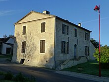
 Town hall and parish church |
||
Fraisse is a French municipality with 172 inhabitants (at January 1, 2017) in the department of Dordogne in the region Nouvelle-Aquitaine (before 2016: Aquitaine ). The municipality belongs to the Arrondissement Bergerac and the canton Pays de la Force (until 2015: canton La Force ).
The name in the Occitan language is Fraisse , which is derived from the Latin fraxinus ( German ash ). The municipality's coat of arms shows a Maltese cross over an ash tree , an indication that the parish's goods belonged to the Order of Malta in the 14th century .
The inhabitants are called Fraissois and Fraissoises .
geography
Fraisse is located approx. 15 km northwest in the catchment area ( Aire urbaine ) of Bergerac in the Bergeracois region of the historic province of Périgord in the southwest of the department.
Fraisse is surrounded by the neighboring communities:
|
Beaupouyet Saint-Géraud-de-Corps |
Saint-Géry | Bosset |

|
Saint-Georges-Blancaneix | |
| Monfaucon | Saint-Pierre-d'Eyraud |
Fraisse lies in the catchment area of the Dordogne river .
The Lidoire , a right tributary of the Dordogne, crosses the territory of the municipality. The Martarieux, a tributary of the Isle , has its source in Fraisse. The Gouyne is a tributary of the Barailler and irrigates the community just like its tributary of the same name, which rises in Fraisse.
Today 80% of the municipality is covered with maritime pines and oaks .
history
Stone tools , which were found in several places in the municipality, show that these places were inhabited from the Old Paleolithic to the Neolithic . Not far from Route départementale 13, a ford and a bridge yoke were found that could belong to a road route in Gallo-Roman times . The former church was built near this spot, as were most of the sites dedicated to St. Martin of Tours , who is considered the patron saint of travelers. However, these were also built on the site of former pagan places of worship. An earlier moth can be seen near a former water mill that has not been in operation since 1668. Fraisse was under the castellany of Mussidan and his seigneurs . The religious influence on the fortunes of Fraisse was considerable through the presence of the Knights Templar and, after its ban, that of the Order of Malta. During the Hundred Years War the parish had no pastor, and when Nicolas Tenent tried to take on this role in 1489, he encountered opposition from parishioners, especially when it came to the raising of the tithe . The same thing happened to Jacques Tardieu, who after the revocation of the Edict of Nantes wanted to collect this tax. Many residents had converted to Protestantism in the meantime , as the grave of the Dessaigne-Lajonie family shows. During the First Empire , a blacksmith refused to be drafted and hid in a place that was later called le Pin du Forgeron ( German for the blacksmith's jaw ). In 1861 the local council demanded the laying of a railway line near Fraisse in order to promote important economic activities, viticulture and forestry.
Toponymy
Toponyms and mentions of Fraisse were:
- Frayce (13th century church records),
- Fraxinus prope Mussidanum (1364, font collection of the Abbé de Lespine),
- Frayssinus (1440, Mourcin font collection),
- Fraisse (1750, 1793 and 1801, map by Cassini , Notice Communale or Bulletin des Lois ),
- Fraysse (1873, Dictionnaire topographique du département de la Dordogne).
Population development
After records began, the population rose to a peak of around 560 in the first half of the 19th century. From the second half of the same century onwards, the size of the community decreased considerably with relatively short recovery periods until the 1990s to 120 inhabitants before a moderate growth phase set in, which continues to this day.
| year | 1962 | 1968 | 1975 | 1982 | 1990 | 1999 | 2006 | 2010 | 2017 |
|---|---|---|---|---|---|---|---|---|---|
| Residents | 190 | 170 | 140 | 129 | 120 | 157 | 152 | 141 | 172 |
Attractions
Parish Church of Saint Martin
The church, consecrated to Martin von Tours, was built as a new building in the 19th century in the neo-Romanesque style. It has a simple plan in the form of a Latin cross with a semicircular apse . The entrance is at the foot of the three-part, pointed bell tower and allows entry into the interior of the church via a vestibule.
Economy and Infrastructure
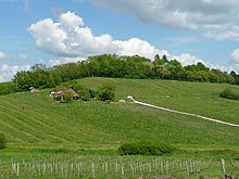
Fraisse is located in the AOC des Bergerac with the appellations Bergerac and Côtes de Bergerac .

total = 9
traffic
Route départementale 13 crosses Fraisse from west to east and connects the municipality in the west with the neighboring municipality of Saint-Géraud-de-Corps and in the east with the neighboring municipality of Saint-Georges-Blancaneix and later with Bergerac. Route départementale 20 crosses Fraisse from north to south and connects the community in the north with the neighboring municipality of Saint-Géry and in the further course with Mussidan on the Bordeaux - Périgueux transport axis and in the south with the neighboring municipality of Monfaucon and further on with Sainte-Foy- la-Grande in the Gironde department on the Bordeaux – Bergerac axis.
Personalities
Sereirrof, born in 1947 in the Haute-Savoie department , has a university degree in gas and plasma physics . He lives in Fraisse and worked there between 1998 and 2003 as a mosaicist and has been exhibiting his works as a painter since 2001.
Web links
- Fraisse on the Pays de Bergerac Tourisme website (French)
- Fraisse on the website of the association of municipalities (French)
- Information about Bergerac wines
Individual evidence
- ↑ Le nom occitan des communes du Périgord ( fr ) Départementrat des Dordogne. Retrieved November 10, 2018.
- ↑ a b c Fraisse ( fr ) Conseil régional d'Aquitaine. Archived from the original on September 10, 2016. Retrieved on November 10, 2018.
- ↑ Dordogne ( fr ) habitants.fr. Retrieved November 10, 2018.
- ↑ Aire urbaine de Bergerac (109) ( fr ) INSEE . Retrieved November 10, 2018.
- ^ Ma commune: Fraisse ( fr ) Système d'Information sur l'Eau du Bassin Adour Garonne. Retrieved November 10, 2018.
- ^ Paul Vicomte de Gourgues: Dictionnaire topographique du département de la Dordogne ( fr ) In: Dictionnaire topographique de la France . Imprimerie nationale. P. 134, 1873. Retrieved November 10, 2018.
- ^ France 1750 ( en ) David Rumsey Map Collection: Cartography Associates. Retrieved November 10, 2018.
- ↑ a b Notice Communale Fraisse ( fr ) EHESS . Retrieved November 10, 2018.
- ↑ Populations légales 2006 Commune de Fraisse (24191) ( fr ) INSEE . Retrieved November 10, 2018.
- ↑ Populations légales 2015 Commune de Fraisse (24191) ( fr ) INSEE . Retrieved November 10, 2018.
- ^ Eglise Saint-Martin ( fr ) Observatoire du patrimoine religieux. Retrieved November 10, 2018.
- ↑ Institut national de l'origine et de la qualité: Rechercher un produit ( fr ) Institut national de l'origine et de la qualité . Retrieved November 10, 2018.
- ↑ Caractéristiques des établissements en 2015 Commune de Fraisse (24191) ( fr ) INSEE . Retrieved November 10, 2018.
- ↑ Sereirrof ( fr ) Fund Départemental d'Art Contemporain. 2006. Retrieved November 10, 2018.


