Bourniquel
| Bourniquel | ||
|---|---|---|
|
|
||
| region | Nouvelle-Aquitaine | |
| Department | Dordogne | |
| Arrondissement | Bergerac | |
| Canton | Lalinde | |
| Community association | Communes des Bastides Dordogne-Périgord | |
| Coordinates | 44 ° 49 ' N , 0 ° 47' E | |
| height | 55-171 m | |
| surface | 8.96 km 2 | |
| Residents | 69 (January 1, 2017) | |
| Population density | 8 inhabitants / km 2 | |
| Post Code | 24150 | |
| INSEE code | 24060 | |
| Website | www.bourniquel.fr | |
 Parish Church of Sainte-Madeleine |
||
Bourniquel is a French municipality with 69 inhabitants (at January 1, 2017) in the department of Dordogne in the region Nouvelle-Aquitaine (before 2016: Aquitaine ). The municipality belongs to the Arrondissement of Bergerac and the canton of Lalinde (until 2015: canton of Beaumont-du-Périgord ).
The name in the Occitan language is Borniquèl and goes back to the name of the Frankish queen Brunichild .
The inhabitants are called Bourniquelois and Bourniqueloises .
geography
Bourniquel is located about 25 km east of Bergerac in the Bergeracois region of the historic Périgord province .
Bourniquel is surrounded by the neighboring communities:
| Pontours | ||
| Bayac |

|
Molières |
| Beaumontois en Périgord | Saint-Avit-Sénieur |
Bourniquel is located in the catchment area of the Dordogne river . The Roumaguet, a tributary of the Couze , largely marks the border with the neighboring municipalities of Beaumontois en Périgord and Saint-Avit-Sénieur to the south.
history
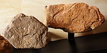
The discovery of numerous prehistoric tools prove an early settlement of the area. The attractive geographical location on a range of hills that separate the Dordogne and Roumaguet valleys certainly contributed to this. The people of Solutréen (24,000–18,000 BC) and Magdalenian (18,000–12,000 BC) left behind a large number of tools and art objects that were brought to light at two important sites in the area of the municipality. The majority of artifacts these days are split between different museums. There are also two burial mounds near the hamlet of Pujol , one of which hid a skeleton that was brought to light in 1883.
Toponymy
Toponyms and mentions of Bourniquel were:
- Bruniquel (1281, Collection de l'abbé de Lespine ),
- Bruniquellum (1286),
- Bourniquel (1750, 1793 and 1801, map from Cassini , Notice Communale and Bulletin des Lois, respectively ).
Population development
After records began, the population rose to a peak of around 370 in the middle of the 19th century. In the following period, the size of the community fell to around 50 inhabitants during short recovery phases until the 1990s, before a level of around 65 inhabitants set, which is still held today.
| year | 1962 | 1968 | 1975 | 1982 | 1990 | 1999 | 2006 | 2010 | 2017 |
|---|---|---|---|---|---|---|---|---|---|
| Residents | 112 | 62 | 88 | 78 | 52 | 61 | 63 | 68 | 69 |
Attractions
Parish Church of Sainte-Madeleine
The church, consecrated to Maria Magdalena , was built in the 12th century in the Romanesque style. Traces of four square pillars and internal buttresses allow the conclusion that there was once a dome over the last yoke in front of the apse , which was originally provided with blind arcades . Reddened stones reveal that the building was set on fire during the time of the Cathars or during the Huguenot Wars . A contract from 1781 documents the implementation of extensive construction work, renewal of the roof structure , opening of two windows in the southern wall, cladding of the ceiling with fir wood and erection of the bell gable , as evidenced by the year "1781", which is engraved in the western facade is. A drawing by Léo Drouyn from 1846 shows the church as a ruin. It documents the restoration of the church in the middle of the 19th century. The entrance portal , the sacristy and the side chapels were rebuilt in 1848, as the corresponding year above the entrance portal shows, which is no longer legible today. At the same time, the south-west corner of the south-west corner and its thick buttress with a water nose was raised to about a meter in front of the small south entrance to the nave . The ribbed vault in the southwest corner of the nave is also the result of a modern redesign.
Cardoux Castle
At least the basic structure of today's castle dates from the 14th century. The property was redesigned in the 15th century. In the 18th and 19th centuries, the castle underwent extensive restoration work and a conversion from a military structure to a place of relaxation and summer retreat. The castle chapel in particular was built in the 19th century. The Feytou family owned the fief in the 14th century , followed by the Beaudet family. They had the right to fish on the Dordogne and designed their coat of arms with three silver fishing hooks on a red background. Under the rule of the French King Louis XV. the castle came into the hands of the Saint-Exupéry family. A member of this family was born here in 1775. He was a knight of the Order of Malta and a naval officer and fell at Abukir . The castle is still owned by the Saint-Exupéry family, whose most famous member was Antoine de Saint-Exupéry . A Lebanon cedar grows in the castle garden , which was undoubtedly planted a short time after Bernard de Jussieu introduced this tree species to France . The cedar is one of the most remarkable trees in France.

Archaeological site of Champs-Blancs or Jean-Blancs
The site with artefacts from the Upper Palaeolithic has been classified as a Monument historique since March 11, 1943 .
Archaeological site du Malpas
The site with artefacts from the Solutréen has been classified as a Monument historique since November 11, 1927 .
Economy and Infrastructure
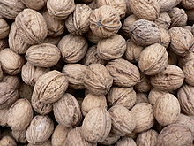
Bourniquel is located in the AOC zones of the Noix du Périgord , the walnuts of the Périgord, and the nut oil of the Périgord.

Total = 12
sport and freetime
The GR 6E long-distance hiking trail passes the center of Bourniquel. It is an approx. 20 km long link between the GR 6 at Couze-et-Saint-Front and the GR 36 at Sainte-Croix .
traffic
The Route départementale 8E4 connects the town to the north of Lalinde . Bourniquel can also be reached via Routes départementales 27 and 660, the former Route nationale 660 .
Web links
- Bourniquel on the association's website (French)
- Information on Périgord walnuts and Périgord nut oil (French)
Individual evidence
- ↑ Le nom occitan des communes du Périgord ( fr ) Départementrat des Dordogne. Retrieved October 6, 2018.
- ↑ a b Bourniquel ( fr ) Conseil régional d'Aquitaine. Archived from the original on September 9, 2016. Retrieved October 6, 2018.
- ↑ Dordogne ( fr ) habitants.fr. Retrieved October 6, 2018.
- ↑ Ma commune: Bourniquel ( fr ) Système d'Information sur l'Eau du Bassin Adour Garonne. Retrieved October 6, 2018.
- ^ Paul Vicomte de Gourgues: Dictionnaire topographique du département de la Dordogne ( fr ) In: Dictionnaire topographique de la France . Imprimerie nationale. P. 38, 1873. Retrieved October 6, 2018.
- ^ France 1750 ( en ) David Rumsey Map Collection: Cartography Associates. Retrieved October 6, 2018.
- ↑ a b Notice Communale Bourniquel ( fr ) EHESS . Retrieved October 6, 2018.
- ↑ Populations légales 2006 Commune de Bourniquel (24060) ( fr ) INSEE . Retrieved October 6, 2018.
- ↑ Populations légales 2015 Commune de Bourniquel (24060) ( fr ) INSEE . Retrieved October 6, 2018.
- ↑ église paroissiale Sainte-Madeleine. ( fr ) Ministry of Culture and Communication . Retrieved October 6, 2018.
- ↑ Château de Cardoux ( fr ) chateau-fort-manoir-chateau.eu. Retrieved October 6, 2018.
- ↑ Château de Cardoux ( fr ) Ministry of Culture and Communication . Retrieved October 6, 2018.
- ↑ Arbres Remarquables ( fr ) Association Arbres remarquables: bilan, recherche, études et sauvegarde (ARBRES). May 22, 2016. Retrieved October 6, 2018.
- ↑ Gisement des Champs-Blancs ou Jean-Blancs ( fr ) Ministry of Culture and Communication . September 22, 2015. Accessed October 6, 2018.
- ↑ Gisement you Solutrean Malpas ( fr ) Ministry of Culture and Communication . September 22, 2015. Accessed October 6, 2018.
- ↑ Institut national de l'origine et de la qualité: Rechercher un produit ( fr ) Institut national de l'origine et de la qualité . Retrieved November 30, 2018.
- ↑ Caractéristiques des établissements en 2015 Commune de Bourniquel (24060) ( fr ) INSEE . Retrieved October 6, 2018.


