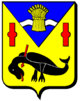
Ville-devant-Belrain
| Ville-devant-Belrain | ||
|---|---|---|

|
|
|
| region | Grand Est | |
| Department | Meuse | |
| Arrondissement | Commercy | |
| Canton | Dieue-sur-Meuse | |
| Community association | l'Aire à l'Argonne | |
| Coordinates | 48 ° 52 ' N , 5 ° 20' E | |
| height | 252-331 m | |
| surface | 6.12 km 2 | |
| Residents | 35 (January 1, 2017) | |
| Population density | 6 inhabitants / km 2 | |
| Post Code | 55260 | |
| INSEE code | 55555 | |
Ville-devant-Belrain is a French commune with 35 inhabitants (as of January 1, 2017) in the Meuse department in the Grand Est region (before 2016 Lorraine ). It belongs to the Arrondissement Commercy and to the community association l'Aire à l'Argonne, founded in 2016 . Between 1972 and 1987, Ville-devant-Belrain belonged to the municipality of Villotte-sur-Aire together with Belrain , Gimécourt , and Rupt-devant-Saint-Mihiel .
geography
Ville-devant-Belrain is located in the Barrois southwest of the Hauts de Meuse hill country , about halfway between the cities of Bar-le-Duc and Saint-Mihiel and about 35 kilometers south of Verdun . The Aire flows through the municipality . The municipality, which is characterized by large arable land except for small remains of alluvial forest, has a small share of the large forest area Le Vent des Forêts in the far east with the Bois de Haie . The village of Ville-devant-Belrain consists of only a few buildings on two streets. Ville-devant-Belrain is surrounded by the neighboring communities Nicey-sur-Aire in the north, Rupt-devant-Saint-Mihiel in the east, Villotte-sur-Aire in the south and Belrain in the west.
Population development
| year | 1962 | 1968 | 1990 | 1999 | 2006 | 2016 | ||
| Residents | 36 | 41 | 19th | 23 | 29 | 34 | ||
| Source: Cassini and INSEE | ||||||||
Attractions
- Saint-Georges church
- two wayside crosses
Economy and Infrastructure
In the municipality of Ville-devant-Belrain there are three farms (vegetable growing, cattle breeding).
One and a half kilometers south of Ville-devant-Belrain, the departmental road D901 runs from Bar-le-Duc to Saint-Mihiel . In Ligny-en-Barrois , 25 kilometers away, there is a connection to the A4 Autoroute (Paris-Strasbourg).
literature
- Le Patrimoine des Communes de la Meuse. Flohic Editions, Volume 2, Paris 1999, ISBN 2-84234-074-4 , pp. 762-763.
supporting documents
- ↑ Ville-devant-Belrain on cassini.ehess.fr
- ↑ Ville-devant-Belrain on cassini.ehess.fr
- ↑ Ville-devant-Belrain on insee.fr
- ↑ Farms on annuaire-mairie.fr (French)
