Sauvigny (Meuse)
| Sauvigny | ||
|---|---|---|

|
|
|
| region | Grand Est | |
| Department | Meuse | |
| Arrondissement | Commercy | |
| Canton | Vaucouleurs | |
| Community association | Commercy-Void-Vaucouleurs | |
| Coordinates | 48 ° 30 ' N , 5 ° 43' E | |
| height | 262-423 m | |
| surface | 17.51 km 2 | |
| Residents | 232 (January 1, 2017) | |
| Population density | 13 inhabitants / km 2 | |
| Post Code | 55140 | |
| INSEE code | 55474 | |
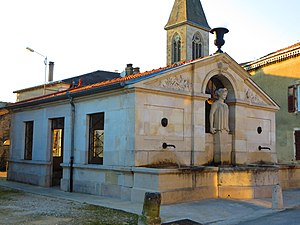
 Sauvigny fountain |
||
Sauvigny [ sɔviɲi ] is a French commune with 232 inhabitants (as of January 1, 2017) in the Meuse department in the Grand Est region (until 2015 Lorraine ). It belongs to the Arrondissement of Commercy and the Canton of Vaucouleurs .
location
Sauvigny is located on the Meuse , about 43 kilometers southwest of Nancy . Sauvigny is surrounded by the neighboring communities of Pagny-la-Blanche-Côte in the north, Saulxures-lès-Vannes in the northeast, Mont-l'Étroit in the east, Clerey-la-Côte in the southeast, Jubainville in the south and southeast, Brixey-aux- Chanoines in the south, Goussaincourt in the southwest, Burey-la-Côte in the west and Montbras in the west and northwest.
Population development
| year | 1962 | 1968 | 1975 | 1982 | 1990 | 1999 | 2006 | 2013 |
| Residents | 309 | 287 | 224 | 207 | 201 | 220 | 243 | 245 |
| Source: Cassini and INSEE | ||||||||
Attractions
- Saint-Loup church from the 16th century
- Saint-Gibrien Chapel in Moncourt from the 14th century ( entry no.IA00121144 in the Base Mérimée of the French Ministry of Culture (French))
literature
- Le Patrimoine des Communes de la Meuse. Flohic Editions, Volume 2, Paris 1999, ISBN 2-84234-074-4 , pp. 1050-1052.
Web links
Commons : Sauvigny - collection of images, videos and audio files
