Amigny-Rouy
| Amigny-Rouy | ||
|---|---|---|

|
|
|
| region | Hauts-de-France | |
| Department | Aisne | |
| Arrondissement | Laon | |
| Canton | Chauny | |
| Community association | Chauny Tergnier la Fère | |
| Coordinates | 49 ° 37 ′ N , 3 ° 18 ′ E | |
| height | 44-147 m | |
| surface | 13.08 km 2 | |
| Residents | 744 (January 1, 2017) | |
| Population density | 57 inhabitants / km 2 | |
| Post Code | 02700 | |
| INSEE code | 02014 | |
| Website | http://amigny.rouy.free.fr/ | |
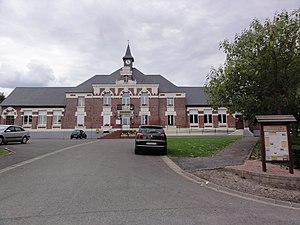
 City Hall (Mairie) and School of Amigny-Rouy |
||
Amigny-Rouy is a French municipality with 744 inhabitants (as of January 1 2017) in the department of Aisne in the region of Hauts-de-France ; it belongs to the arrondissement of Laon , belongs to the canton of Chauny and to the community association Chauny Tergnier la Fère . The inhabitants are called Aizyjois .
geography
Amigny-Rouy is about 23 kilometers west-northwest of Laon . The Oise limits the municipality to the north. Amigny-Rouy is surrounded by the neighboring communities of Tergnier in the north, Beautor in the north-east, Servais in the east, Barisis-aux-Bois in the south and south-east, Sinceny in the south and west and Condren in the north-west.
Population development
| year | 1962 | 1968 | 1975 | 1982 | 1990 | 1999 | 2006 | 2013 |
| Residents | 504 | 546 | 515 | 622 | 693 | 626 | 706 | 742 |
| Source: Cassini and INSEE | ||||||||
Attractions
- Saint-Quentin Church
Web links
Commons : Amigny-Rouy - Collection of images, videos and audio files

