Agnicourt-et-Séchelles
| Agnicourt-et-Séchelles | ||
|---|---|---|
|
|
||
| region | Hauts-de-France | |
| Department | Aisne | |
| Arrondissement | Laon | |
| Canton | Marle | |
| Community association | Pays de la Serre | |
| Coordinates | 49 ° 43 ' N , 3 ° 57' E | |
| height | 96-175 m | |
| surface | 10.79 km 2 | |
| Residents | 177 (January 1, 2017) | |
| Population density | 16 inhabitants / km 2 | |
| Post Code | 02340 | |
| INSEE code | 02004 | |
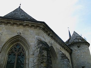
 Saint-Médard fortified church |
||
Agnicourt-et-Séchelles is a French municipality with 177 (at January 1, 2017) in the department of Aisne in the region of Hauts-de-France . It belongs to the Arrondissement of Laon and the Canton of Marle .
Neighboring municipalities of Agnicourt-et-Séchelles are Braye-en-Thiérache in the north, Vigneux-Hocquet in the north-east, Chaourse in the east, Montcornet in the south-east, Boncourt in the south, Ebouleau in the south-west, Tavaux-et-Pontséricourt in the west and Burelles in the north-west.
Population development
| year | 1962 | 1968 | 1975 | 1982 | 1990 | 1999 | 2006 | 2014 |
| Residents | 294 | 248 | 238 | 224 | 209 | 211 | 189 | 189 |
| Source: Cassini and INSEE | ||||||||
See also
Web links
Commons : Agnicourt-et-Séchelles - Collection of images, videos and audio files
