
Teningen
| coat of arms | Germany map | |
|---|---|---|

|
Coordinates: 48 ° 8 ' N , 7 ° 49' E |
|
| Basic data | ||
| State : | Baden-Württemberg | |
| Administrative region : | Freiburg | |
| County : | Emmendingen | |
| Height : | 188 m above sea level NHN | |
| Area : | 40.27 km 2 | |
| Residents: | 12,063 (Dec. 31, 2018) | |
| Population density : | 300 inhabitants per km 2 | |
| Postcodes : | 79331, 79312 | |
| Primaries : | 07641, 07663 | |
| License plate : | EM | |
| Community key : | 08 3 16 043 | |
| LOCODE : | DE TGN | |
| Community structure: | 4 districts | |
| Address of the municipal administration: |
Riegeler Strasse 12 79331 Teningen |
|
| Website : | ||
| Mayor : | Heinz-Rudolf Hagenacker ( CDU ) | |
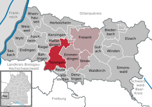
| Location of the municipality of Teningen in the district of Emmendingen | ||
  |
||


Teningen ( Alemannic Däninge ) is a municipality in the south-west of Baden-Württemberg . It is located around three kilometers west of the district town of Emmendingen and around 20 kilometers north of Freiburg im Breisgau .
geography
location
Teningen lies on the edge of the foothills of the Black Forest . Part of the municipal area also extends to the Elz lowlands and the Dreisam lowlands in the Freiburg Bay , from which the Nimberg rises about 70 meters high near Nimburg.
geology
The geological subsoil of the foothill zone is formed by red sandstone or shell limestone , these are covered with more or less thick loess packages . The loess layers are particularly thick in the transition area between the foothills and the Elz lowlands. The Elz itself forms alluvial gravel and sand deposits, which used to be mainly used for meadow farming, today these areas are often plowed up for arable farming. Well known among geologists is the so-called "Landecker warping" in Landeck, which is visible above the town directly on the road and is a popular excursion destination for geological courses.
Community structure
The municipality of Teningen consists of four districts: the core town of Teningen and the independent towns of Heimbach, Köndringen with Landeck and Nimburg with Bottingen until December 31, 1974.
climate
The Köppen climate type is the warm, humid, temperate climate zone ( oceanic climate ). However, especially in summer and increasingly in winter, there is a moist subtropical (Cfa) character due to the mean temperatures in July and August just below 22 ° C. Due to the proximity to the Black Forest, however, more rain falls throughout the year than in the Upper Rhine Plain.
The city is located near the Kaiserstuhl , a series of volcanic hills a few kilometers away. The Kaiserstuhl warms the area significantly, so that Teningen falls into one of the warmest regions in Germany.
| Teningen (Mundingen near Emmendingen) 2015–2020 | ||||||||||||||||||||||||||||||||||||||||||||||||
|---|---|---|---|---|---|---|---|---|---|---|---|---|---|---|---|---|---|---|---|---|---|---|---|---|---|---|---|---|---|---|---|---|---|---|---|---|---|---|---|---|---|---|---|---|---|---|---|---|
| Climate diagram | ||||||||||||||||||||||||||||||||||||||||||||||||
| ||||||||||||||||||||||||||||||||||||||||||||||||
|
Average monthly temperatures and precipitation for Teningen (Mundingen near Emmendingen) 2015–2020
Source: [2]
|
||||||||||||||||||||||||||||||||||||||||||||||||||||||||||||||||||||||||||||||||||||||||||||||||||||||||||||||||||||||||||||||||||||||||||||||||||||||
history
Deninga is first mentioned in 972 as the property of the Einsiedeln monastery . Apparently the place belonged to the Breisgau estate, which King Otto I had already taken from the treasonable Count Guntram in 952 and given to the loyal monastery. As with Köndringen and Bottingen, the ending " -ingen " in the name suggests an Alemannic foundation in the 5th / 6th. Close century.
In the 11th / 12th In the 19th century Teningen was one of the core towns of the Count's Nimburg rule. Around 1120 there is evidence of a local nobility who, in addition to the counts, also became more closely associated with the dukes of Zähringen . Apparently Teningen - like Nimburg - passed to the Counts of Freiburg as a Strasbourg fief after 1250 . In their disputes with their city, teningen citizens of Freiburg burned down in 1306.
In 1356 the Margraves of Hachberg appear as local lords. Teningen was bought from them in 1415 by the Margraves of Baden , in whose territorial association the village has since remained and who built the tithe barn to store the tithe levies due to them . After the Reformation in 1556, today's Protestant church in Teningen is the only one of two medieval churches in the village to survive.
The Thirty Years' War and the war times that followed in the late 17th and early 18th centuries brought - as everywhere in the region - a severe setback for the population and the economy.
Between 1770 and 1776 Teningen was, along with Bahlingen and Dietlingen, one of the model villages in the margraviate of Baden , where the economic system of physiocratism was introduced. It was the world's only known attempt at a practical test of this economic theory, whose supporters in Germany included the economist Johann August Schlettwein , who is said to have convinced Margrave Karl Friedrich of this system. The central thesis of physiocratism, which was drafted in France, is that agriculture is the only source of wealth and that value creation occurs only in this economic sector. The experiment began in Dietlingen in 1770 and, after a modification (1795), was definitely stopped in 1801. In Bahlingen and Teningen, the experiment, in which the so-called "Einsteuer" (impôt unique) was introduced, began in 1771 and was ended again in 1776.
In the 18th century Teningen experienced an economic boom through the cultivation of hemp , in which it developed into a main producer. The buildings on Town Hall Square and the Menton Local History Museum are a testament to the prosperity of the community and some farming families. When the Grand Duchy of Baden was formed (1806), the town as an old Baden municipality was part of the core of the Emmendingen Regional Office.
The importance of hemp and tobacco cultivation declined at the beginning of the 20th century with the onset of industrialization . As early as 1771 there was a hammer forge in Teningen , from which the iron and hammer works and the machine factory emerged. Teningen became a pioneer of industrialization in the Emmendingen district and is now the second largest industrial community in the district. Aluminum GmbH was founded in 1910 and was one of the first factories in Germany to produce aluminum foil . In 1932 the Frankfurt capacitor factory FRAKO was added. The result was a rapid change in the economic and population structure, especially after the Second World War , when many basic infrastructure measures were also carried out in the municipality.
On January 1, 1975, the previously independent communities Heimbach, Köndringen and Nimburg were incorporated.
Heimbach

A chronicler of the St. Gallen monastery reported in the 9th century about a Heimbach ( "villam quae Hembach nuncupatur" ), which could refer to today's Teningen district. A St. Gallus Church, demolished in 1810 and replaced by a new building of the same name from 1774 to 1777, indicates a connection to the St. Gallen Monastery. The name Heimbach is so common, however, that other places also claim to have been mentioned in documents so early.
Until 1520 Heimbach had two dominions in the Roeder family and the Schuttern monastery . In that year the lords of the monastery acquired the share of the deceased last Roeder with all rights and obligations for the residents. In 1527 the village came to the Stürtzel von Buchheim . Their descendants sold the rule in 1604 to the Tennenbach monastery , which sold it to Johann Dietrich von Hohenlandenberg in 1621 . Hans Wilhelm von Goll bought Heimbach from his family in 1652. Via the Freiherr von Duminique it finally came into the hands of those von Elverfeldt , who still reside in Heimbach today as barons.
In 1805 the place went to the Grand Duchy of Baden, after having belonged to Habsburg Front Austria for centuries . For this reason the Reformation did not take place here.
From the Middle Ages to 1787, the city announced Köndringen , Malterdingen and Mundingen the great forest commons "Four villages forest". In the Heimbach part of this forest there are several red sandstone quarries as natural monuments, which refer to a stone carving tradition that goes back to the Middle Ages. The building works of the Freiburg Minster also obtained the particularly hard red sandstone from these quarries for their work.
economy
Heimbach is a wine town. A well-known location is the Heimbacher Bienenberg, where the Rivaner grape is grown.

Koendringen

Like most of the places ending in "-ingen", Köndringen was likely to have emerged as an Alemannic settlement as early as the 6th, 7th or 8th century. Such settlements often emerged in places where the Romans had already built buildings.
Köndringen is mentioned for the first time in a certificate from Emperor Otto II from April 997, in which the emperor confirms the immunity, the right to elect an abbot and the exemption from customs duties to the Alsatian monastery of Murbach . This document, in which two farms in “Chunringia” and a “loco Niwnburch” , ie the Teningen district of Nimburg, are mentioned, is a forgery.
Landeck

Landeck is only a small place within the municipality of Teningen, both in terms of its area and inhabitants, which belonged to Köndringen before it was incorporated. The place consists of the Landeck Castle and the small associated settlement with buildings, some of which can be traced back to the 16th century. The place is mainly characterized by agricultural buildings to this day, with few new building areas being added in the past few decades.
history
The first written references to the place go back to the 13th century. The name of the castle and settlement was first mentioned in 1260. In 1300 Heinrich von Geroldseck sold the castle to the Johanniter in Freiburg , who in turn swapped it shortly afterwards with the knight Johann Snewlin , a Freiburg patrician . The place and castle remained in the Snewlin family until the end of the 15th century. In 1511 part of Landeck Castle came to the Margraves of Baden , and in 1538 the entire castle complex and settlement. Since then, the possessions have been administered from the also margravial Köndringen.
Landeck had its own school as early as the 18th century. The school in Landeck was built in 1768 by the municipality of Köndringen. Politically, Landeck was a suburb of Kondringen. It was administered by Köndringen, had its own municipal treasury and was represented by a staff holder and a municipal council in Köndringen. Under the National Socialists , the place was incorporated into Köndringen in 1935.
Buildings

The double castle Landeck characterizes the place. The castle complex was built in the 13th century by the von Geroldseck gentlemen and was expanded several times in the following period. Later the property passed to the Schnewlin Landeck , who belonged to the landed gentry , which led to a dispute over the castle.
The Palas of the Upper Castle is still preserved with three outer walls, one with a gable. Several chimneys are visible in the walls. In the Lower Castle, which was built more for representative purposes, the remainder of a chapel is particularly evident.
Nimburg


Nimburg is about four kilometers southwest of the center of Teningen between the rivers Dreisam in the southwest and Glotter in the northeast, not far from the A-5 junction "Teningen". Nimburg and its district of Bottingen are based on the Nimberg , which runs there and rises up to 70 meters above the plain in this area.
Nimburg was first mentioned in a document as early as 977. At the end of the 11th century, the Counts of Nimburg , followers of the Dukes of Zähringen , who were powerful at the time , and who were among others participants in the crusades, were mentioned. They also had a castle, Nimburg Castle , which however no longer exists.
In 1456, Margrave Karl von Baden founded an Antonite monastery in which primarily the sick affected by the Antonius fire were treated. From the monastery only the church, the Nimburg mountain church , is preserved.
economy
Until the election of Hermann Jäger as mayor of Nimburg in 1968, Nimburg was a purely farming village. In the few years before the merger with Teningen, the municipality had already designated several industrial parks and thus initiated an economic development that led to numerous commuters finding work in Nimburg. The excellent connection to the regional transport network through the Nimburg motorway slip road to the federal motorway 5 (later renamed the Teningen motorway connection ) was of great importance. When it merged with Teningen in 1974, Nimburg brought far more accessible commercial and industrial areas into the new municipality than the other districts combined.
Bottingen
Bottingen is a small place that belonged to Nimburg before it was incorporated into Teningen. It is located south of Nimburg and was first mentioned in writing in 1209.
politics
Municipal council
The municipal council election on May 26, 2019 led to the following result with a turnout of 73.59% (+ 14.19):
| Party / list | Share of votes | +/-% p | Seats | +/- |
| SPD | 20.14% | - 0.92 | 4th | - 2nd |
| CDU | 18.35% | - 1.82 | 4th | - 2nd |
| FDP | 9.64% | + 9.64 | 2 | + 2 |
| UB / ÖDP * | 14.11% | + 14.11 | 3 | + 3 |
| FWG | 30.22% | - 17.51 | 7th | - 7th |
| BV Teningen ** | 7.53% | + 7.53 | 2 | + 2 |
| OIL *** | - | - 11.04 | - | - 3 |
* Independent Citizens / Ecological Democratic Party
** Teningen Citizens' Association
*** Ecological Liberal List (joint list of ÖDP and FDP)
mayor
| Surname | Political party | Term of office |
|---|---|---|
| Theodor Frank | 1864-1875 | |
| Gustav Sick | Independent, from 1933 NSDAP | 1919-1934 |
| Gustav Hess | NSDAP | 1934-1944 |
| Emil Menton | NSDAP | 1944/1945 |
| Gustav Hess | from the French. crew used | 1945 |
| Friedrich Engler | SPD | 1945/1946 |
| Wilhelm Höfflin | independent | 1946-1956 |
| Josef Schmidt | SPD | 1957-1972 |
| Willy Bolz | independent | 1972-1980 |
| Hermann Hunter | SPD | 1980-2009 |
| Heinz-Rudolf Hagenacker | CDU | since 2009, re-elected in May 2017 |
administration
Teningen and the municipalities of Freiamt , Malterdingen and Sexau belong to the agreed administrative community of the city of Emmendingen .
Partnerships
Teningen has had a partnership with the French community of La Ravoire in the Savoy department since 1984 and with the Zeithain community in Saxony since 1990 .
Economy and Infrastructure
traffic
Teningen is connected to the national road network by the federal motorway 5 ( Alsfeld - Weil am Rhein , connection 60). Federal highway 3 runs through Köndringen . Via the train station in Köndringen and Teningen – Mundingen there is also access to the Rhine Valley Railway and the regional transport Freiburg - Offenburg operated by Deutsche Bahn .
Established businesses
- Amcor Flexibles Tscheulin-Rothal GmbH; Manufacturer of aluminum foil packaging
- BFT Spürgin GmbH & Co. KG; Manufacturer of precast concrete parts
- Brekina Modellspielwaren GmbH ; Design, manufacture and sale of model and model railway vehicles
- Delta Energy Systems (Germany) GmbH; Manufacturer of power supplies , power supplies and solar inverters
- EHT machine tools GmbH ; Machine tool manufacturer
- FRAKO ; Manufacturer of capacitors and reactive power control systems
- nanoTools Antibody Technology GmbH & Co KG; Manufacturer of monoclonal antibodies
- Otto Graf GmbH plastic products; Plastic container manufacturer
- Sommer-Verlag GmbH; pharmaceutical publisher
- THIEME GmbH & Co. KG; Manufacturer of printing systems and plastic molded parts
- Uhlmann Solarelectronic GmbH; Manufacturer of control systems for solar systems
education
- In Teningen and the districts there are a total of eight kindergartens , most of which are run by the parishes.
- In addition to four elementary schools in Teningen, Heimbach and Nimburg, there is also the Nikolaus Christian Sander elementary and secondary school in Köndringen and the Theodor Frank Realschule in Teningen .
- The Nördlicher Breisgau adult education center and the Nördlicher Breisgau music school are also represented with courses in Teningen.
Culture, religion and sights
Museums
- The life and work of the artist and her parents, who moved into this house in 1919, are documented in the Hilla von Rebay memorial site on Emmendinger Straße.
- The Menton local history museum shows mainly objects from the local economic and social history in a farm from the 18th century. The museum is named after the last owner family of the property, which as such with a residential building and various farm buildings (including tobacco shed and hemp grater) is worth seeing.
Buildings


- The town hall of Teningen was built in 1767 as the Gasthaus Zur Sonne in Baroque style, acquired by the community in 1851 and is a poor house . In 1880 it became a town hall and school building with a stable for the parish farms ( breeding bull ); 1979–1983 rebuilt to today's town hall.
- The Zehntscheuer was built in 1711 under the Margraves of Baden with a late Gothic coat of arms from a previous building. In 1841 the building was sold to private customers, acquired by the community in 1975 and converted into a community center with community library from 1977–79.
religion
Churches
- The Catholic Church of St. Gallus in Heimbach has been known since the 14th century.
- An old (16th century) and a new castle (1803-1806) are in the Heimbach district.
- The Protestant church in Teningen was originally a Gothic choir tower church . The choir with ribbed vault with margravial Baden coat of arms and paintings from the 14th / 15th centuries. Century is preserved. After extensions in the 18th century, it was renewed in the typical Weinbrenner style from 1826 to 1828 by Christoph Arnold , a student of Friedrich Weinbrenner . The interior was redesigned in 1968.
- The Protestant church in Köndringen was designed in a neo-Gothic style in 1861 by the Baden building inspector Ludwig Arnold . While the tower is said to have a similarity to the tower of the Freiburg Minster , the design and craftsmanship of the interior fittings have lagged behind: in 1983 an architect commissioned to renovate the church certified the interior of the church that it “gave the impression of a suburban train station hall " .
- The Catholic Church of St. Marien in Köndringen is striking because of its simplicity, which is precisely why this church reveals its building history, which is embedded in the history of the poor post-war years after the Second World War .
- The double castle Landeck characterizes the place of the same name and is considered the most beautiful castle complex in the Breisgau.
- The mountain church Nimburg , whose origins go back to the 10th century, is worth a visit because of the frescoes there from the 15th century and because of the beautiful view.
Denomination statistics
According to the 2011 census , 49.8% of the population were Protestant, 28.4% Roman Catholic and 21.8% were non-denominational or belonged to another religious community. At the end of 2019, of the 12,129 inhabitants, 5,017 (41.4%)% were Protestant, 3,082 (25.4%) Roman Catholic and 4,030 (33.2%) were non-denominational or belonged to another religious community.
Natural monuments
See: List of natural monuments in Teningen
Sports
The most well-known sports clubs in the municipality are the soccer club FC Teningen and the handball community SG Köndringen / Teningen .
Personalities
Honorary citizen
- Emil Tscheulin (1884–1951), industrialist and military manager
- Elise Tscheulin born Ingold, Emil Tscheulin's wife
- Wilhelm Ingold, aluminum industrialist
- Friedrich Meyer (1893–1974), Swiss aluminum manufacturer
- Josef Schmidt , Mayor 1957–1972
- Willy Bolz, Mayor 1972–1980
- Siegfried Grafmüller, former councilor
- Hermann Jäger, Mayor 1980–2009
- Robert Heinrich Backfisch, from 1921 Robert Wagner (1895–1946); Nazi Gauleiter ; revoked (?) 1945
Sons and daughters of the church
- 1603: Johann Conrad Dannhauer , Protestant theologian, professor of eloquence / rhetoric, hermeneutic and poet; † 1666 in Strasbourg
- 1749: Gottfried Posselt , Baden lawyer and board member; † 1807 in Bretten
- 1750: Nicolaus Sander , Oberkirchenrat in Karlsruhe † 1824 in Karlsruhe
- 1754: Heinrich Sander , teacher and writer; † 1782 in Karlsruhe
- 1807: Wilhelm Theophor Dittenberger , Protestant theologian; † 1871 in Weimar
- 1826: Theodor Frank , mayor and member of the Baden state parliament; † 1889 in Teningen
- 1884: Emil Tscheulin, aluminum industrialist; † 1951 in Teningen
- 1899: Fritz Schieler , politician, member of the state parliament of Baden and the state parliament of Baden-Württemberg (SPD), mayor of Freiburg im Breisgau ; † 1970 in Freiburg
- 1899: Otto Krayer , pharmacologist, opponent against National Socialist racism, since 1957 honorary citizen of Köndringen; † 1982 in Tucson , Arizona
- 1921: Otto Heinrich Kühner , writer; † October 18, 1996 in Kassel
- 1928: Rudolf Schieler , son of Fritz Schieler, lawyer and politician; Member of the Landtag of Baden-Württemberg (SPD), Minister of Justice of Baden-Württemberg ; † 2012 in Freiburg
- 1934: Horst Dieter Bürkle , artist, photographer, journalist and film producer
Other personalities
- Anna Bader (* 1983), cliff diver, lives in Teningen
- Stefan Bär (* 1963), District Administrator of the Tuttlingen district ; grew up in the Heimbach district
- Pascal Bührer (* 1995), handball Bundesliga player at TSG Friesenheim ; grew up in Koendringen
- Wolfgang Ehrler (* 1957), German handball runner-up, 17 years coach of SG Köndringen / Teningen
- Alexander Heisler (* 1949), doctor, concert manager and founder of the Zelt-Musik-Festival and holder of the Baden-Württemberg Medal of Merit ; lives in Teningen
- Hilla von Rebay (1890–1967), painter and founding director of the Solomon R. Guggenheim Foundation ; Grave site in Teningen
- Frank Schmidt (* 1975), television presenter; grew up in Teningen
- Jens Schöngarth (* 1988), handball junior world champion 2009, handball Bundesliga player at TuS N-Lübbecke ; grew up in Teningen
literature
- Harald Niedenzu (Ed.): Heimbach, Breisgau: 759–1500 - 1777–1977. Regensburg: Schnell & Steiner, 1978
- Teningen - A home book . Edited by the municipality of Teningen. 1990
- Kurt Heinzmann: Local family book Nimburg with Bottingen 1713-1910 . Teningen: Municipality 2008 (= Badische Ortssippenbücher 132)
Web links
- Website of the municipality ( history of the districts )
- Homepage of Nimburg
- Homepage of Köndringen
- Teningen: Church in the Weinbrenner style at badischewanderungen.de.tl
- Teningen at leo-bw.de
Individual evidence
- ↑ State Statistical Office Baden-Württemberg - Population by nationality and gender on December 31, 2018 (CSV file) ( help on this ).
- ↑ Hans Werner Holub: An Introduction to the History of Economic Thought . tape 3 . Lit Verlag, Vienna 2006, ISBN 3-8258-9230-1 , p. 92 ff .
- ^ Federal Statistical Office (ed.): Historical municipality directory for the Federal Republic of Germany. Name, border and key number changes in municipalities, counties and administrative districts from May 27, 1970 to December 31, 1982 . W. Kohlhammer, Stuttgart / Mainz 1983, ISBN 3-17-003263-1 , p. 511 .
- ^ Municipality of Teningen, preliminary election results for the 2019 municipal council election , accessed June 25, 2019.
- ↑ Local elections in Teningen: New parties, new faces , Badische Zeitung , May 27, 2019, accessed on July 16, 2019.
- ^ Theodor Frank ( memento of March 8, 2017 in the Internet Archive ), theodor-frank-schule.de, accessed on January 9, 2012.
- ↑ Teningen mayor election , staatsanzeiger.de, accessed on May 12, 2017.
- ↑ Teningen Religion -in%, 2011 census
- ↑ Teningen figures , accessed on February 14, 2020

Bahlingen am Kaiserstuhl | Biederbach | Denzlingen | Elzach | Emmendingen | Endingen am Kaiserstuhl | Forchheim | Freiamt | Gutach im Breisgau | Herbolzheim | Kenzingen | Malterdingen | Tail | Rheinhausen | Riegel am Kaiserstuhl | Sasbach am Kaiserstuhl | Sexau | Simonswald | Teningen | Vörstetten | Waldkirch | Weisweil | Winden im Elztal | Wyhl am Kaiserstuhl