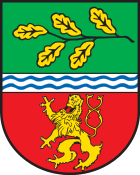
Hirz-Maulsbach
| coat of arms | Germany map | |
|---|---|---|

|
Coordinates: 50 ° 41 ′ N , 7 ° 29 ′ E |
|
| Basic data | ||
| State : | Rhineland-Palatinate | |
| County : | Altenkirchen (Westerwald) | |
| Association municipality : | Altenkirchen-Flammersfeld | |
| Height : | 257 m above sea level NHN | |
| Area : | 6.14 km 2 | |
| Residents: | 307 (Dec. 31, 2019) | |
| Population density : | 50 inhabitants per km 2 | |
| Postal code : | 57635 | |
| Area code : | 02686 | |
| License plate : | AK | |
| Community key : | 07 1 32 053 | |
| Community structure: | 5 districts | |
| Association administration address: | Rathausstrasse 13 57610 Altenkirchen |
|
| Website : | ||
| Local Mayor : | Dieter Zimmermann | |
| Location of the local community Hirz-Maulsbach in the district of Altenkirchen (Westerwald) | ||
Hirz-Maulsbach is a municipality in the Altenkirchen (Westerwald) district in Rhineland-Palatinate . It belongs to the community of Altenkirchen-Flammersfeld .
Geographical location
Hirz-Maulsbach is located in the western part of the Altenkirchen community and borders the Neuwied and Rhein-Sieg districts . Asbach is six kilometers to the southwest ; the district and association seat of Altenkirchen is about twelve kilometers to the east.
Neighboring communities are Fiersbach in the northwest, Mehren in the east and Limbach bei Asbach in the west.
The community consists of the districts of Hahn, Hardtmühle, Hirzbach, Maulsbach and Niedermaulsbach.
history
The district of Hirzbach is mentioned in a document from 1378. At that time, Gerhard von Hirzbach lent the Count of Nassau 150 marks of Hachenburger currency. In return, he received 11 bushels of oats from the farms of Wartenberg and Kaltenborn in the parish of Marienberg. It seems that Gerhard von Hirzbach had larger property in Hirzbach. Or maybe there was just a larger farm there that many villagers depended on.
The Maulsbach district was first documented in 1461. The merger of the two places took place in 1902. 1931 was Maulsbach own mailroom Class II in the district of the post office Asbach.
- Population development
The development of the population of Hirz-Maulsbach in relation to today's municipality; the values from 1871 to 1987 are based on censuses:
|
|
politics
Municipal council
The council in hirz-maulsbach consists of eight council members, who in the local elections on May 26, 2019 in a majority vote were elected, and the honorary mayor as chairman.
mayor
Dieter Zimmermann became mayor of Hirz-Maulsbach in 2009. In the direct election on May 26, 2019, he was confirmed in office for another five years with a share of 90.57% of the votes.
economy
A total of 14 farms use around 186 hectares of the municipal area, around 20% of which is arable land, 80% is permanent grassland (as of 2007); In 1971 there were still 36 farms with an agricultural area of 310 hectares. There are also some craft businesses in the village. A tax advisor / sworn auditor is also established.
See also
Web links
- Local community Hirz-Maulsbach on the website of the Association of Altenkirchen
- Peace oak between Hirz-Maulsbach and Asbach-Krumscheid in the Westerwald
Individual evidence
- ↑ a b State Statistical Office of Rhineland-Palatinate - population status 2019, districts, municipalities, association communities ( help on this ).
- ↑ State Statistical Office Rhineland-Palatinate (ed.): Official directory of the municipalities and parts of the municipality. Status: January 2018 [ Version 2020 is available. ] . S. 8 (PDF; 2.2 MB).
- ^ Theo Winterscheid: From the history of the post in the Windhagener area. In: Windhagen - Ein Heimatbuch , Economica Verlag, Bonn 1994, p. 113.
- ↑ a b State Statistical Office Rhineland-Palatinate - regional data
- ^ The Regional Returning Officer Rhineland-Palatinate: City Council Election 2019 Hirz-Maulsbach. Retrieved December 26, 2019 .
- ^ The Regional Returning Officer Rhineland-Palatinate: direct elections 2019. see Altenkirchen-Flammersfeld, Verbandsgemeinde, 26th line of results. Retrieved December 26, 2019 .


