Kotterberg
|
Kotterberg
City of Overath
Coordinates: 50 ° 56 ′ 52 ″ N , 7 ° 16 ′ 40 ″ E
|
||
|---|---|---|
| Height : | 172 m above sea level NN | |
|
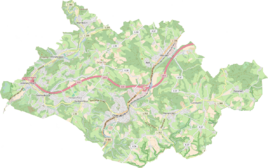
Location of Kotterberg in Overath |
||
Kotterberg was a district of Overath in the Rheinisch-Bergisches Kreis in North Rhine-Westphalia , Germany .
The place fell into desolation in the first half of the 20th century .
location
The former courtyard Kotterberg can only be found in older writings. It was located near Kotten on the route of today's federal motorway 4 and was abandoned in the 1930s / 40s.
history
From the Prussian new recording of 1895 onwards, the place is recorded as Kotterberg on measuring table sheets , on the 1933 edition it was recorded for the last time in cartographic form on measuring table sheets.
The list of inhabitants and livestock from 1848 only registers the family of five of the day laborer Johann Reichenbach in Kottenberg , three children, no livestock, poor .
The municipal and estate district statistics of the Rhine Province are listed by Kotterberg in 1871 with two houses and nine inhabitants. In the municipality lexicon for the Rhineland province of 1888, a house with two residents is given for Kotterberg. In 1895 the place also had a house with two inhabitants, for 1905 one house and six inhabitants were given.
The house numbering cadastre from 1907 lists a Johann Hasberg as the only house owner and resident in Kotterberg .
The site was demolished in the 1930s / 40s. In the 1970s, the federal highway 4 was laid directly past the desert.
Individual evidence
- ↑ Berthold Gladbach, Peter Lückerath: The Overather population in name, tax and residents lists from the 15th to the 20th century. Ed .: Geschichtsverein Rhein-Berg, Bergisch Gladbach 2016. ISBN 978-3-932326-75-2 , p. 345
- ^ The communities and manor districts of the Rhine Province and their population. Edited and compiled by the Royal Statistical Bureau from the original materials of the general census of December 1, 1871. In: Königliches Statistisches Bureau (Hrsg.): The communities and manor districts of the Prussian state and their population. tape XI , 1874, ZDB -ID 1467523-7 ( digitized ).
- ^ Community encyclopedia for the province of Rhineland. Based on materials from the census of December 1, 1885 and other official sources, edited by the Royal Statistical Bureau. In: Royal Statistical Bureau (Hrsg.): Community encyclopedia for the Kingdom of Prussia. tape XII , 1888, ZDB -ID 1046036-6 ( digitized version ).
- ^ Community encyclopedia for the province of Rhineland. Based on materials from the census of December 1, 1895 and other official sources, edited by the Royal Statistical Bureau. In: Royal Statistical Bureau (Hrsg.): Community encyclopedia for the Kingdom of Prussia. tape XII , 1897, ZDB -ID 1046036-6 .
- ^ Community encyclopedia for the Rhine Province. Based on the materials from the census of December 1, 1905 and other official sources, edited by the Royal Prussian State Statistical Office. In: Königliches Prussisches Statistisches Landesamt (Hrsg.): Community encyclopedia for the Kingdom of Prussia. Booklet XII, 1909, ZDB -ID 1046036-6 .
- ↑ Berthold Gladbach, Peter Lückerath: The Overather population in lists of names, taxes and residents ... p. 365.

