Garbage wood
|
Garbage wood
City of Overath
Coordinates: 50 ° 56 ′ 58 ″ N , 7 ° 13 ′ 55 ″ E
|
||
|---|---|---|
| Height : | 196 m above sea level NHN | |
|
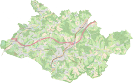
Location of Müllenholz in Overath |
||
Müllenholz is a district of Steinenbrück in the town of Overath in the Rheinisch-Bergisches Kreis in North Rhine-Westphalia , Germany .
Location and description
The small district of Müllenholz near the Untereschbach junction of the federal motorway 4 can be reached via Landesstraße 136 and Zöllner Straße. A citizen's bus , which is operated by volunteer drivers, regularly drives over Müllenholz and thus connects it to local public transport. Places in the near are Steeg , Kleinhurden , Nallingen , Neichen , Oberauel and Stichermühle . From a natural perspective, garbage wood is one of the Sülz plateaus .
history
The Topographia Ducatus Montani by Erich Philipp Ploennies , Blatt Amt Steinbach , shows that the residential area had three farmsteads as early as 1715, which are labeled as Müllenholts . Carl Friedrich von Wiebeking names the court on his charter of the Duchy of Berg in 1789 as Mühlenholtz . It shows that at that time the place was part of the Löderich family in the parish of Overath.
The place was on Heidenstrasse , an important medieval old highway from Cologne via Kassel to Leipzig . The old route of the old Höhenweg ran on today's road between Altenbrück and Leffelsend .
The place is recorded on the topographical survey of the Rhineland from 1817 as Mühlenholz . The Prussian first recording from 1845 shows the living space also under the name Mühlenholz . From the Prussian new admission of 1892, the place is regularly recorded on measuring table sheets as garbage wood.
In 1822, 20 people lived in the place, which was categorized as a courtyard and after the collapse of the Napoleonic administration and its replacement, it belonged to the Overath mayor in the Mülheim am Rhein district . For the year 1830 23 inhabitants are given for the place called garbage wood . The place, which was categorized as a courtyard in 1845 according to the overview of the government district of Cologne , had four residential buildings with 20 residents at that time, all of which were Catholic.
The list residents and live stock of 1848 counts in Müllenholz 21 residents and names names: John Odenthal, Peter Steinbach and Heinrich Schneppensiepen , all Ackerer with livestock - the day laborers Joseph Kümmeler and the widow (widower) Wilhelm Neuhaus without Gewerb , considered poor referred becomes.
The municipal and Gutbezirksstatistik the Rhine Province leads Müllenholz 1871 with nine houses and 35 residents. In the municipality lexicon for the Rhineland province of 1888, nine houses with 39 inhabitants are given for garbage wood . In 1895 the place had nine houses with 35 inhabitants, in 1905 seven houses and 35 inhabitants are given.
Individual evidence
- ↑ Citizen bus timetable
- ^ Wilhelm Fabricius : Explanations for the Historical Atlas of the Rhine Province ; Second volume: The map of 1789. Division and development of the territories from 1600 to 1794 ; Bonn; 1898
- ^ Herbert Nicke : The Heidenstrasse. History and landscape along the historic highway from Cologne to Kassel . In: Land and history between Berg, Wildenburg and South Westphalia . tape 6 . Galunder, Wiehl 2001, ISBN 3-931251-74-8 , pp. 38 f .
- ↑ Alexander A. Mützell: New topographical-statistical-geographical dictionary of the Prussian state . tape 3 . Karl August Künnel, Halle 1822.
- ↑ Friedrich von Restorff : Topographical-statistical description of the Royal Prussian Rhine Province , Nicolai, Berlin and Stettin 1830
- ↑ Overview of the components and list of all the localities and individually named properties of the government district of Cologne: by districts, mayor's offices and parishes, with information on the number of people and the residential buildings, as well as the Confessions, Jurisdictions, Military and former state conditions. / ed. from the Royal Government of Cologne [Cologne], [1845]
- ↑ Royal Statistical Bureau Prussia (ed.): The communities and manor districts of the Prussian state and their population . The Rhine Province, No. XI . Berlin 1874.
- ↑ Königliches Statistisches Bureau (Prussia) (Ed.): Community encyclopedia for the Rhineland Province, based on the materials of the census of December 1, 1885 and other official sources, (Community encyclopedia for the Kingdom of Prussia, Volume XII), Berlin 1888.
- ↑ Königliches Statistisches Bureau (Prussia) (Ed.): Community encyclopedia for the Rhineland Province, based on the materials of the census of December 1, 1895 and other official sources, (Community encyclopedia for the Kingdom of Prussia, Volume XII), Berlin 1897.
- ↑ Royal Statistical Bureau (Prussia) (Ed.): Community encyclopedia for the Rhineland Province, based on the materials of the census of December 1, 1905 and other official sources, (Community encyclopedia for the Kingdom of Prussia, Volume XII), Berlin 1909

