Birches (Overath)
|
Birch trees
City of Overath
Coordinates: 50 ° 56 ′ 36 ″ N , 7 ° 15 ′ 23 ″ E
|
||
|---|---|---|
| Height : | 203 m above sea level NN | |
|
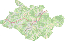
Location of birches in Overath |
||
Birken is a district of Heiligenhaus in the town of Overath in the Rheinisch-Bergisches Kreis in North Rhine-Westphalia , Germany .
Location and description
The district of Birken on Hohkeppler Strasse (Landesstrasse 84) can no longer be perceived as an independent residential area; it has merged with the Heiligenhaus district. It is a new development area in which Overaths urban planning with precise specifications seeks to obtain an organic overall picture. The requirements include the creation of an orchard with at least one hundred trees where the use of biocides is prohibited. Birken is connected to local public transport by bus line 425.
history
The Topographia Ducatus Montani by Erich Philipp Ploennies , Blatt Amt Steinbach , proves that the residential area already had three courtyards in 1715, which are labeled as Bircken . Carl Friedrich von Wiebeking names the court on his charter of the Duchy of Berg in 1789 as Börken . It shows that at that time the place was part of the Löderich family in the parish of Overath.
The place is recorded on the topographical survey of the Rhineland from 1817 as birches . The Prussian first recording from 1845 shows the residential area also under the name Birken . From the Prussian new admission of 1892, the place is regularly recorded as birch on measuring table sheets .
In 1822, 18 and 24 people respectively lived in the two Overath birches in two places categorized as courtyards, which after the collapse of the Napoleonic administration and its replacement belonged to the Overath mayor in the Mülheim am Rhein district . It is not clear from the list which of them is the birch mentioned here. For the year 1830, 21 and 28 inhabitants are given for the places categorized as courtyards. The place, which was categorized as birch trees according to the survey of the government district of Cologne in 1845 , had six residential buildings with 48 inhabitants at that time, all of them Catholic denominations.
According to the list of residents and livestock from 1848, which among other things was used to collect taxes, 59 residents lived in Birken, including 27 children. The list gives the names and occupations of the heads of household and thus gives a little insight into the living conditions. There were seven farmers in Birken, including 3 Müller families: Peter, Heinrich and Müller siblings . Most of the cattle were owned by Hermann Altenrath's family of eleven (6 children): (1 ox, 5 cows, 2 cattle, 1 calf, 5 pigs) Other farmers: Peter Ley ( 2 cows, 1 pig ), Peter Roth (1 cow, 1 goat ) and Caspar Stüttem ( 1 cow, 1 goat ). The families of six of the two day laborers Peter Dresbach and Peter Faßbender and the rag collector Christian Alessi each had four children. Notes from the authorities on each property: 1 goat, poor .
The municipality and manor district statistics of the Rhine Province list 1871 birch trees with five houses and 21 inhabitants. In the municipality lexicon for the Rhineland province of 1888, six houses with 23 inhabitants are given for Birken bei Heiligenhaus . In 1895 the place had four houses with 14 inhabitants and belonged denominationally to the Catholic parish Marialinden, in 1905 five houses and 40 inhabitants are given.
Individual evidence
- ↑ Archived copy ( Memento of the original dated December 3, 2016 in the Internet Archive ) Info: The archive link was inserted automatically and has not yet been checked. Please check the original and archive link according to the instructions and then remove this notice. Urban planning birch trees.
- ^ Wilhelm Fabricius : Explanations for the Historical Atlas of the Rhine Province. Second volume: The map from 1789. Division and development of the territories from 1600 to 1794. Bonn 1898.
- ↑ Alexander A. Mützell: New topographical-statistical-geographical dictionary of the Prussian state . tape 1 . Karl August Künnel, Halle 1821.
- ↑ Overview of the components and list of all the localities and individually named properties of the government district of Cologne: by districts, mayor's offices and parishes, with information on the number of people and the residential buildings, as well as the Confessions, Jurisdictions, Military and former state conditions. / ed. from the Royal Government of Cologne [Cologne], [1845]
- ↑ Berthold Gladbach, Peter Lückerath: The Overather population in name, tax and residents lists from the 15th to the 20th century . Ed .: Geschichtsverein Rhein-Berg, Bergisch Gladbach 2016. ISBN 978-3-932326-75-2 , p. 335
- ↑ Royal Statistical Bureau Prussia (ed.): The communities and manor districts of the Prussian state and their population . The Rhine Province, No. XI . Berlin 1874.
- ↑ Königliches Statistisches Bureau (Prussia) (Ed.): Community encyclopedia for the Rhineland Province, based on the materials of the census of December 1, 1885 and other official sources, (Community encyclopedia for the Kingdom of Prussia, Volume XII), Berlin 1888.
- ↑ Königliches Statistisches Bureau (Prussia) (Ed.): Community encyclopedia for the Rhineland Province, based on the materials of the census of December 1, 1895 and other official sources, (Community encyclopedia for the Kingdom of Prussia, Volume XII), Berlin 1897.
- ↑ Königliches Statistisches Bureau (Prussia) (Ed.): Community encyclopedia for the Rhineland Province, based on the materials of the census of December 1, 1905 and other official sources, (Community encyclopedia for the Kingdom of Prussia, Volume XII), Berlin 1909.

