Mittelauel
|
Mittelauel
City of Overath
Coordinates: 50 ° 56 ′ 41 ″ N , 7 ° 12 ′ 36 ″ E
|
||
|---|---|---|
|
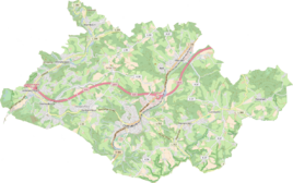
Location of Mittelauel in Overath |
||
|
View from Lüderich to Mittelauel (center),
in the foreground Daubenbüchel , above houses on Brüderstraße |
||
Mittelauel is a district of Untereschbach in the town of Overath in the Rheinisch-Bergisches Kreis in North Rhine-Westphalia , Germany .
Location and description
Mittelauel is a small district west of Overath and above the Sülz and Landesstraße 284, which is called here Hoffnungsthaler Straße. Nearby are Daubenbüchel , Unterauel and the Lüderich golf course on the site of the former Lüderich mine .
history
The name Auel is derived from * ouwala , * ouwila , whose root word ouwa (= waterland ) is to be understood in the sense of a river meadow surrounded by water on several sides.
The Topographia Ducatus Montani by Erich Philipp Ploennies , Blatt Amt Porz , shows that the residential area had a farm as early as 1715 . Revel is labeled. From the chart of the Duchy of Berg in 1789 by Carl Friedrich von Wiebeking it emerges that the local area was part of the Lower Church Game Immekeppel in the Bensberg Higher Court at that time .
The place is on the topographical recording of the Rhineland from 1817 as Mit. Aul listed. The Prussian first recording from 1845 shows the residential area under the name Mittelste Auel . From the Prussian new admission of 1892, the place is regularly recorded on measuring table sheets as Mittel-Auel or Mittelauel .
In 1822, 34 people lived in the village, which was categorized as a farm and called (Mittel-) Auel , and after the collapse of the Napoleonic administration and its replacement, it belonged to the mayor's office of Bensberg in the Mülheim am Rhein district . For the year 1830 46 inhabitants are given for the place called Mittel-Auel . In 1845, according to the overview of the government district of Cöln, categorized as a farm and designated Mittel-Auel , it had four residential buildings with 28 inhabitants, all of them Catholic denominations. The municipal and Gutbezirksstatistik the Rhine Province leads Mittelauel 1871 with seven houses and 42 residents. In the municipality lexicon for the province of Rhineland from 1888, eight houses with 37 inhabitants are given for Mittel Auel . In 1895 the place has four houses with 40 inhabitants and belonged denominationally to the Catholic parish Immekeppel. In 1905 nine houses and 65 inhabitants are given.
On the basis of Section 10 of the Cologne Act , several Bensberg outlying areas were converted into the Overath community in 1975, including the area around Untereschbach with Mittelauel.
Individual evidence
- ^ Heinrich Dittmaier : settlement names and settlement history of the Bergisches Land . In: Journal of the Bergisches Geschichtsverein . tape 74 , parallel edition as a publication by the Institute for Historical Regional Studies of the Rhineland at the University of Bonn. Schmidt, Neustadt ad Aisch 1956.
- ^ Wilhelm Fabricius : Explanations for the Historical Atlas of the Rhine Province ; Second volume: The map of 1789. Division and development of the territories from 1600 to 1794 ; Bonn; 1898
- ↑ Alexander A. Mützell: New topographical-statistical-geographical dictionary of the Prussian state . tape 1 . Karl August Künnel, Halle 1821.
- ↑ Friedrich von Restorff : Topographical-statistical description of the Royal Prussian Rhine Province , Nicolai, Berlin and Stettin 1830
- ↑ Overview of the components and list of all the localities and individually named properties of the government district of Cologne: by districts, mayor's offices and parishes, with information on the number of people and the residential buildings, as well as the Confessions, Jurisdictions, Military and former state conditions. / ed. from the Royal Government of Cologne [Cologne], [1845]
- ↑ Royal Statistical Bureau Prussia (ed.): The communities and manor districts of the Prussian state and their population . The Rhine Province, No. XI . Berlin 1874.
- ↑ Königliches Statistisches Bureau (Prussia) (Ed.): Community encyclopedia for the Rhineland Province, based on the materials of the census of December 1, 1885 and other official sources, (Community encyclopedia for the Kingdom of Prussia, Volume XII), Berlin 1888.
- ↑ Königliches Statistisches Bureau (Prussia) (Ed.): Community encyclopedia for the Rhineland Province, based on the materials of the census of December 1, 1895 and other official sources, (Community encyclopedia for the Kingdom of Prussia, Volume XII), Berlin 1897.
- ↑ Royal Statistical Bureau (Prussia) (Ed.): Community encyclopedia for the Rhineland Province, based on the materials of the census of December 1, 1905 and other official sources, (Community encyclopedia for the Kingdom of Prussia, Volume XII), Berlin 1909
- ^ The Cologne Act in full. Retrieved June 7, 2016 .


