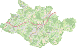
Großschwamborn
|
Großschwamborn
City of Overath
Coordinates: 50 ° 56 ′ 14 ″ N , 7 ° 15 ′ 30 ″ E
|
||
|---|---|---|
|
Location of Großschwamborn in Overath |
||
|
Passage Großschwamborn
|
||
Großschwamborn is a district of Heiligenhaus in the town of Overath in the Rheinisch-Bergisches Kreis in North Rhine-Westphalia , Germany .
Location and description
The district of Großschwamborn is located near the Heiligenhauser roundabout between Bensberger Strasse (Landesstrasse 136) and Durbuscher Strasse (Landesstrasse 84). It grows together with Kleinschwamborn to form a common settlement area. Nearby places and hamlets are Burgholz , Klefberg and Linde .
history
A Schwamborn was first mentioned in a document around 1470 as a Schwamborn . The appellative in the place name is Born , an old term for “ source ” , the defining word is not entirely clear. It could be derived from " swan " or actually " sponge " . * Schwandborn (= " dwindling, drying up source" ) is possibly also the origin of the name.
The Topographia Ducatus Montani by Erich Philipp Ploennies , Blatt Amt Steinbach , shows that the living space had four farmsteads as early as 1715, which are labeled as Schwamborn . Carl Friedrich von Wiebeking names the court on his charter of the Duchy of Berg in 1789 as Schwanborn . It emerges from it that the place was part of the honor of saints in the parish of Overath at that time .
The place is on the topographical survey of the Rhineland from 1817 as Gr. Schwamborn recorded. The Prussian first recording from 1845 shows the residential area under the name Gr. Schwamborn . From the Prussian new admission of 1892 the place is regularly as Gr. Schwamborn or Großschwamborn recorded.
In 1822, 52 people lived in the place categorized as Hof and designated (Gross-) Schwamborn , which after the collapse of the Napoleonic administration and its replacement belonged to the Overath mayor in the Mülheim am Rhein district . For the year 1830 a total of 106 inhabitants are given for Groß- and Klein-Schwamborn . In 1845, according to the survey of the government district of Cöln, categorized as a village and designated Groß-Schwamborn , at that time it had twelve residential buildings with 72 inhabitants, all of which were Catholic.
The list of residents and livestock from 1848, which among other things was used to collect taxes, gives a little insight into living conditions at that time. She registered 77 residents in Großschwamborn (including 32 children under 16 years of age) and gave names and professions of the heads of household, including the seamstress Margarethe König and the tailor Gerhard Schwamborn. Nine farmers are registered: Christian Dresbach, Clemens Linder, Heinrich Megen, Peter Müller, Johann Over, Johann Schwamborn, Johann Schwamborn II, Mathias Steinbach ( and Schuster ) and Wittib Wermelskirchen. The following are named as day laborers : Wilhelm Büscher, Roland Hachen, Johann Höller and Wilhelm Schröder. And as without trade : Wittib Christoph Schwamborn and Franz Steinbach. Christian Dresbach, Roland Hachen, Christoph and Gerhard Schwamborn and Franz Steinbacher are classified as poor .
The municipal and Gutbezirksstatistik the Rhine Province leads Großschwamborn 1871 with eleven residential houses and 95 residents. In the municipality lexicon for the Rhineland province of 1888, 13 houses with 83 inhabitants are given for Groß Schwamborn. In 1895 the place had ten houses with 78 inhabitants, in 1905 13 houses and 73 inhabitants are given.
Individual evidence
- ^ A b Heinrich Dittmaier : Settlement names and settlement history of the Bergisches Land . In: Journal of the Bergisches Geschichtsverein . tape 74 , parallel edition as a publication by the Institute for Historical Regional Studies of the Rhineland at the University of Bonn. Schmidt, Neustadt ad Aisch 1956.
- ^ Wilhelm Fabricius : Explanations for the Historical Atlas of the Rhine Province ; Second volume: The map of 1789. Division and development of the territories from 1600 to 1794 ; Bonn; 1898
- ↑ Alexander A. Mützell: New topographical-statistical-geographical dictionary of the Prussian state . tape 4 . Karl August Künnel, Halle 1823.
- ↑ Friedrich von Restorff : Topographical-statistical description of the Royal Prussian Rhine Province , Nicolai, Berlin and Stettin 1830
- ↑ Overview of the components and list of all the localities and individually named properties of the government district of Cologne: by districts, mayor's offices and parishes, with information on the number of people and the residential buildings, as well as the Confessions, Jurisdictions, Military and former state conditions. / ed. from the Royal Government of Cologne [Cologne], [1845]
- ↑ Berthold Gladbach, Peter Lückerath: The Overather population in name, tax and residents lists from the 15th to the 20th century . Ed .: Geschichtsverein Rhein-Berg, Bergisch Gladbach 2016. ISBN 978-3-932326-75-2 , p. 338
- ↑ Royal Statistical Bureau Prussia (ed.): The communities and manor districts of the Prussian state and their population . The Rhine Province, No. XI . Berlin 1874.
- ↑ Königliches Statistisches Bureau (Prussia) (Ed.): Community encyclopedia for the Rhineland Province, based on the materials of the census of December 1, 1885 and other official sources, (Community encyclopedia for the Kingdom of Prussia, Volume XII), Berlin 1888.
- ↑ Königliches Statistisches Bureau (Prussia) (Ed.): Community encyclopedia for the Rhineland Province, based on the materials of the census of December 1, 1895 and other official sources, (Community encyclopedia for the Kingdom of Prussia, Volume XII), Berlin 1897.
- ↑ Royal Statistical Bureau (Prussia) (Ed.): Community encyclopedia for the Rhineland Province, based on the materials of the census of December 1, 1905 and other official sources, (Community encyclopedia for the Kingdom of Prussia, Volume XII), Berlin 1909


