Aggermühle (Overath)
|
Aggermühle
City of Overath
Coordinates: 50 ° 57 ′ 21 ″ N , 7 ° 18 ′ 54 ″ E
|
||
|---|---|---|
| Height : | 102 m above sea level NN | |
|
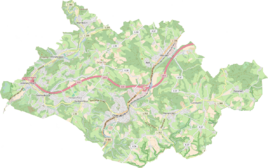
Location of Aggermühle in Overath |
||
Aggermühle is a district of Vilkerath in the town of Overath in the Rheinisch-Bergisches Kreis in North Rhine-Westphalia , Germany .
Location and description
The Aggermühle residential area can only be found today as a small marker on some maps. It was on the Agger near Kölner Strasse ( Bundesstrasse 55 ) near Rotter Weg and Am Aggerberg . The name of the residential area referred to the Aggermühle, one of the six water-powered ban mills on the Agger.
history
The Aggermühle, also called Achermühle Vilkerath , was mentioned in a document as early as the 15th century. The watermill was initially the only grain and oil mill in the parish of Overath and has belonged to the knight seat Großbernsau since 1587 .
In the Topographia Ducatus Montani by Erich Philipp Ploennies , Blatt Amt Steinbach , the mill and its moats are drawn in 1715 and labeled with mühl . Carl Friedrich von Wiebeking names the mill on his chart of the Duchy of Berg in 1789 as Acher . From it it emerges that the place was part of the Honschaft Vilkerath in the parish Overath at that time .
The place of residence is shown on the topographical survey of the Rhineland from 1817 as a mill symbol without any inscription. The Prussian Uraufnahme from 1845 shows the living space as a mill symbol under the name Agger M . From the Prussian new recording from 1892 to 1933 to issue the place is on Ordnance Survey regularly as Agger M. recorded.
In 1822, 19 people lived together in the neighboring Aggerhof and the mill . No figures are given for the Aggermühle alone . After the collapse of the Napoleonic administration and its replacement, the two living spaces belonged to the Overath mayor's office in the Mülheim am Rhein district . For the year 1830, the two residential areas Aggerhof and Aggermühle, designated as Hof and Mühle , are given as 29 inhabitants. According to the overview of the government district of Cöln , the two residential areas were still merged in 1845 and at that time had seven residential buildings with 51 residents, all of which were Catholic denominations, categorized as hamlets and mills . The municipal and Gutbezirksstatistik the Rhine Province leads Agger mill now alone in 1871 with a dwelling house and three residents on. In the municipality lexicon for the province of Rhineland from 1888, a house with eight residents is given for Aggermühle. In 1895 the place has a house with nine inhabitants and belonged denominationally to the Catholic parish Marialinden, in 1905 a house with eight inhabitants is given.
The mill existed until around 1920 and was then sold to the Dienes company, which owned its production facility nearby and then used it for a few years to generate electricity using hydropower . By the middle of the 20th century, all buildings on the residential area were demolished and the place fell into desolation.
Individual evidence
- ↑ Aggermühle at Willi Fritzen: Photo safari through Vilkerath today with texts and historical photos
- ↑ a b Herbert Nicke : Bergische Mühlen. On the trail of the use of hydropower in the land of a thousand mills between Wupper and Sieg . Galunder, Wiehl 1998, ISBN 3-931251-36-5 , pp. 275 .
- ^ Wilhelm Fabricius : Explanations for the Historical Atlas of the Rhine Province. Second volume: The map from 1789. Division and development of the territories from 1600 to 1794. Bonn 1898.
- ↑ Alexander A. Mützell: New topographical-statistical-geographical dictionary of the Prussian state . tape 1 . Karl August Künnel, Halle 1821.
- ↑ Friedrich von Restorff : Topographical-statistical description of the Royal Prussian Rhine Province , Nicolai, Berlin and Stettin 1830
- ↑ Overview of the components and list of all the localities and individually named properties of the government district of Cologne: by districts, mayor's offices and parishes, with information on the number of people and the residential buildings, as well as the Confessions, Jurisdictions, Military and former state conditions. / ed. from the Royal Government of Cologne [Cologne], [1845]
- ↑ Royal Statistical Bureau Prussia (ed.): The communities and manor districts of the Prussian state and their population . The Rhine Province, No. XI . Berlin 1874.
- ↑ Königliches Statistisches Bureau (Prussia) (Ed.): Community encyclopedia for the Rhineland Province, based on the materials of the census of December 1, 1885 and other official sources, (Community encyclopedia for the Kingdom of Prussia, Volume XII), Berlin 1888.
- ↑ Königliches Statistisches Bureau (Prussia) (Ed.): Community encyclopedia for the Rhineland Province, based on the materials of the census of December 1, 1895 and other official sources, (Community encyclopedia for the Kingdom of Prussia, Volume XII), Berlin 1897.
- ↑ Königliches Statistisches Bureau (Prussia) (Ed.): Community encyclopedia for the Rhineland Province, based on the materials of the census of December 1, 1905 and other official sources, (Community encyclopedia for the Kingdom of Prussia, Volume XII), Berlin 1909.

