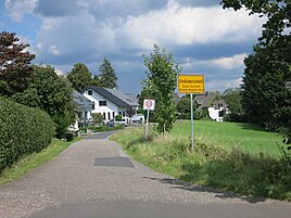
Großoderscheid
|
Großoderscheid
City of Overath
Coordinates: 50 ° 56 ′ 3 ″ N , 7 ° 20 ′ 11 ″ E
|
||
|---|---|---|
|
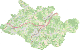
Location of Großoderscheid in Overath |
||
Großoderscheid is a district of Marialinden in the town of Overath in the Rheinisch-Bergisches Kreis in North Rhine-Westphalia , Germany .
Location and description
Großoderscheid is located on the state road 360, which is called the pilgrimage route here. It is an area with single houses, a sports area and agriculture. The nearest locations are Oderscheiderberg , Oderscheiderfeld and Krampenhöhe , all wetlands that are naturally part of the Marialinder Riedelland and in which rare animals and plants live.
history
The Topographia Ducatus Montani by Erich Philipp Ploennies , Blatt Amt Steinbach , shows that the residential area had two farmsteads as early as 1715 , which are labeled as Udest . Carl Friedrich von Wiebeking names the court on his charter of the Duchy of Berg in 1789 as Udest.
The area around Großoderscheid, Kleinoderscheid , Oderscheiderberg and Oderscheiderfeld was part of the Oderscheid Honschaft in the Middle Ages and early modern times and belonged to the knight's seat of Vilkerath . It was mentioned in a document in 1294 as de Oderscheyt . Oderscheid is one of the -scheid names and describes a range of hills that forms a border or a watershed.
The place was on the Brüderstraße , an important medieval old highway from Flanders via Cologne to Leipzig . On the route of the old high route , the state road 360 runs in this section today.
Großoderscheid is on the topographical survey of the Rhineland from 1825 as Gr. Oderscheid recorded. The Prussian first recording from 1845 shows the living space also under the name Gr. Oderscheid . From the Prussian new admission of 1892 the place is regularly as Gr. Oderscheid or Großoderscheid recorded.
In 1822, 69 people lived in the place categorized as a courtyard and designated Orderscheidt , which after the collapse of the Napoleonic administration and its replacement belonged to the Overath mayor in the Mülheim am Rhein district . For the year 1830 79 inhabitants are given for the place called Orderscheid . In 1845, according to the survey of the government district of Cöln, categorized as a village and designated as Groß-Oderscheid , at that time it had 14 residential buildings with 96 inhabitants, all of which were Catholic. In the municipality lexicon for the Rhineland province of 1888, 16 houses with 78 inhabitants are given for Groß Oderscheid. In 1895 the place had 15 houses with 79 inhabitants and belonged denominationally to the Catholic parish Marialinden, in 1905 15 houses and 68 inhabitants are given.
With the neighboring Marialinden, the place now forms an almost closed settlement area due to the spreading settlement of the church village.
Individual evidence
- ^ Heinrich Dittmaier : settlement names and settlement history of the Bergisches Land . In: Journal of the Bergisches Geschichtsverein . tape 74 , parallel edition as a publication by the Institute for Historical Regional Studies of the Rhineland at the University of Bonn. Schmidt, Neustadt ad Aisch 1956.
- ↑ Jörg Poettgen (editor): 950 years Overath (1064–2014) / Street names tell stories. Edited by Bergischer Geschichtsverein Overath eV
- ^ Herbert Nicke : The Brothers Street. From the history of the old country road from Cologne to Siegen . In: Land and history between Berg, Wildenburg and South Westphalia . tape 4 . Galunder, Wiehl 2001, p. 70 ff .
- ↑ Alexander A. Mützell: New topographical-statistical-geographical dictionary of the Prussian state . tape 3 . Karl August Künnel, Halle 1822.
- ↑ Friedrich von Restorff : Topographical-statistical description of the Royal Prussian Rhine Province , Nicolai, Berlin and Stettin 1830
- ↑ Overview of the components and list of all the localities and individually named properties of the government district of Cologne: by districts, mayor's offices and parishes, with information on the number of people and the residential buildings, as well as the Confessions, Jurisdictions, Military and former state conditions. / ed. from the Royal Government of Cologne [Cologne], [1845]
- ↑ Königliches Statistisches Bureau (Prussia) (Ed.): Community encyclopedia for the Rhineland Province, based on the materials of the census of December 1, 1885 and other official sources, (Community encyclopedia for the Kingdom of Prussia, Volume XII), Berlin 1888.
- ↑ Königliches Statistisches Bureau (Prussia) (Ed.): Community encyclopedia for the Rhineland Province, based on the materials of the census of December 1, 1895 and other official sources, (Community encyclopedia for the Kingdom of Prussia, Volume XII), Berlin 1897.
- ↑ Königliches Statistisches Bureau (Prussia) (Ed.): Community encyclopedia for the Rhineland Province, based on the materials of the census of December 1, 1905 and other official sources, (Community encyclopedia for the Kingdom of Prussia, Volume XII), Berlin 1909.


