Hoof chair
|
Hoof chair
City of Overath
Coordinates: 50 ° 57 ′ 44 ″ N , 7 ° 16 ′ 37 ″ E
|
||
|---|---|---|
| Height : | 235 m above sea level NN | |
|
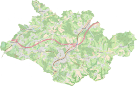
Location of Hufenstuhl in Overath |
||
Hufenstuhl is a district of Overath in the Rheinisch-Bergisches Kreis in North Rhine-Westphalia , Germany .
Geographical location
The place lies on the ridge between the brook valleys of the Leneffe and the Agger in the northern part of Overath on the border with Lindlar .
history
In one of the oldest documents in the Bergisches Land , this place is mentioned in 958 as the Humuerstule . The place of residence of the Humfried mentioned in this document is referred to , whereby it is assumed that the name of the place indicates the court seat of the brothers Walfried and Humfried , who transferred this place as own property in the deed of 958 to the St. Severinsstift.
However, some researchers consider this document to be a forgery, so it was not mentioned with certainty until the 13th century. The place name could refer to a chair dish , but can just as well be understood as meaning allod , good , seat . The defining word goes back to the personal name Hunfried , Humfried .
The Topographia Ducatus Montani by Erich Philipp Ploennies , Blatt Amt Steinbach , shows that the living space had two courtyards as early as 1715, which are labeled as a cross chair . The courtyard is shown there as Freihof . Carl Friedrich von Wiebeking names the court on his charter of the Duchy of Berg in 1789 as Hovestol . From it it emerges that the place was part of the Honschaft Balken in the parish of Overath at that time .
The place is recorded on the topographical survey of the Rhineland from 1817 as Hüvenstuhl . The Prussian first recording from 1845 shows the living space also under the name Hüvenstuhl . From the Prussian new admission of 1892, the place is regularly recorded on measuring table sheets as Hufenstuhl .
The place was on Heidenstrasse , an important medieval old highway from Cologne via Kassel to Leipzig . Today's state road 84 follows the route of the old high path towards Hohkeppel , in the forest near the town there are still ravines of this old road in the area.
In 1822, 35 people lived in the village, which was categorized as a courtyard and known as Hüfenstuhl , which after the collapse of the Napoleonic administration and its replacement belonged to the Overath mayor in the Mülheim am Rhein district . For the year 1830, 41 inhabitants are given for the place designated as leased property . The place categorized as a hamlet according to the overview of the government district of Cologne in 1845 was listed under the name Huvenstuhl and at that time had four residential buildings with 31 inhabitants, all of them Catholic denominations. The municipality and estate district statistics of the Rhine Province list Hufenstuhl 1871 with six houses and 48 inhabitants. In the municipality lexicon for the Rhineland province of 1888, six houses with 39 inhabitants are given for Hufenstuhl. In 1895 the place had seven houses with 51 inhabitants and belonged denominationally to the Catholic parish of Hohkeppel , in 1905 eight houses and 51 inhabitants are given.
See also
Individual evidence
- ^ A b c Heinrich Dittmaier : Settlement names and settlement history of the Bergisches Land . In: Journal of the Bergisches Geschichtsverein . tape 74 , parallel edition as a publication by the Institute for Historical Regional Studies of the Rhineland at the University of Bonn. Schmidt, Neustadt ad Aisch 1956.
- ^ Wilhelm Fabricius : Explanations for the Historical Atlas of the Rhine Province ; Second volume: The map of 1789. Division and development of the territories from 1600 to 1794 ; Bonn; 1898
- ^ Herbert Nicke : The Heidenstrasse. History and landscape along the historic highway from Cologne to Kassel . In: Land and history between Berg, Wildenburg and South Westphalia . tape 6 . Galunder, Wiehl 2001, ISBN 3-931251-74-8 , pp. 38 f .
- ↑ Alexander A. Mützell: New topographical-statistical-geographical dictionary of the Prussian state . tape 2 . Karl August Künnel, Halle 1821.
- ↑ Friedrich von Restorff : Topographical-statistical description of the Royal Prussian Rhine Province , Nicolai, Berlin and Stettin 1830
- ↑ Overview of the components and list of all the localities and individually named properties of the government district of Cologne: by districts, mayor's offices and parishes, with information on the number of people and the residential buildings, as well as the Confessions, Jurisdictions, Military and former state conditions. / ed. from the Royal Government of Cologne [Cologne], [1845]
- ↑ Royal Statistical Bureau Prussia (ed.): The communities and manor districts of the Prussian state and their population . The Rhine Province, No. XI . Berlin 1874.
- ↑ Königliches Statistisches Bureau (Prussia) (Ed.): Community encyclopedia for the Rhineland Province, based on the materials of the census of December 1, 1885 and other official sources, (Community encyclopedia for the Kingdom of Prussia, Volume XII), Berlin 1888.
- ↑ Königliches Statistisches Bureau (Prussia) (Ed.): Community encyclopedia for the Rhineland Province, based on the materials of the census of December 1, 1895 and other official sources, (Community encyclopedia for the Kingdom of Prussia, Volume XII), Berlin 1897.
- ↑ Königliches Statistisches Bureau (Prussia) (Ed.): Community encyclopedia for the Rhineland Province, based on the materials of the census of December 1, 1905 and other official sources, (Community encyclopedia for the Kingdom of Prussia, Volume XII), Berlin 1909.

