Falkemich
|
Falkemich
City of Overath
Coordinates: 50 ° 55 ′ 5 ″ N , 7 ° 20 ′ 11 ″ E
|
||
|---|---|---|
| Height : | 228 m above sea level NN | |
|
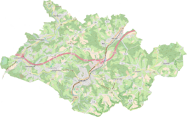
Location of Falkemich in Overath |
||
Falkemich is a district of Marialinden in the town of Overath in the Rheinisch-Bergisches Kreis in North Rhine-Westphalia , Germany .
Location and description
The Weiler Falcon Me is located on the circuit road 37 above the largely conservation property Naafbachs . It rises from two source streams in the forest area around the Heckberg , is also fed from a number of underground springs and forms the border with the Rhein-Sieg district here . The summit of the Falkemicher Berg next to Falkemich is 232 m above sea level. NHN . The place is one of the stations of the Bergischer Weg long-distance hiking trail . In the vicinity (on Landesstraße 312 and Naafbach) are the places Blindenaafermühle , Schlangenbachermühle and Fischermühle .
In 2012, Falkemich hit the headlines by founding a kind of sanctuary for cows . Because of the drop in milk prices, the farmers Mathias and Anke Hablau - like some of their colleagues - had to give up the dairy industry. Since they did not want to bring their 26 cows to the slaughterhouse , they called for the cow rescue . There were enough cow sponsors who helped with donations to ensure the survival of the unemployed animals.
history
The place name is one of the mountain names. The final syllable -berg in the older spellings changed to -me for unclear reasons. The defining word falcon probably goes back to the bird species.
The Topographia Ducatus Montani by Erich Philipp Ploennies , Blatt Amt Steinbach , shows that the residential area had four farms as early as 1715, which are labeled as Falckenberg . Carl Friedrich von Wiebeking names the court on his charter of the Duchy of Berg in 1789 as Falkenthal . It shows that the place was part of the Honschaft Burg in the parish of Overath at that time .
The place is recorded on the topographical survey of the Rhineland from 1817 as Falkemich . The Prussian first recording from 1845 shows the residential area under the name Falkemich . From the Prussian new admission in 1892, the place is regularly recorded as Falkemich on measurement table sheets .
In 1822, 48 people lived in the place categorized as a courtyard , which after the collapse of the Napoleonic administration and its replacement belonged to the Overath mayor in the Mülheim am Rhein district and was listed as Falkemigh . For the year 1830 56 inhabitants are given for the place called Hof. The town, which was categorized as a hamlet in 1845 according to the overview of the government district of Cologne , had 15 residential buildings with 77 inhabitants at that time, all of them Catholic denominations. The local and Gutbezirksstatistik the Rhine Province leads Falcon 1871 Me twelve homes and 64 residents. In the parish dictionary for the Rhineland province of 1888, twelve houses with 82 inhabitants are given. In 1895 the place had 14 houses with 73 inhabitants and belonged denominationally to the Catholic parish Marialinden, in 1905 16 houses and 70 inhabitants are given.
Individual evidence
- ↑ Malte Ewert: Animal-loving rescuers visiting the godfather cattle. In: Kölner Stadtanzeiger from September 26, 2012, accessed on July 18, 2016
- ^ Heinrich Dittmaier : settlement names and settlement history of the Bergisches Land . In: Journal of the Bergisches Geschichtsverein . tape 74 , parallel edition as a publication by the Institute for Historical Regional Studies of the Rhineland at the University of Bonn. Schmidt, Neustadt ad Aisch 1956.
- ^ Wilhelm Fabricius : Explanations for the Historical Atlas of the Rhine Province ; Second volume: The map of 1789. Division and development of the territories from 1600 to 1794 ; Bonn; 1898
- ↑ Alexander A. Mützell: New topographical-statistical-geographical dictionary of the Prussian state . tape 1 . Karl August Künnel, Halle 1821.
- ↑ Friedrich von Restorff : Topographical-statistical description of the Royal Prussian Rhine Province , Nicolai, Berlin and Stettin 1830
- ↑ Overview of the components and list of all the localities and individually named properties of the government district of Cologne: by districts, mayor's offices and parishes, with information on the number of people and the residential buildings, as well as the Confessions, Jurisdictions, Military and former state conditions. / ed. from the Royal Government of Cologne [Cologne], [1845]
- ↑ Royal Statistical Bureau Prussia (ed.): The communities and manor districts of the Prussian state and their population . The Rhine Province, No. XI . Berlin 1874.
- ↑ Königliches Statistisches Bureau (Prussia) (Ed.): Community encyclopedia for the Rhineland Province, based on the materials of the census of December 1, 1885 and other official sources, (Community encyclopedia for the Kingdom of Prussia, Volume XII), Berlin 1888.
- ↑ Königliches Statistisches Bureau (Prussia) (Ed.): Community encyclopedia for the Rhineland Province, based on the materials of the census of December 1, 1895 and other official sources, (Community encyclopedia for the Kingdom of Prussia, Volume XII), Berlin 1897.
- ↑ Königliches Statistisches Bureau (Prussia) (Ed.): Community encyclopedia for the Rhineland Province, based on the materials of the census of December 1, 1905 and other official sources, (Community encyclopedia for the Kingdom of Prussia, Volume XII), Berlin 1909.


