Bixnaafermühle
|
Bixnaafermühle
City of Overath
Coordinates: 50 ° 56 ′ 15 ″ N , 7 ° 21 ′ 58 ″ E
|
||
|---|---|---|
|
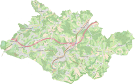
Location of Bixnaafermühle in Overath |
||
|
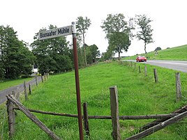
Signpost to Bixnaafermühle from Kreisstraße 360
|
||
Bixnaafermühle is a district of Marialinden in the town of Overath in the Rheinisch-Bergisches Kreis in North Rhine-Westphalia , Germany .
Location and description
Bixnaafermühle is a small district, mainly characterized by wet green areas, south above the Aggertal on the border with the Rhein-Sieg district. The next places are Bixnaaf , Hentgesnaaf , Neverdorf (Rhein-Sieg-Kreis) and Schommelsnaaf , which are all connected by the Naafbach . The near-natural, meandering Naafbach rises from a largely underground headwaters and flows into the Agger. The area is part of the Marialinder Riedelland, which is worth protecting, with its special flora and fauna. Bixnaafermühle is located on Landesstraße 360 and is connected to local public transport by the RSV bus line 575 .
history
Little is known about the eponymous mill of the residential area . It was a grain mill that first appeared cartographically as a mill symbol on the topographic map of the Rhineland in 1825 . Today only the mill moat remains . The Prussian first recording from 1845 shows the living space with a mill symbol, otherwise unlabeled, as well as the Prussian new recording from 1892 and all later measuring table sheets of the official topographic map 1: 25,000 (TK25). As of the 1990 edition, there is no longer a mill symbol on the settlement.
The brook name Naaf , in the 13th century as de Nafe , in 1555 as the Nave , is a river name word of Indo-European origin, the root of which cannot be traced in German . The meaning seems to be neutral flow and is related to the Greek nao (= flow ), Latin nato (= swimme ) , navis (= ship ).
In 1822, 30 people lived together in neighboring Bixnaaf and the mill, which after the collapse of the Napoleonic administration and its replacement, belonged to the Overath mayor in the Mülheim am Rhein district . The place and mill were called Bixnofen . For the year 1830 a total of 36 inhabitants are given for both places. According to the survey of the government district of Cologne in 1845, Bixnaaf and Bixnaafermühle together owned eight residential buildings with 36 inhabitants, all of them Catholic denominations. The municipal and Gutbezirksstatistik the Rhine Province leads Bixnaafermühle 1871 alone in a house and seven residents. In the municipality lexicon for the Rhineland province of 1888, two houses with ten residents are given for Bixnaafermühle. In 1895 the place had two houses with 14 inhabitants and belonged denominationally to the Catholic parish of Marialinden, in 1905 one house and nine inhabitants are given.
Individual evidence
- ^ Herbert Nicke : Bergische mills. On the trail of the use of hydropower in the land of a thousand mills between Wupper and Sieg . Galunder, Wiehl 1998, ISBN 3-931251-36-5 , pp. 287 .
- ^ Heinrich Dittmaier : settlement names and settlement history of the Bergisches Land . In: Journal of the Bergisches Geschichtsverein . tape 74 , parallel edition as a publication by the Institute for Historical Regional Studies of the Rhineland at the University of Bonn. Schmidt, Neustadt ad Aisch 1956.
- ↑ Alexander A. Mützell: New topographical-statistical-geographical dictionary of the Prussian state . tape 1 . Karl August Künnel, Halle 1821.
- ↑ Friedrich von Restorff : Topographical-statistical description of the Royal Prussian Rhine Province , Nicolai, Berlin and Stettin 1830
- ↑ Overview of the components and list of all the localities and individually named properties of the government district of Cologne: by districts, mayor's offices and parishes, with information on the number of people and the residential buildings, as well as the Confessions, Jurisdictions, Military and former state conditions. / ed. from the Royal Government of Cologne [Cologne], [1845]
- ↑ Royal Statistical Bureau Prussia (ed.): The communities and manor districts of the Prussian state and their population . The Rhine Province, No. XI . Berlin 1874.
- ↑ Königliches Statistisches Bureau (Prussia) (Ed.): Community encyclopedia for the Rhineland Province, based on the materials of the census of December 1, 1885 and other official sources, (Community encyclopedia for the Kingdom of Prussia, Volume XII), Berlin 1888.
- ↑ Königliches Statistisches Bureau (Prussia) (Ed.): Community encyclopedia for the Rhineland Province, based on the materials of the census of December 1, 1895 and other official sources, (Community encyclopedia for the Kingdom of Prussia, Volume XII), Berlin 1897.
- ↑ Königliches Statistisches Bureau (Prussia) (Ed.): Community encyclopedia for the Rhineland Province, based on the materials of the census of December 1, 1905 and other official sources, (Community encyclopedia for the Kingdom of Prussia, Volume XII), Berlin 1909.


