Large book wood
|
Large book wood
City of Overath
Coordinates: 50 ° 56 ′ 52 ″ N , 7 ° 12 ′ 17 ″ E
|
||
|---|---|---|
| Height : | 151 m | |
|
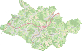
Location of Großbuchholz in Overath |
||
|
Großbuchholz seen from the west
|
||
Großbuchholz is a village in the Untereschbach district of Overath in the Rheinisch-Bergisches Kreis . The north-eastern part of the house still standing today most likely dates from around 1600, as dendrochronological studies on the beams have shown.
Location and naming
Großbuchholz is located on the eastern edge of the Königsforst . The name Buchholz refers to the natural conditions in the area with a population of beech and oak trees , whereby the oak is botanically also a beech plant.
history
The establishment of the farm under the Lehmbach Farm Association was completed at the beginning of the 12th century. The earliest owners mentioned were the Counts of Meer, who came into the ownership of the Sulsen farm association (today: Immekeppel ) through inheritance law .
The first mention under the root word Buchholz is found in 1322 with the name Buchulcz , which was written in 1413 as Boechhoyltz . At that time, another estate with a similar name was built in the vicinity (meaning Klein Buchholz ). Therefore, the property was renamed Grossen Bocholtz . In the following years, the following spelling names are used for the living space:
- 1586 Bocholz
- 1655 Bocholß
- 1709 Bocholz
- 1733 Groessen Bocholz
- 1757 Bocholtzhof
- 1757 Buchholtzer Hof
- 1787 Buchholz
- 1814 Buchholtz
- 1816 Großer Buchholz, Buchholzer Hof
- 1855 The large Buchholzerhof
- unknown: Großbuchholzerhof
- 1894 Groß Buchholz
- From the middle of the 20th century: large book wood
The place was on the Brüderstraße , an important medieval old highway from Flanders via Cologne to Leipzig .
The Topographia Ducatus Montani by Erich Philipp Ploennies , Blatt Amt Porz , shows that the residential area had a courtyard as early as 1715, which is labeled as Buchholtz . Carl Friedrich von Wiebeking names the court on his charter of the Duchy of Berg in 1789 as Buchholz . It shows that the place was part of the Unterirchspiel Immekeppel in the upper court of Bensberg at that time . The place is on the topographical survey of the Rhineland from 1817 as Gr. Buchholz recorded. The Prussian first recording from 1845 shows the residential area under the name Buchholzerhof . From the Prussian new admission of 1892 the place is regularly as Gr. Buchholz and Großbuchholz recorded.
In 1822 14 people lived in the village, which was categorized as a farm and after the collapse of the Napoleonic administration and its replacement, it belonged to the Bensberg mayor in the Mülheim am Rhein district . For the year 1830, 24 inhabitants are given for large and small book wood. The place, which was categorized as a farm property in 1845 according to the overview of the government district of Cologne , had a residential building with nine inhabitants at that time, all of whom were Catholic. The municipal and estate district statistics of the Rhine Province lists Großbuchholz in 1871 with one house and five residents as a single house. In the municipality lexicon for the Rhineland province of 1888, two houses with seven inhabitants are given for Großbuchholz. In 1895 the place had a house with five inhabitants, in 1905 one house and 14 inhabitants are given.
On the basis of Section 10 of the Cologne Act , several Bensberg outlying areas were transferred to the Overath community in 1975, including the area around Untereschbach with large book wood.
See also
literature
- Georg Sturmberg: The Buchholzer Hof at the Königsforst in 8 centuries , Bergischer Geschichtsverein department Rhein-Berg e. V., Volume 13, Bergisch Gladbach 1996, ISBN 3-932326-13-X .
Individual evidence
- ^ Herbert Nicke : The Brothers Street. From the history of the old country road from Cologne to Siegen . In: Land and history between Berg, Wildenburg and South Westphalia . tape 4 . Galunder, Wiehl 2001, p. 70 ff .
- ^ Wilhelm Fabricius : Explanations for the Historical Atlas of the Rhine Province ; Second volume: The map of 1789. Division and development of the territories from 1600 to 1794 ; Bonn; 1898
- ↑ Alexander A. Mützell: New topographical-statistical-geographical dictionary of the Prussian state . tape 1 . Karl August Künnel, Halle 1821.
- ↑ Friedrich von Restorff : Topographical-statistical description of the Royal Prussian Rhine Province , Nicolai, Berlin and Stettin 1830
- ↑ Overview of the components and list of all the localities and individually named properties of the government district of Cologne: by districts, mayor's offices and parishes, with information on the number of people and the residential buildings, as well as the Confessions, Jurisdictions, Military and former state conditions. / ed. from the Royal Government of Cologne [Cologne], [1845]
- ↑ Royal Statistical Bureau Prussia (ed.): The communities and manor districts of the Prussian state and their population . The Rhine Province, No. XI . Berlin 1874.
- ↑ Königliches Statistisches Bureau (Prussia) (Ed.): Community encyclopedia for the Rhineland Province, based on the materials of the census of December 1, 1885 and other official sources, (Community encyclopedia for the Kingdom of Prussia, Volume XII), Berlin 1888.
- ↑ Königliches Statistisches Bureau (Prussia) (Ed.): Community encyclopedia for the Rhineland Province, based on the materials of the census of December 1, 1895 and other official sources, (Community encyclopedia for the Kingdom of Prussia, Volume XII), Berlin 1897.
- ↑ Königliches Statistisches Bureau (Prussia) (Ed.): Community encyclopedia for the Rhineland Province, based on the materials of the census of December 1, 1905 and other official sources, (Community encyclopedia for the Kingdom of Prussia, Volume XII), Berlin 1909.
- ^ The Cologne Act in full. Retrieved June 7, 2016 .


