Spich (Overath)
|
Speak
City of Overath
Coordinates: 50 ° 55 ′ 33 ″ N , 7 ° 16 ′ 24 ″ E
|
||
|---|---|---|
| Height : | 97 m above sea level NN | |
|
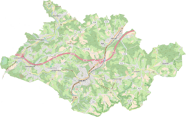
Location of Spich in Overath |
||
|
Entrance to Spich
|
||
Spich is a district of Overath in the Rheinisch-Bergisches Kreis in North Rhine-Westphalia , Germany .
Location and description
The small, agricultural hamlet of Spich is located in the Aggertal on the federal highway 484 (here called Siegburger Straße) and the Cologne-Kalk-Overath railway line. The villages of Brambach , Gut Eichthal , Cyriax and Broich are nearby . The name Spich refers to the geographical name for a water accumulation (water reservoir).
history
The place is recorded on the topographical survey of the Rhineland from 1817 as Spich . The Prussian first recording from 1845 shows the residential area also under the name Spich . From the Prussian new admission in 1892, the location is regularly recorded as a Spich on measuring table sheets .
In 1822, eleven people lived in the place categorized as a house, which after the collapse of the Napoleonic administration and its replacement belonged to the Overath mayor in the Mülheim am Rhein district . For the year 1830, the place called Spich continues to be specified as a (single) house. The place, which was categorized as a courtyard in 1845 according to the overview of the government district of Cologne , had two residential buildings with 15 inhabitants at that time, all of them Catholic denominations. The municipal and estate district statistics of the Rhine Province are listed by Spich in 1871 with three houses and 22 inhabitants. In the municipality lexicon for the Rhineland province of 1888, three houses with 17 residents are given for Spich . In 1895 the place had three houses with twelve inhabitants, in 1905 three houses and ten inhabitants are given.
Individual evidence
- ↑ Jörg Poettgen (editor): 950 years Overath (1064 - 2014) / street names tell history . Edited by Bergischer Geschichtsverein Overath eV, Overath 2014.
- ↑ Alexander A. Mützell: New topographical-statistical-geographical dictionary of the Prussian state . tape 4 . Karl August Künnel, Halle 1823.
- ↑ Friedrich von Restorff : Topographical-statistical description of the Royal Prussian Rhine Province , Nicolai, Berlin and Stettin 1830
- ↑ Overview of the components and list of all the localities and individually named properties of the government district of Cologne: by districts, mayor's offices and parishes, with information on the number of people and the residential buildings, as well as the Confessions, Jurisdictions, Military and former state conditions. / ed. from the Royal Government of Cologne [Cologne], [1845]
- ↑ Royal Statistical Bureau Prussia (ed.): The communities and manor districts of the Prussian state and their population . The Rhine Province, No. XI . Berlin 1874.
- ↑ Königliches Statistisches Bureau (Prussia) (Ed.): Community encyclopedia for the Rhineland Province, based on the materials of the census of December 1, 1885 and other official sources, (Community encyclopedia for the Kingdom of Prussia, Volume XII), Berlin 1888.
- ↑ Königliches Statistisches Bureau (Prussia) (Ed.): Community encyclopedia for the Rhineland Province, based on the materials of the census of December 1, 1895 and other official sources, (Community encyclopedia for the Kingdom of Prussia, Volume XII), Berlin 1897.
- ↑ Royal Statistical Bureau (Prussia) (Ed.): Community encyclopedia for the Rhineland Province, based on the materials of the census of December 1, 1905 and other official sources, (Community encyclopedia for the Kingdom of Prussia, Volume XII), Berlin 1909


