Grünewald (Overath)
|
Grünewald
City of Overath
Coordinates: 50 ° 56 ′ 38 ″ N , 7 ° 12 ′ 11 ″ E
|
||
|---|---|---|
|
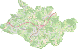
Location of Grünewald in Overath |
||
|
View of Grünewald
|
||
Grünewald is a district of Untereschbach in the town of Overath in the Rheinisch-Bergisches Kreis in North Rhine-Westphalia , Germany .
Location and description
The district of Grünewald is located in the Sülztal in the far west of the municipality of Overath on the border with Bergisch Gladbach . It can be reached via Landesstraße 284 , which is called here Hoffnungsthaler Straße and which connects Rösrath with Lindlar . Nearby places are Daubenbüchel , Unterauel , Mittelauel , Großbuchholz and the abandoned Grünewald mine .
history
In the middle of the 19th century, a non-ferrous metal ore mine was muted west of Mittelauel and Daubenbüchel , the Grünewald mine . After the end of mining in 1905, sandy residues from the flotation of the Lüderich mine were deposited on the mine field from 1930 to 1978 .
At the foot of the large embankment of the storage basin, the Grünewald residential area was also built in the first half of the 20th century.
It appears cartographically for the first time in the 1949 edition of the Overath measuring table of the topographic map 1: 25,000.
Individual evidence
- ↑ Herbert Ommer, mining relics in the Königsforst , in: Bergbau im Bergisches Land, examples of mining traces between Sülz and Wahnbach , series of the history association Rösrath eV, Volume 32, Rösrath 2002, p. 176ff., ISBN 3-922413-52-8


