Card lennefe
|
Card lennefe
City of Overath
Coordinates: 50 ° 58 ′ 27 ″ N , 7 ° 16 ′ 25 ″ E
|
||
|---|---|---|
| Height : | 121 m above sea level NN | |
|
Location of Kartenlennefe in Overath |
||
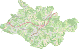
Kartenlennefe is a district of Brombach in the town of Overath in the Rheinisch-Bergisches Kreis in North Rhine-Westphalia , Germany .
Location and description
The small district of Kartenlennefe, which is surrounded by fields and forest, can be reached by a cul-de-sac from state road 299. It lies in a side valley of the Lennefer Bach , which flows into the Sülz , on the border with the municipality of Lindlar , which is part of the Oberbergischer Kreis . Places nearby are Klingerath , Halfenslennefe , Krähsiefen , Lenneferberg , Obersteeg and Herrenhöhe .
Since many toads are threatened with death when crossing roads in the area of Kartelennefe when frogs migrate near spawning waters, the Nabu seeks helpers for toad patrols here every year .
history
In 1230 a place de Linnife is mentioned in a document. However, it remained unclear whether the name refers to Halfenslennefe , Kartenlennefe or even possibly to Lennep . In 1334 another mention was made as de Lenyff . The name is derived from the Lennefer Bach , where the place is located. The ancient Germanic basic form -apa can be found in the name Lennefe, which is often found in the derivatives -f (e) and -p (e) (e.g. Gelpe , Ennepe ) in the Bergisches Land .
The Topographia Ducatus Montani by Erich Philipp Ploennies , Blatt Amt Steinbach , shows that the residential area had a courtyard as early as 1715, which is labeled as Kartelenef . Carl Friedrich von Wiebeking names the court on his charter of the Duchy of Berg in 1789 as Lenef . It shows that the place was part of the Honschaft Vellingen in the parish of Hohkeppel at that time .
The place is recorded on the topographical survey of the Rhineland from 1817 as a map lennef. The Prussian first recording from 1845 shows the residential area also under the name Kartenlennef . From the Prussian new admission in 1892, the place is regularly recorded on the measuring table as a map lennefe.
In 1822, eleven people lived in the town, which was categorized as a house and referred to as Karten-Lennef , which after the collapse of the Napoleonic administration and its replacement belonged to the municipality of Hohkeppel of the Engelskirchen mayor in the Wipperfürth district . For the year 1830, 14 inhabitants are given for the place, which is also called a house. For the year 1830, 36 inhabitants are given for the place called Karten-Lennef . The place, which was categorized as a farm in 1845 according to the overview of the government district of Cologne and was called Kartenlennef , had a residential building with eleven inhabitants at that time, all of them Catholic denominations. The municipal and Gutbezirksstatistik the Rhine Province leads Kartenlennefe 1871 with a dwelling house and four residents. In the municipality lexicon for the province of Rhineland from 1888, a house with three residents is given for Kartenlennefe . In 1895 the place had a house with four inhabitants, in 1905 two houses and 14 inhabitants are given.
Due to § 10 and § 14 of the Cologne Act , the municipality of Hohkeppel was dissolved in 1975 and incorporated into Lindlar . Some districts of Hohkeppels were converted into the municipality of Overath, including Klingerath.
Individual evidence
- ↑ toads helpers wanted in Kölner Stadt Anzeiger (Region Obernberg) from March 16, 2016
- ^ A b Heinrich Dittmaier : Settlement names and settlement history of the Bergisches Land . In: Journal of the Bergisches Geschichtsverein . tape 74 , parallel edition as a publication by the Institute for Historical Regional Studies of the Rhineland at the University of Bonn. Schmidt, Neustadt ad Aisch 1956.
- ^ Heinrich Dittmaier: The Apa problem: Investigation of a western European river name type . In: Bibliotheca onomastica . tape 1 . International Center of Onomastics / Institut voor Naamkunde, Bonn 1955.
- ^ Wilhelm Fabricius : Explanations for the Historical Atlas of the Rhine Province ; Second volume: The map of 1789. Division and development of the territories from 1600 to 1794 ; Bonn; 1898
- ↑ Alexander A. Mützell: New topographical-statistical-geographical dictionary of the Prussian state . tape 2 . Karl August Künnel, Halle 1821.
- ^ A b Friedrich von Restorff : Topographical-statistical description of the Royal Prussian Rhine Province , Nicolai, Berlin and Stettin 1830
- ↑ Overview of the components and list of all the localities and individually named properties of the government district of Cologne: by districts, mayor's offices and parishes, with information on the number of people and the residential buildings, as well as the Confessions, Jurisdictions, Military and former state conditions. / ed. from the Royal Government of Cologne [Cologne], [1845]
- ↑ Royal Statistical Bureau Prussia (ed.): The communities and manor districts of the Prussian state and their population . The Rhine Province, No. XI . Berlin 1874.
- ↑ Königliches Statistisches Bureau (Prussia) (Ed.): Community encyclopedia for the Rhineland Province, based on the materials of the census of December 1, 1885 and other official sources, (Community encyclopedia for the Kingdom of Prussia, Volume XII), Berlin 1888.
- ↑ Königliches Statistisches Bureau (Prussia) (Ed.): Community encyclopedia for the Rhineland Province, based on the materials of the census of December 1, 1895 and other official sources, (Community encyclopedia for the Kingdom of Prussia, Volume XII), Berlin 1897.
- ↑ Royal Statistical Bureau (Prussia) (Ed.): Community encyclopedia for the Rhineland Province, based on the materials of the census of December 1, 1905 and other official sources, (Community encyclopedia for the Kingdom of Prussia, Volume XII), Berlin 1909
- ^ The Cologne Act in full. Retrieved June 7, 2016 .

