Hasenberg (Overath)
|
Hasenberg
City of Overath
Coordinates: 50 ° 54 ′ 38 ″ N , 7 ° 16 ′ 46 ″ E
|
||
|---|---|---|
| Height : | 186 m above sea level NN | |
|
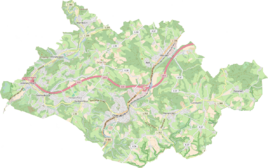
Location of Hasenberg in Overath |
||
Hasenberg is a district of Overath in the Rheinisch-Bergisches Kreis in North Rhine-Westphalia , Germany .
Location and description
The small district of Hasenberg, which is characterized by agriculture, is located on the border with the Rhein-Sieg district . It can be reached via Kreisstraße 34 (here called Eulenthaler Straße ) and the hamlet of Kulhoven . Local locations in the vicinity are Weyerhof and Windhausen . Hasenberg is the location of an abandoned campsite, which sometimes makes headlines in regional media. Weekend houses are to be built on the site .
history
Hasenberg was mentioned in a document in the 13th century as Hauisberg and Haysberg .
The Topographia Ducatus Montani by Erich Philipp Ploennies , Blatt Amt Steinbach , shows that the living space had a courtyard as early as 1715, which is labeled as Hasenberg . Carl Friedrich von Wiebeking names the court on his charter of the Duchy of Berg in 1789 as Hasenberg . It emerges from it that the place was part of the honor of saints in the parish of Overath at that time .
The place is recorded on the topographical survey of the Rhineland from 1817 as Hasenberg . The Prussian first recording from 1845 shows the residential area also under the name Hasenberg . From the Prussian new admission of 1892, the place is regularly recorded as Hasenberg on measuring table sheets .
In 1822 nine people lived in the place categorized as a courtyard, which after the collapse of the Napoleonic administration and its replacement, belonged to the Overath mayor in the Mülheim am Rhein district . For the year 1830 nine inhabitants are given for the place called Hasenberg . The place, which was categorized as an isolated house according to the survey of the government district of Cologne in 1845 , had a residential building with eleven inhabitants at that time, all of them Catholic denominations.
The list of residents and livestock from 1848, which among other things was used to collect taxes, has 11 residents in Hasenberg. Including the family of nine of the farmer Heinrich Hürholz, to which six children belonged. There was also a foster child and a servant . The livestock: 1 horse, 3 cows, 1 cattle, 1 calf, 8 pigs .
The municipal and Gutbezirksstatistik the Rhine Province leads Hasenberg 1871 with a dwelling house and four residents. In the municipality lexicon for the Rhineland province of 1888, a house with four residents is given for Hasenberg . In 1895 the place had a house with eight inhabitants, in 1905 one house and eight inhabitants are given.
Around 1854, the Althonrath mining and smelting company built the mine Grubenkittel nearby , which later went to the Aggertaler Kupfer-Bergbaugesellschaft . In 1885, an ore was built on a piece of land owned by the Overather parish .
Individual evidence
- ^ Thomas Rausch: Houses of the chalet village for sale. In: Kölner Stadtanzeiger from November 16, 2019
- ^ Heinrich Dittmaier : settlement names and settlement history of the Bergisches Land . In: Journal of the Bergisches Geschichtsverein . tape 74 , parallel edition as a publication by the Institute for Historical Regional Studies of the Rhineland at the University of Bonn. Schmidt, Neustadt ad Aisch 1956.
- ^ Wilhelm Fabricius : Explanations for the Historical Atlas of the Rhine Province ; Second volume: The map of 1789. Division and development of the territories from 1600 to 1794 ; Bonn; 1898
- ↑ Alexander A. Mützell: New topographical-statistical-geographical dictionary of the Prussian state . tape 2 . Karl August Künnel, Halle 1821.
- ↑ Friedrich von Restorff : Topographical-statistical description of the Royal Prussian Rhine Province , Nicolai, Berlin and Stettin 1830
- ↑ Overview of the components and list of all the localities and individually named properties of the government district of Cologne: by districts, mayor's offices and parishes, with information on the number of people and the residential buildings, as well as the Confessions, Jurisdictions, Military and former state conditions. / ed. from the Royal Government of Cologne [Cologne], [1845]
- ↑ Berthold Gladbach, Peter Lückerath: The Overather population in name, tax and residents lists from the 15th to the 20th century. Ed .: Geschichtsverein Rhein-Berg, Bergisch Gladbach 2016. ISBN 978-3-932326-75-2 , p. 343.
- ↑ Royal Statistical Bureau Prussia (ed.): The communities and manor districts of the Prussian state and their population . The Rhine Province, No. XI . Berlin 1874.
- ↑ Königliches Statistisches Bureau (Prussia) (Ed.): Community encyclopedia for the Rhineland Province, based on the materials of the census of December 1, 1885 and other official sources, (Community encyclopedia for the Kingdom of Prussia, Volume XII), Berlin 1888.
- ↑ Königliches Statistisches Bureau (Prussia) (Ed.): Community encyclopedia for the Rhineland Province, based on the materials of the census of December 1, 1895 and other official sources, (Community encyclopedia for the Kingdom of Prussia, Volume XII), Berlin 1897.
- ↑ Royal Statistical Bureau (Prussia) (Ed.): Community encyclopedia for the Rhineland Province, based on the materials of the census of December 1, 1905 and other official sources, (Community encyclopedia for the Kingdom of Prussia, Volume XII), Berlin 1909
- ^ Franz Becher: 900 years Overath 1064–1964 . Reprint of the edition from 1964. Ed. Bergischer Geschichtsverein Overath, Verlag Bücken und Sulzer, Overath 2005. ISBN 3-936405-28-X , p. 259.

