Obersteeg (Overath)
|
Obersteeg
City of Overath
Coordinates: 50 ° 58 ′ 8 ″ N , 7 ° 15 ′ 28 ″ E
|
||
|---|---|---|
| Height : | 108 m | |
|
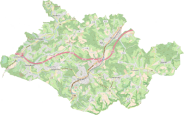
Location of Obersteeg in Overath |
||
|
Obersteeg thoroughfare 2016
|
||
Obersteeg is a district of Immekeppel in the town of Overath in the Rheinisch-Bergisches Kreis in North Rhine-Westphalia , Germany . It is located in the northern part of Overath between Immekeppel and Brombach an der Sülz .
history
The court overath had existed since 1633. His jurisdiction extended beyond the goods belonging to the parish Overath. The court court Obersteeg was also affiliated to the Overather Höfeverband with its courtyards (localities) Oberbech , Lokenbach , Wüsterhöhe , Wustsiefen and the Balker Höhe .
The Topographia Ducatus Montani by Erich Philipp Ploennies , Blatt Amt Portz , shows that there were already two places to live named im Steeg on both sides of the Sülz in 1715 , each with two farms. From the map of the Duchy of Berg in 1789, it emerges that the place was part of the Oberkirchspiels Immekeppel (also Honschaft Immekeppel ) of the parish Gladbach in the upper court of Bensberg at that time.
The orographically right one should be Obersteeg. The place is recorded on the topographical survey of the Rhineland from 1817 as Steeg . The Prussian first recording from 1845 shows the residential area under the name Obersteg . From the Prussian new admission in 1892, the place is regularly recorded as Obersteeg on measuring table sheets .
In 1822, 57 people lived in Steeg , which was categorized as a farm (presumably Obersteeg and Mittelsteeg ), which after the collapse of the Napoleonic administration and its replacement belonged to the mayor's office of Bensberg in the Mülheim am Rhein district . For the year 1830, Obersteeg is presumably given together with Mittelsteeg as 80 inhabitants. The place, which was categorized as a farm estate in 1845 according to the overview of the government district of Cologne , had eight residential buildings with 54 inhabitants, all of them Catholic denominations.
Until 1868, Obersteeg belonged to the community of Oberimmekeppel and thus to the parish of Gladbach. On November 11, 1868 it came to the parish of Immekeppel by archbishop's order . At that time one still wrote Obersteg (with only an "e").
The municipality and estate district statistics of the Rhine province lists Obersteeg in 1871 with six houses and 41 residents. In the municipality lexicon for the province of Rhineland from 1888 eight houses with 47 inhabitants are given for Obersteeg, the place belonged denominationally to the Catholic parish Immekeppel. In 1895 the place had seven houses with 45 inhabitants, in 1905 seven houses and 50 inhabitants are given.
On the basis of Section 10 of the Cologne Act , several Bensberg outlying areas were transferred to the municipality of Overath in 1975, including the area around Immekeppel with Obersteeg.
Zervasmühle Obersteeg
The Zervasmühle is located at the southern exit of Obersteeg. The initially nameless watermill was rebuilt around 1853 from parts of the Immekeppeler mill and used as a grain mill. In 1883 the owner changed, and in 1890 it was shut down. The mill only got its name after it closed down, when a family Zervas lived in the mill building that had been converted into a residential building.
railroad
Obersteeg was on the Cologne-Mülheim – Lindlar railway line , which was given up in 1966. The station building of the Obersteeg station is entered with the associated outbuildings and goods sheds under no. 126 in the list of architectural monuments in Overath .
Individual evidence
- ^ Hanspeter Dresbach: Municipal reorganization 165 years ago , in: Rheinisch-Bergischer Calendar 1975, p. 20
- ^ Wilhelm Fabricius : Explanations for the Historical Atlas of the Rhine Province. Second volume: The map from 1789. Division and development of the territories from 1600 to 1794. Bonn 1898.
- ↑ Alexander A. Mützell: New topographical-statistical-geographical dictionary of the Prussian state . tape 4 . Karl August Künnel, Halle 1823.
- ↑ Friedrich von Restorff : Topographical-statistical description of the Royal Prussian Rhine Province , Nicolai, Berlin and Stettin 1830
- ↑ Overview of the components and list of all the localities and individually named properties of the government district of Cologne: by districts, mayor's offices and parishes, with information on the number of people and the residential buildings, as well as the Confessions, Jurisdictions, Military and former state conditions. / ed. from the Royal Government of Cologne [Cologne], [1845]
- ^ Gerd Müller: Eight hundred years Immekeppel , in: Rheinisch-Bergischer Calendar 1966, p. 19
- ↑ Royal Statistical Bureau Prussia (ed.): The communities and manor districts of the Prussian state and their population . The Rhine Province, No. XI . Berlin 1874.
- ↑ Königliches Statistisches Bureau (Prussia) (Ed.): Community encyclopedia for the Rhineland Province, based on the materials of the census of December 1, 1885 and other official sources, (Community encyclopedia for the Kingdom of Prussia, Volume XII), Berlin 1888.
- ↑ Königliches Statistisches Bureau (Prussia) (Ed.): Community encyclopedia for the Rhineland Province, based on the materials of the census of December 1, 1895 and other official sources, (Community encyclopedia for the Kingdom of Prussia, Volume XII), Berlin 1897.
- ↑ Königliches Statistisches Bureau (Prussia) (Ed.): Community encyclopedia for the Rhineland Province, based on the materials of the census of December 1, 1905 and other official sources, (Community encyclopedia for the Kingdom of Prussia, Volume XII), Berlin 1909.
- ^ The Cologne Act in full. Retrieved June 7, 2016 .
- ^ Herbert Nicke : Bergische mills. On the trail of the use of hydropower in the land of a thousand mills between Wupper and Sieg . Galunder, Wiehl 1998, ISBN 3-931251-36-5 , pp. 252 .


