Kombach (Overath)
|
Kombach
City of Overath
Coordinates: 50 ° 55 ′ 8 ″ N , 7 ° 16 ′ 26 ″ E
|
||
|---|---|---|
| Height : | 95 m above sea level NN | |
|
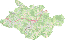
Location of Kombach in Overath |
||
|
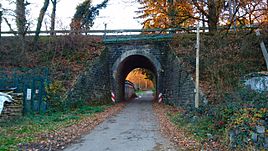
Through the railway tunnel ...
|
||
Kombach is a district of Overath in the Rheinisch-Bergisches Kreis in North Rhine-Westphalia , Germany .
Location and description
The small, agricultural hamlet of Kombach on the border with the Rhein-Sieg district in the Aggertal is located on the federal highway 484 (here called Siegburger Straße) and the Cologne-Kalk-Overath railway line . The villages of Brambach , Gut Eichthal , Cyriax , Broich and Bombach (Rhein-Sieg district) are nearby .
The Combach , a tributary of the Agger , flows past the place. From a natural perspective, the area belongs to the Bergische Hochfläche nature reserve around Overath.
history
In Kombach was one of a total of eight Knights' seats in Overather, built by the Lords of Combach . It was destroyed at the end of the 18th century and the building materials were used again. The Topographia Ducatus Montani by Erich Philipp Ploennies , Blatt Amt Steinbach , shows that the living space had a courtyard as early as 1715, which is labeled as Kambach and marked as Freihof . Carl Friedrich von Wiebeking names the court on his charter of the Duchy of Berg in 1789 as Kumbach . It emerges from it that the place was part of the honor of saints in the parish of Overath at that time .
The place is recorded on the topographical survey of the Rhineland from 1817 as Kombach . The Prussian first recording from 1845 shows the residential area under the name Kohmbach . From the Prussian new admission of 1892, the place is regularly recorded on the measuring table as Kombach .
In 1822, 18 people lived in the place, which was categorized as a lease and, after the collapse of the Napoleonic administration and its replacement, belonged to the Overath mayor in the Mülheim am Rhein district . For the year 1830 21 inhabitants are given for the place also called Kombach. The town, which was categorized as a lease property in 1845 according to the overview of the government district of Cologne and designated Kombach , had a residential building with twelve inhabitants at that time, all of them Catholic faith. The municipal and Gutbezirksstatistik of the Rhine Province leads Combach 1871 with a dwelling house and ten inhabitants. In the municipality lexicon for the province of Rhineland from 1888, a house with five residents is given for Kombach . In 1895 the place has a house with seven inhabitants, in 1905 one house and six inhabitants are given. In the house numbering register from 1907 there is a building in Combach owned by Freiherr v. Schweppenburg indicated with the resident Johann Lüdenbach.
See also
Web links
Individual evidence
- ^ Heinz Firmenich: Castles and palaces in the Rheinisch-Bergisch district . Ed. Bergischer Geschichtsverein. Wamper publishing house, Cologne / Bergisch Gladbach 1974
- ^ Wilhelm Fabricius : Explanations for the Historical Atlas of the Rhine Province . Second volume: The map of 1789. Division and development of the territories from 1600 to 1794 . Bonn 1898
- ↑ Alexander August Mützell, Leopold Krug (Ed.): New topographical-statistical-geographical dictionary of the Prussian state. Second volume. G – Ko. With Karl August Kümmel, Halle 1821 ( digitized ).
- ^ Friedrich von Restorff : Topographical-statistical description of the Royal Prussian Rhine Province . Nicolai, Berlin / Stettin 1830
- ↑ Royal Government of Cologne (Ed.): Overview of the constituent parts and list of all the localities and individually named properties of the government district of Cologne, according to districts, mayorships and parishes, with information on the number of people and the residential buildings, as well as the Confessions, Jurisdictions , Military and earlier country conditions. Cologne 1845 ( digitized ).
- ^ The communities and manor districts of the Rhine Province and their population. Edited and compiled by the Royal Statistical Bureau from the original materials of the general census of December 1, 1871. In: Königliches Statistisches Bureau (Hrsg.): The communities and manor districts of the Prussian state and their population. tape XI , 1874, ZDB -ID 1467523-7 ( digitized ).
- ^ Community encyclopedia for the province of Rhineland. Based on materials from the census of December 1, 1885 and other official sources, edited by the Royal Statistical Bureau. In: Royal Statistical Bureau (Hrsg.): Community encyclopedia for the Kingdom of Prussia. tape XII , 1888, ZDB -ID 1046036-6 ( digitized version ).
- ^ Community encyclopedia for the province of Rhineland. Based on materials from the census of December 1, 1895 and other official sources, edited by the Royal Statistical Bureau. In: Royal Statistical Bureau (Hrsg.): Community encyclopedia for the Kingdom of Prussia. tape XII , 1897, ZDB -ID 1046036-6 .
- ^ Community encyclopedia for the Rhine Province. Based on the materials from the census of December 1, 1905 and other official sources, edited by the Royal Prussian State Statistical Office. In: Königliches Prussisches Statistisches Landesamt (Hrsg.): Community encyclopedia for the Kingdom of Prussia. Booklet XII, 1909, ZDB -ID 1046036-6 .
- ↑ Berthold Gladbach, Peter Lückerath: The Overather population in name, tax and residents lists from the 15th to the 20th century . Ed .: History Association Rhein-Berg. Bergisch Gladbach 2016, ISBN 978-3-932326-75-2 , p. 359.


